Temperatures drop Tuesday after the warmest day of 2025


Monday stayed mostly dry for a good chunk of southeast Wisconsin. We had a few isolated storms in northern counties around midday then a few showers and storms in northern counties early Tuesday morning. Some of those storms could have seen a bit of small hail but we stayed away from any severe storms and any watches and warnings.
Instead of the storms, the warmth took the front seat of the forecast Monday. Almost all of southeast Wisconsin reached the 80s! Only Sheboygan stayed in the upper 70s for highs.
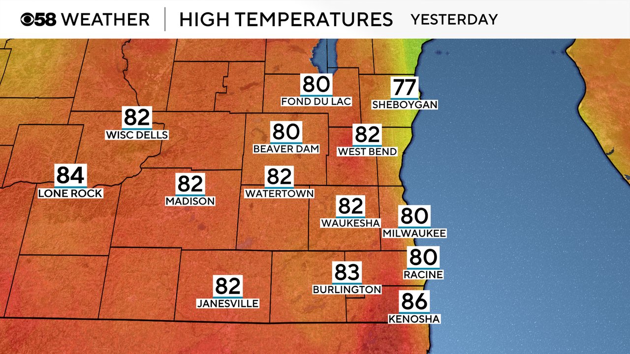
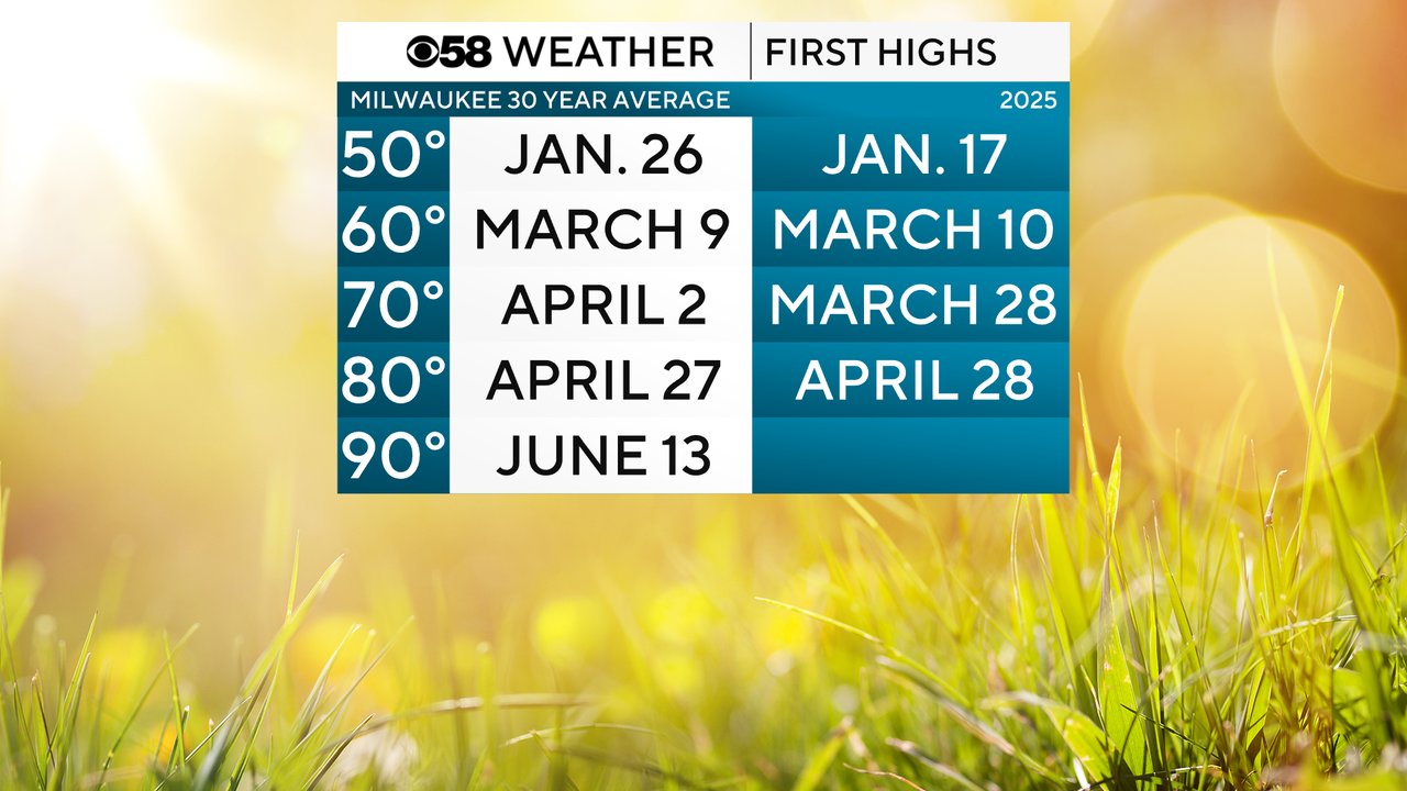
It was the first 80 degree day of the year in 2025 for Milwaukee which hit 80 degrees and arrives almost exactly average for the first 80 degree temp of the season. April 27th is the official average for our first day in the 80s to start the year. The next milestone is 90 degrees which on average doesn't arrive until the middle of June.
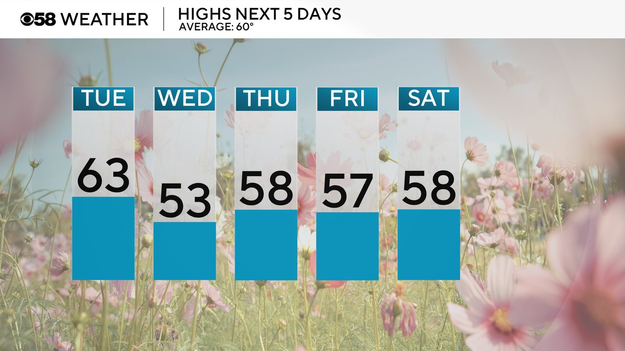
Official highs for Tuesday will go down in the upper 70s. Most of southeast Wisconsin is still very mild in the upper 60s and low 70s Tuesday morning but will slowly drop to around 60 for most of the morning through early afternoon then drop quickly through the 50s and 40s Tuesday evening. A few cooler and below-average days in the 50s are on the way for Wednesday through Saturday.
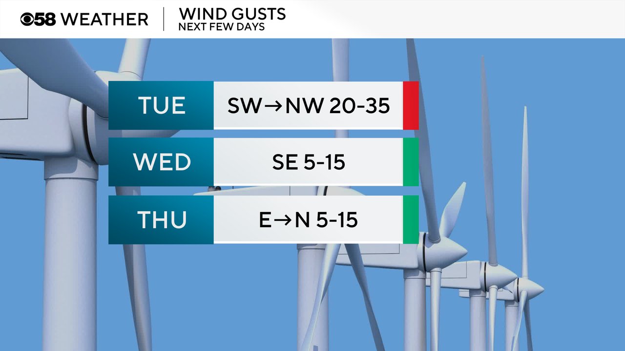
The wind which was pretty blustery most of Monday will stay strong Tuesday with wind gusts to 35 mph throughout the day shifting from the southwest to the northwest eventually bringing in the colder air. The wind should become lighter and more manageable for Wednesday and Thursday.
Download the CBS 58 Weather app to track the temps for the end of April and beginning of May.