


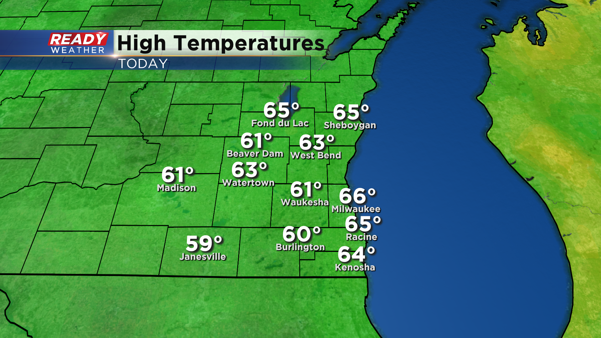
Temperatures topped out in the mid 60s across most of southeast Wisconsin today thanks to a few peeks of sunshine this morning, but once the clouds thickened up and the showers moved in, temps dropped into the 50s for most of the afternoon.
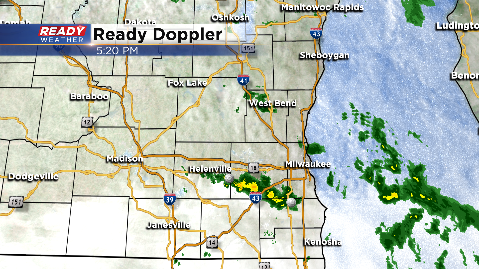
As of 5:20pm, there are still a few isolated showers and patchy drizzle out there, but that will taper off before midnight with dry weather expected for the rest of the weekend.
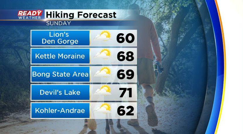
After some lingering cloud cover early Sunday, breaks in the clouds will develop by late morning with partly sunny skies expected in the afternoon. A lake breeze will likely develop around midday, with highs in the 60s lakeside and low 70s inland.
Wind will stay off the lake on Monday, and with a few clouds around highs will top out either side of 70 degrees, but a much warmer air mass will start to move in on Tuesday and remain in place through the rest of the week. Highs rebound back into the mid 70s lakeside Wednesday with highs either side of 80 degrees both Thursday and Friday.
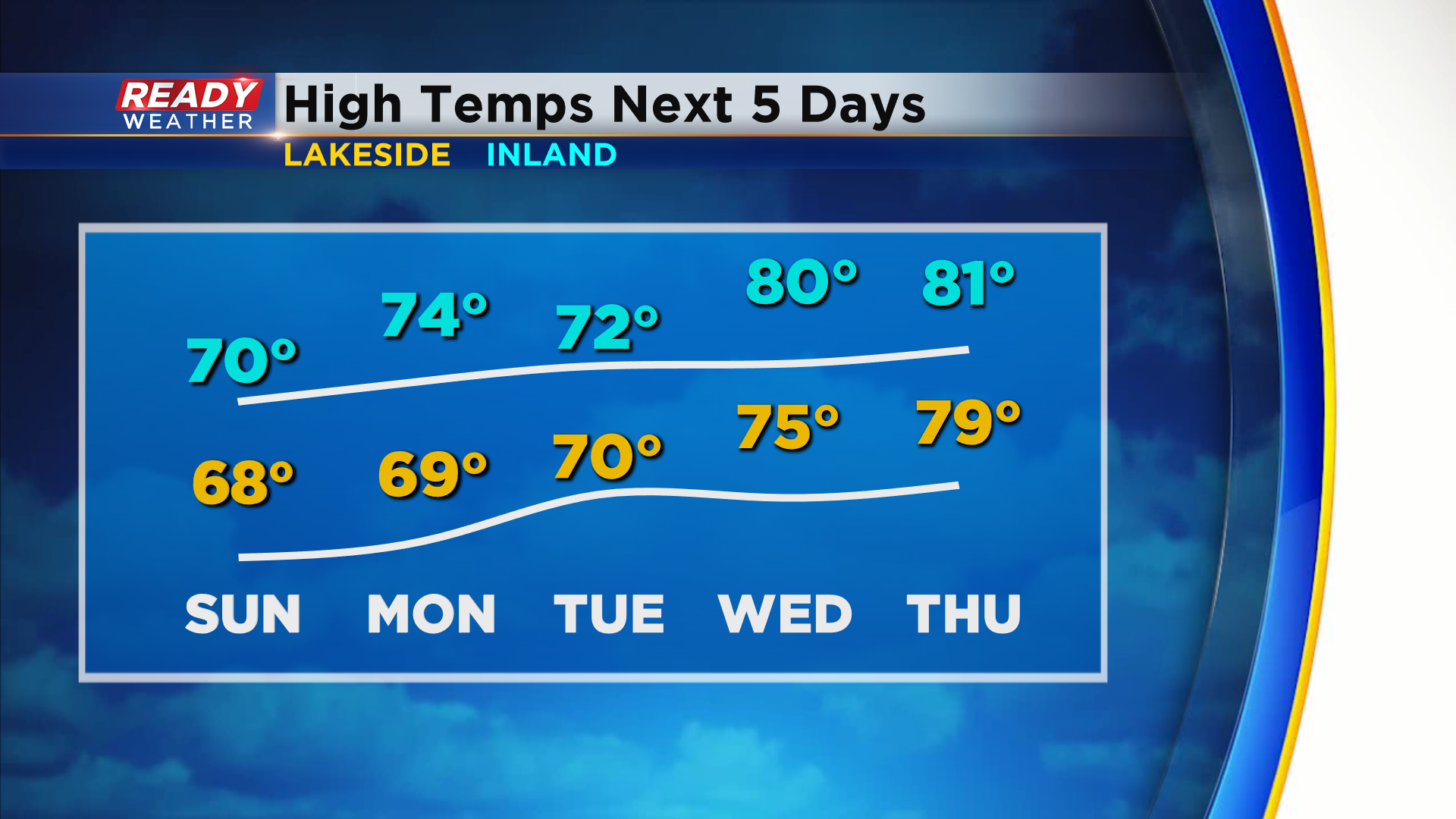
There will also be an uptick in humidity, with dew points possibly in the 60s by Thursday.
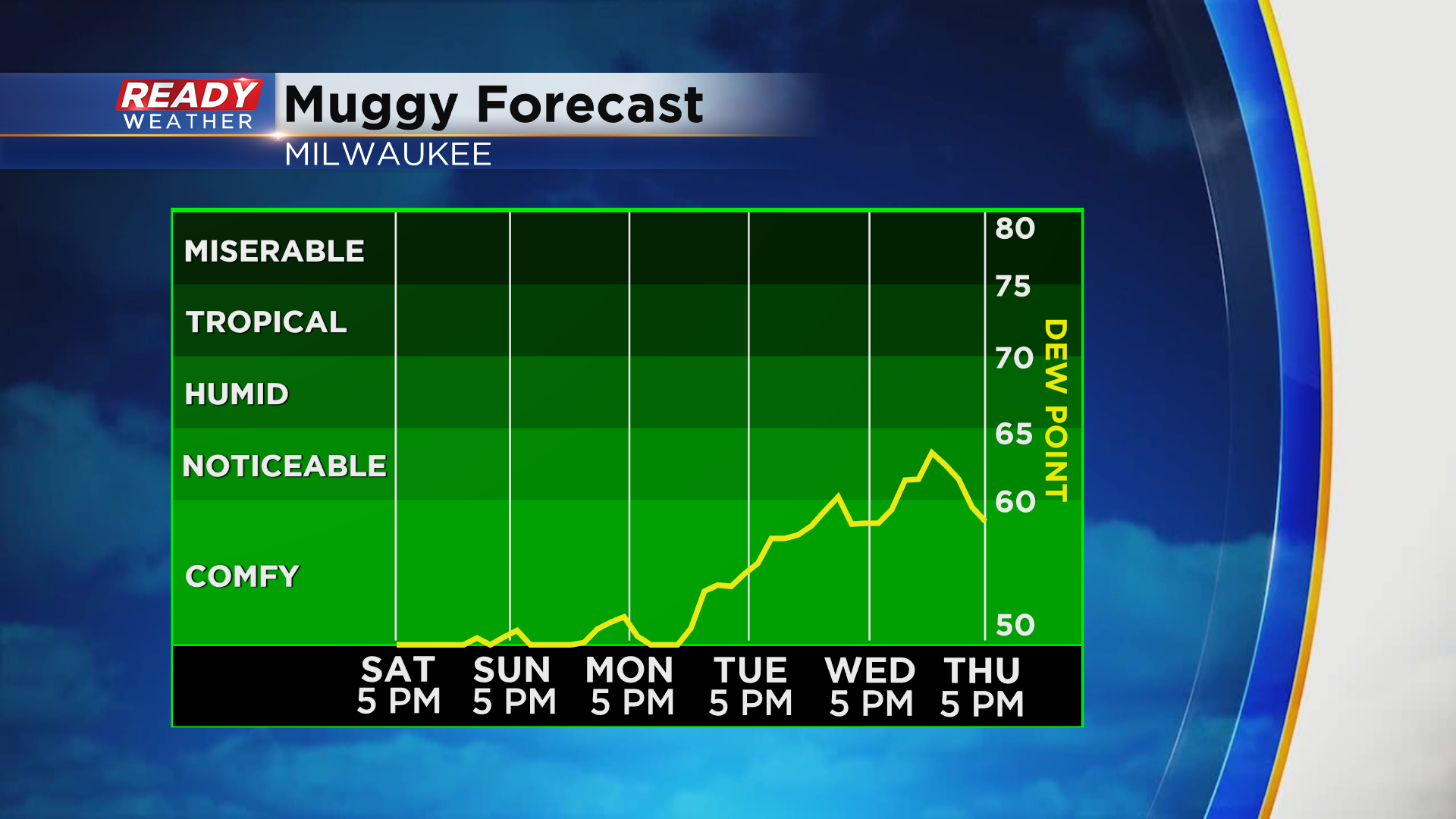
The increase in heat and humidity will lead to pop up shower and storm chances at times Tuesday through Friday, but no day looks to be a complete washout. Download the CBS 58 Ready Weather App to see the full 7 day forecast.