The last weekend of 2019 looks to be rather wet

-
2:50

Meet CBS 58’s Pet of the Week: Second Chance
-
3:18

Financial advisor shares 4 ways to spring-clean your finances
-
2:44

MTEA raises temperature as MPS starts sending budget-saving elimination...
-
2:04

’Everybody’s happy’: Brewers fans go home full of hope...
-
2:39

Neighbors near Highway 67 and McMahon asking for safety changes...
-
2:43

Fans, drivers pleasantly surprised by lack of Opening Day traffic...
-
2:04

City of Milwaukee files its largest nuisance lawsuit against...
-
1:19

Olympic champion Jordan Stolz throws out first pitch for Brewers’...
-
1:00

Annual Girls’ Day at Milwaukee City Hall aims to empower young...
-
3:05

’It’s going to be our year’: Brewers fans celebrate first...
-
1:50

$80M cargo hub development at Milwaukee’s Mitchell International...
-
2:46

CBS 58 Hometowns LIVE: Zablocki Golf Course

Milwaukee (CBS 58)--Gosh, we've been spoiled this week. A string of 50s and sunshine to boot! Now, after a record high of 58 on Thursday, we've cooled off behind a cool front. I'm not saying cold front because the air isn't chilly, especially for this time of year. In fact, our high will approach 40. This is 10 degrees above normal for the end of December.
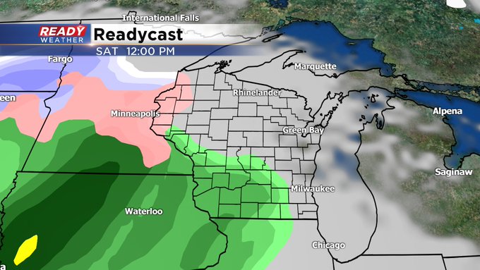
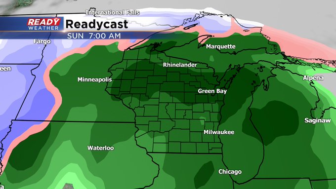
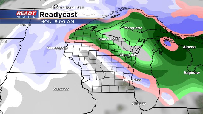
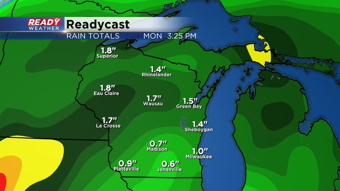
Meantime, look for rain to move into the area Saturday afternoon and hang around Sunday. An inch of rainfall, at least, could fall. I think we'll get "dry slotted" during the day on Sunday but then more moisture returns for Sunday evening. We're holding off on the snow until Monday during the day. It will linger into Tuesday and could provide a bit of an accumulation. Stay tuned!