Tumultuous Tuesday weather a real possibility for southeast Wisconsin


MILWAUKEE (CBS 58)--I feel like we're watching Groundhog Day again. The same type of weather setup we saw on Friday could play out again Tuesday evening and night. It's another strong area of low pressure jetting in from the southwest. There's a lot of wind energy too.
This time, most of the northern half of the viewing area is under a marginal risk while along and south of I-94 is featured in a slight risk. The enhanced category has expanded to include Walworth, Jefferson, Waukesha, Racine, and Kenosha counties.
All kinds of weather hazards, including damaging wind, hail, dangerous lightning, and heavy rain are all possible. Please be weather aware on Tuesday. Of course this is Election Day. This is even more reason why you should download the free CBS 58 weather mobile app to keep track of weather alerts and the current radar.
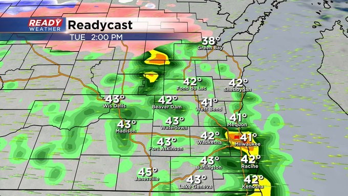
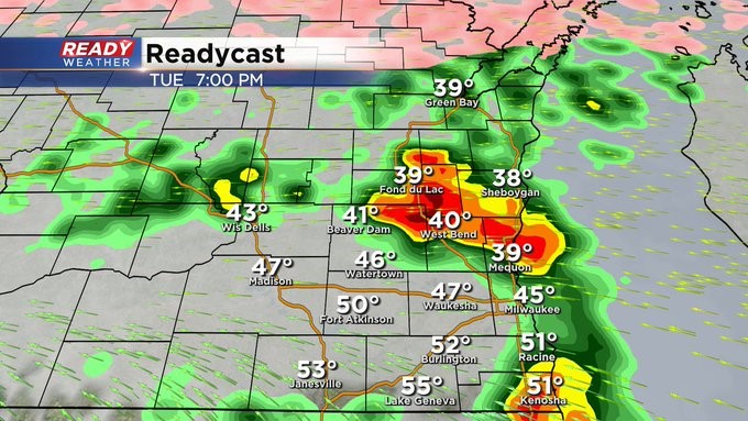
Two rounds are possible. The first will be from Noon until 3 pm. Those storms could produce small hail. The main severe window will be from 6 pm until 10 pm.
Before the cold front crosses the area during the day on Wednesday, some of us could reach the mid 60s at least. Then the numbers really fall off behind the front along with some very gusty winds. Look for 40s by the end of the day. The end of the week is much quieter until we get to Easter. There's a risk of showers that day. Hopefully not all day though.