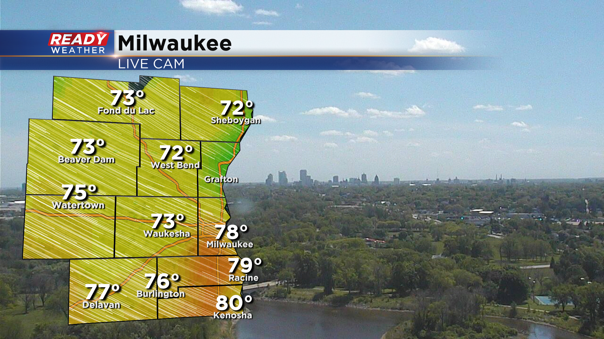
Today had been advertised as the pick day of the week, and it's been a picture perfect late May day! Temps are in the 70s with comfortable humidity, abundant sunshine, and a nice breeze.
Unfortunately this awesome weather isn't here to stay. A low pressure system will track across northern Illinois Thursday into Friday, bringing clouds, showers, and a blustery wind off the lake. Winds will turn to the northeast this evening with increasing clouds heading through Thursday morning. Scattered showers will be possible by later Thursday afternoon, but the best chance for widespread rain comes Thursday night into early Friday morning.
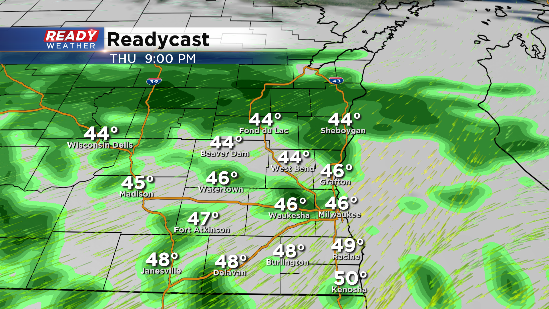
The steadier rain will taper off to scattered light showers and drizzle on Friday, but they look to linger for a good chunk of the day.
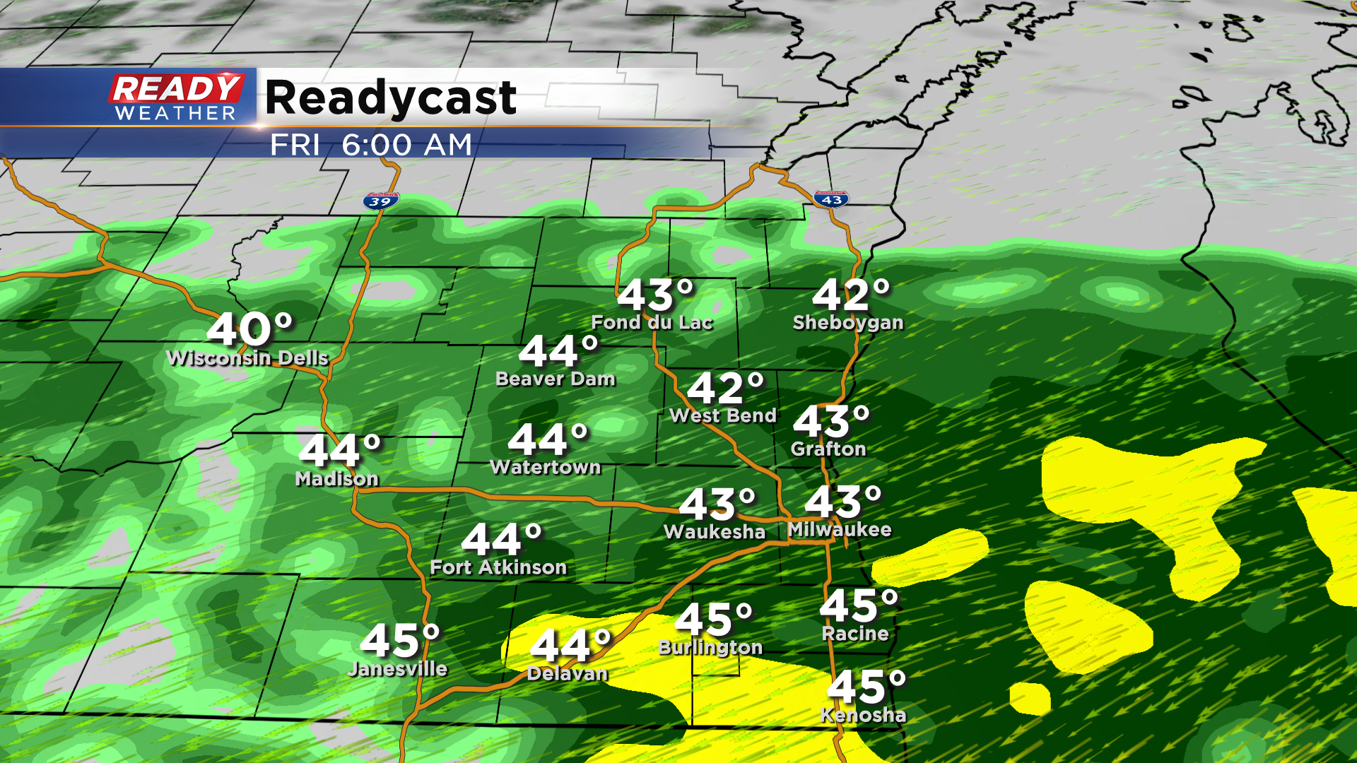
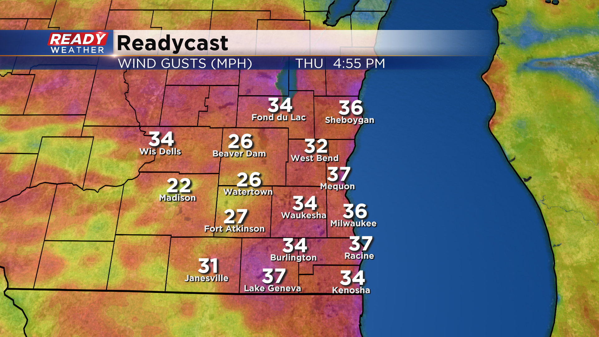
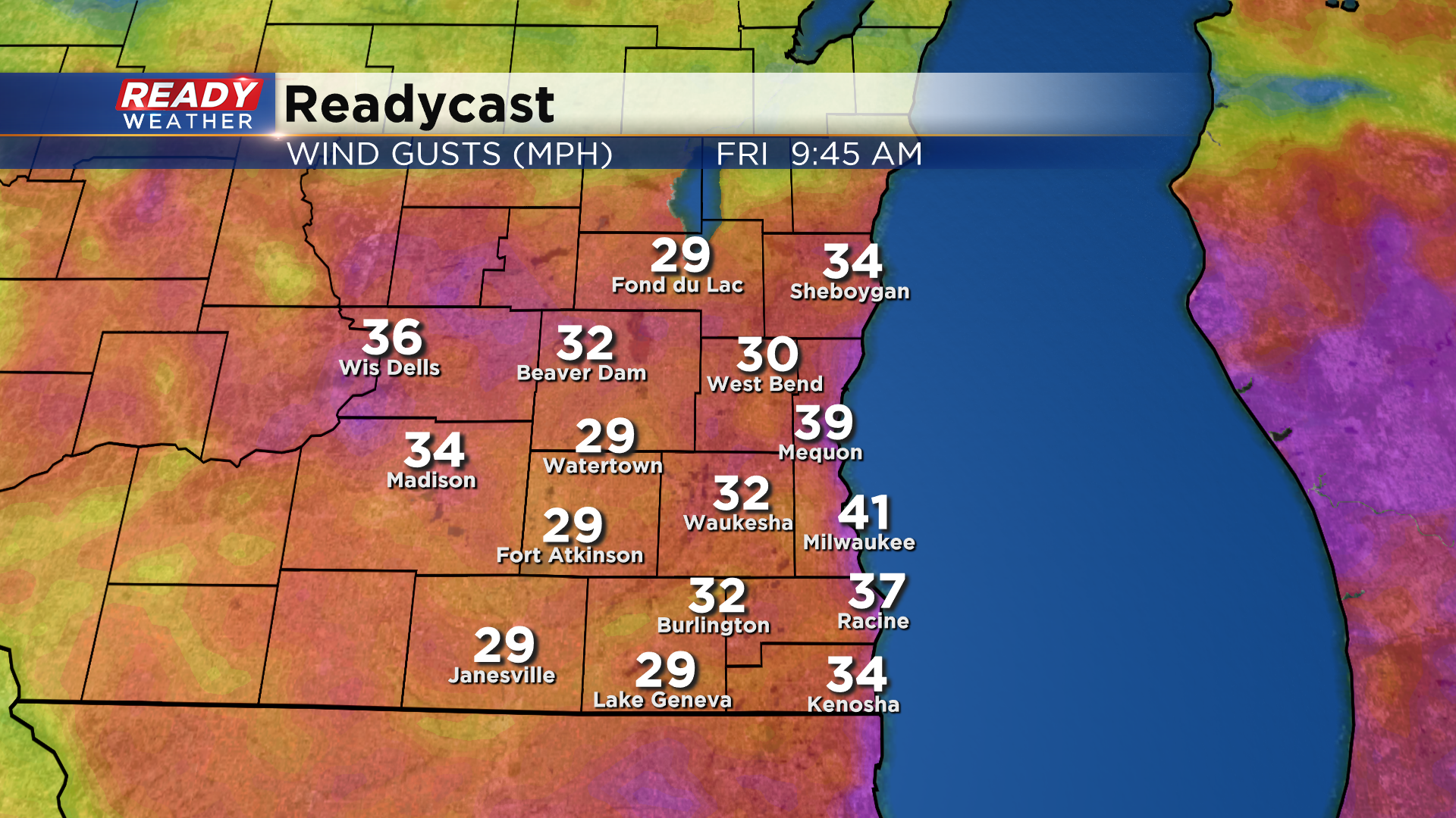
With this system tracking to our south, we'll be on the cooler side of the low. Temps will only reach the low to mid 50s on Thursday and will struggle to climb out of the 40s on Friday. Factor in winds gusting off the lake at 30-40 mph, and it'll feel rather chilly and raw, especially Friday morning.
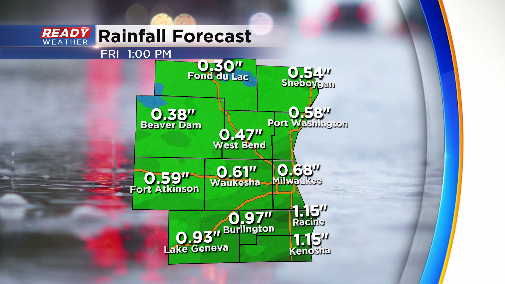
Models are in pretty good agreement in rain totals from this system, with a solid .50-1" expected for most. While the weather will be quite raw, we could use the rain.
Good news is high pressure builds in for Memorial Day Weekend, bringing dry weather and sunshine back into the forecast. Download the CBS 58 Ready Weather App to see how temperatures rebound after the end of the week rain.
