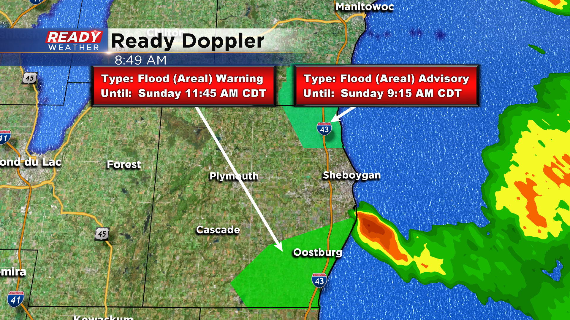
9 am Update: Lingering flooding this morning in Sheboygan county due to stationary storm


Updated: 8:50 am Sunday August 9th:
The storm that prompted the Flash Flood Warning early this morning has moved over the lake, but not before dropping 2-6" of rain in Cedar Grove and Oostburg. An additional storm popped up in far northeast Sheboygan county this morning and dropped a quick 1-2" as well.
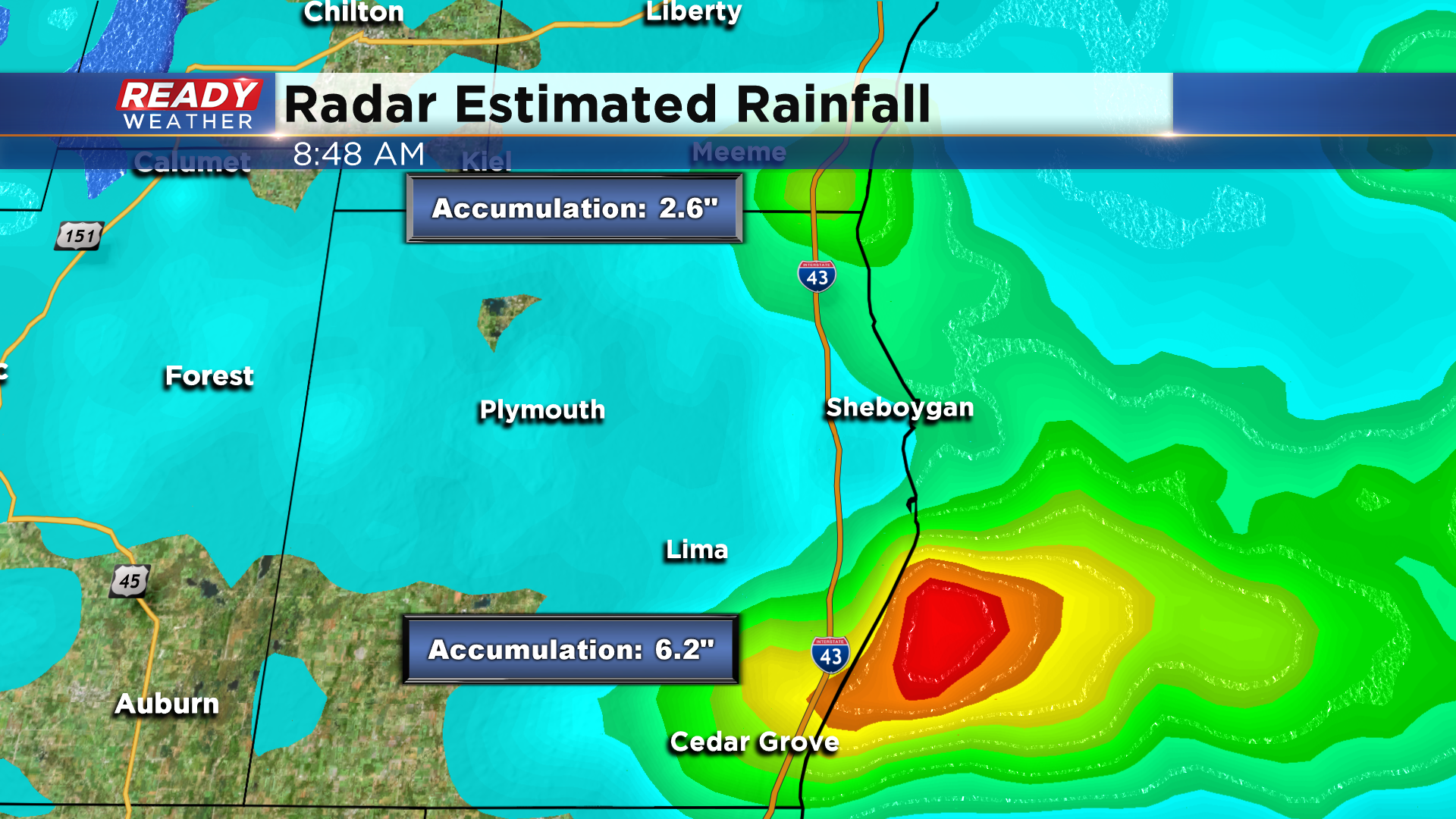
The Flash Flood Warning was allowed to expire at 8:30 am, but it was replaced with an Areal Flood Warning due to lingering standing water on roads and flooding in low lying areas. An Areal Flood Advisory is also in effect for far NE Sheboygan county through 9:15am due to the heavy rain.
----------------------------------------------------------------------------------
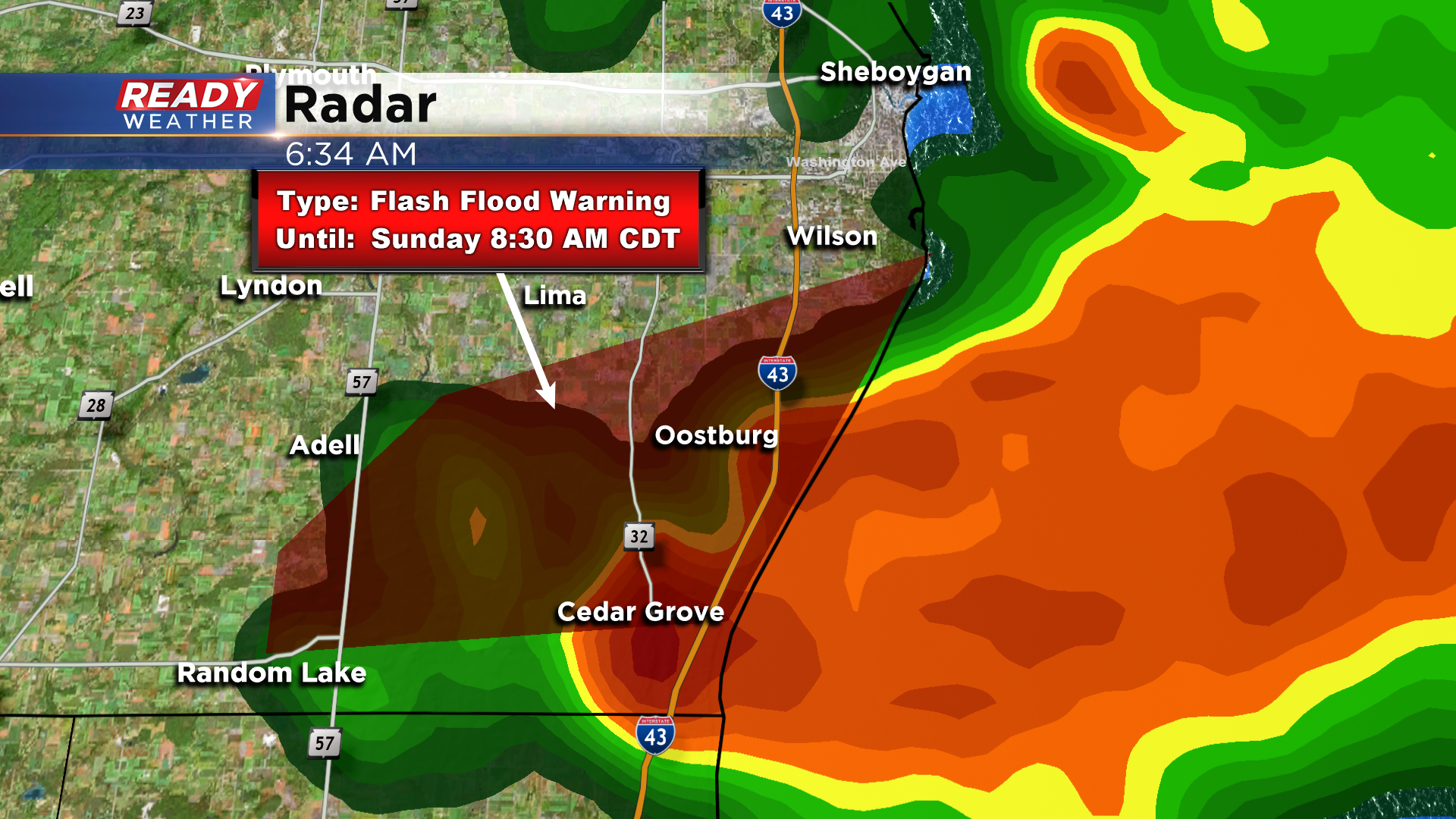
Updated: 6:30 am Sunday August 9th:
A thunderstorm popped up over far southeast Sheboygan county and hasn't moved much for the past two hours while dropping 2-3" of rain. This has been causing water over roads in Oostburg. A Flash Flood Warning is in effect for this area through 8:30 am. Large hail in this storm has also caused some crop damage in Dacada.
------------------------------------------------------------------------------------------------
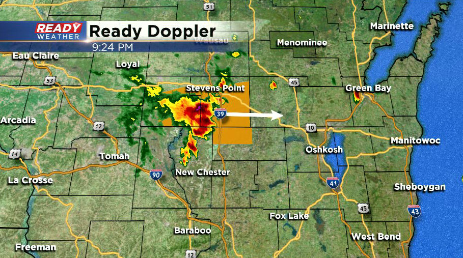
Updated: 9:30 pm Saturday August 8th:
A lone severe storm is tracking along that stalled boundary in central Wisconsin this evening. This storm is currently tracking East at 45 mph and has a history of producing 60 mph wind gusts. Current track of this storm would keep it north of Fond du Lac and Sheboygan, but the southern part of that storm may clip far northern parts of the county if the storm tracks a little more southeast.
Once this moves through, we should be mainly dry through tonight.
-------------------------------------------------------------------------------------
Updated: 5:45 pm Saturday August 8th:
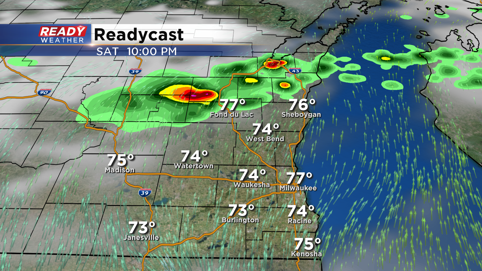
All of southeast Wisconsin has dried out early this evening with plenty of sunshine in place. However, the boundary that triggered the storms in our northern spots earlier this afternoon is still stalled just to the north of the area. A complex of strong to isolated severe storms in MN is expected to track east towards this boundary through the evening.
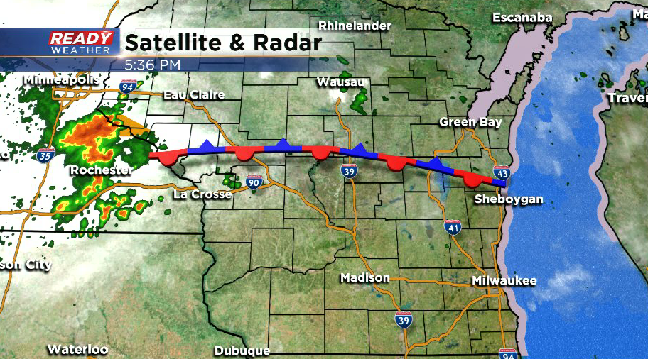
Models haven't done a good job picking up on these ongoing storms at all, but if they're able to hold together we could see a few isolated showers or storms after 9 pm. The storms should be weakening after sunset, which should keep their strong/severe potential low.
Most of the area should dry out after midnight, with dry, hot, and humid conditions expected Sunday morning into the afternoon.
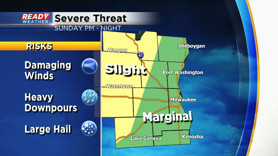
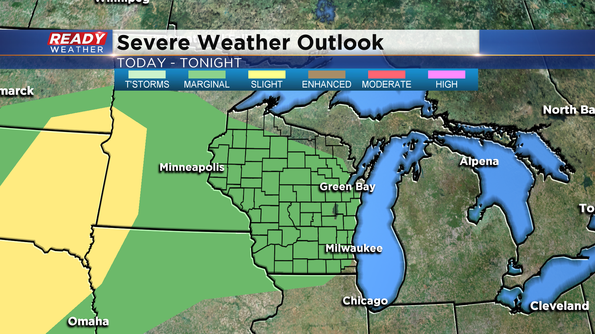
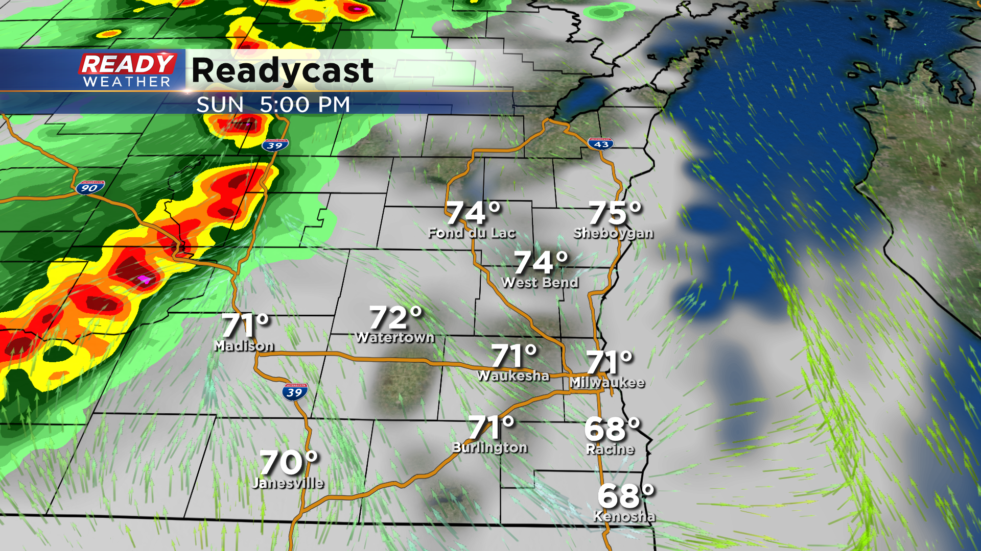
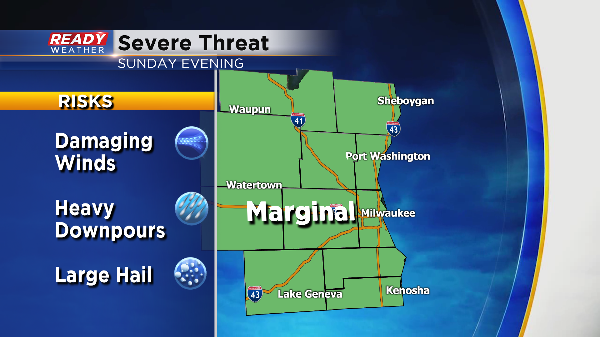
By Sunday evening, we could be dealing with a line of strong to severe storms. There's still a decent amount of uncertainty in these storms, but if they do form they'll have a good chance at being strong to severe. Our western spots have been upgraded to a Level 2, Slight Risk, for severe storms for Sunday.
Additional scattered storms are expected Sunday night into Monday morning as the cold front approaches.
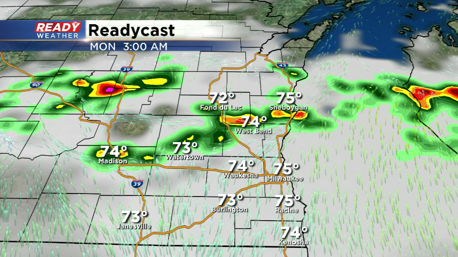
Just like today and tomorrow, there's some uncertainty as to whether the cold front will clear the area Monday morning, or if it holds off until Monday afternoon. If it doesn't move through in the morning, we could have another round of strong to severe storms Monday afternoon. Cooler and less humid air will move in behind the front. Check back for forecast updates through the weekend as we fine tune the specifics.
-------------------------------------------------------------------------------------------------
Updated: 12:30 pm Saturday August 8th:
Scattered storms have continued to fire along the aforementioned boundary throughout the morning, which has now sagged into Fond du Lac and Sheboygan counties. These storms are not severe and have only been producing heavy downpours and lightning so far today.
Spotty storms will continue to sag southward at least into parts of Dodge, Washington, and Ozaukee counties early this afternoon, but it's uncertain if the storms will make it any further south than that. Strongest storms may produce small hail.
----------------------------------------------------------
A complex of sub-severe storms tracked across northern Wisconsin overnight and is currently pushing out over Lake Michigan. Additional isolated storms have developed along a boundary trailing the complex of storms. These are moving east-southeast and may clip Fond du Lac and Sheboygan counties through midday.
This boundary will stall out somewhere across central Wisconsin this afternoon and serve as the focus for isolated to scattered storm development later this afternoon and evening. There's still quite a bit of uncertainty as to how today will pan out due to the placement of that boundary and if it will be enough of a "push" to get storms going. Currently, the best chance for storms through this evening will be across Sheboygan and Fond du Lac counties (40% chance), with areas south of Milwaukee likely staying dry.
If storms are able to develop, they could be on the stronger side with gusty winds, hail, and heavy downpours. There's a level 1, Marginal Risk, for severe storms in place for most of the area besides far SE Wisconsin. The higher chance for severe storms will remain well to our west in South Dakota, Nebraska, and western Minnesota and Iowa.
Although it's rather nice this morning, it will become more humid this afternoon as dew points rise into the mid to upper 60s with highs in the mid 80s.
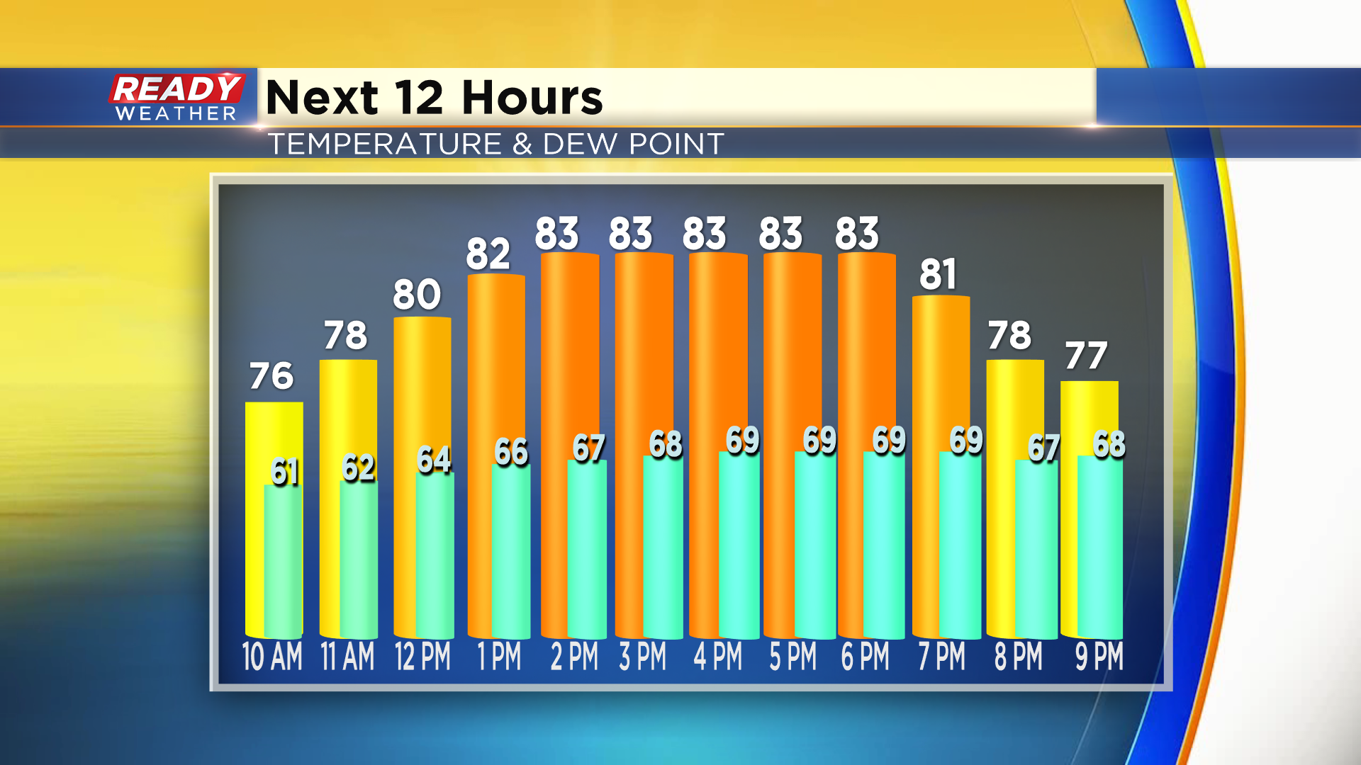
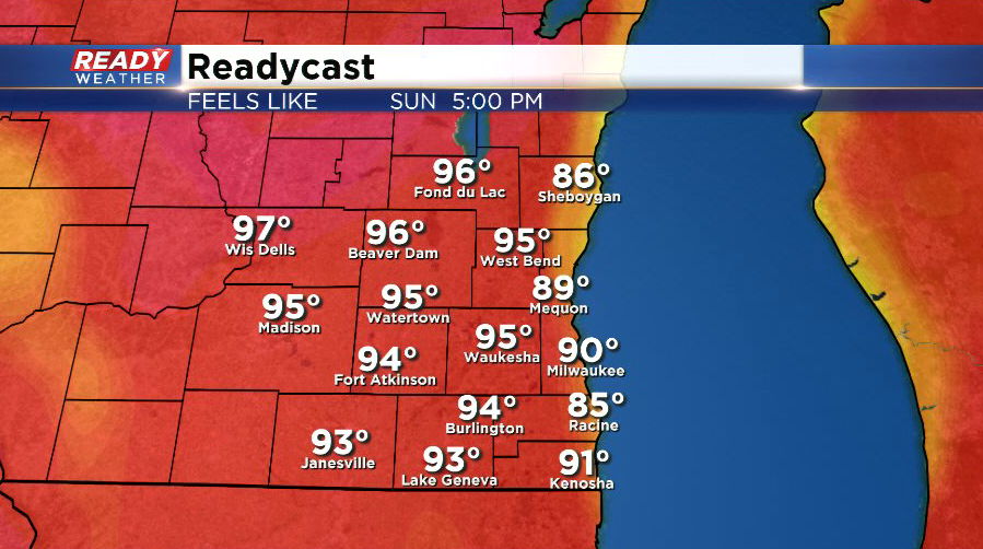
We'll be even warmer and more humid on Sunday with highs in the upper 80s to around 90. That heat and humidity will fuel a better chance for thunderstorms late in the afternoon through Sunday night.
There could be multiple rounds of storms into Monday, but unfortunately there's still quite a bit of uncertainty as to how many rounds could impact southeast Wisconsin. The heat and humidity will lead to a better chance for these storms to be severe. Gusty winds, heavy rain, and hail will be the main threats across all of southeast Wisconsin.
Download the CBS 58 Ready Weather App to track the storms, and check back here for updates throughout the day.