Unseasonably warm weather continues ahead of our next soaking rain
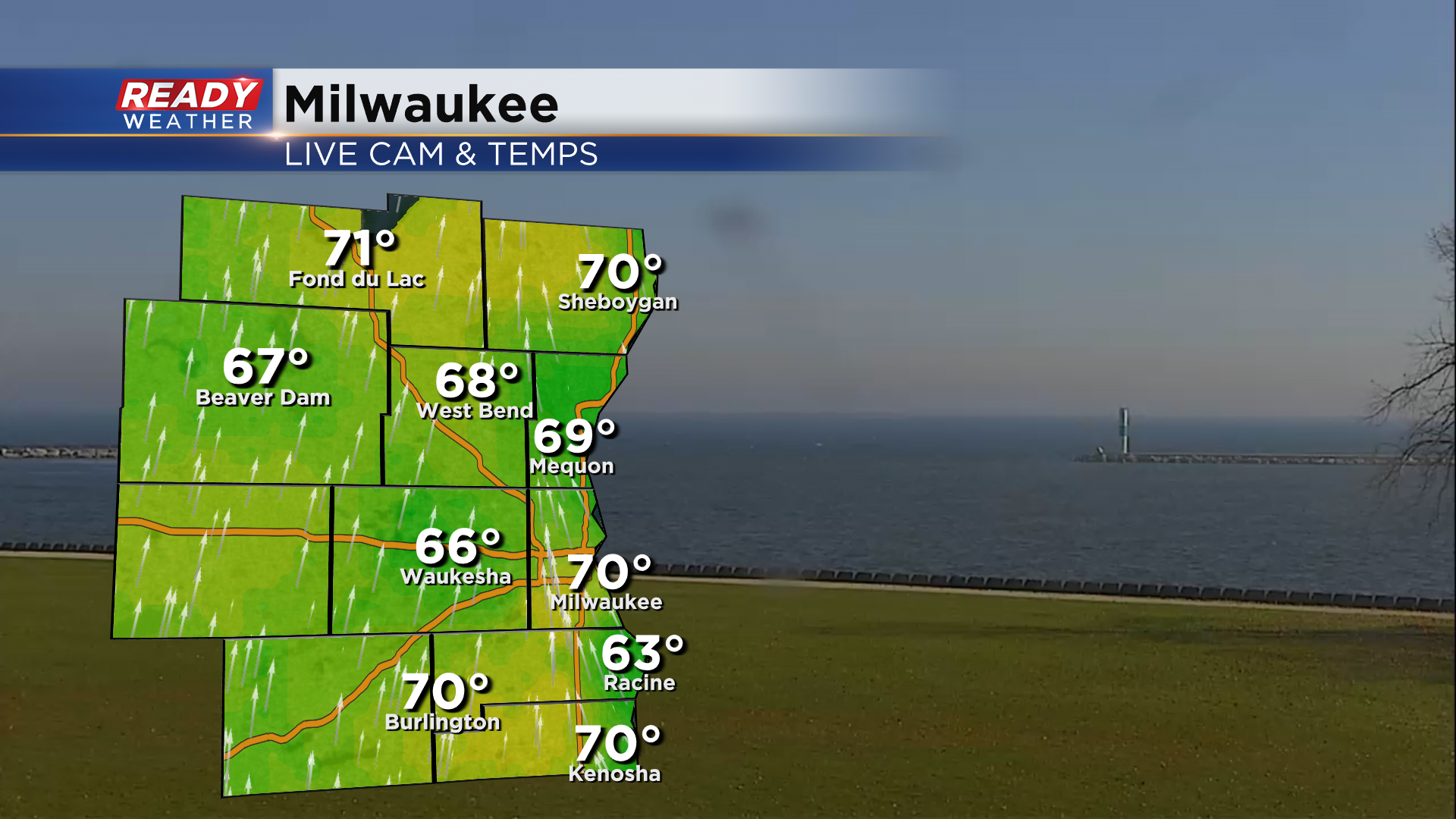
It's another glorious day across southeast Wisconsin with temps well on their way into the low 70s once again!
High temperatures won't get near record territory today, but we are on record watch on Thursday as a breezy southwest wind gusting between 20-30 mph helps boost temps into the low to perhaps mid 70s.
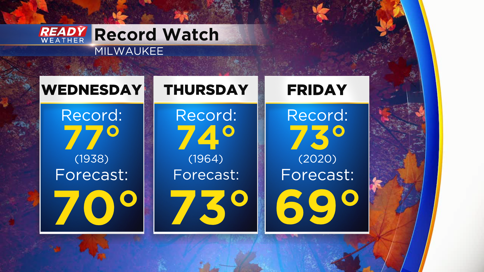
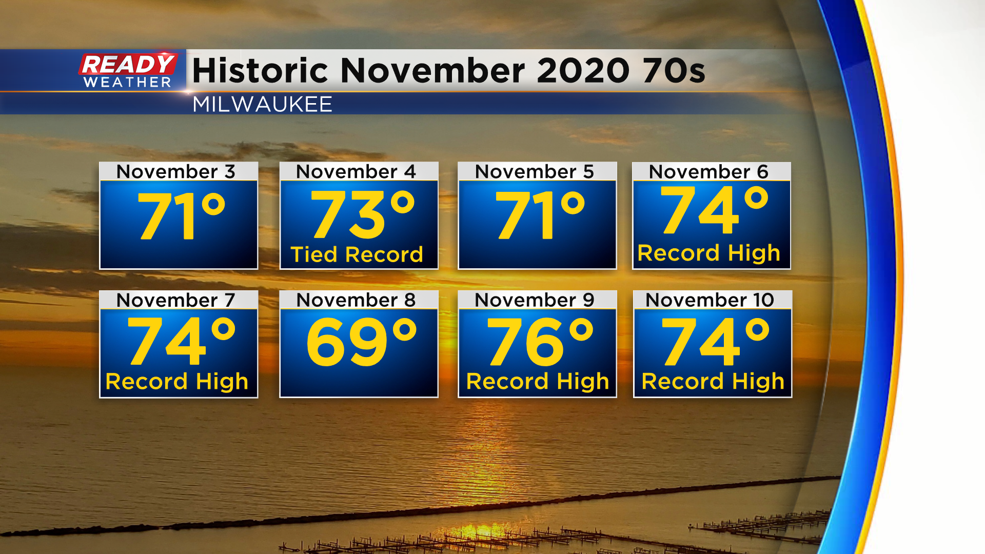
We'll likely come up short of the record high on Friday as more clouds and rain move into the area. Friday's record high was set back in 2020 when we had an unprecedented stretch of temps in the low to mid 70s.
The blustery southwest wind continues on Friday, which will help us get into the upper 60s, but rain will slowly build in from the west during the day. The afternoon and evening look fairly soggy for most except possibly far southeast WI. We can't rule out a few storms either.
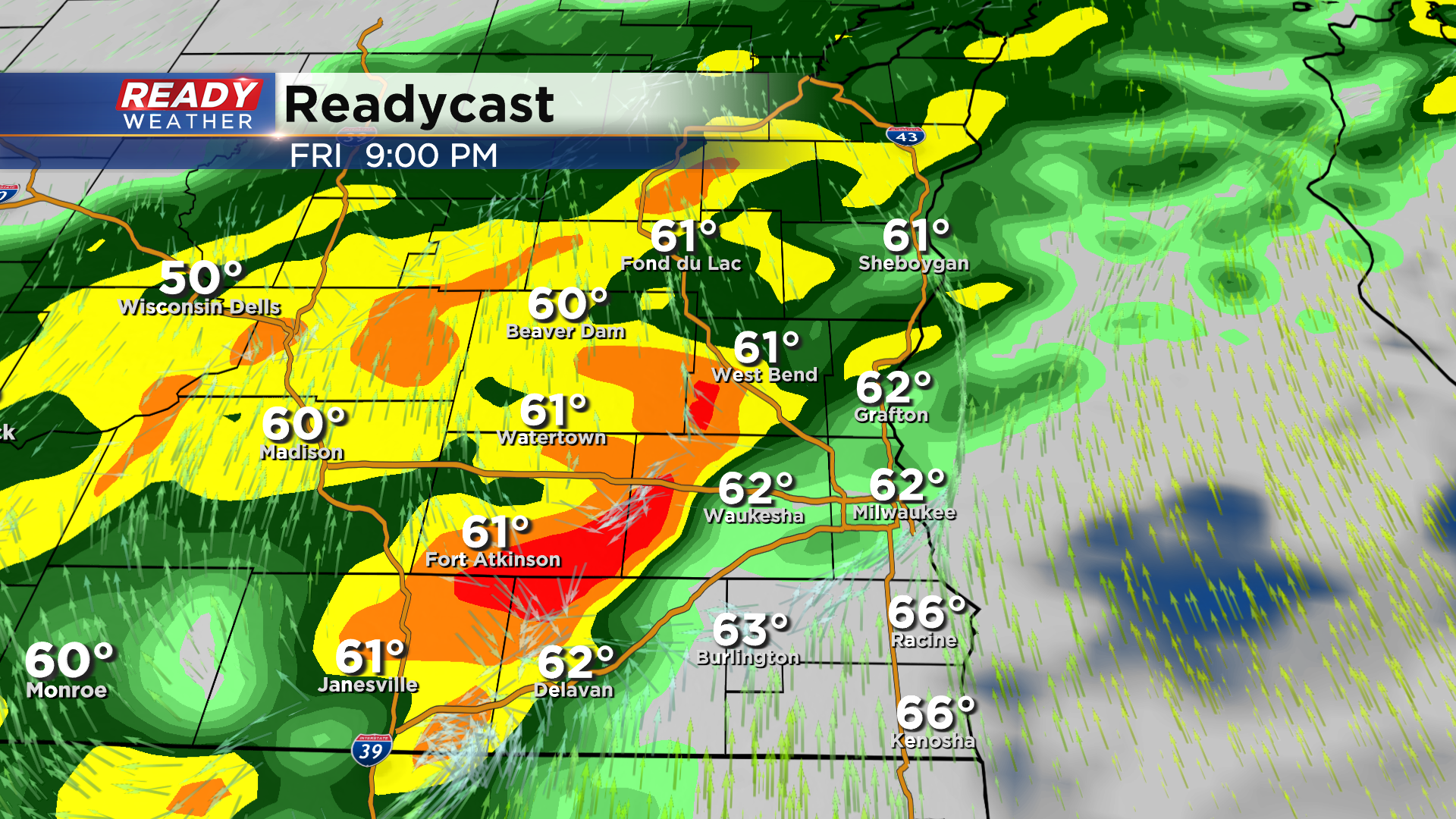
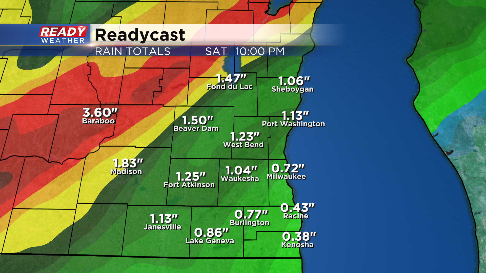
This solid area of rain will continue to slowly push through on Saturday, so plan on a soggy start to the weekend. By the time the rain exits, anywhere from .50-1.50" of rain will be possible. Far NW spots and areas closer to central WI could easily pick up 2" or more of rain due to the slow moving nature of this front.
Download the CBS 58 Ready Weather App to see how much temps fall behind this system.
