Warm and muggy conditions will lead to strong storms today....Afternoon Update
By: CBS58 Staff
Posted: Jul 26, 2017 3:33 AM CDT

-
1:05

United Healthcare, MMAC give $600K to support 30 incoming Marquette...
-
1:32

Milwaukee police officer shot near S. Cesar Chavez and Scott...
-
1:14

Mayor Johnson replaces Milwaukee’s election chief 6 months...
-
1:19

Packers’ offseason plans come together
-
2:09

How campus protests could impact young voter turnout in Wisconsin
-
1:49

’It’s impacting everybody’: Alverno College in Milwaukee...
-
0:57

Milwaukee police officers head east for national bike ride honoring...
-
2:11

Protests and encampment at UWM continue into 2nd week
-
1:48

Milwaukee Host Committee holds ’Coffee and Conversations’...
-
4:52

Previewing May’s event calendar in the Historic Third Ward
-
2:50

Mount Mary’s annual CREO Fashion Show this Friday has a different...
-
4:00

Wisconsin BBB warns about moving scams

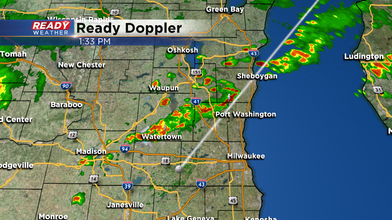
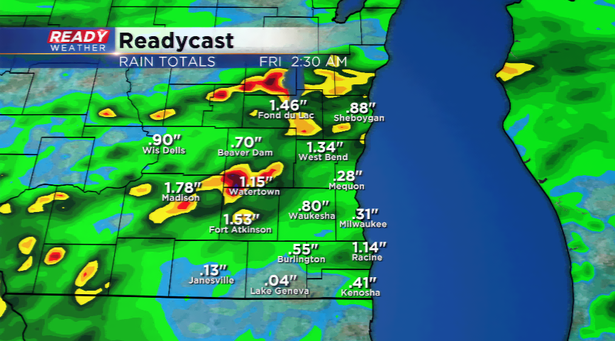
UPDATE: No changes to the forecast. Scattered showers and storms continue to develop ahead of a cold front this afternoon. Small hail and gusty winds remain possible.
A cold front will power through the state the next 24 hours kicking up showers and
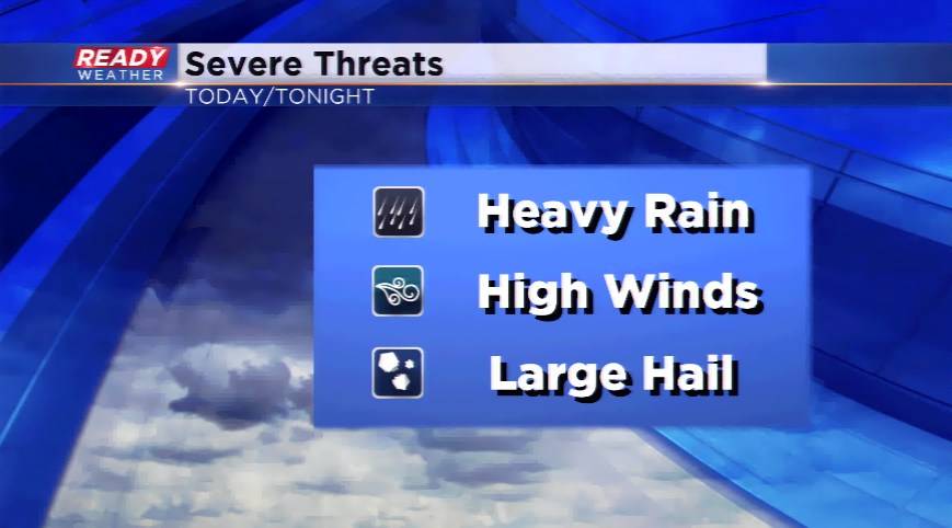
The Storm Prediction Center has parts of our western counties
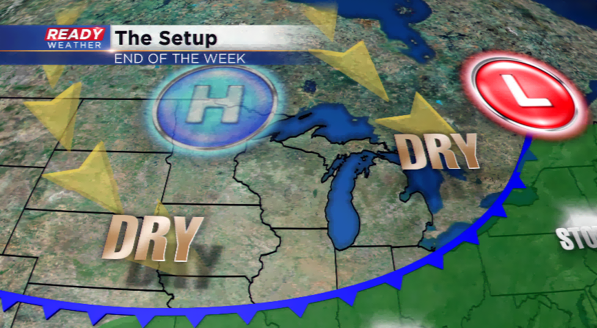
Week’s end will feature much drier conditions and sunshine developing into the weekend. Highs will hover in the 70s to around 80. It might be one of t
Sign up for the CBS 58 Newsletter