Warmest temps of the year on track for Friday with a few light showers the next few days


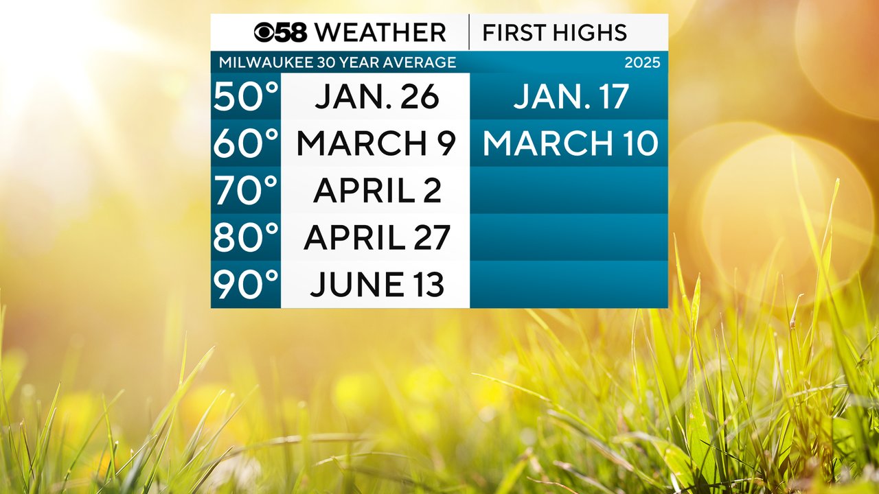
So far 2025 has been fairly on track for hitting our milestone high temperatures close to their average dates. We had our first 50 degree day in the middle of January about 10 days then hit our first 60 degree day almost right on the average date. We are still waiting on our first 70 degree day, but that could change Friday.
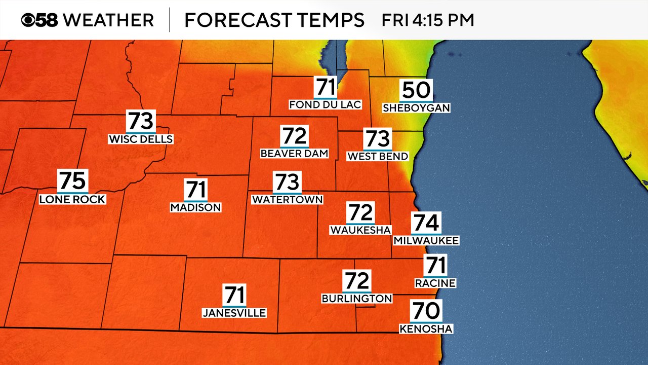
As a warm front surges north Friday it will give us the first chance of the season for highs to reach into the 70s! A few weather models are hinting at low to middle 70s! But this warmth will be dependent on the possibility of a lake breeze which is why Sheboygan is showing up cooler. As well as any rain. If showers linger into Friday afternoon the warmth might not reach us.
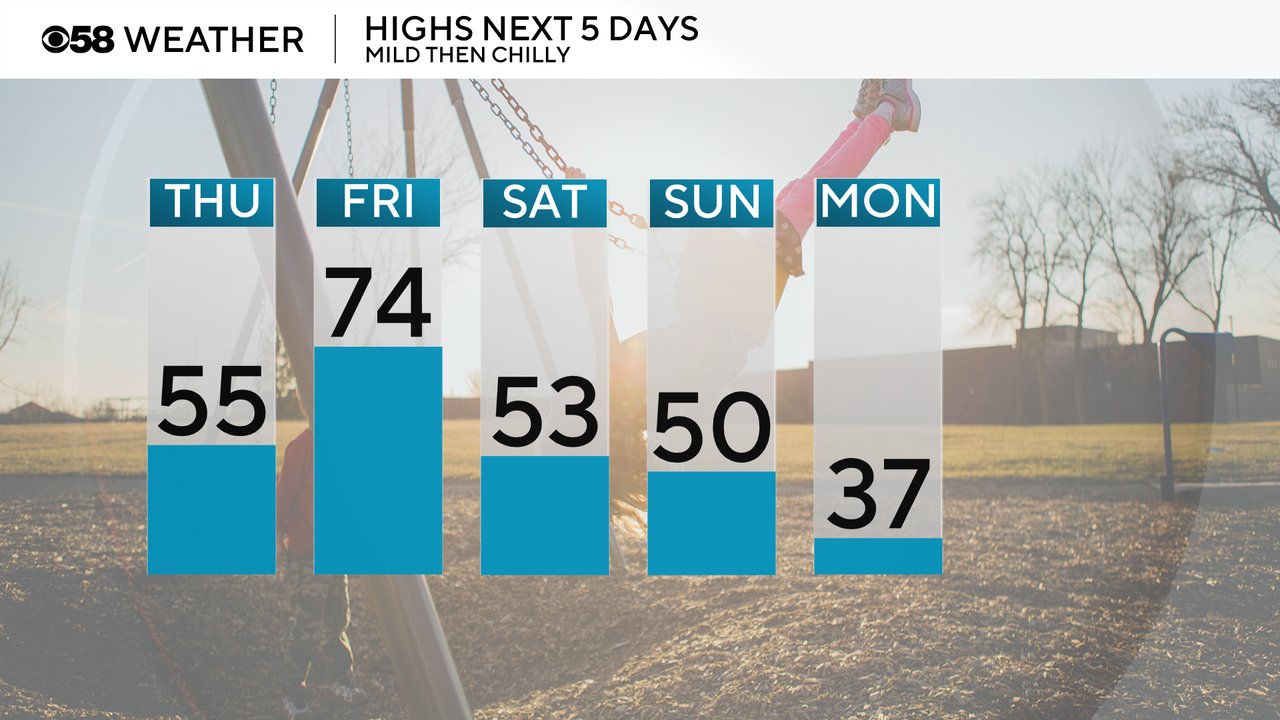
Even before the possibility of 70s for Friday, Thursday is already a little warmer in the 50s. The Weekend isn't bad with temps with most hovering around 50 but we really get chilly by Monday for the Brewers home opener in the 30s.
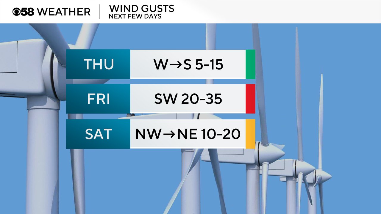
The wind won't be too bad Thursday from 5-15 mph but the wind really picks up Friday bringing in all that warm air with gusts to 35 mph. The breeze will linger through the weekend.
A few showers are starting to roll into our western counties this Thursday morning. Those showers should mostly be confined to the morning hours but the rest of the day stays with more clouds than sunshine with a stray sprinkle.
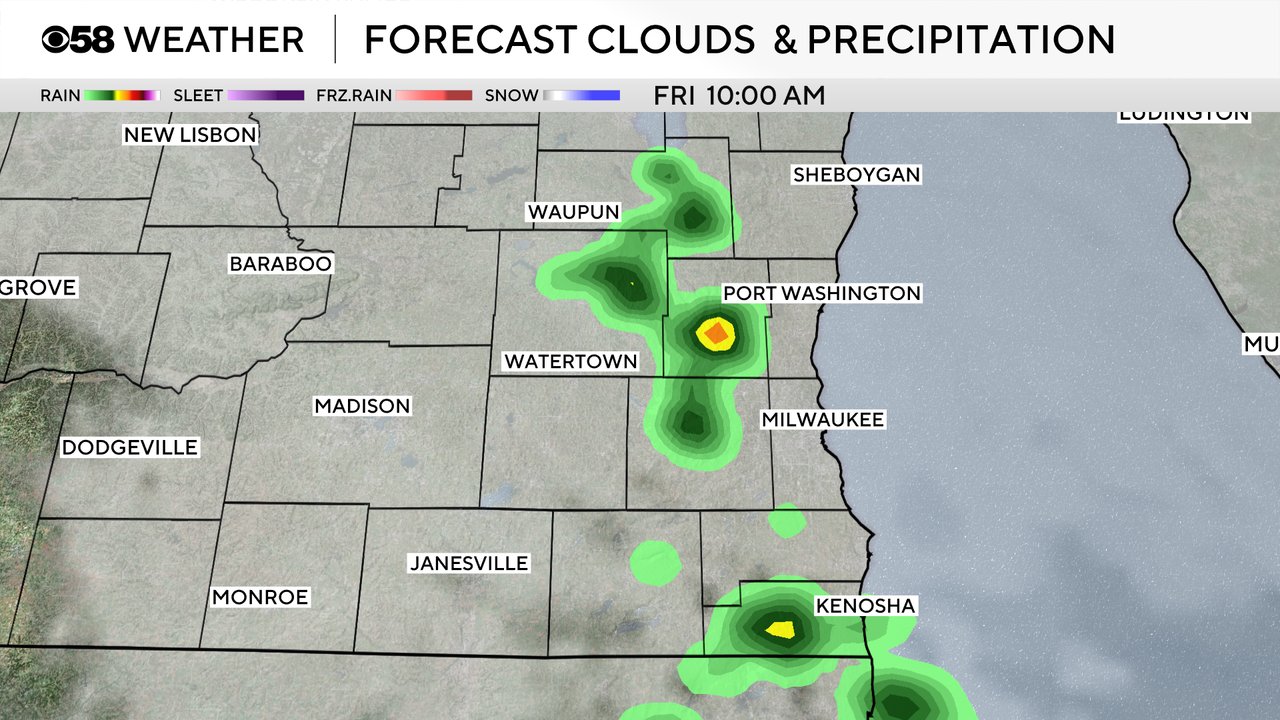
Here's a radar image that will update with time:

Friday morning has a similar chance for showers and maybe a better chance at a few downpours or even a stray rumble of thunder. Once again the afternoon hours look drier. Scattered showers look a bit more possible throughout Saturday but Sunday could be our wettest day with both rain and snow.
Download the CBS 58 Weather app to track the temperatures for Friday and the rain with the interactive radar.