Widespread rain and some thunder expected tonight and Sunday night


After some isolated light showers throughout the day today, we’re seeing a break this evening with some fog in place. Heavier, more widespread rain will move in after 9 p.m. tonight and continue through mid morning on Sunday. A few rumbles of thunder will be possible overnight tonight as well.
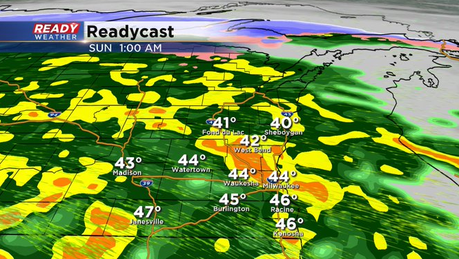
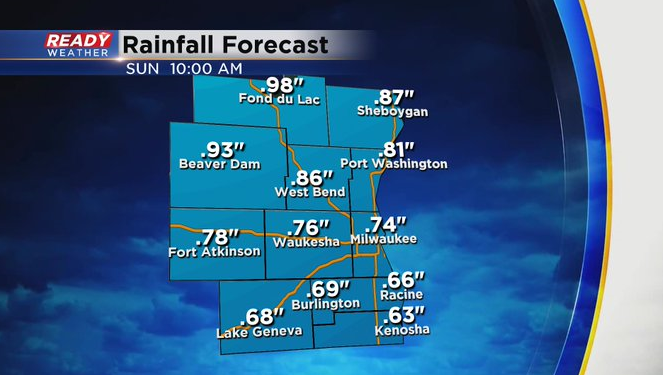
Rain totals look to be between .75-1” in this round, with higher totals possible where there are thunderstorms. Temperatures will rise throughout the night and are expected to be in the upper 40s to around 50 to start the day.
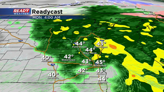
We’ll see a break in the rain during the late morning and afternoon on Sunday, and a few peeks of sun may even develop during the afternoon. Temperatures will be very mild, climbing into the upper 50s. Another round of steady rain will move in Sunday night, ending Monday morning. Temperatures will be warm enough for all rain, with an additional .50-75” possible.
Colder air will wrap into the area later Monday, changing the rain showers over to snow showers Monday night before ending early Tuesday morning. Some minor accumulation will be possible, which could impact the Tuesday morning commute.