
-
2:13

Vos testifies on first day of trial for Racine County man who...
-
2:52

’We need the state and federal government’: Milwaukee mayor...
-
4:55

Saz’s State House celebrating 50th anniversary with special...
-
1:57

Celebration of life held for former Packers president Bob Harlan
-
0:58

Mukwonago firefighters honored after ice rescue on Rainbow Springs...
-
0:55

New initiative in Milwaukee aims to connect youth with positive...
-
2:23

DanDan in Milwaukee’s Third Ward to reopen after failing health...
-
1:39

Balloon Adventure brings a creepy, crawly experience to Lake...
-
2:06

Staying mostly dry as the reminders of last week’s blizzard...
-
4:14

Celebrating March Madness with basketball-inspired workout tips
-
4:06

Delafield’s I.d. offering four-course Easter brunch plus take-and-bake...
-
3:09

Plan a Goodwill wedding and let your wallet achieve wedded bliss

A fast moving system will arrive Tuesday night into Wednesday morning providing a true mix of snow, sleet, and freezing rain across southeastern Wisconsin.
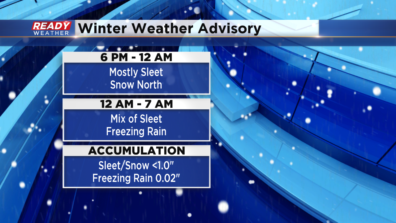
Most of Tuesday will be quiet across the area. Between 6 pm and Midnight expect a mix of snow and sleet to move across southeastern Wisconsin. The best chance for snow will occur north of I-94. As warm air starts to move into the system aloft, the snow will turn back over to sleet.
There will be a window for sleet and even freezing rain between Midnight and 7 am Wednesday.
The snow and sleet accumulation will remain below an inch with minor icing from freezing rain. While the overall totals aren't impressive, these types of winter systems will create slick roads Tuesday night into Wednesday morning.