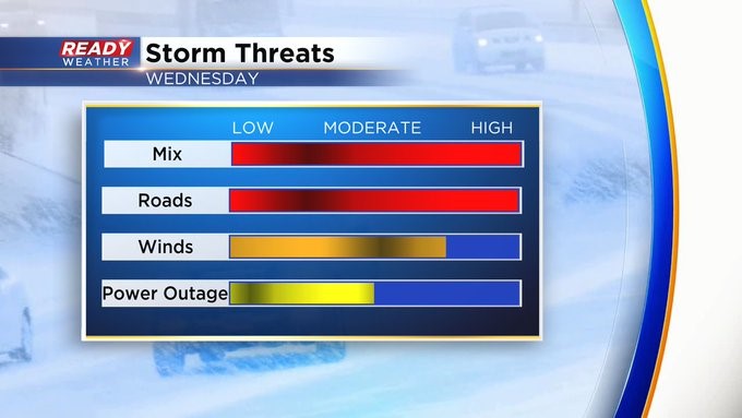
Early evening update: Snow, sleet, freezing rain mix continues to cause power outages and poor road conditions
Updated: Wednesday, February 22nd 8:15pm:
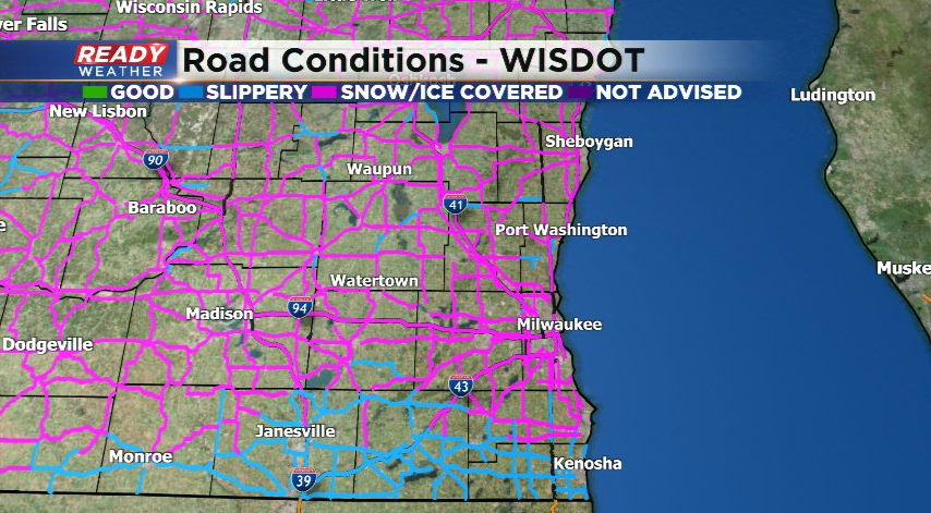
The precipitation is starting to weaken across western Wisconsin. The overall trend will be for the wintry mix to weaken after midnight. Unfortunately, the roads won't be improving anytime soon.
After most of the precipitation ends, dry air will arrive aloft, and freezing drizzle will be an issue overnight. Side roads will still be very problematic by the Thursday morning commute.
______________________________________________________________________________________________________________
Updated: Wednesday, February 22nd 6:15pm:
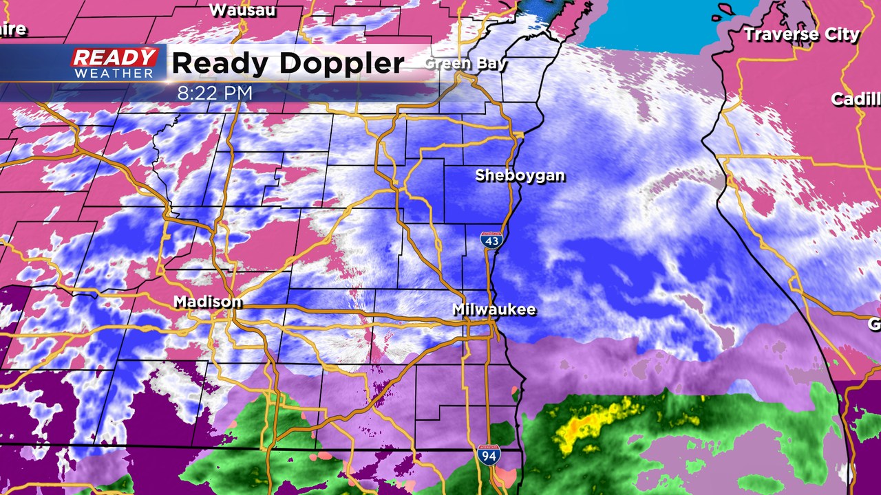
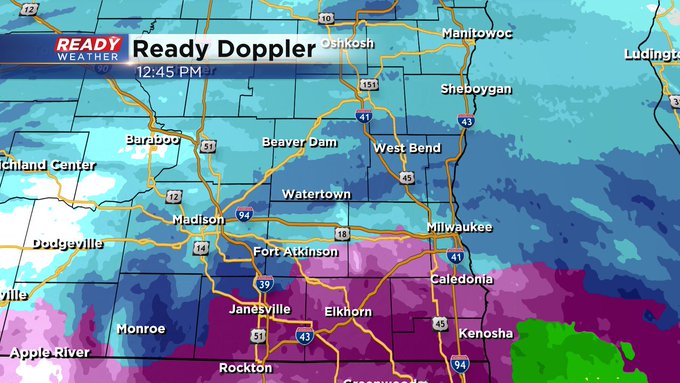
A true wintry mix continues to steadily fall across southeast Wisconsin. Sleet has been the dominant precipitation type across Milwaukee county for the last several hours with accumulating freezing rain south of MKE and mainly snow well north into Fond du Lac and Sheboygan counties. We are beginning to see some warmer air lifting northward into SE WI, so this sleet/mix line may drift farther north heading through this evening.
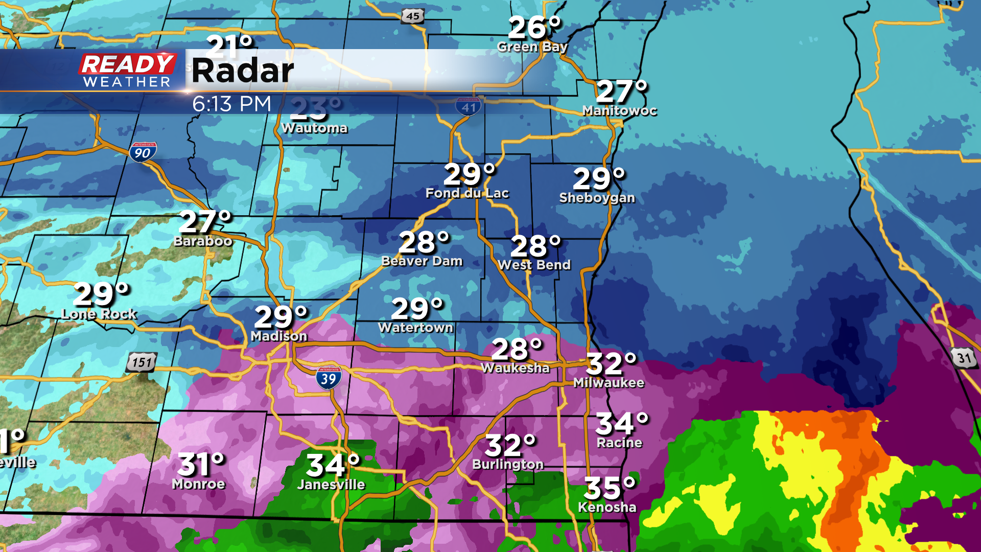
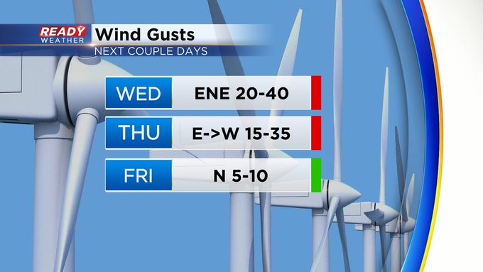
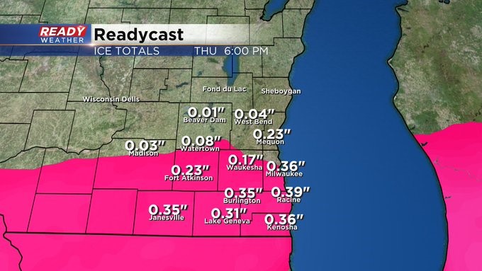
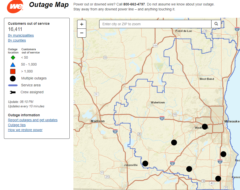
Between .25-.50" of freezing rain has already fallen and accumulated in Kenosha, Racine, and Walworth counties. That combined with 30-40 mph wind gusts have caused over 16,000 to lose power as of 6pm.
Roads are also in poor shape despite being pretreated and salted. There have been numerous accidents and roads won't improve until this mix becomes very light after midnight.
Stay in tonight if you don't have to travel.
-------------------------------------------------------
Update as of 5:00 pm Wednesday, February 22nd
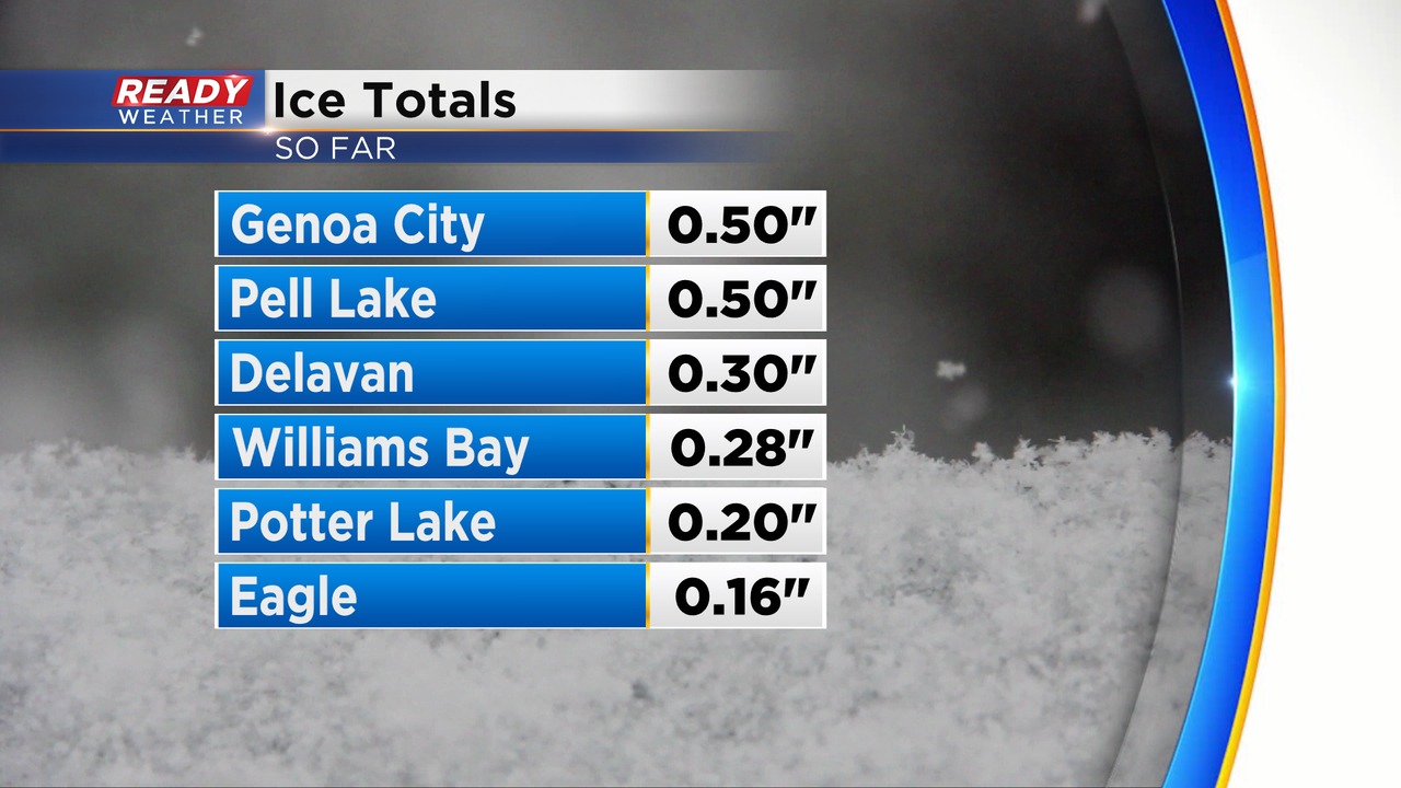
Thankfully, the majority of the mix hasn't been freezing rain. We did get some reports out of the Ice Storm warned area with around 0.50" of ice. Tree branches are susceptible to that icing and could cause some isolated power interruptions. The sleet has been the dominant form of precipitation this morning and afternoon across the metro. Northern areas have been mostly snow.
We expect the snow to continue across our northern areas during the rest of the evening into the overnight. Another 2" to 4" will be possible.
Mostly sleet will continue across the 94 east/west corridor with a mix of freezing rain and sleet across the Ice Storm Warning.
Most of the winter weather will weaken overnight with freezing drizzle lingering into Thursday morning.
______________________________________________________________________________________________________________
Update as of 1:00 pm Wednesday, February 22nd...
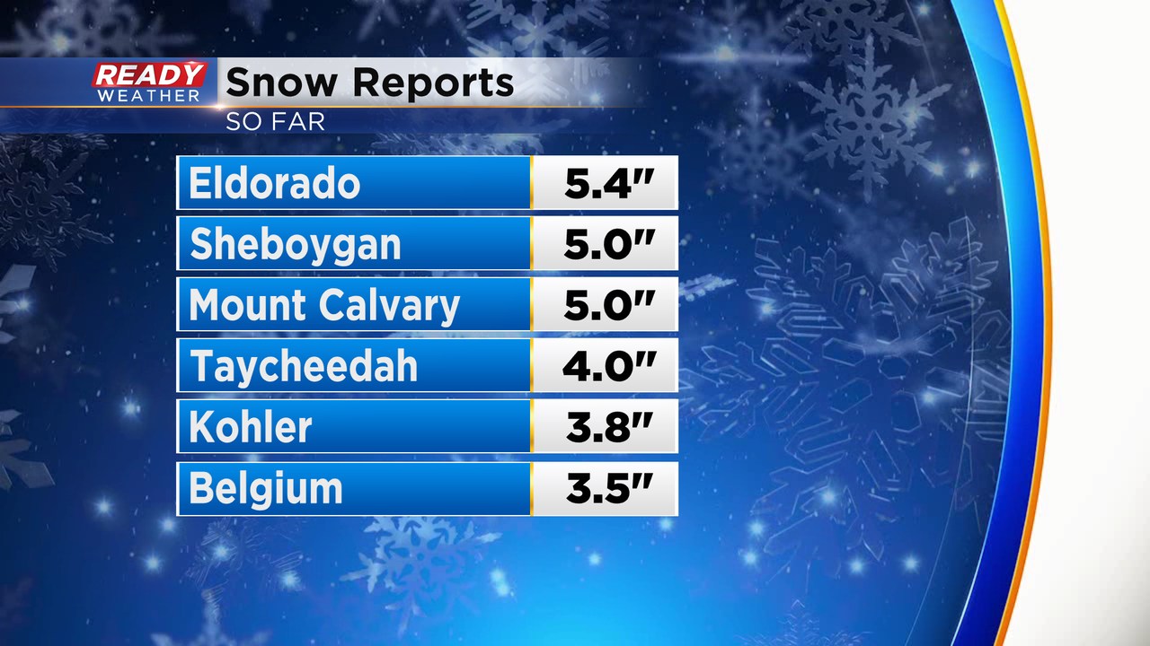
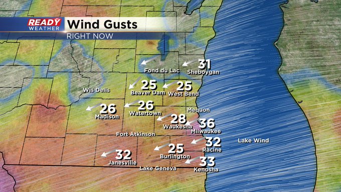
Remember this date from 2017?? It was our one and only 70 degree day in all of records for the month of February, we hit 71. But back to reality, today is anything but warm. Winds will make it feel extra chilly and troublesome for travel with all this wet weather, especially your north-south roads with the strong easterly fetch. Visibility will waffle up and down with bouts of heavier precipitation, especially north of Milwaukee where mostly snow is occurring. At this time new snow reports of five inches have come through in Sheboygan and four inches in Taycheedah (that's Fond du Lac county).
Update as of 11:00 am Wednesday, February 22nd...
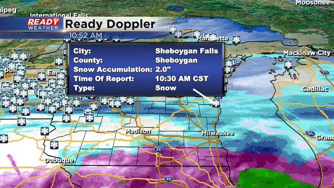
Wet weather is filling in across the area. As of now, we've got one snow report of two inches in Sheboygan Falls. All of this precipitation is moving northeast.
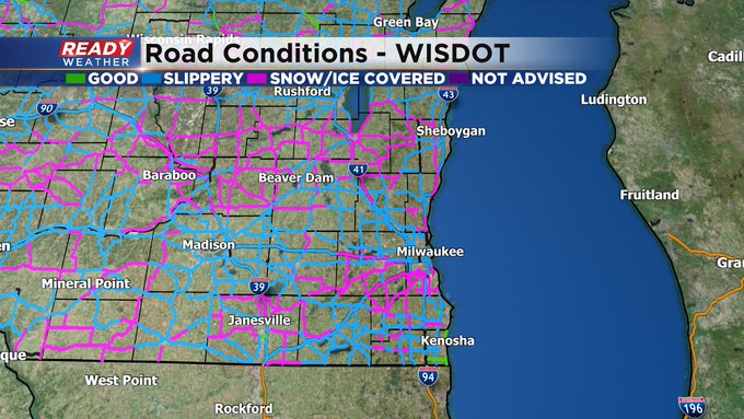
The bottom line is major impacts to travel are expected today. Here's the latest road conditions map:
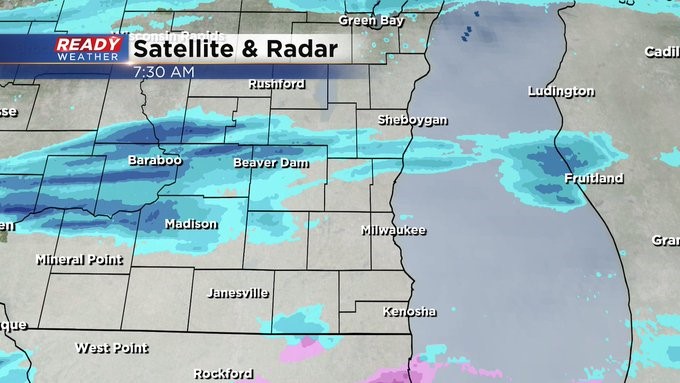
Update as of 7:30 am Wednesday, February 22nd...
Snow breaking out on the radar now, especially north of I-94. We're going to watch out for ice moving into the area by mid and late morning. This will impact the area, especially south of I-94 into tonight. Travel will be hazardous as well into tonight and overnight as well. Make sure your cell phones are fully charged in case the power goes out across the region.
_____________________________________________________________________________________________________________
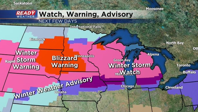
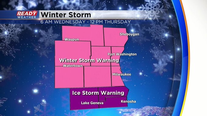
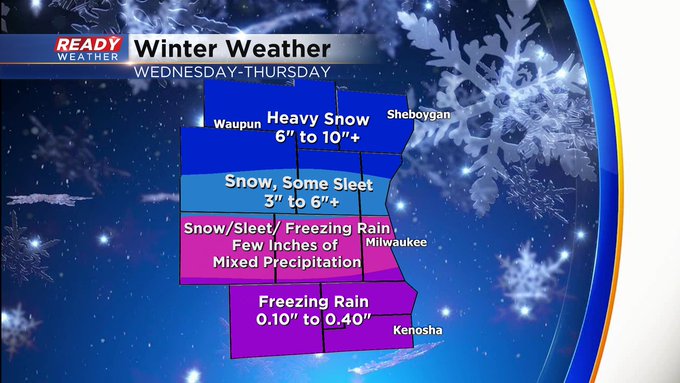
MILWAUKEE (CBS 58) -- We warned you and know it's coming. Expect a potpourri of wintry weather across our area all day Wednesday into much of Thursday morning. The farther north you go it'll be snow and ice toward the Illinois border. We have a Winter Storm Warning in place for most of the area from 6 am Wednesday until noon Thursday. It's an Ice Storm Warning also from 6 am Wednesday until noon Thursday for Racine, Kenosha, and Walworth Counties.
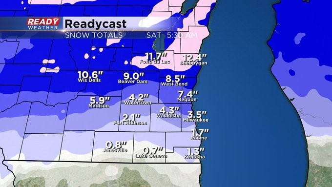
Temperatures will be critical to this forecast. But as it stands now, we could see more than 1/4" of ice toward the Illinois border and then close to a foot of snow well north of I-94, say around Sheboygan and Fond du Lac.
Low pressure will pull east on Thursday bringing a cold front through the area. Look for dropping temps during the day. Wintry mix is possible in the morning and then snow showers into the afternoon. Another shot of snow showers will be possible late Friday into Saturday. Then we focus on 35-40 degree weather for the weekend and dry conditions.