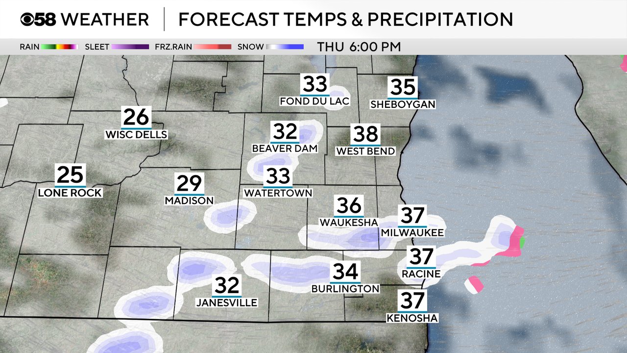
50-degree drop in feels-like temps coming with steady rain switching to bursts of snow


Temperatures are warm to kick off Thursday morning in the 40s. Highs on Thursday likely happen around noon in the middle to upper 40s or even a run at 50 in some areas. The wind will be strong Thursday with gusts to 40 mph at times. That wind will allow temperatures to drop quickly in the afternoon and evening after a cold front moves in. Temps will be in the 20s by late this evening and teens by Friday morning.

The big drop in temps could cause a flash freeze where all of the melted snow and the wet roads from the rain on Thursday freezes over causing icy conditions for anyone out driving Thursday night or Friday morning.
A few light rain showers and some fog are already out there Thursday morning. A round of steady, at times moderate, rain looks likely centered around midday Thursday.
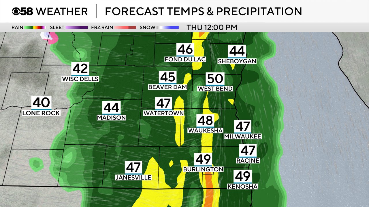
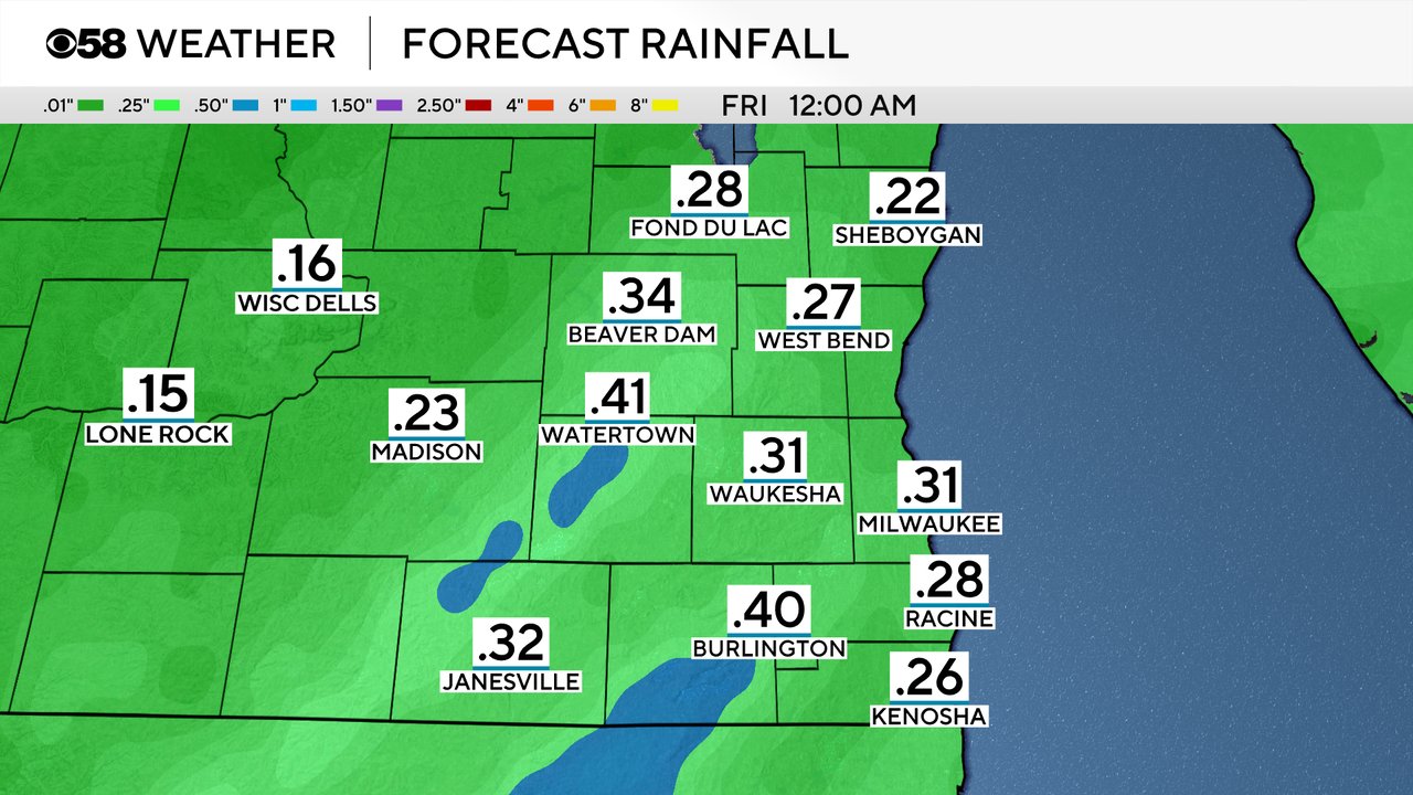
Rain totals Thursday will range from a quarter inch to 0.40". That is a good soaking rain and will likely clean up the roads, briefly, from salt, as well as melt more snow.
Then we get some snow showers that roll through in the late afternoon through evening hours. The best timing for some bursts of snow will be from 5-10 PM.
Some of the snow could come down heavy and cover roadways with a quick dusting of snow. Bursts of snow combined with wind gusts already to 40 mph could result in near-whiteout conditions. Snow squalls are possible and snow squall warnings could be issued as the bursts of snow move through.
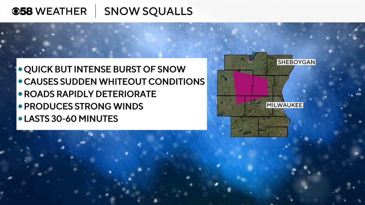
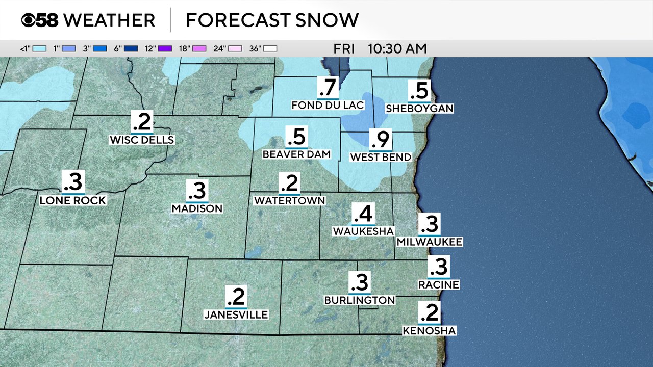
Even though bursts of snow are possible, accumulation will stay relatively light with snow totals under 1" in most areas. Most of the snow will be fairly slushy and will likely freeze very quickly.
Download the CBS 58 Weather app to track the drop in temps along with the rain switching to snow.