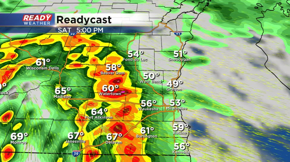
Evening Update: Tornado warning has expired; watching strong thunderstorms roll through SE Wisconsin


Updated: 6:36 p.m. April 30, 2022
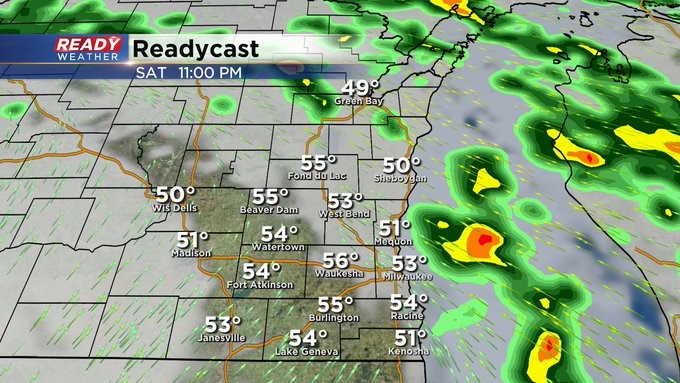
The tornado warning for Walworth County has been allowed to expire. A Tornado Watch is still in effect for Jefferson and Walworth Counties. We are still watching some strong storms roll into Waukesha County. There are more strong and severe storms to our south in Illinois.
See the latest radar updating with time here:
------
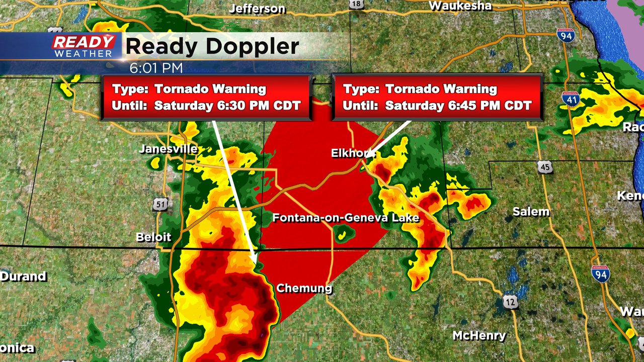
Updated: 6:13 p.m. April 30, 2022
A tornado warning has been issued for Walworth County until 6:45 p.m. Saturday, April 30th. The tornado was located in northern Illinois near Sharon, IL. This storm could impact most of Walworth County including Lake Geneva and Devalan.
------
Updated: Saturday, April 30th: 6:00 pm:
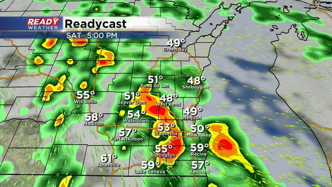
A tornado warned storm just NE of Rockford is closing in on SW Walworth county at 30 mph.
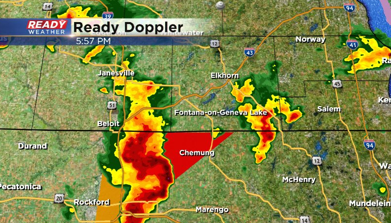
This storm is currently showing rotation near Poplar Grove, IL as it's crossing the warm front.
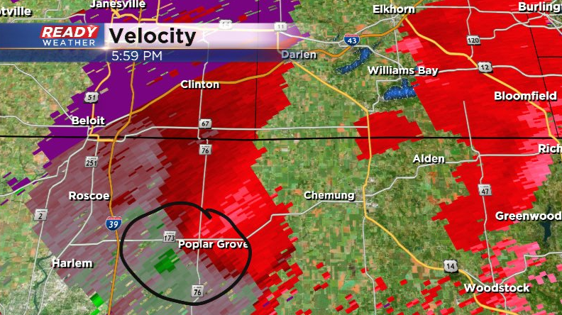
This storm also has a history of producing damaging winds and quarter sized hail.
----------------------------------------------------------------------
Updated: Saturday, April 30th 4:00 pm:
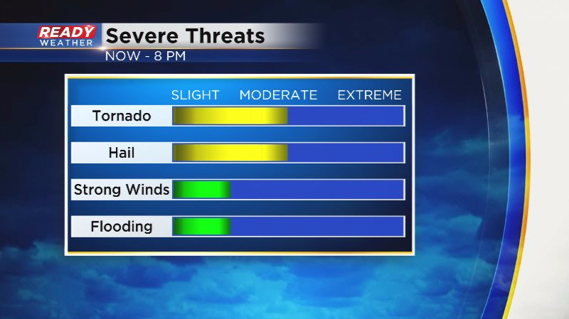
Clusters of thunderstorms have developed across Illinois the last couple of hours and have been lifting to the northeast. Currently there are no warnings on these storms as they have been a bit disorganized, but there have been signs of rotation at times. Meanwhile, there are a few tornado warnings in far SW WI, but those storms won't pose any threat to SE WI.
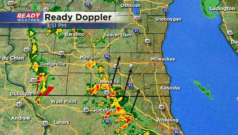
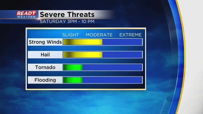
We'll continue to keep a close eye on the storms lifting out of Illinois, but they are outracing the warm front and are currently moving into a less favorable environment for storms here in SE WI. That being said, don't let your guard down yet. Hail and isolated tornadoes will continue to be the main threats now through 8 pm.
----------------------------------------------------------------------------------
Updated: Saturday, April 30th 2:00 pm:
A Tornado Watch has been issued for Jefferson and Walworth counties until 8pm this evening. These counties and counties to the west have the best shot at a few isolated tornadoes through mid evening.
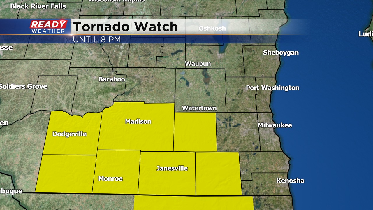
These areas have been seeing breaks in the clouds this afternoon, which will help fuel strong to severe storms between 3pm-8pm.
The sunshine has also helped temps jump into the mid 60s well away from the lake. A strong southeasterly wind will keep the tornado threat away from the lakeshore counties, but we still have a hail and damaging wind risk with storms as they progress east this evening.
Download the CBS 58 Ready Weather App to get the latest warnings sent to your phone.
-----------------------------------------------------------------------------
Update as of Noon Saturday, April 30th...
Now it's a sit-and-wait game. We have to see how much sun, if any, we get today. If we do, that'll really "stir up" the atmosphere and help develop stronger storms potentially later in the day and into the evening. The CBS58 Ready Weather team will watch the situation carefully. Stay tuned on air and online for weather developments.
____________________________________________________________________________________________________________
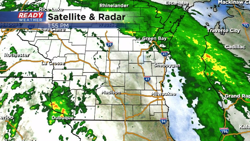
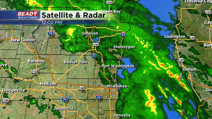
Update as of 10 am Saturday, April 30th...
Rain and some storms on the radar. Look for a stormier trend after 3 or 4 pm, lasting through the evening. Some of the storms could be strong to severe. It all depends on how far north a warm front gets and how sunny it becomes today. Hopefully we'll keep these storms below severe limits.
____________________________________________________________________________________________________________
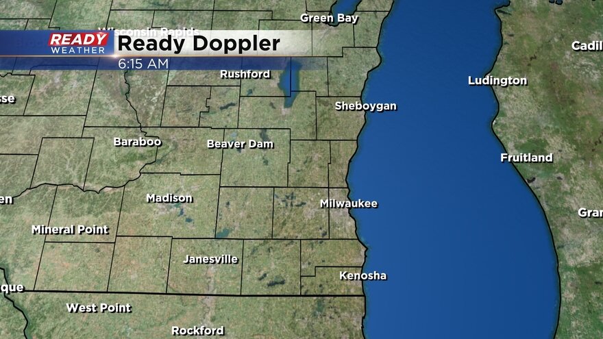
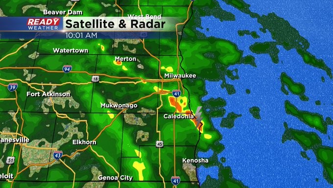
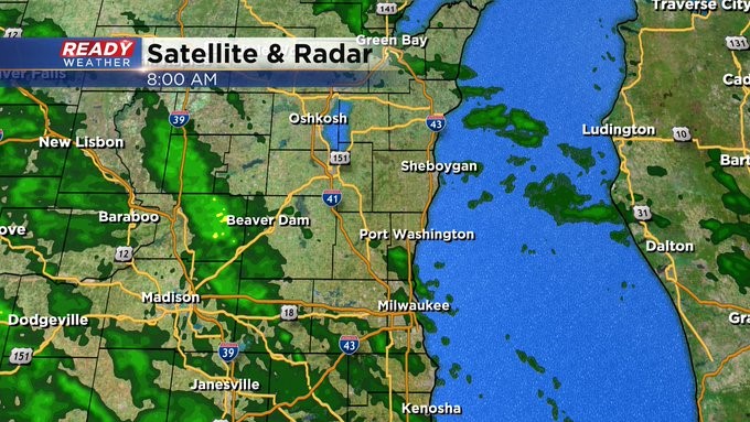
Update as of 8 am Saturday, April 30th...
It's just a chilly and showery now. But that could change after 3 or 4 pm. We're watching how far a warm front will lift north today. Onshore winds could help stabilize the atmosphere into the afternoon along with a lack of sunshine (hopefully). Stay tuned as they say in the TV business.
____________________________________________________________________________________________________________
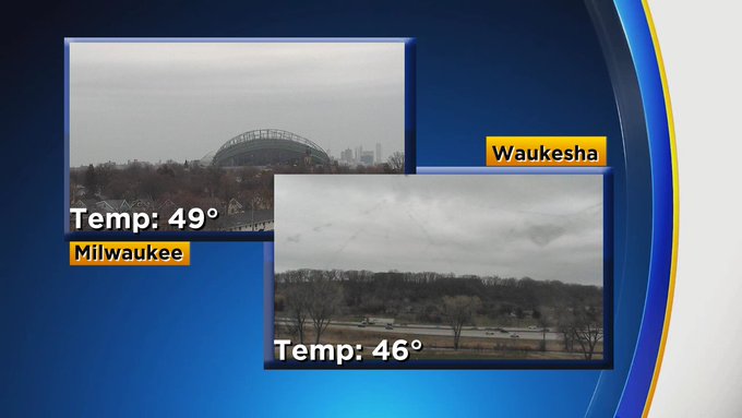
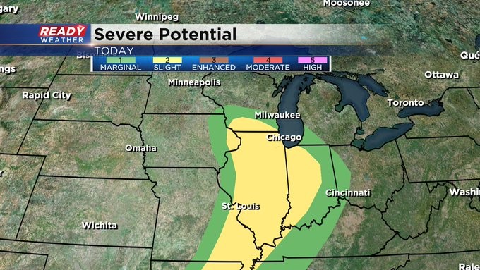
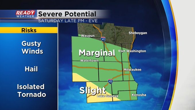
MILWAUKEE (CBS 58)--Our dreary weather pattern looks to be getting a bit stormier today as a warm front tries to lift north across the area. Scattered showers and thunderstorms are possible, especially later in the day and through the evening. Hail, damaging wind, frequent lightning, and isolated tornadoes are all possible with these storms. As it stands now, the biggest threat for the stronger storms looks to be south and west of the metro Milwaukee area where a slight risk of severe weather is in place. It's a marginal risk for everyone else practically.
The storms depart into the overnight, but it'll remain brisk. The next few days should be quiet until more rain moves in for Tuesday. Another system will then impact us by Friday and into the following weekend for more shower chances.