A few evening showers possible otherwise plenty of sun today and tomorrow
After a gloomy Saturday, it's shaping up to be a fantastic Sunday with abundant sunshine currently in place across southeast Wisconsin.
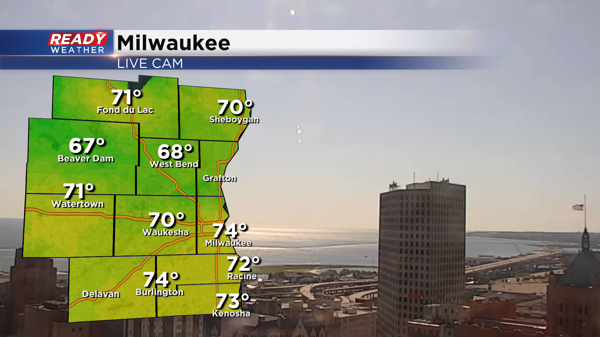
A few more clouds will pop up as we head through the afternoon, but temps will rise to either side of 80° thanks to the sunshine. We'll also have a breezy westerly wind frequently gusting between 20-30 mph with a few gusts over 35 mph possible.
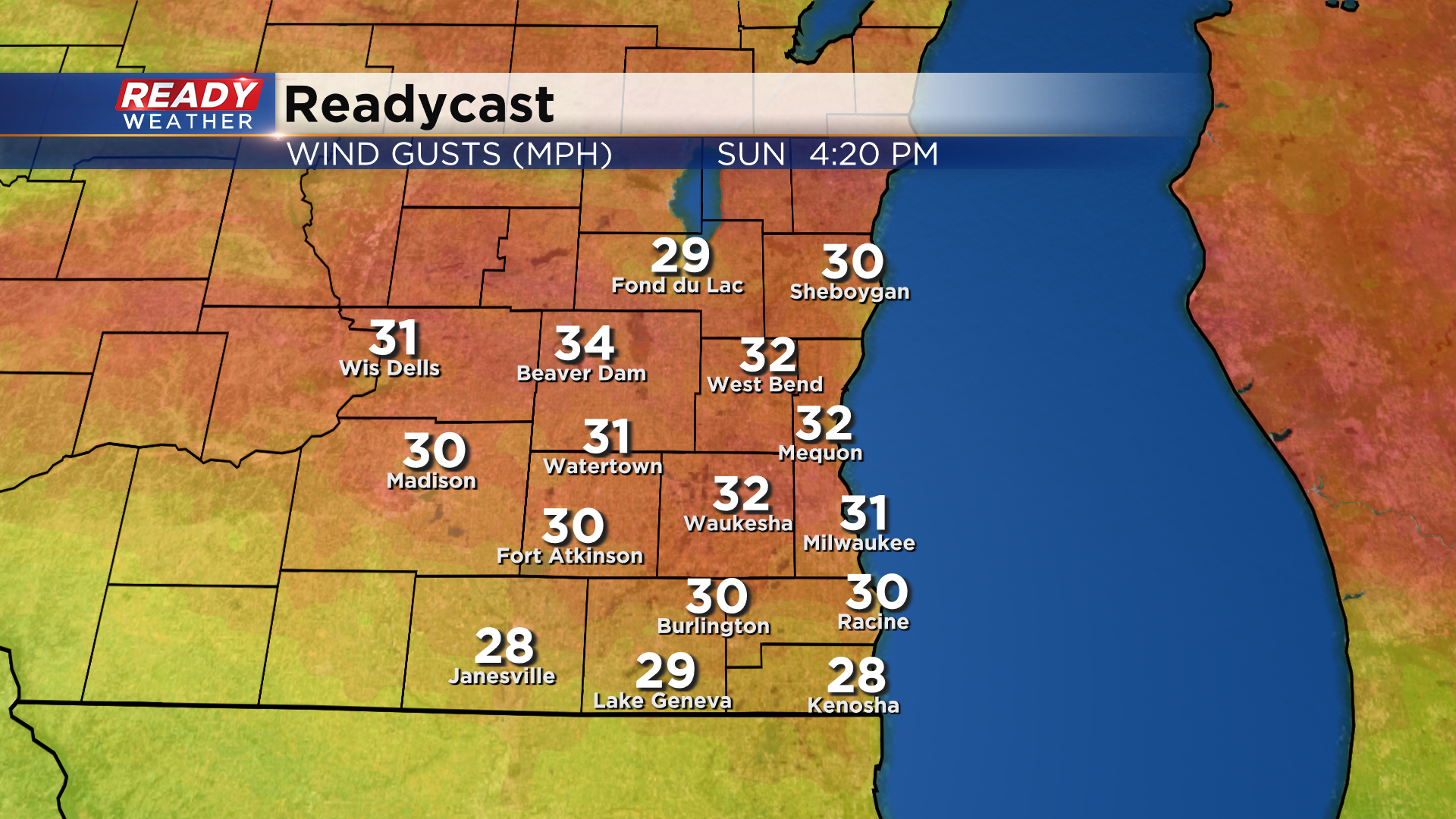
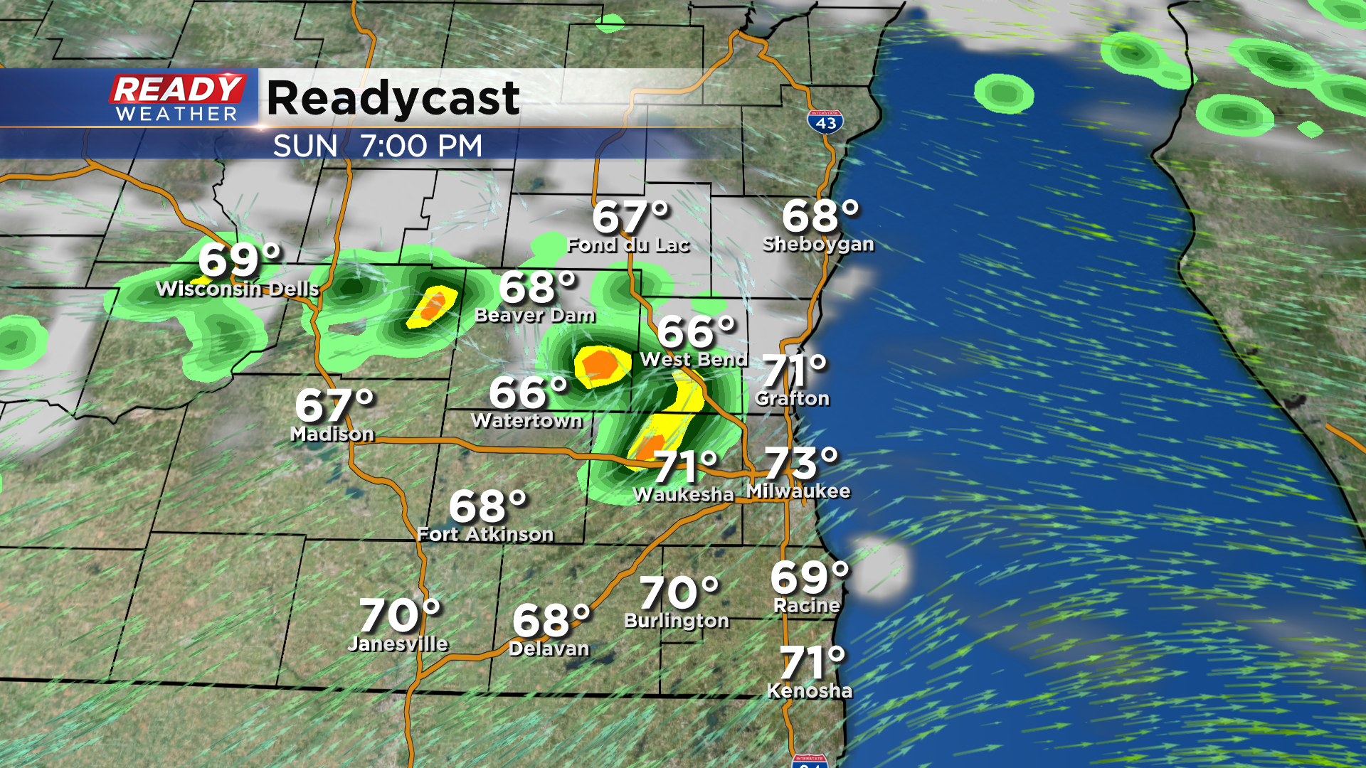
These breezy winds are ahead of a cold front that will move through this evening. That front could trigger a few isolated showers between 6-9 pm.
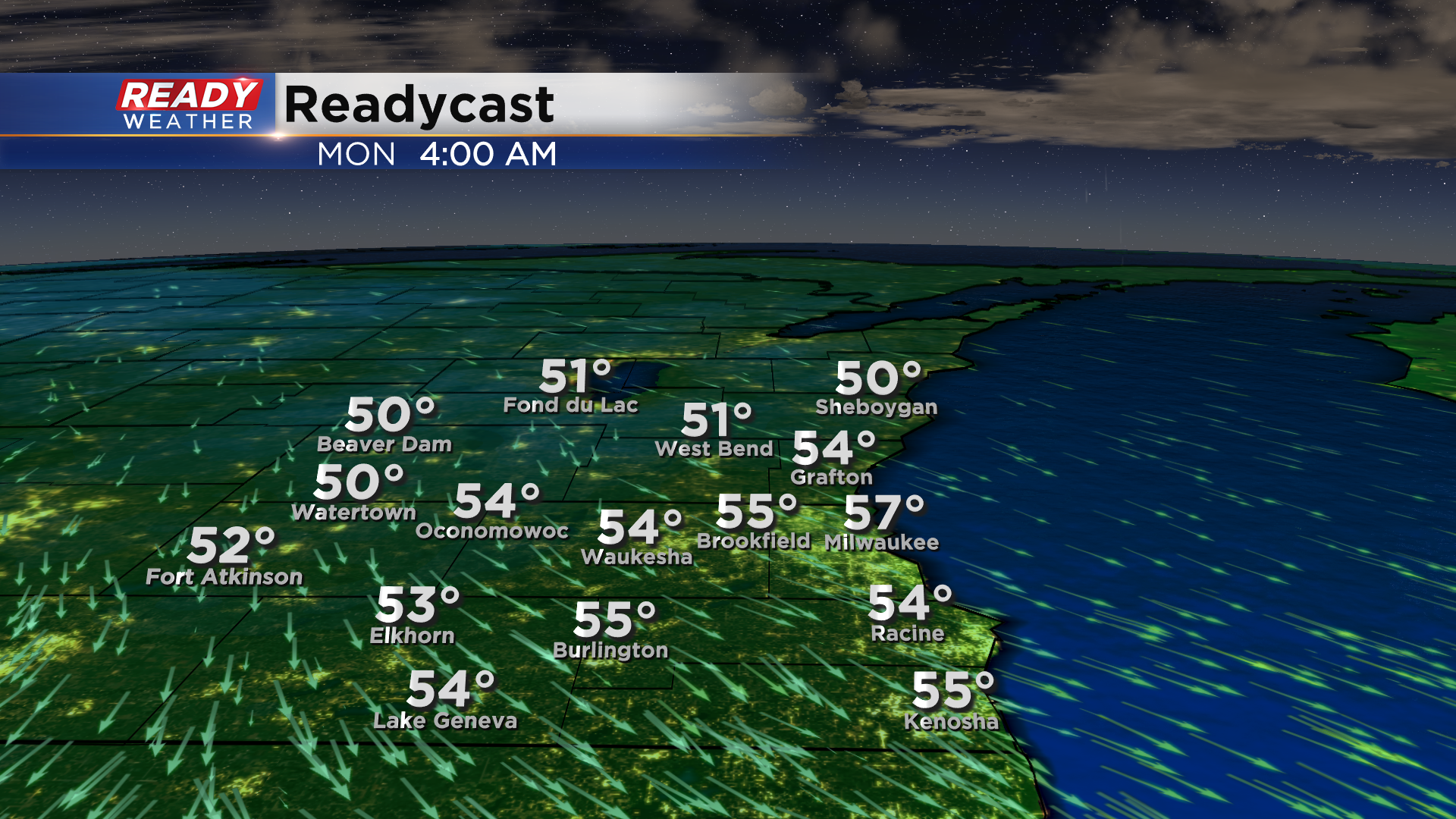
Skies will clear out quickly behind these showers overnight, allowing temps to fall into the low to mid 50s in most locations. A few spots well inland could even dip into the upper 40s.
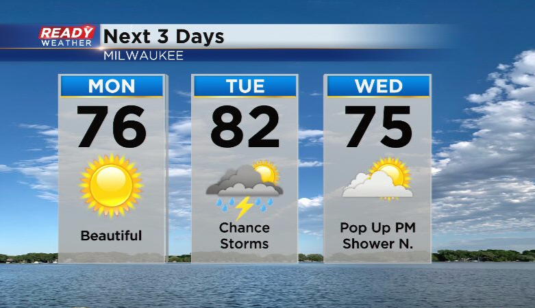
Abundant sunshine is expected for Labor Day with temps a few degrees cooler than Sunday, topping out in the mid 70s. Another cold front will work through the area on Tuesday, bringing a little better chance for scattered storms. Temps cool back into the 70s behind the front for the middle of the week.
Download the CBS 58 Ready Weather App to see the full 7 day forecast.
