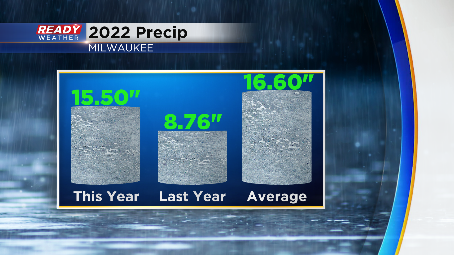
We've been floating just above and below on yearly precip. And to date we could use a bit more.
While faring much better than last year, by the end of today we'll be a good inch below normal for precip on the year. The good news is there is rain on the way!
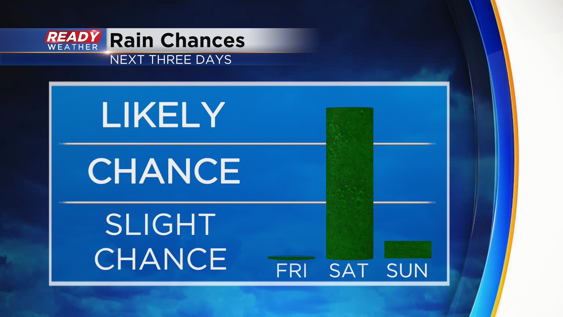
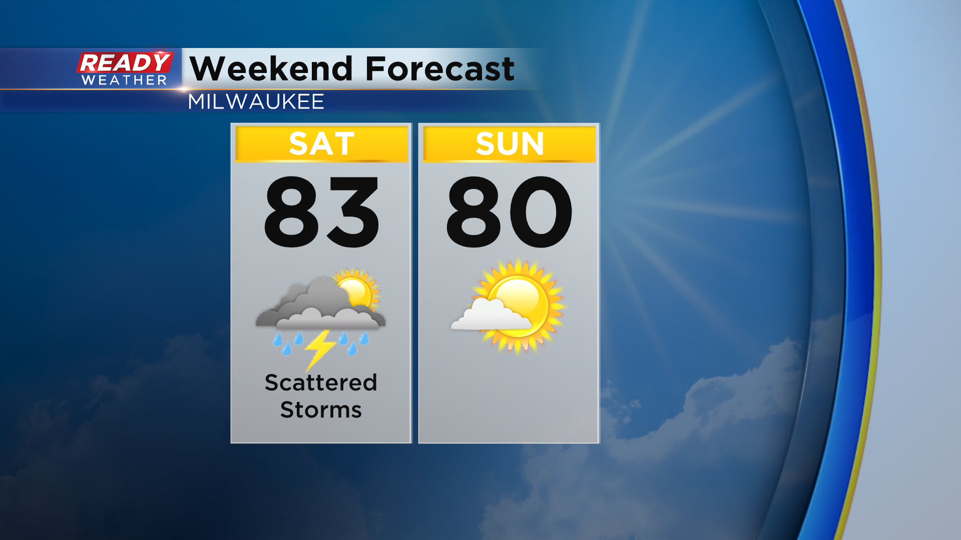
It comes on the day tomorrow. A scattering of showers and storms will be with us Saturday, but at least Sunday looks dry for outdoor fun.
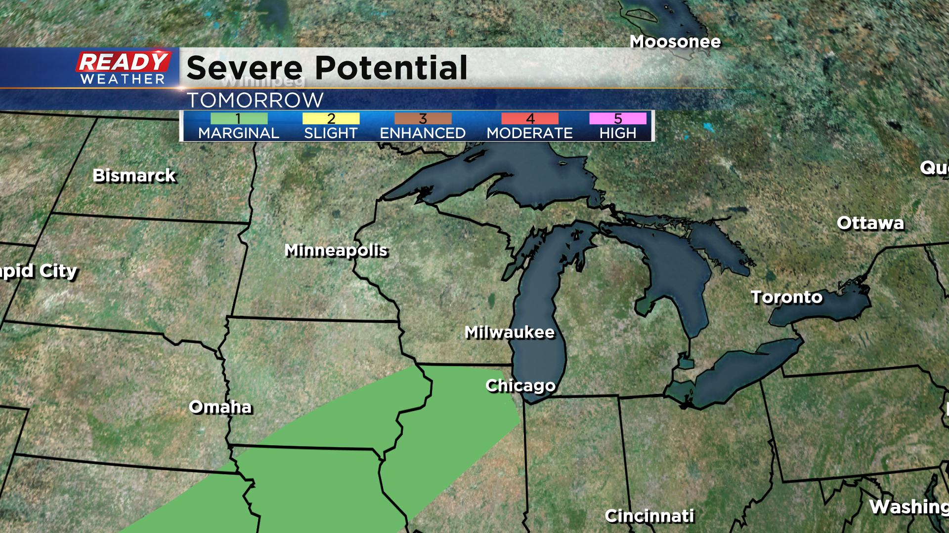
Even at that, there will be dry times in between pockets of rain and a few storms. The most certain time for wet weather will be mid morning until around noon. Notice the image thumbnail of this blog showing fairly widespread activity around 9am, especially for southern parts of the area. Behind this first batch of rain will be an approaching cold front. There's more uncertainty on if additional storms can develop along this boundary with lack of upper level instability and potential lingering clouds. At this time severe weather is not very likely.
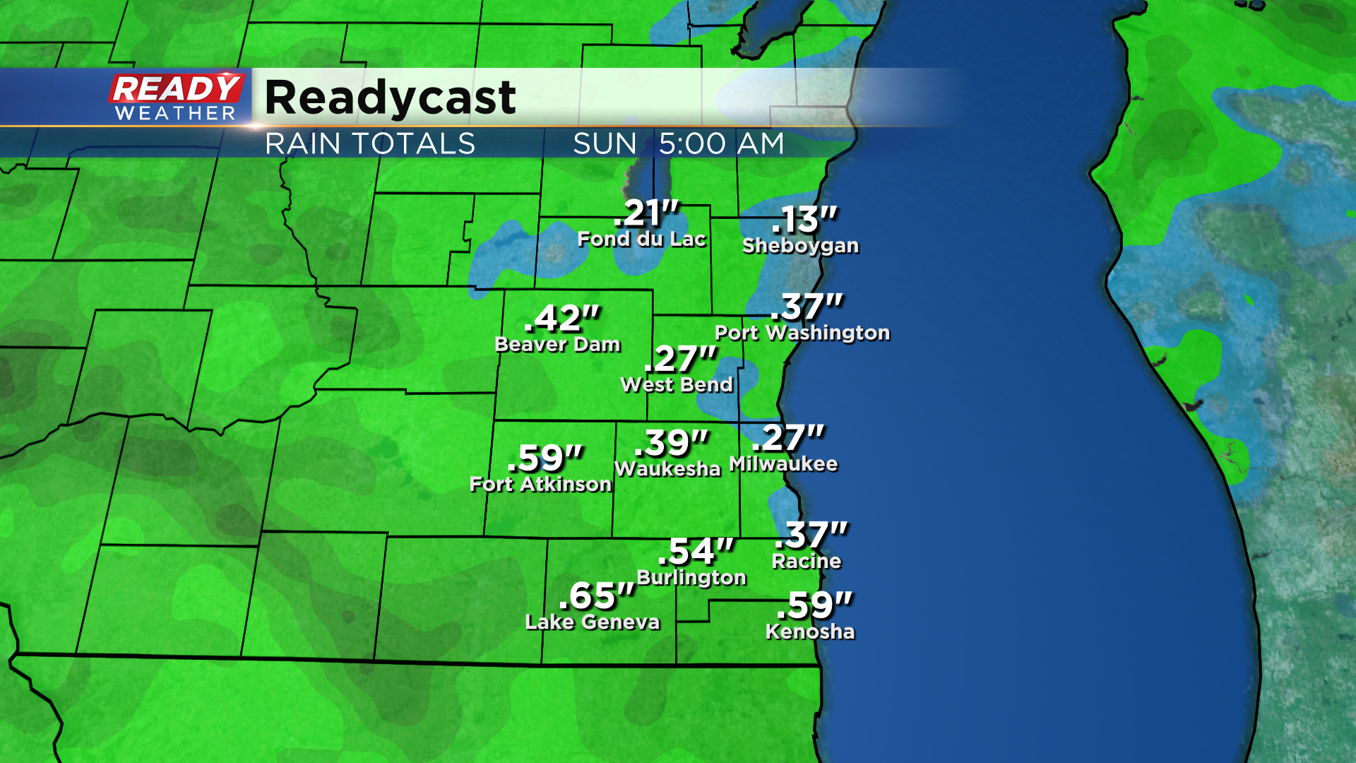
A low end risk for strong to severe storms is only marginally likely up to the state border. That said, any storms that can get going later in the day could come with gusty wind, possibly some hail and a few downpours. Rainfall totals will vary based on the second opportunity for rain, but overall about a quarter inch of rainfall is likely with isolated higher amounts in any later day storms that fly overhead.
Download the CBS58 Ready Weather App to stay ahead of the showers as you plan your Saturday. I love the future radar product to time when rain will approach your area!
I'm meteorologist Rebecca Schuld