After quiet weather week Monday storm brings blast of cold air


After a whole week of quiet weather and steady temps we will see our weather pattern start to change as we go into next week. If you have some outdoor things to do like getting up holiday decorations you still have a full 5 days to do it including a really nice weekend.
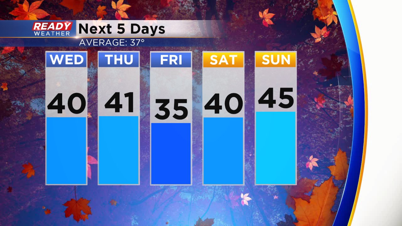
Our pattern will shift with a clipper that moves through starting Sunday night and lasting through Monday night. The current track has precipitation will start as rain showers and eventually switching to snow later on Monday. Some snow accumulation is possible but it's way too early to start talking amounts.
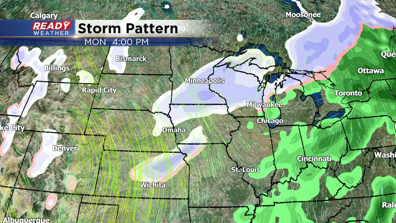
As the Clipper passes it will drag in some cold air behind it, potentially the coldest of the season with highs struggling to even hit 20°.

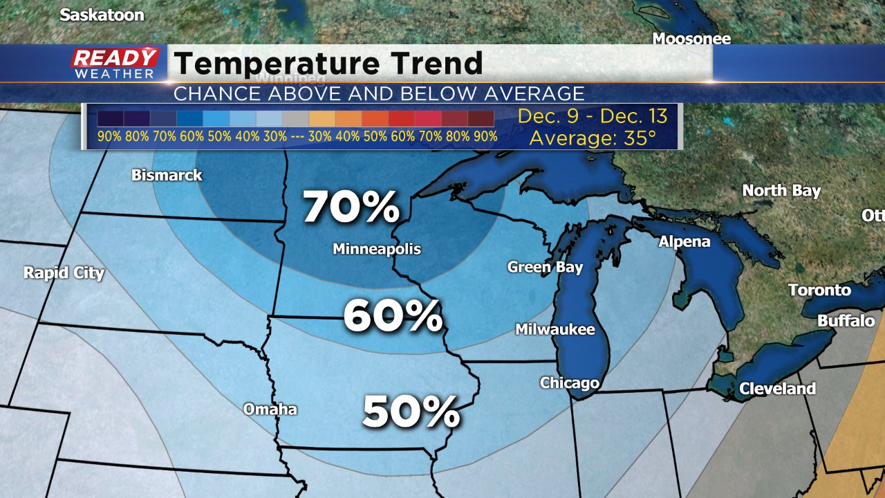
The temperature trend shows the cool down pretty well with a 50-70% chance for below-average temps which at that point of the month are in the low and middle 30s. The coldest of the season so far was back in November when the high only hit 19°. We could be getting close to that type of cold some days.
Download the CBS 58 Ready Weather app to see how long the cold air lasts in the 10-day forecast.