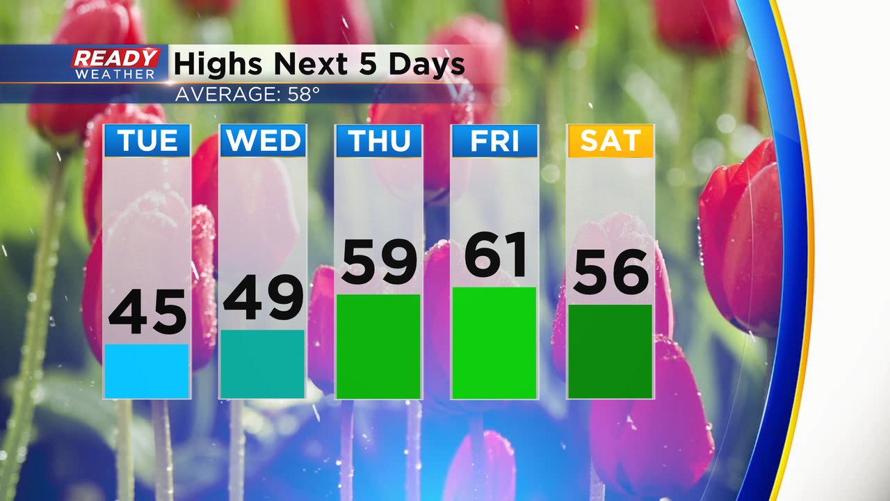
We are in the middle of a cool stretch of weather in southeast Wisconsin. High temperatures over the next few days are expected to stay in the 40s. A lake breeze will make it even harder to get into the 50s as the wind stays out of the NE or SE. We briefly get a little warmer for the end of the work week with highs around 60 both Thursday and Friday before dropping again.
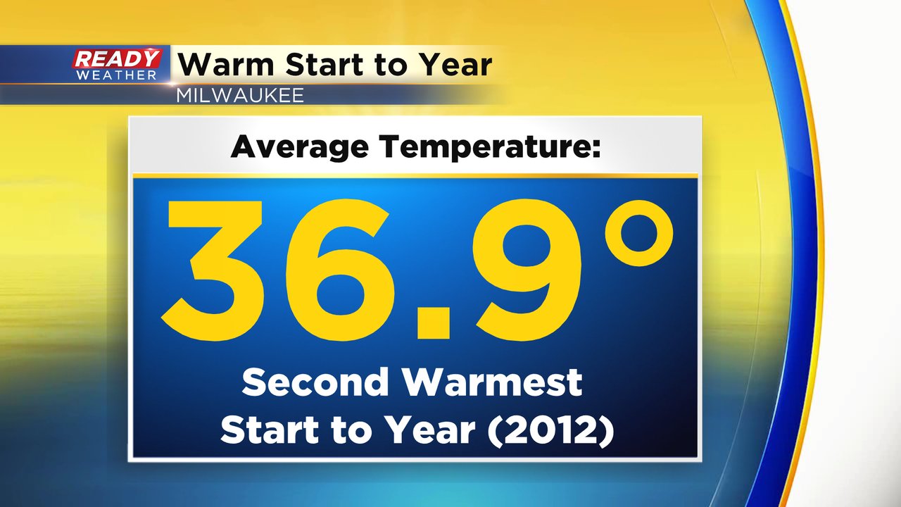
Even though we have seen some recent cold temps, through almost four full months of the year it has actually been fairly warm. The average temperature since January 1st sits at 36.9* which when put into context is the second warmest start to the year on record. 2012 holds that record through the end of May and also is currently the warmest year on record.
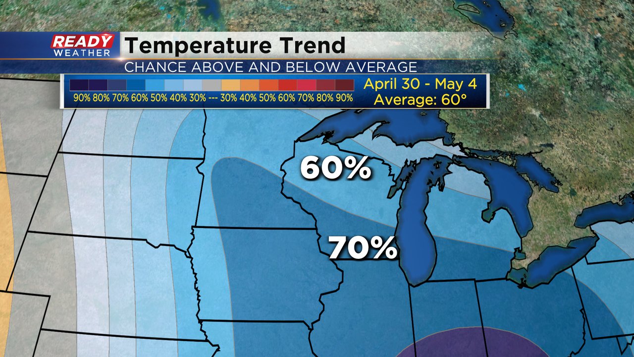
Our chilly stretch of weather looks to continue for the end of April and the first few days of May. The Climate Prediction Center puts Wisconsin in an area with a 60-70% chance for below-average temperatures. Average highs for the start of May are in the low 60s but we may struggle to get out of the 40s once again.
Download the CBS 58 Ready Weather app to track the temperatures.


