


Happy Earth Day! It's another day in southeast Wisconsin and that means we either have wind to deal with or rain - today it's rain. The wind will die down the next few days and stay light from 5-15 mph. A round of showers and a few storms is currently rolling in from the west. A few downpours can be expected. The chance for rain Tuesday stays with us through the midday hours then dries out during the afternoon and evening.
Here is a radar image that will update with time:

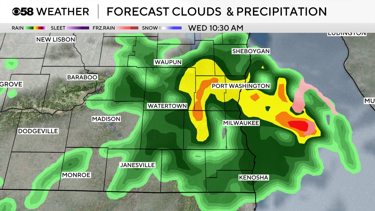
After a mostly dry second half of Tuesday we stay dry Tuesday night but more showers and storms look possible, if not likely, for Wednesday. Some weather models have more rain Wednesday morning, others have more in the PM, but everyone should see a good soaker Wednesday. Thursday and Friday also have shower chances as well although the thunderstorm risk goes away.
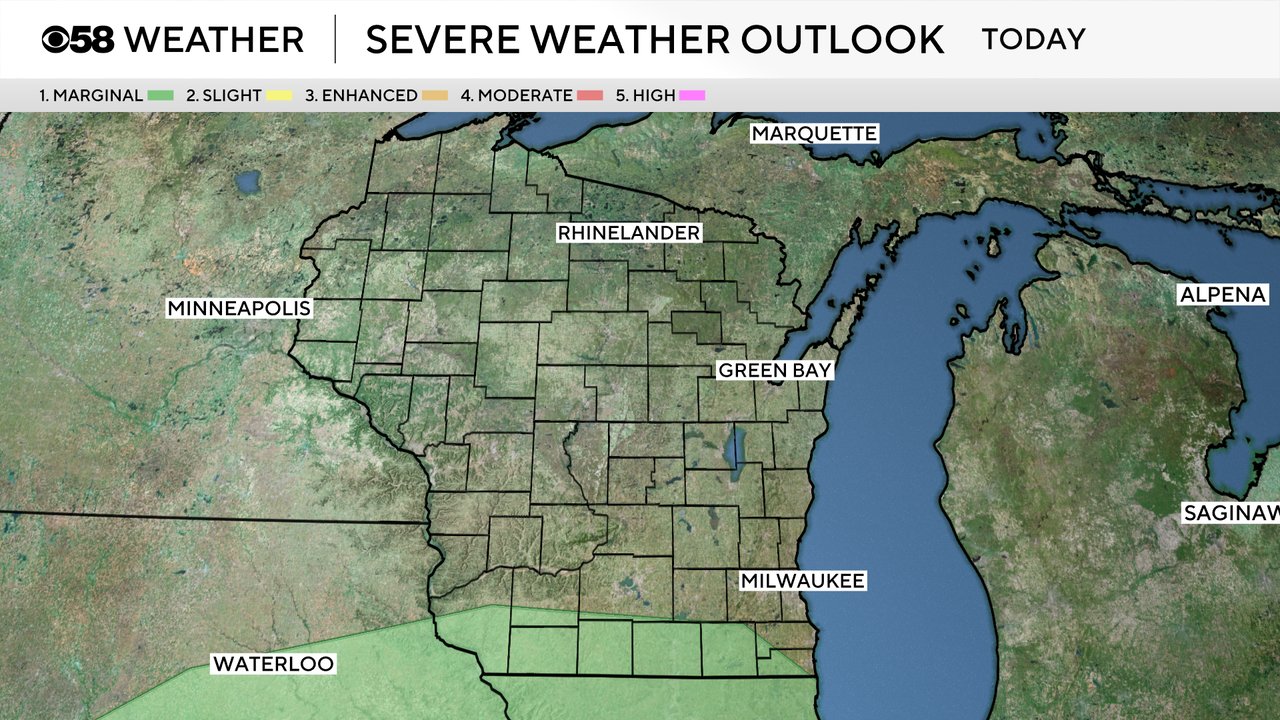
There is a sliver of a Level 1 Marginal Risk for strong to severe storms in place right along the WI/IL border for Tuesday. The biggest threat would be some small hail with any storms we see. Widespread severe weather is not anticipated. A few more stronger storms are possible Wednesday as well.
Rain totals over the next 48 hours look to range from a quarter inch to three quarters of an inch for most of southeast Wisconsin. Another chance at a soaking rain. Some areas could get a bit more in communities that see more thunderstorms.

Download the CBS 58 Weather app to track the rain chances through Friday.