Another round of strong storms possible Monday ahead of a refreshing cold front
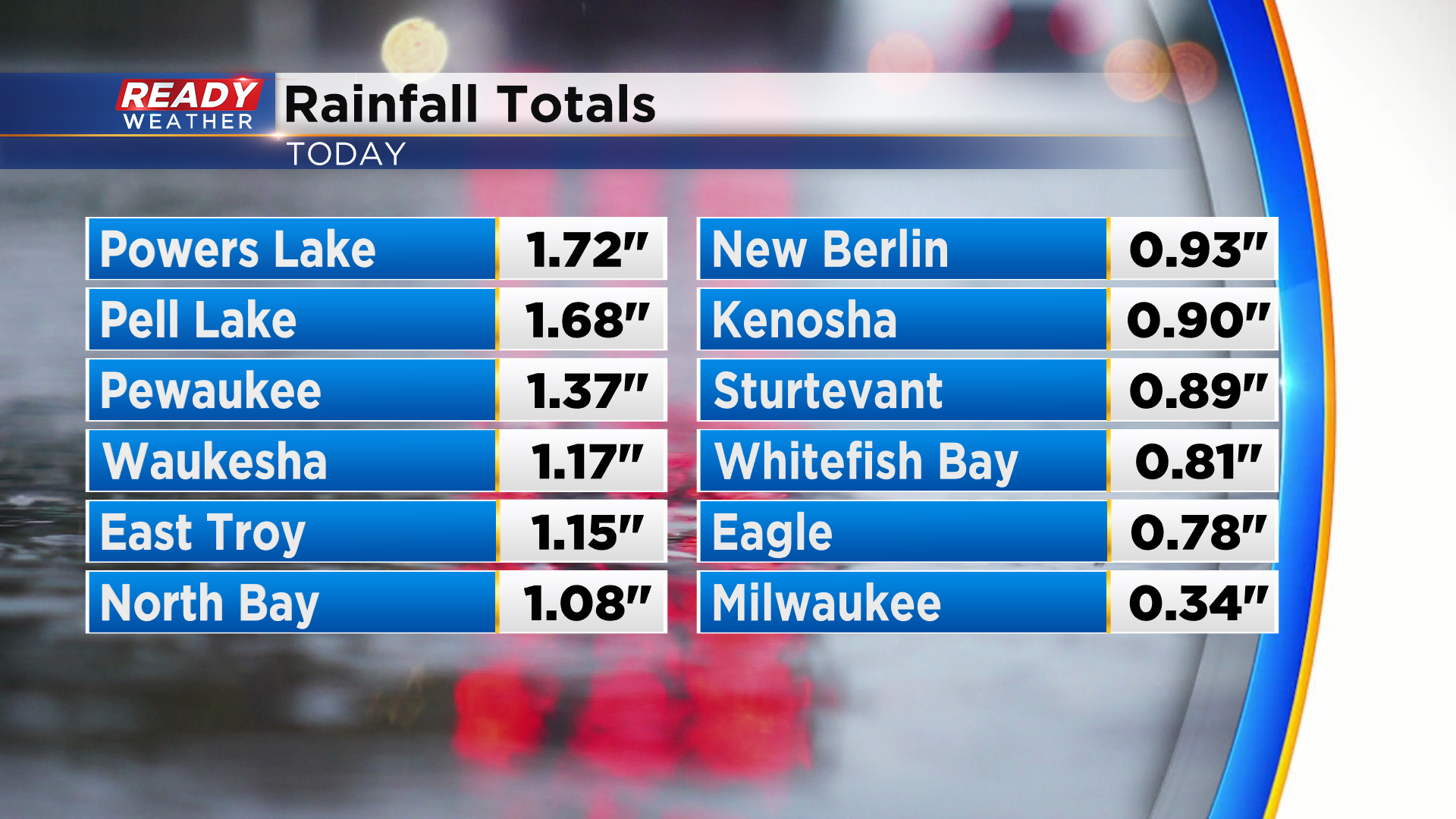
Showers and storms have ended for the night, but not before dropping .25-1.50" across much of southeast Wisconsin.
We'll be quiet overnight locally, but we'll be keeping an eye on the storms currently developing ahead of the cold front in central Minnesota.
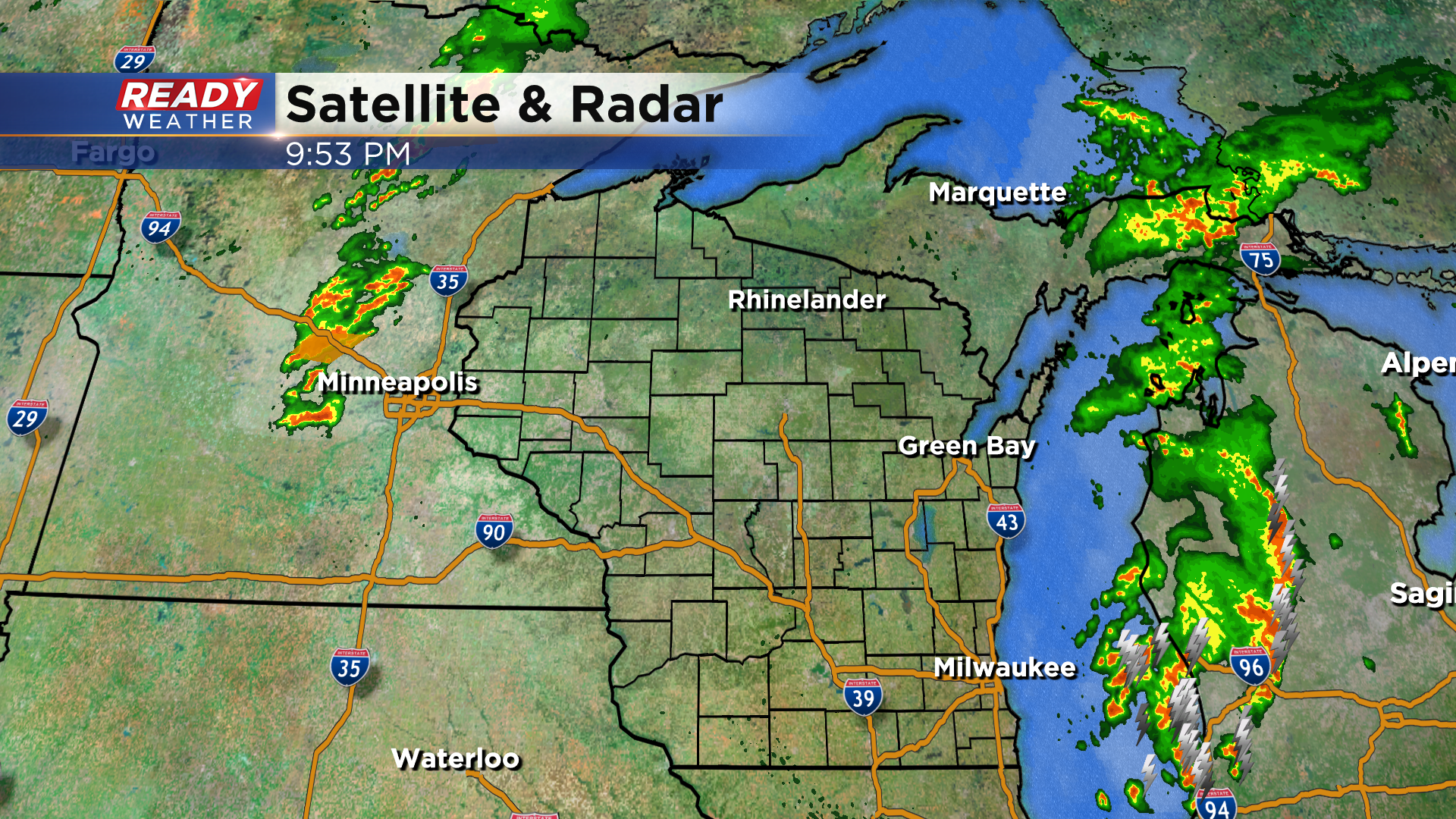
These storms look to track across the state overnight, but they'll likely dissipate as they reach southeast Wisconsin between 6-9am Monday morning. Northern locations have the best shot at the early morning showers or storms.
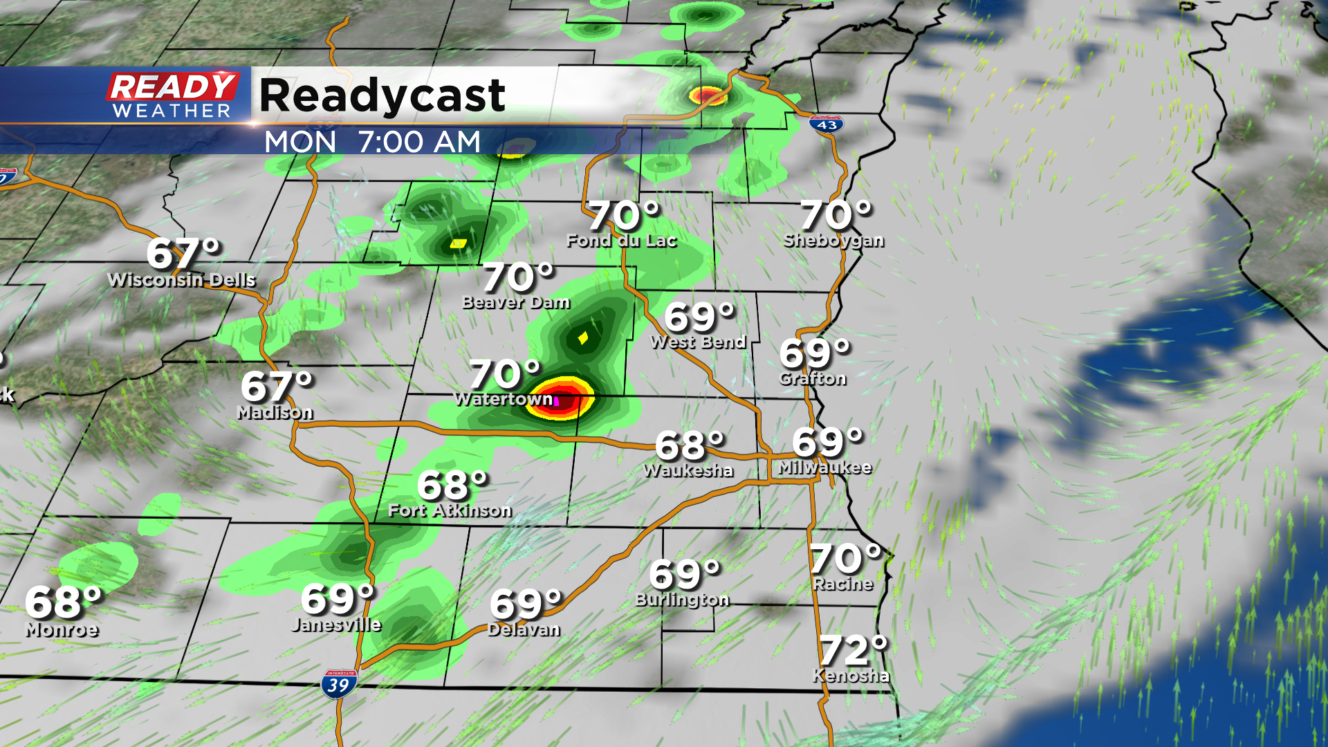
If these storms dissipate before getting here, our chances for another round of severe storms would increase, especially south of I-94. Plenty of warmth and humidity will be in place to fuel the storms.
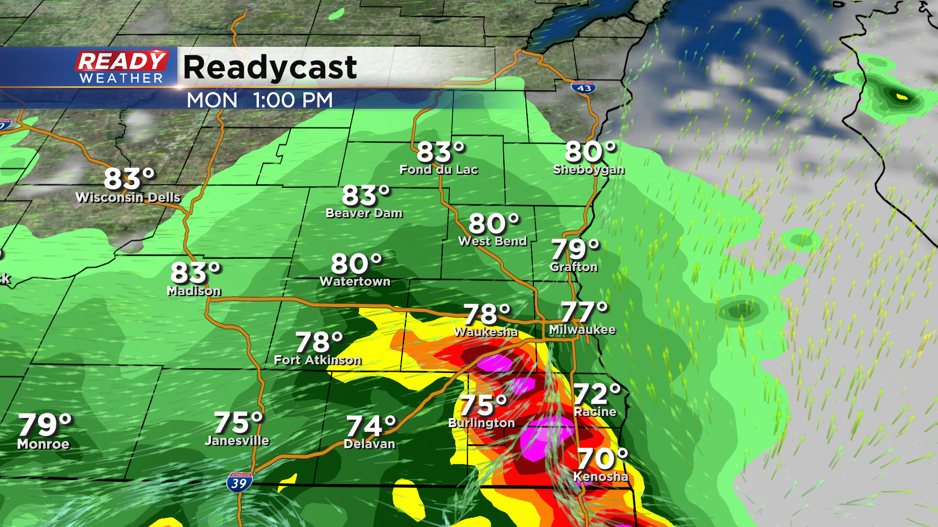
Racine, Kenosha, and parts of Walworth county are under a level 2 of 5, Slight Risk, for severe storms Monday. However, if the morning round of storms holds together long enough it would cause the severe storms will track by *just* to our south in northern Illinois.
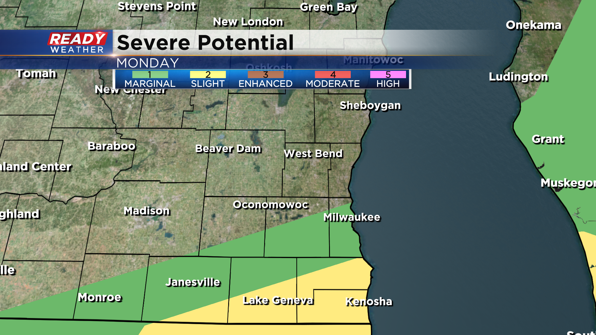
The cold front will track through during the afternoon with humidity levels dropping Monday evening. Dew points will then remain at comfortable levels for the remainder of the week.
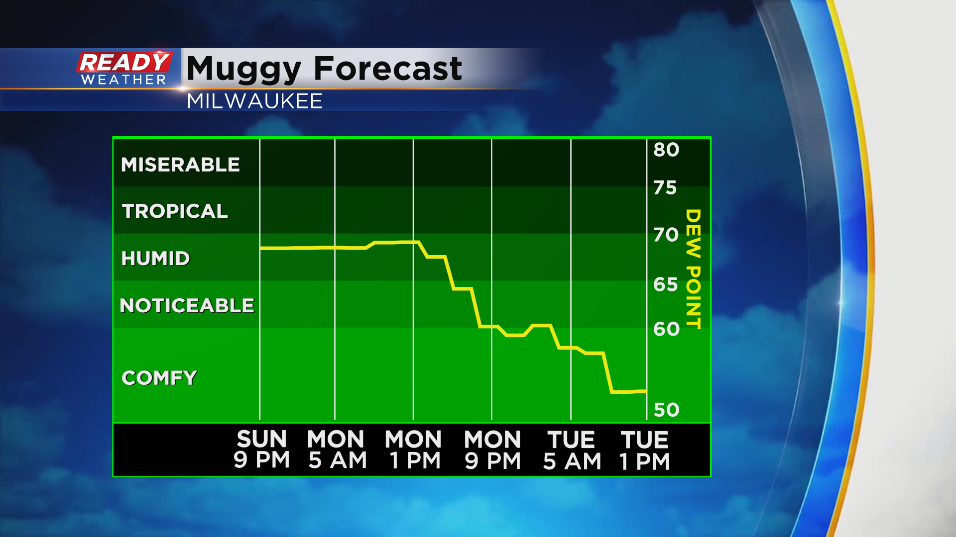
This week will be rather dry and sunny as well once we get past Monday with comfortable temps as well! Download the CBS 58 Ready Weather App to see the full 7 day forecast.
