Another round of wet snow on the way Friday night into Saturday
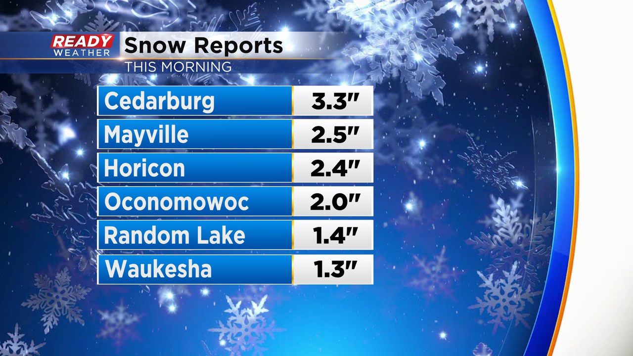
Some of you woke up to a coating of wet snow this morning as a narrow band of heavy, wet snow tracked across the area. While there was some accumulation on the pavement initially, most of the accumulation was on the grass.
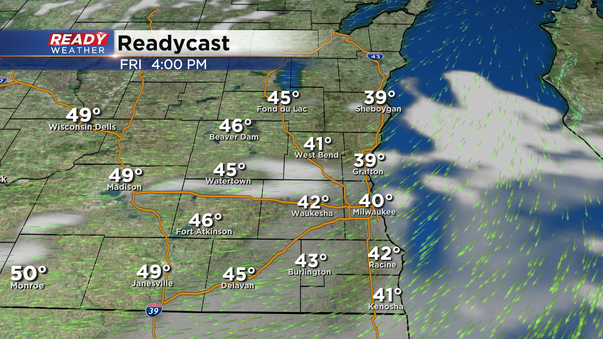
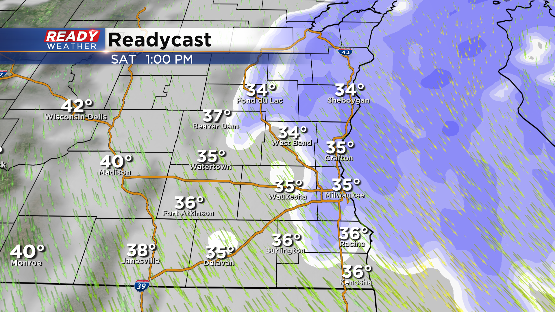
Quiet weather has settled in behind the early morning precip. and will continue for most of Friday. Temps should be able to make it into the low to mid 40s Friday under a mix of sun and clouds.
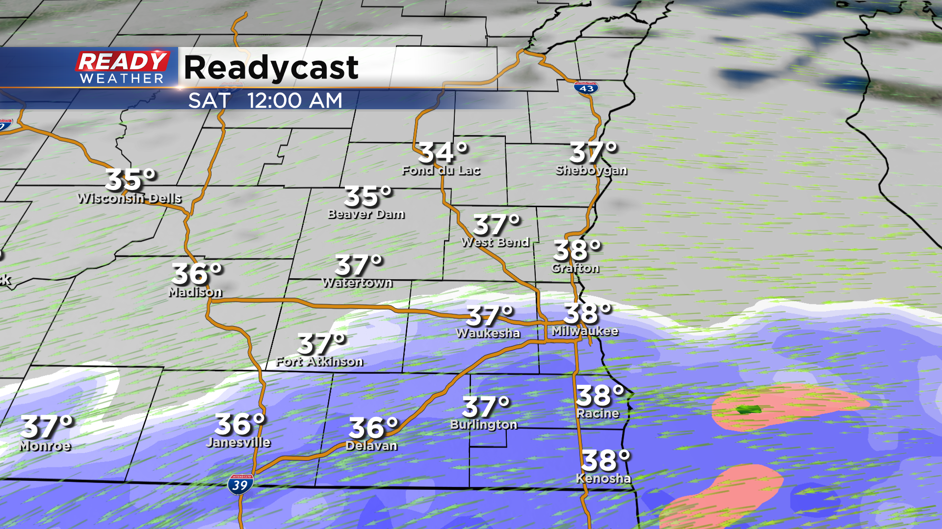
Snow will begin to work into southeast Wisconsin from south to north around or after midnight Saturday, overspreading the area throughout early Saturday morning.
Steady moderate to heavy snow will then continue for much of Saturday morning, winding down around midday or early afternoon.
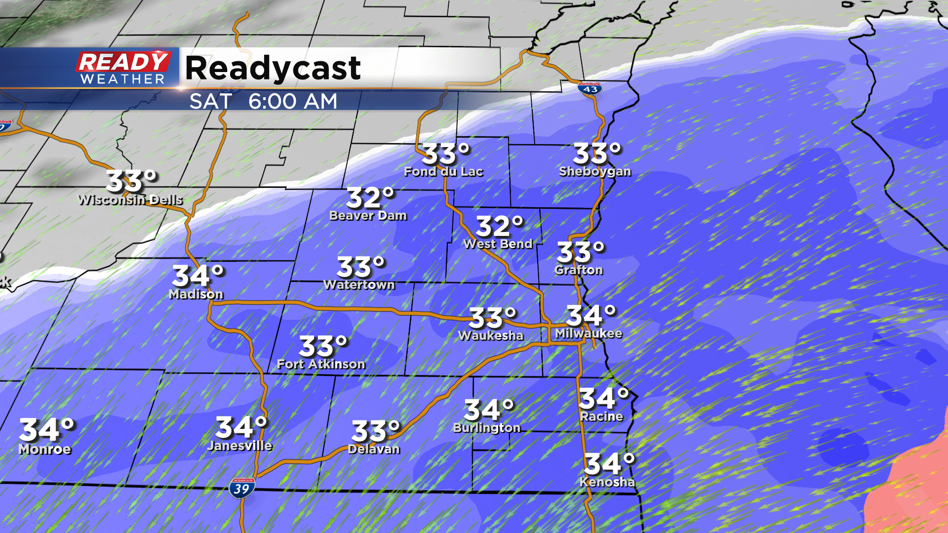
There are several factors at play with regards to how much snow will accumulate. Air temps will be near or above freezing, and roads temps will be well above freezing as well. At this point, we'll likely see more accumulation on the grass than on the roads. That being said, snow will be able to overcome the warm roads temps if it's coming down heavily enough, which is definitely possible in some locations. With a low snow to water ratio, and compaction expected, a general 4-8" of accumulation is possible with highest totals on colder, grassy surfaces.
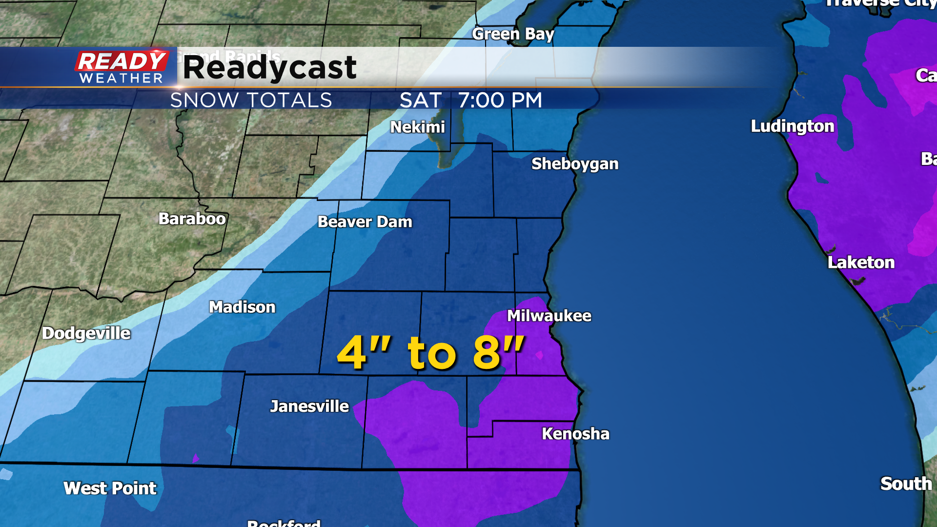
A Winter Weather Advisory will likely be issued during this time. On top of the heavy, wet snow, we're also expecting wind gusts of 25-35 mph, which may lead to isolated power outages if this heavy wet snow piles up on branches and powerlines again. Low visibility Friday night into Saturday morning will be the biggest impact.
Download the CBS 58 Ready Weather App for more updates as we get closer to this event.
