


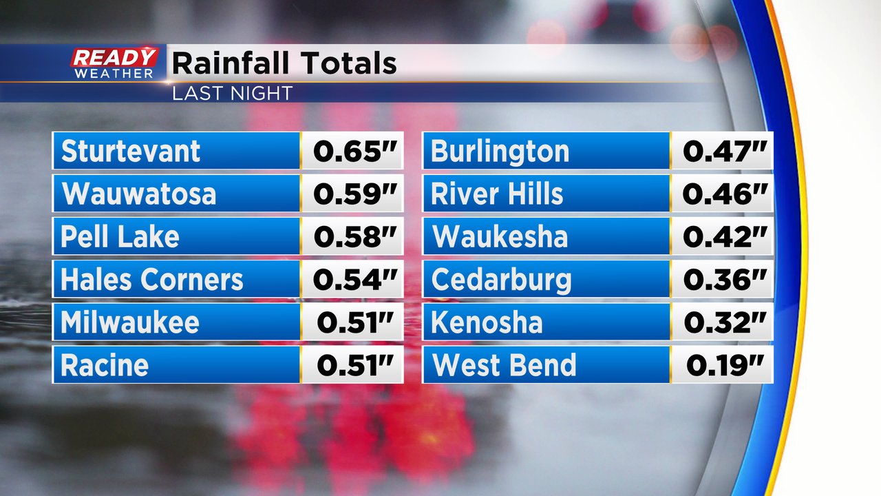
We had another soaking round of precipitation Sunday night in southeast Wisconsin. Similar to our last few rounds of precip, most of this fell as rain, especially in our southern half of counties. Anywhere from 0.25-0.75" of just rain fell in these areas.
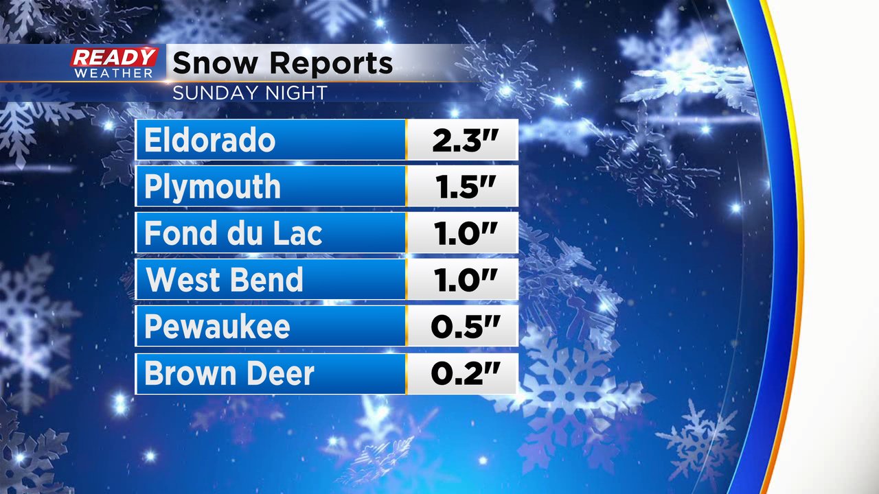
Areas north of I-94 did see some wet snow. Most of that will melt during the day Monday and what remains into Tuesday melts with the sunshine. Anywhere from a few tenths just north of I-94 to a couple inches in northern counties was reported.
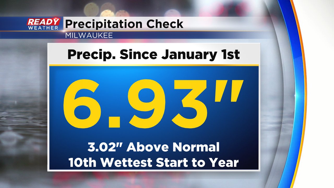
Adding on another half inch of rain to Milwaukee's already impressive precipitation total for the year puts us at almost 7" since January 1st. That's the 10th wettest start to the calendar year on record.
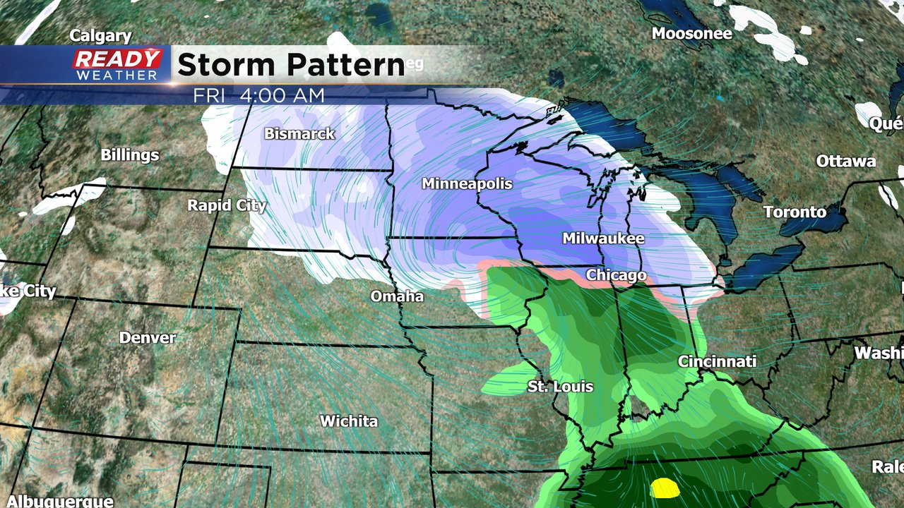
Not much precipitation is expected the next 72 hours with just an isolated rain or snow shower on Monday, completely dry day on Tuesday then Wednesday may have a flurry late in the day.

Our dry stretch won't last long with a good chance for snow already showing up for Thursday evening into Friday with some lingering snow possible Saturday.
Download the CBS 58 Ready Weather app to track any changes to the snow forecast for the end of the week.