Another warm and humid day before sweet relief and a soaking rain


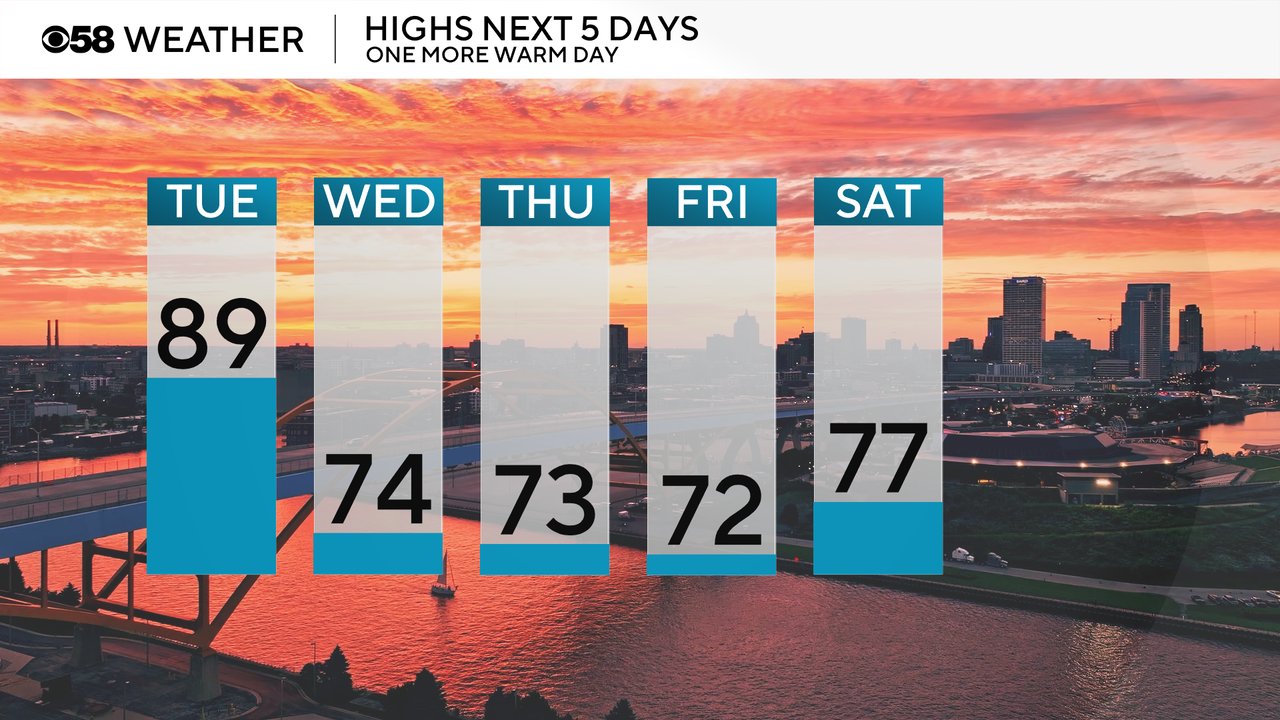
After Monday's 90s, Tuesday is going to be another warm day. Highs on Tuesday reach the upper 80s with a few isolated 90s not completely out of the question. Then we get a cold front Tuesday night that drops to temps down into the lower half of the 70s for a few days.
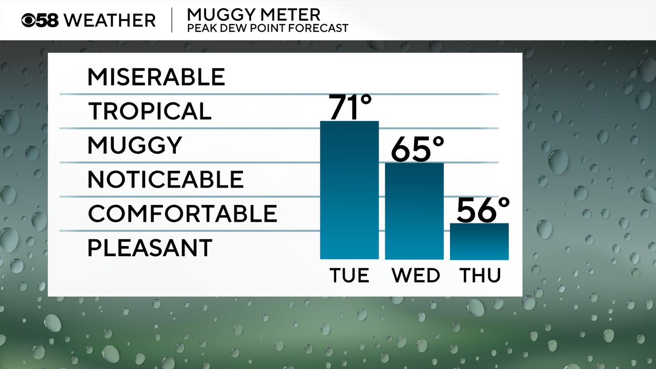
Dew points are going to stay juicy as well with peak dew points in the tropical category Tuesday. Wednesday is still a bit muggy in the morning but humidity levels drop during the day leading to a fairly comfy end to the week.
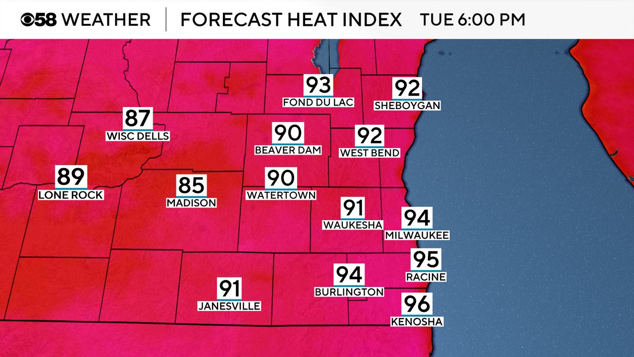
The combination of warmth and humidity for Tuesday will push feels like temps into the mid 90s in some areas.
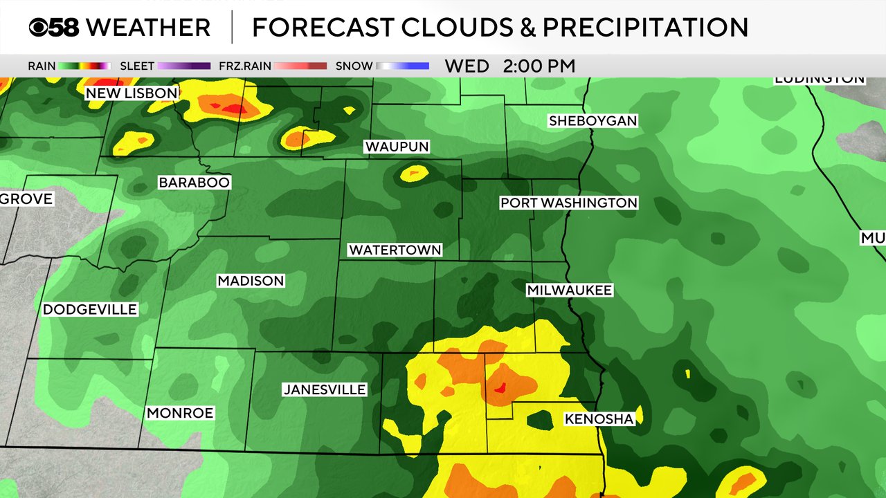
We did have a few light showers reach parts of the viewing area Tuesday morning. A few isolated showers and storms may be possible Tuesday afternoon and evening but the better chance for rain arrives on Wednesday. Scattered showers start to roll in Wednesday morning with some areas of heavy rain and embedded thunderstorms possible Wednesday afternoon and evening. A few showers may linger into Thursday morning.
Download the CBS 58 Weather app to track the warmth and humidity and any storms that develop.