Beautiful September days continue until Helene gets close


After Tuesday's rain, Wednesday was a gorgeous, warm day in the 70s. Thursday and Friday will be more of the same as high temperatures stay in the middle 70s before dropping a bit for the weekend but staying above average in the 70s through the end of September.

The temperatures trend for the start of October also looks mild with a 40-50% chance for above average temperatures for the first five days of the new month. Average highs for the start of October drop into the upper 60s so even upper 60s and low 70s would be above average.

There's no chance for rain on Thursday and Friday with sunshine but as the remnants of Helene get close to us on Saturday, there is a slight chance for some showers. The best chance for showers will be in our southern counties near the IL border.

Helene is currently a Category 2 storm as of Thursday morning and still expected to strengthen into at least a Category 3 Major Hurricane before making landfall in Florida Thursday evening. The storm remains a hurricane all the way through Georgia before weakening as it moves west across Tennessee.
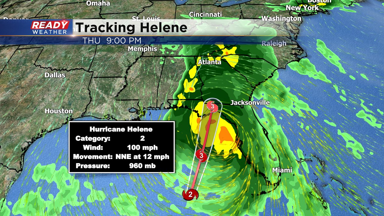
Download the CBS 58 Ready Weather app where you can add Tropical Tracks to the interactive radar and track Helene.