Briefly warm and humid Thursday with another round of rain and storms


We got some really good rain on Wednesday. Steady rain fell during the morning and after a break during part of the afternoon we saw some stronger storms and heavy downpours roll in for Wednesday evening. Rain totals for most of southeast Wisconsin ranged from 1-2" for most with a few areas getting more than 2" and a handful just less than 1".
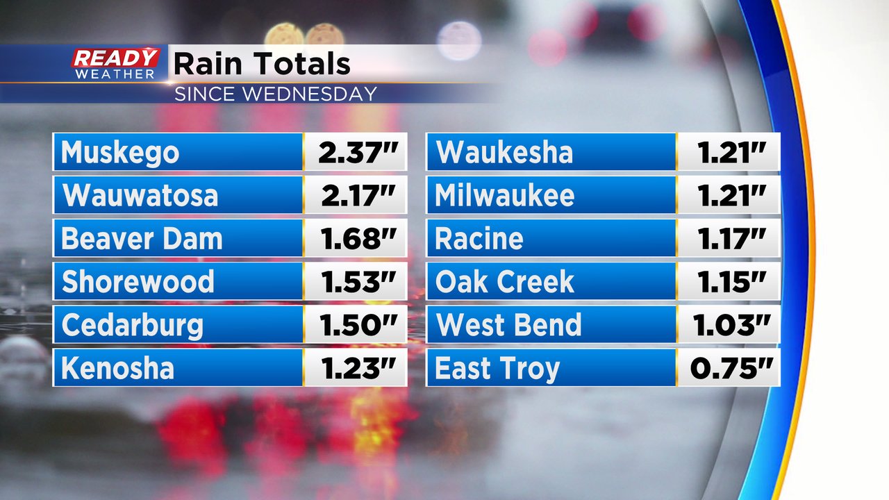
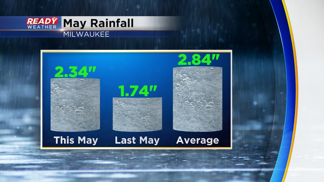
The 1.21" of rain picked up in Milwaukee on Wednesday puts us at exactly a half inch below average for the month of May. We still have a few days left to make up that deficit!
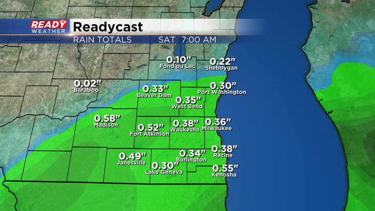
After a mostly dry morning on Thursday with just an isolated shower chance we will see scattered showers and storms return for Thursday afternoon and evening. A few storms could be stronger just like they were on Wednesday. A little rain could linger through Thursday night and Friday morning so a rain chance has been added there. Additional rainfall shouldn't amount to the 1-2" numbers we saw Wednesday but up to a half inch of new rain is possible.
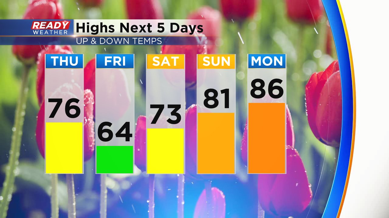
Thursday will also be a little warmer and briefly more humid. We get rid of the lake breeze and see a wind out of the south which warms us up into the middle 70s. The temperatures will drop back into the 60s Friday with a north wind then warm back up for the holiday weekend.
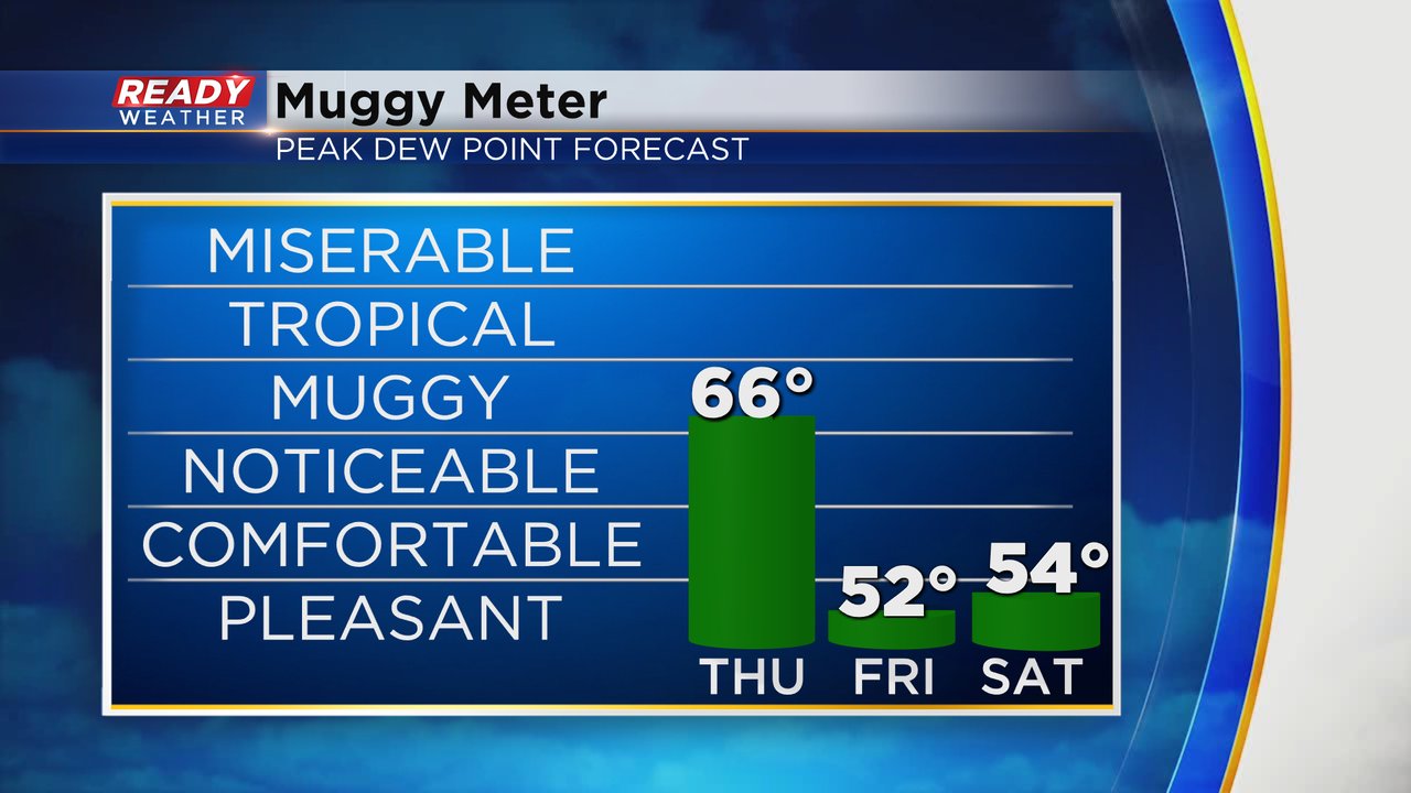
There's a lot of stickiness and humidity Thursday morning with dew points in the middle 60s. That humidity will start to come down late Thursday afternoon then become comfortable with dew points dropping into the 50s for Friday and Saturday.
Download the CBS 58 Ready Weather app to track the rain and storms.