Busy Weather Pattern Continues
Your weather in a nutshell: Bitter cold to more snow to cold again... then mild with a potential wintry mix as we near the holiday season.
So far, our winter weather season has been anything but boring for forecasters. Our immediate concern is focused on the cold. We have a Wind Chill Advisory officially starting at 9pm tonight - 10am tomorrow morning.

Half the battle is the cold air mass upon us, the other half is the gusty wind! By 11am, Milwaukee had already reported wind gusts at 40mph. Take a look at how wind translates to wind chills as shown in this chart provided by the National Weather Service:
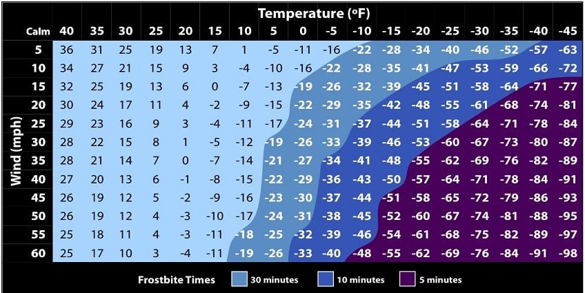
Temperatures are hovering in the teens for the rest of our daylight period, but once we head into the night, the chill is on! Let's say we fall to zero later tonight, and the winds howl at 20 mph. That gives us a wind chill of -22° and that my friends is cold enough to trigger the advisory. The advisory is issued for chills at -20° to -34° for a period of three hours or more. And we easily fit into that category, area wide, for tonight into tomorrow morning. During this time make sure you check on your neighbors and take extra care of your pets. Frostbite can occur in thirty minutes with air this frigid. What about the kiddos? Make sure they have layers and most exposed skin covered before sending them off to school.
So what next? As the chills ease, we're already bracing for our next winter storm.
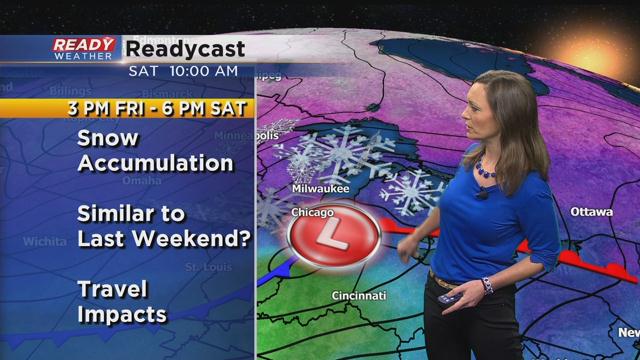
Mother nature has been right on time delivering what now looks to be the third weekend storm in a row. While we shiver through these bitter cold wind chills, this winter storm is already brewing. Even though temps will improve during the storm, rising to the 20s is still cold enough Friday through Saturday for mainly snow. There's a bit of an unsaid rule that you don't give out snow totals more than 48 hours in advance of the storm because models can still change quite a bit and sometimes storms can still be many miles away. But given our recent history and storm track, it is looking like accumulating snowfall is likely, similar to last weekend. Snow looks to start in an isolated fashion early Friday. Then becomes steady later in the day and night. Lingering light snow will continue much of Saturday. Anticipate some type of Winter Storm Watch within the next 24 hours. Stay with the CBS58 Readywx team as we continue to follow this storm. We'll be here all weekend to keep you covered, so be sure to tune in!
As the system then pulls away from the area of Sunday, temps will go downhill and we'll be bracing for sub-zero chills once again. The breezy northwest wind may also lead to some blowing snow for folks heading down to watch the Pack take on the Bears in Chicago, Sunday at Noon.
The good news is that we'll climb out of the deep freeze as the next week wears on, but this time it could spell more trouble for, yet again, another potential big storm. With temps closer to the freezing mark we could be watching a wintry mix of precipitation by Wednesday and Thursday. Although there's still disagreement between the major weather models as to temperature and precipitation type. It's another one we'll be watching closely!
By the end of next week weather looks quiet which would be great for holiday travel. One model takes us through Christmas Day and it does show some light snow possible. I say just enough to keep things festive!
Be sure to download the CBS58 Readywx app to stay up to date on changing weather conditions while you move about your day!
I'm meteorologist Rebecca Schuld
