


The last ten days have all been at or 80 degrees which continues a very warm summer. 54 of the days since June 1 have been at 80 degrees or warmer which is tied for the third longest streak through Monday's date. It has been just over two weeks since a high temperature dipped below 75*.

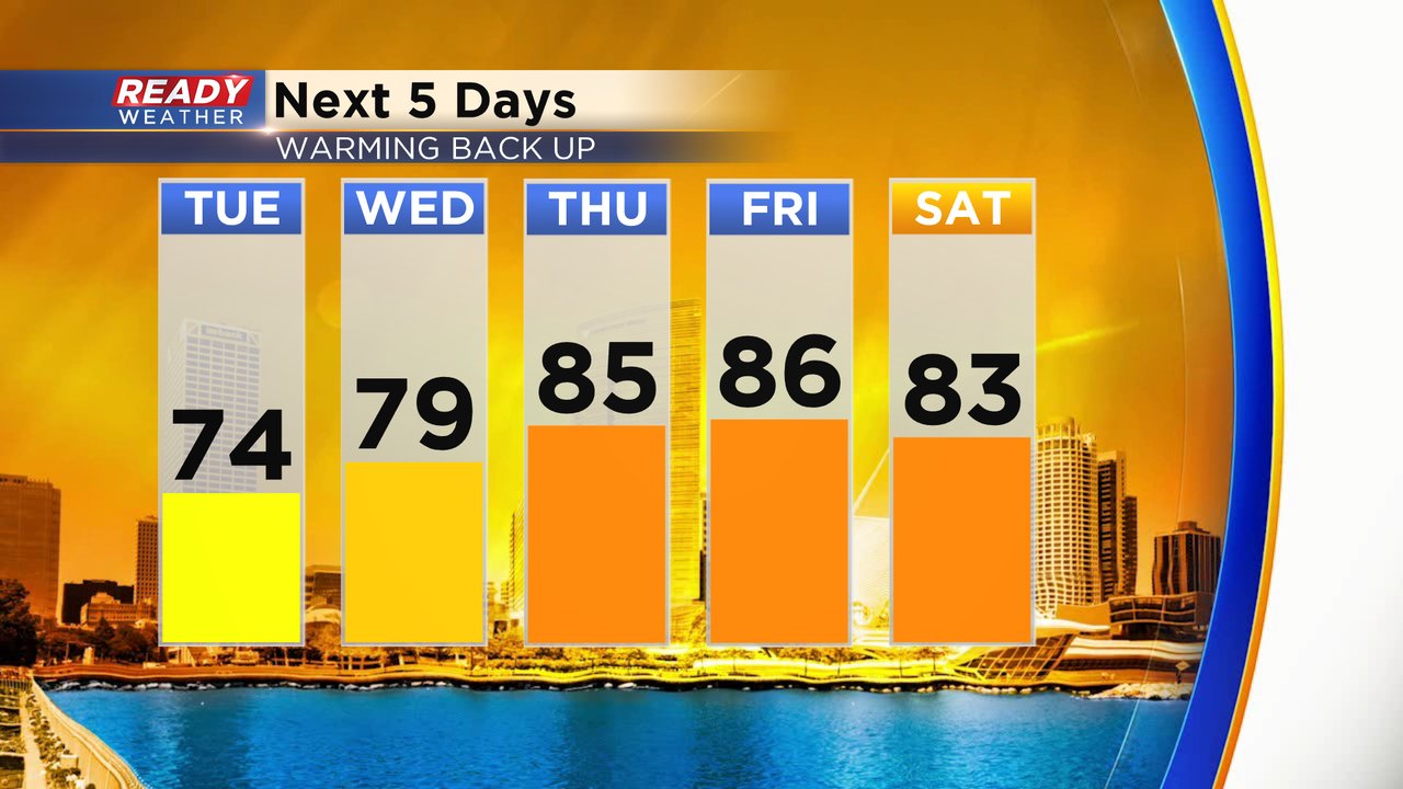
That two week long streak could end Tuesday with highs expected in the middle 70s thanks to cooler air that arrived Monday and a lake breeze. The cooler air doesn't last long with highs returning to average on Wednesday then warming into the middle 80s for the end of the work week.
As temperatures warm, the humidity stays pretty steady in the comfortable category. Dew points are expected to stay in the upper 50s through Thursday but some more muggy air is expected as we head into the weekend.

The temperature trend from the Climate Prediction Center now takes us through the end of August and shows Wisconsin just slightly above-average. Expect no big temp changes the next two weeks with highs most day right around 80*.

Download the CBS 58 Ready Weather app to continue to track the temps with the 10-day forecast.