Couple of storm chances as we head through the weekend
After the heavy rain earlier this week, we've had a pretty nice stretch of weather across SE WI. It's given us time to dry out and for river levels to drop back below flood stage. Our dry stretch of weather unfortunately won't continue through the weekend as a couple of systems push through.
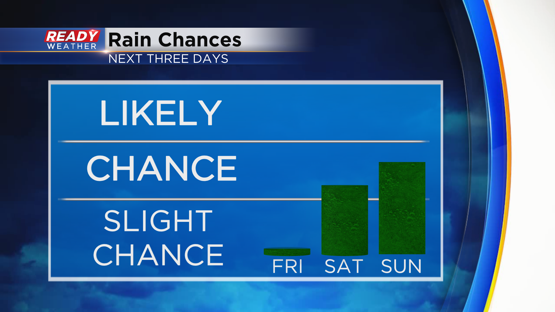
Dry weather will continue throughout today and a good portion of Saturday. Rain chances then arrive by late afternoon/early evening Saturday, becoming more widespread Saturday night into early Sunday morning.
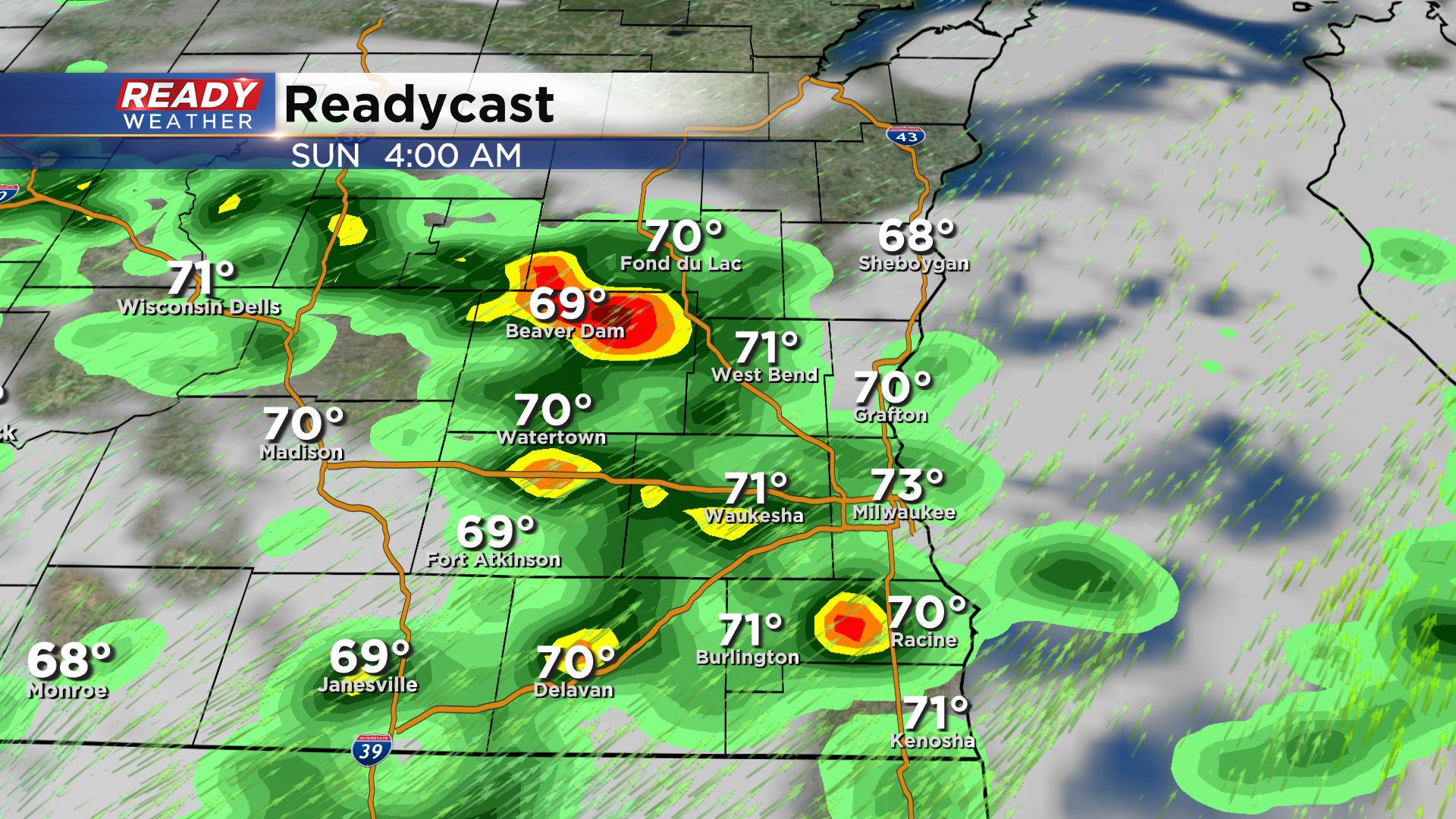
There will likely be a decent break in the rain from mid morning Sunday through late afternoon, but additional showers and storms are possible along a cold front Sunday evening. There is still some uncertainty as to where the storms will form late Sunday. The best chance will be near the Wisconsin/Illinois border.
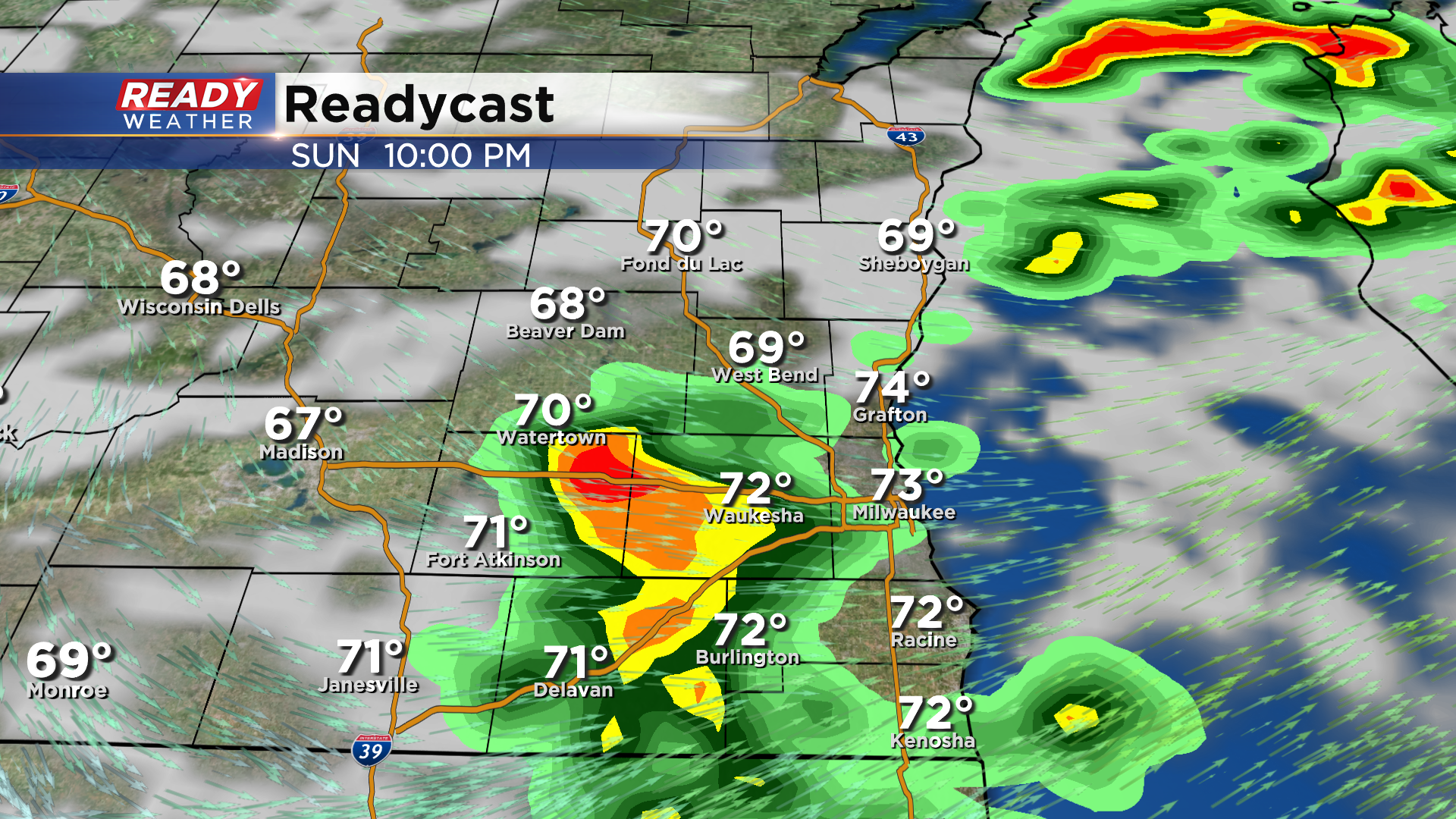
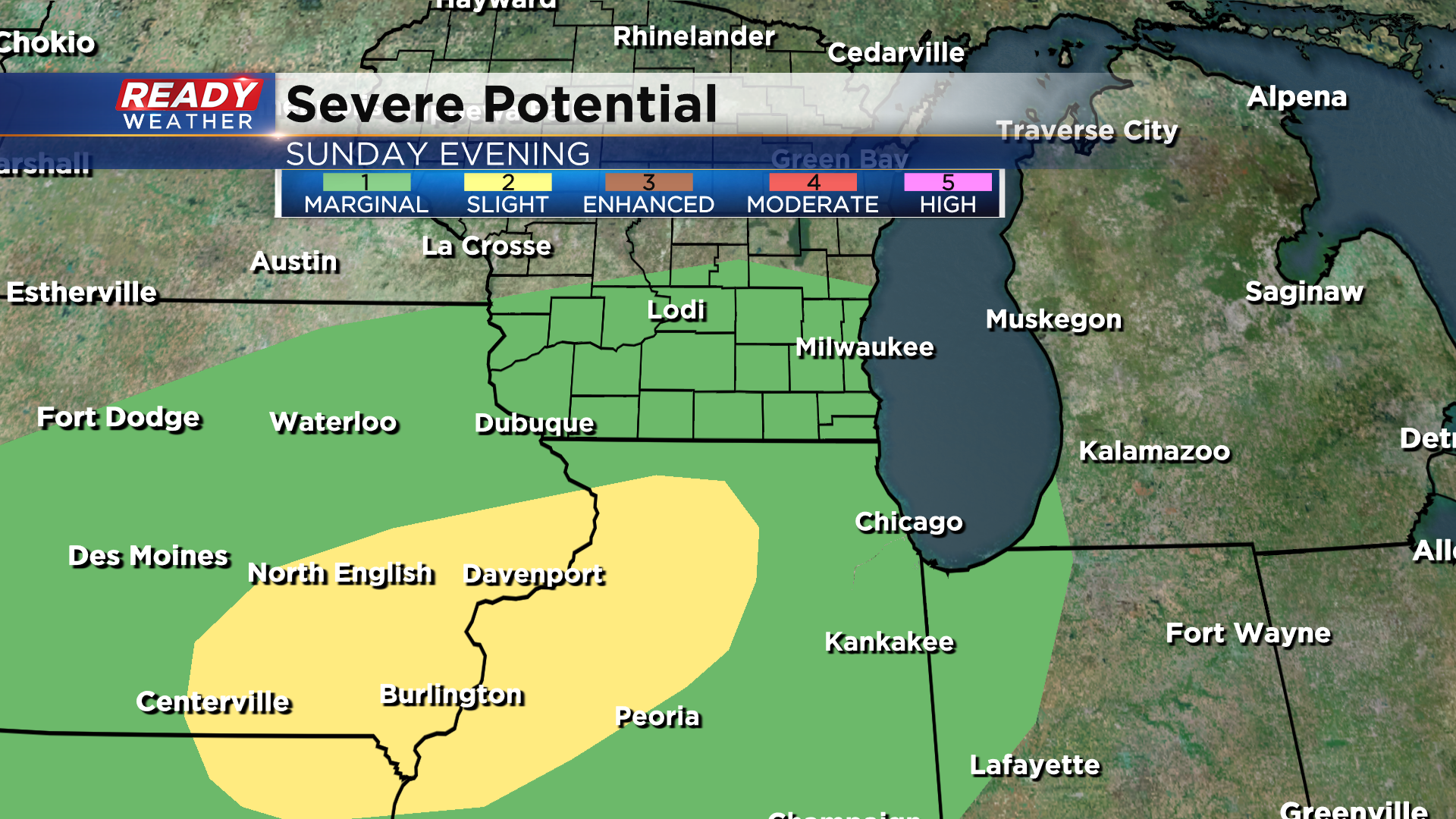
Storms that fire Sunday evening could be on the strong side with hail and gusty winds being the mean threats. However, the better chance at severe weather looks to be from Iowa into northern Illinois - something we'll keep an eye on through the weekend!
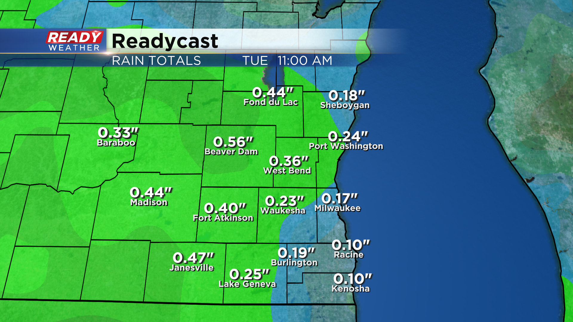
Thankfully the rain this weekend will be progressive, so we're not expecting heavy rain like last weekend. Most spots can expect .10-.30" with locally higher totals around .50-1" in places that see thunderstorms.
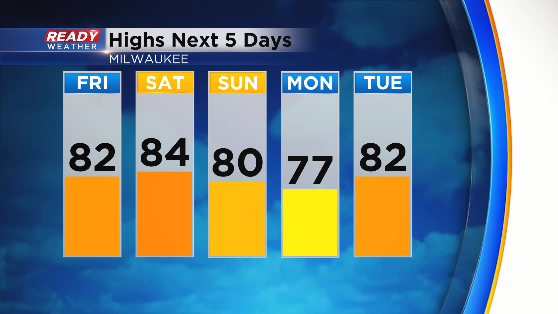
After spending the weekend in the low to mid 80s, temps drop back into the 70s on Monday behind the cold front. That being said, it will be a short-lived cool down as temps rise back into the low 80s by the middle of next week.
Download the CBS 58 Ready Weather App to see if there's any cool, fall weather on the way.
