Afternoon Update: Warning now replaced with Winter Weather Advisory for continued cold and blowing snow


Updated: Friday, December 23 4pm:
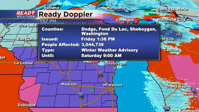
The Winter Storm Warning has been canceled! It has been replaced with a lower end Winter Weather Advisory. And that is still primarily for cold and blowing snow issues. It runs until 9am Saturday.
Updated: Friday, December 23 11am:
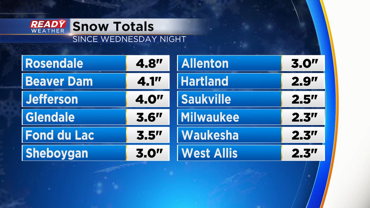
More snow totals are rolling in this morning with many locations picking up 2-4". This was lower than expected due to the low pressure system pushing a little farther east than expected and not strengthening until today. We were expecting this to happen in Michigan, but instead it's occurring in Quebec.
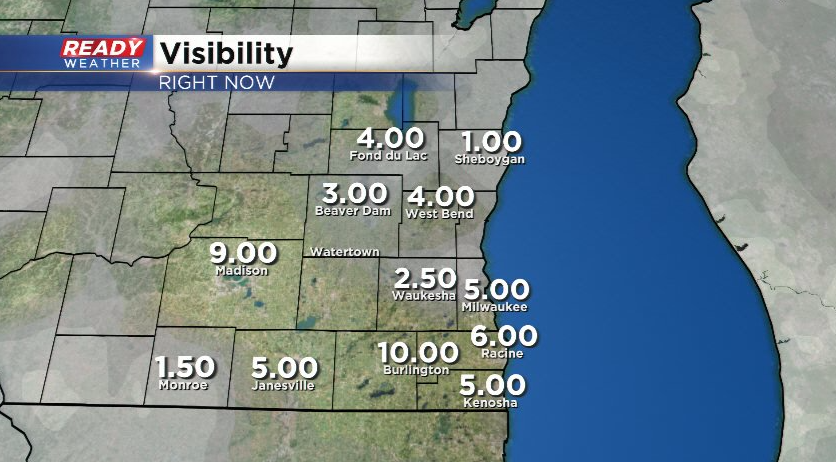
Wind gusts are starting to ramp up, currently gusting between 35-50 mph. This wind blowing around the snow is creating low visibility, especially in rural areas/counties like Sheboygan county.
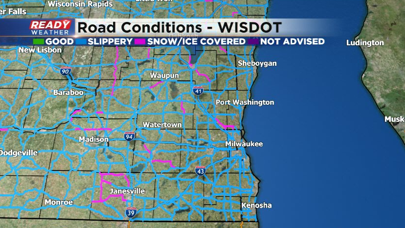
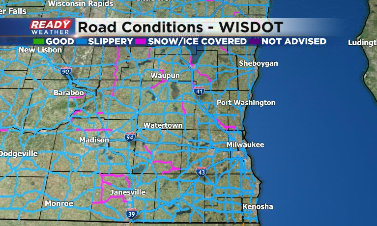
Roads still aren't in great shape, especially roads that aren't major interstates/highways. There have been numerous crashes and spin outs this morning due to people driving too fast for conditions.
If you are traveling today, take it slow. Even if you see bare pavement, it's still slick. If you get into an accident or your car becomes disabled, stay in your car!!
--------------------------------------------------------------------
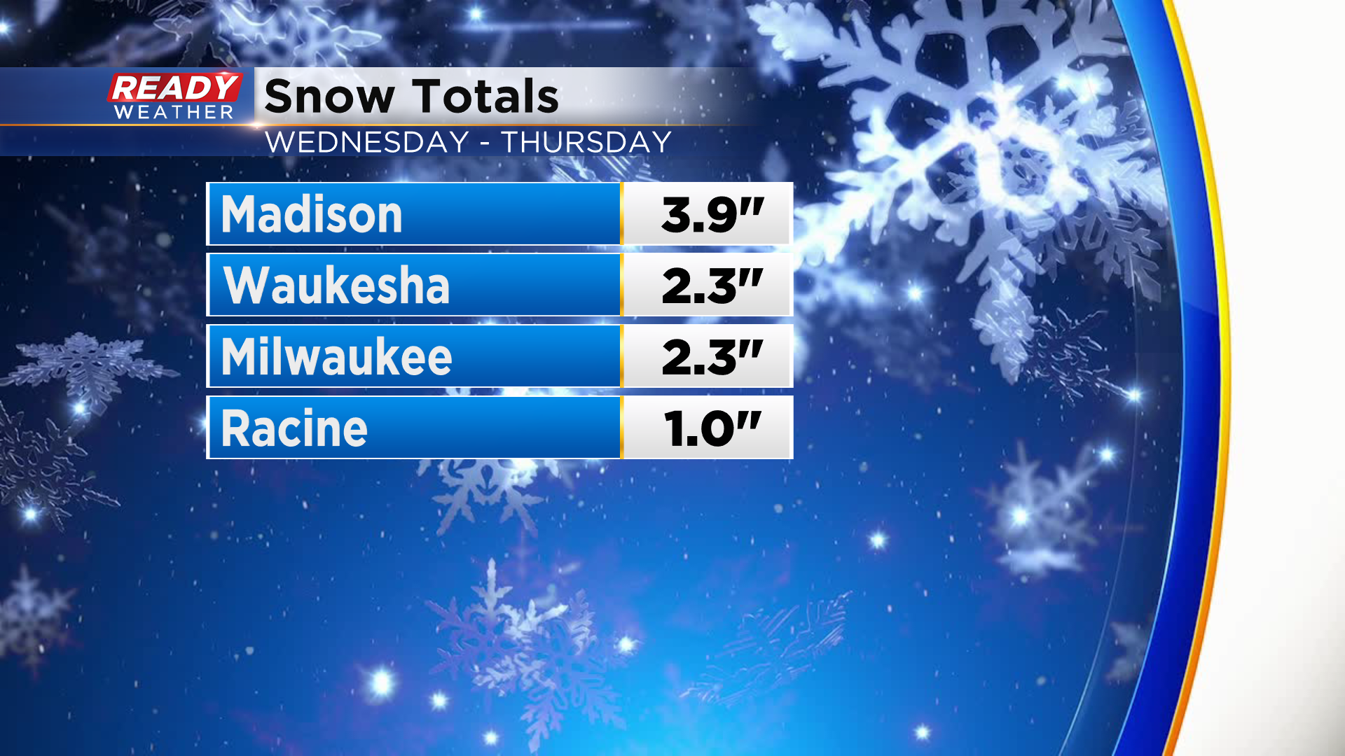
The snow has wrapped up for the most part, but we likely won't have many snow totals until after 7 or 8am. Officially picked up 2.3" in Milwaukee as of midnight Friday.
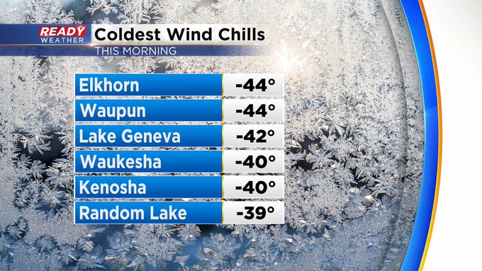
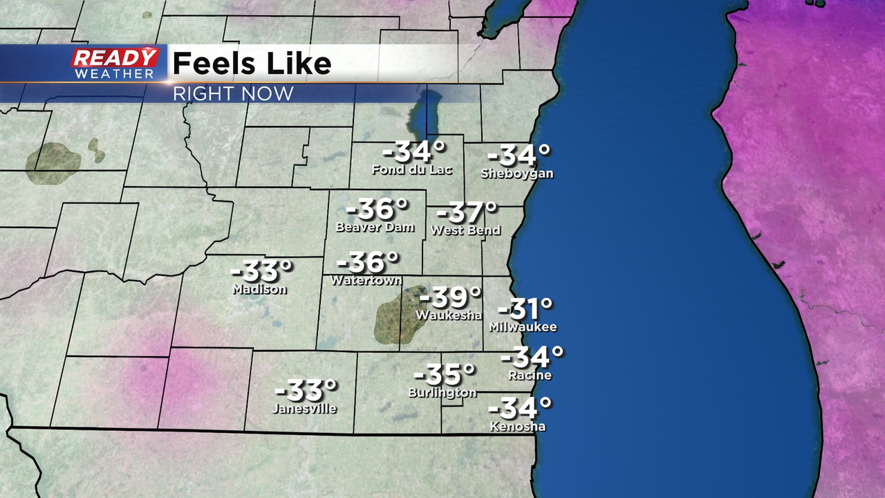
Now the dangerous cold and strong winds are settling in. Wind chills are currently between -30 and -40 across southern WI with winds gusting between 30-40 mph.
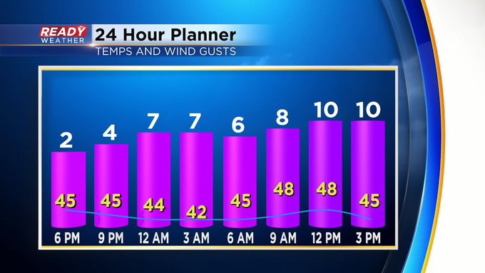
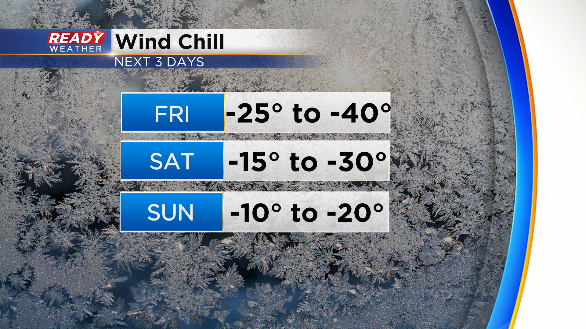
Wind gusts will increase between 35-50 mph during the day today, keeping wind chills at -20 or colder. Wind chills will drop down between -25 and -30 by Saturday morning but improve to -15 by the afternoon. Wind chills stay below zero on Christmas Day, but wind will be lighter by then.
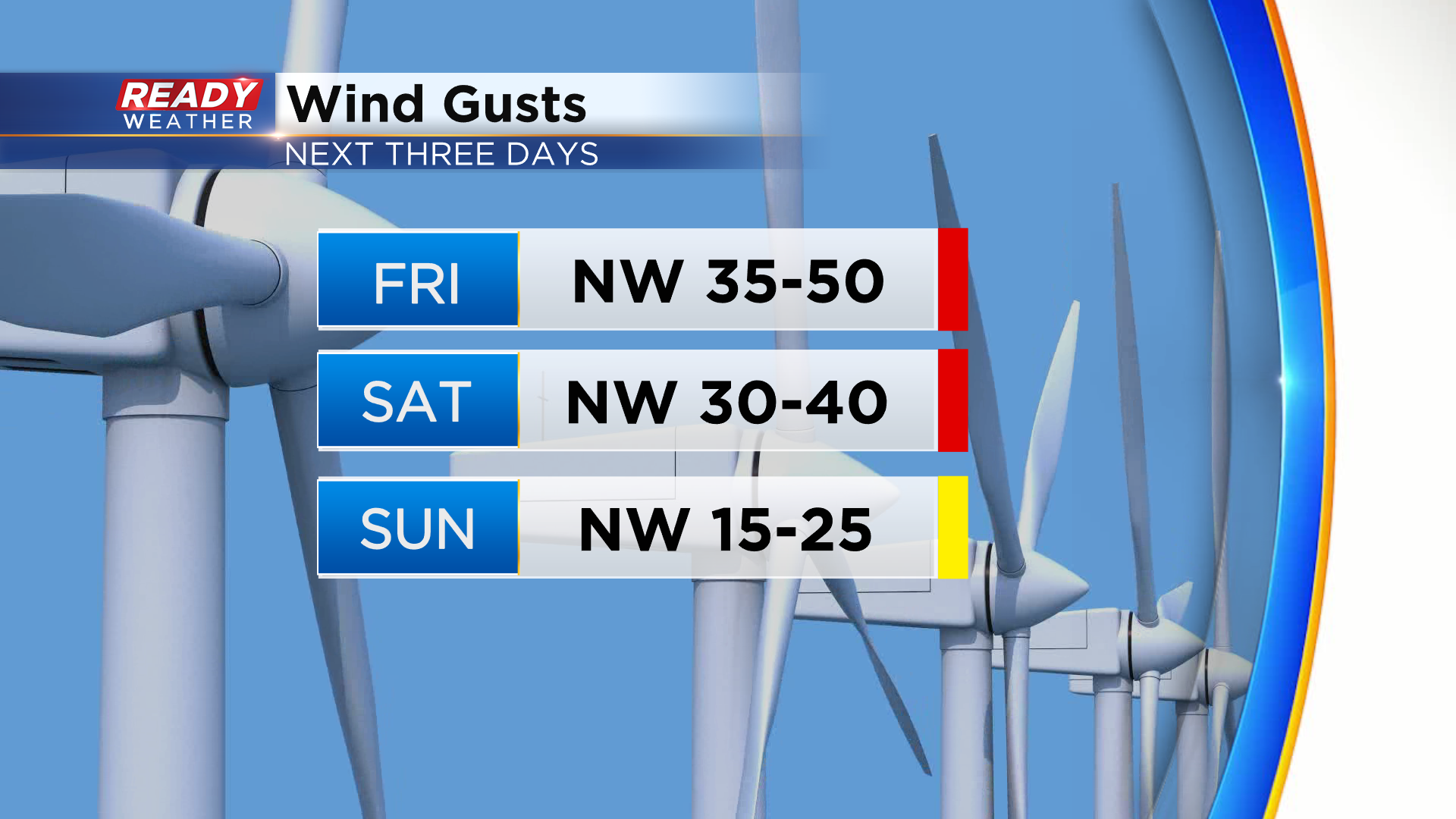
Wind gusts will peak around 50 mph today and remain around 40 mph tonight through Saturday. This will cause blowing and drifting across the state all day today and Saturday. The cold temps will make it difficult to melt any of the snow currently on the roads, and most roads are icy and snow covered in SE WI.
Wind gusts finally start to taper off a bit on Christmas Day but will still be around 35 mph during the morning.
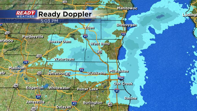
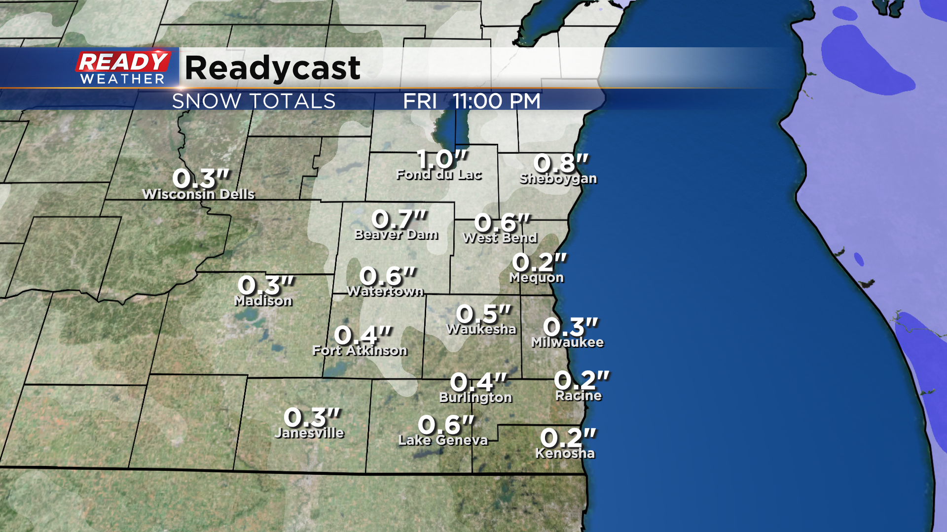
While most of the snow is done, a little wrap around snow is possible in the evening. Most of us will only see a dusting from this, but folks in Sheboygan and Fond du Lac counties could pick up an additional inch.
Take your time if you're traveling today! Download the CBS 58 Ready Weather App to get the latest on road conditions.