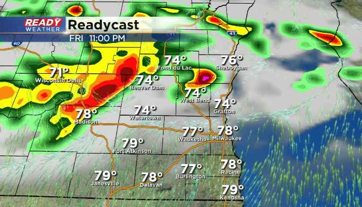
10 PM Update: Storm chances primarily north and well west overnight


Updated: 10 pm Thursday, August 26th:
Showers in SW WI continue to weaken as they move east-southeast.
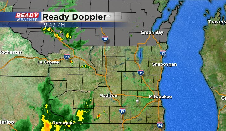
Additional spotty showers and isolated storms haven't been impressive near the Dells, and the heavier rain east of the Twin Cities will continue to track to the east.
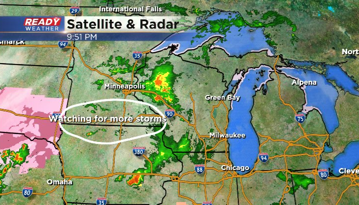
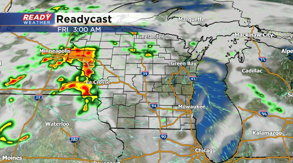
We're expecting more storms to develop west of La Crosse over the next couple of hours, however latest trends keep this activity out of SE WI until Friday morning, and by then it looks like it may be falling apart.
What happens with this overnight - morning round of storms will determine where and when the next round of strong to severe storms fires. Currently this looks like Friday evening into Friday night.
------------------------------------------------------
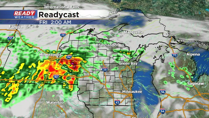
Updated: 7pm Thursday, August 26th:
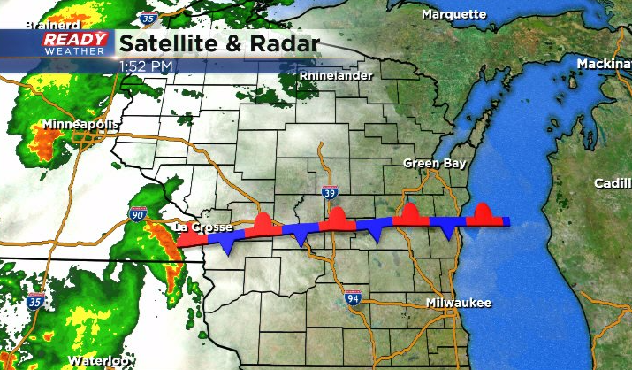
Showers and storms have struggled to stay together as they've moved across the Mississippi River throughout the afternoon and early evening. Recently, a new area of scattered rain and storms has developed in NE Iowa, but so far any storms that have tried to move east have weakened.
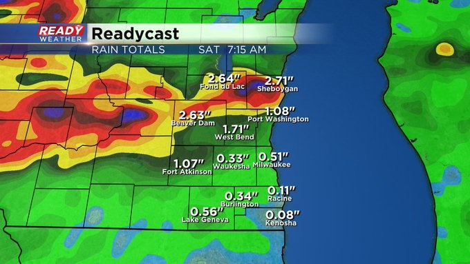
Current thinking is any storms from this cluster will stay in SW WI and weaken if they push any farther east through the rest of the evening. Our attention then turns to northern Iowa and southern Minnesota where clusters of storms are expected to develop closer to midnight. These storms will track to the east into the area Friday morning, but unfortunately the exact track of these storms remain in question. Current thinking is folks along and north of I-94 have the best chance at these storms, with more of a scattered threat to the south. Storms my produce gusty winds along with the heavy rain potential.
What the overnight round of storms does and where it pushes the stalled front will determine where the next round of storms fires Friday afternoon - Saturday morning.
--------------------------------------------------------------------------------------------------
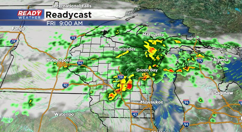
Updated: 2pm Thursday, August 26th:
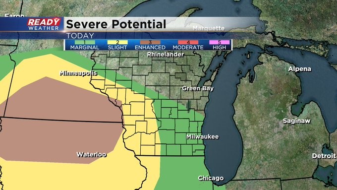
Quite the complicated forecast as we head through the next 24-36 hours. In the short term, we're keeping an eye on the line of storms approaching La Crosse. Current thinking is they will follow the stalled boundary across southern WI, but how organized and strong this line will be remains in question. It's only moving at 25 mph right now, which would be it in SE WI by early evening.
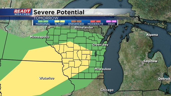
Strong winds will be possible in these storms. SE WI remains under a level 1 of 5, Marginal Risk, for this isolated strong wind threat.
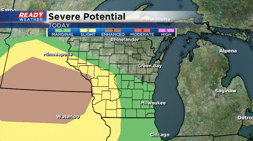
Our attention will then turn to northern Iowa and southern Minnesota where another complex of storms is expected to develop later tonight. These could track into southern Wisconsin early Friday morning, but the exact track and timing remain uncertain. After a break into the early afternoon, we'll be watching for another round of potentially strong to severe storms late afternoon Friday into early Saturday morning. Damaging winds would be the main threat along with an isolated tornado or two.
Storms should lift north of the area by daybreak Saturday, with another storm chance Sunday with the stronger cold front.
----------------------------------------------------------------------------
MILWAUKEE (CBS 58)--No shortage of heat and humidity and storms through the weekend. It'll be hard to pinpoint the times. But just realize the risk is there, especially Friday, early Saturday morning, and on/off Sunday. We're dealing with a few different weather features, first a warm front and then a cold front. The cold front moves through later Sunday and then we start to dry out into early next week. But the best advice the next few days is keep it tuned here or watch us on CBS 58 for further weather updates as we proceed through the next few days, Of course, the free CBS 58 weather app is also a great tool to have.