Dry to start the week before storm chances increase late Tuesday into Wednesday


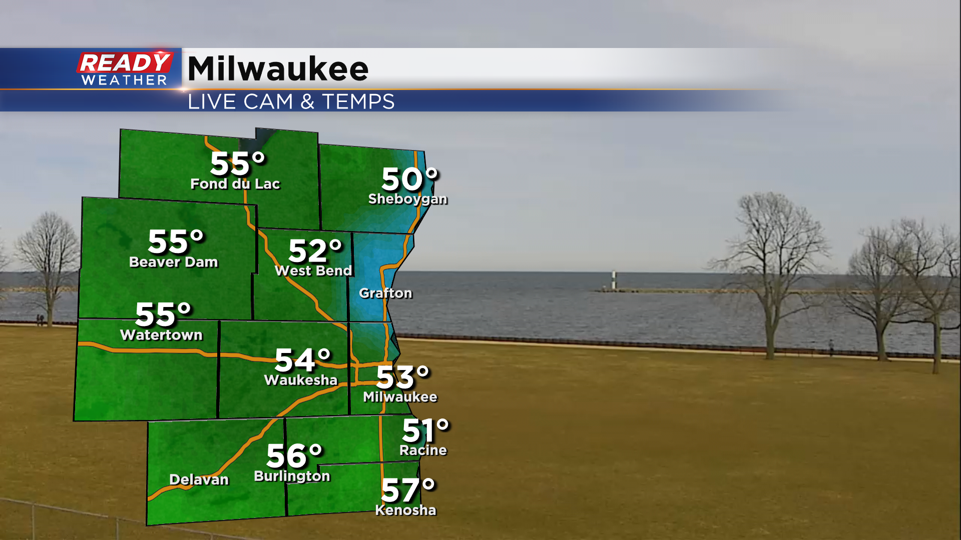
It's been so nice to see the sun today, and temps have responded to the sunshine with temps in the 50s!
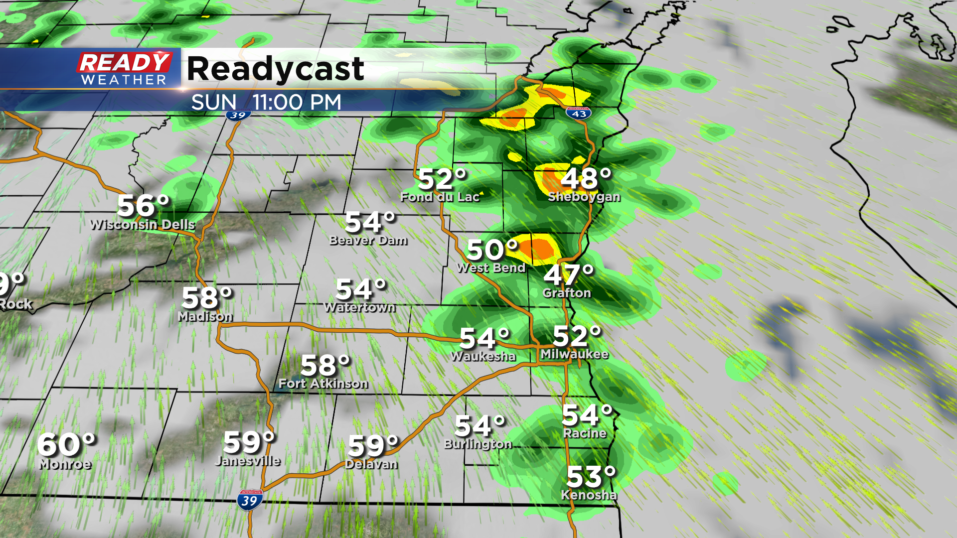
Clouds have been increasing this afternoon ahead of a low pressure system and warm front. A few isolated showers will be possible between 10pm-12am as the warm front moves through, but these will exit fairly quickly with decreasing clouds heading into Monday morning.
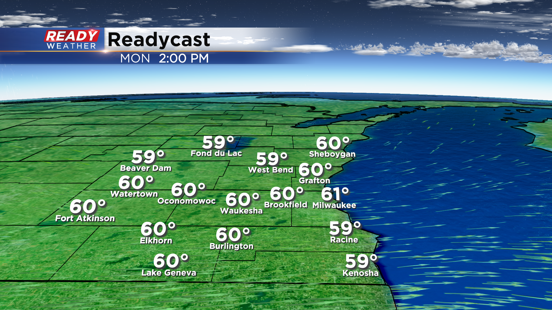
Monday is trending dry as a cold front settles across northern Illinois, keeping light rain to our south. A mix of sun and clouds and westerly breeze will push temps close to 60° for most of southeast Wisconsin.
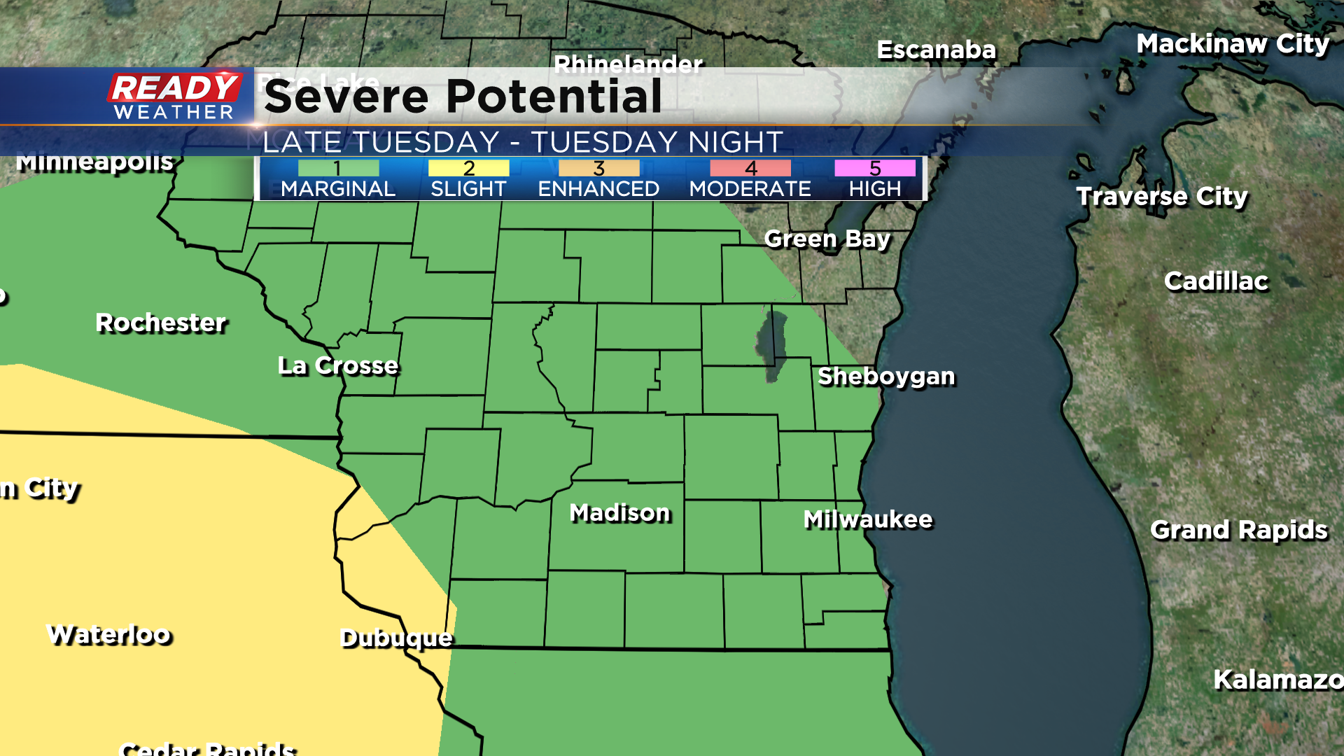
After a quiet and dry start to Tuesday, our weather will become more active Tuesday evening through Wednesday as a strong area of low pressure tracks across the Upper Midwest. An area of showers and storms looks to develop Tuesday evening into Tuesday night ahead of the warm front.
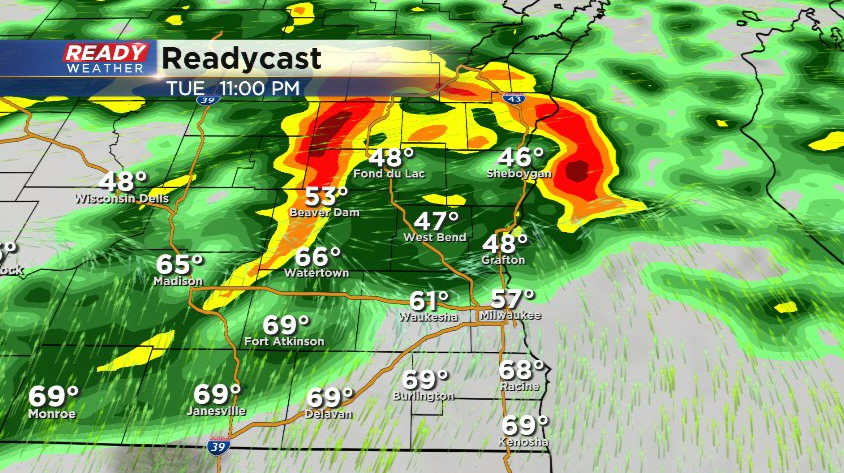
These storms could produce large hail, and because of the hail threat all of southeast Wisconsin is under a Level 1, Marginal Risk, for severe storms.
The warm front will be well north of the area on Wednesday, so you'll notice more humidity in place along with temps well in the 60s. With this warm and relatively humid airmass in place ahead of a strong cold front, we'll be looking at another chance for strong to severe storms Wednesday afternoon or evening.
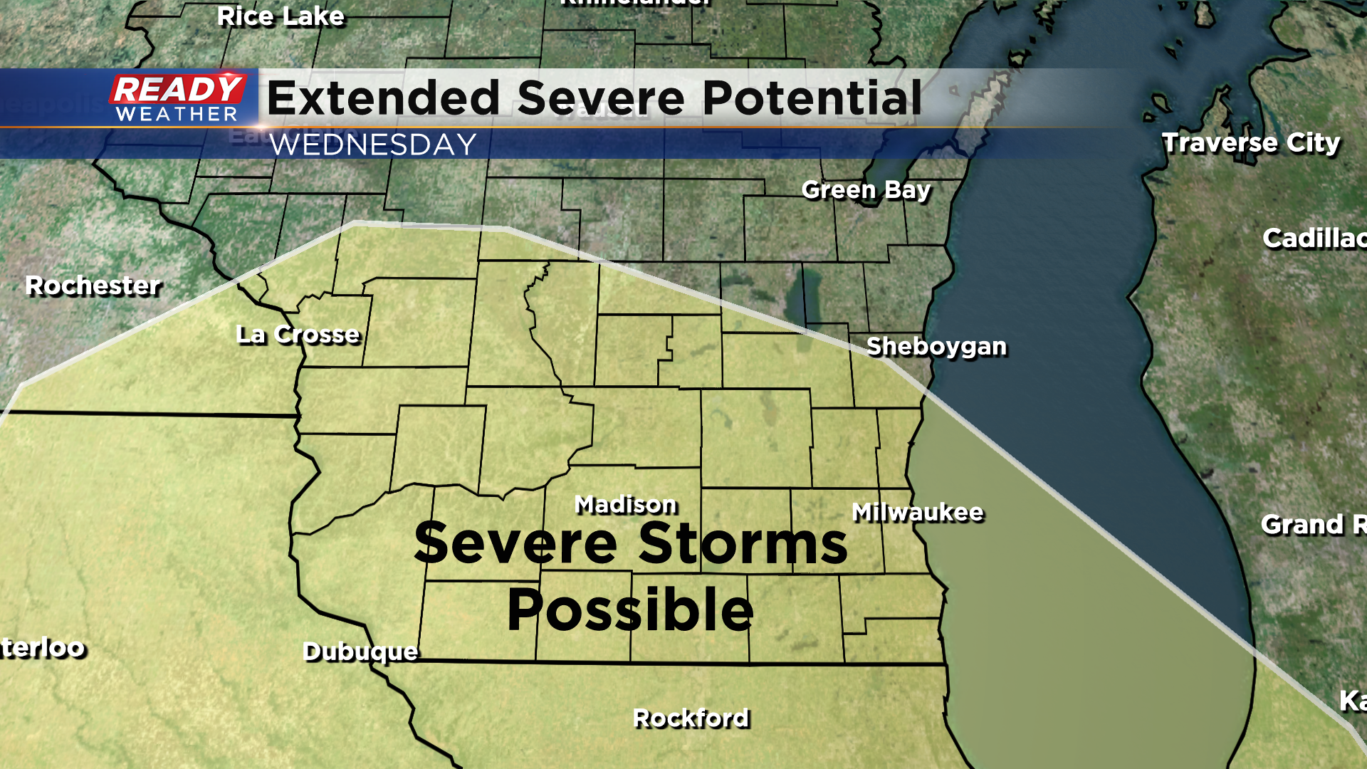
There are still timing differences as to when the cold front will move through, so check back for updates over the next few days, but damaging winds and hail look to be the primarily threats, but an isolated tornado can't be ruled out. Below normal temps and windy conditions will settle in behind this system for the rest of the week. Download the CBS 58 Read Weather App to track the severe storm chances.