


It's been another fantastic late May day across southeast Wisconsin with plenty of sunshine. However, clouds are moving in as a weak disturbance moves through the state.
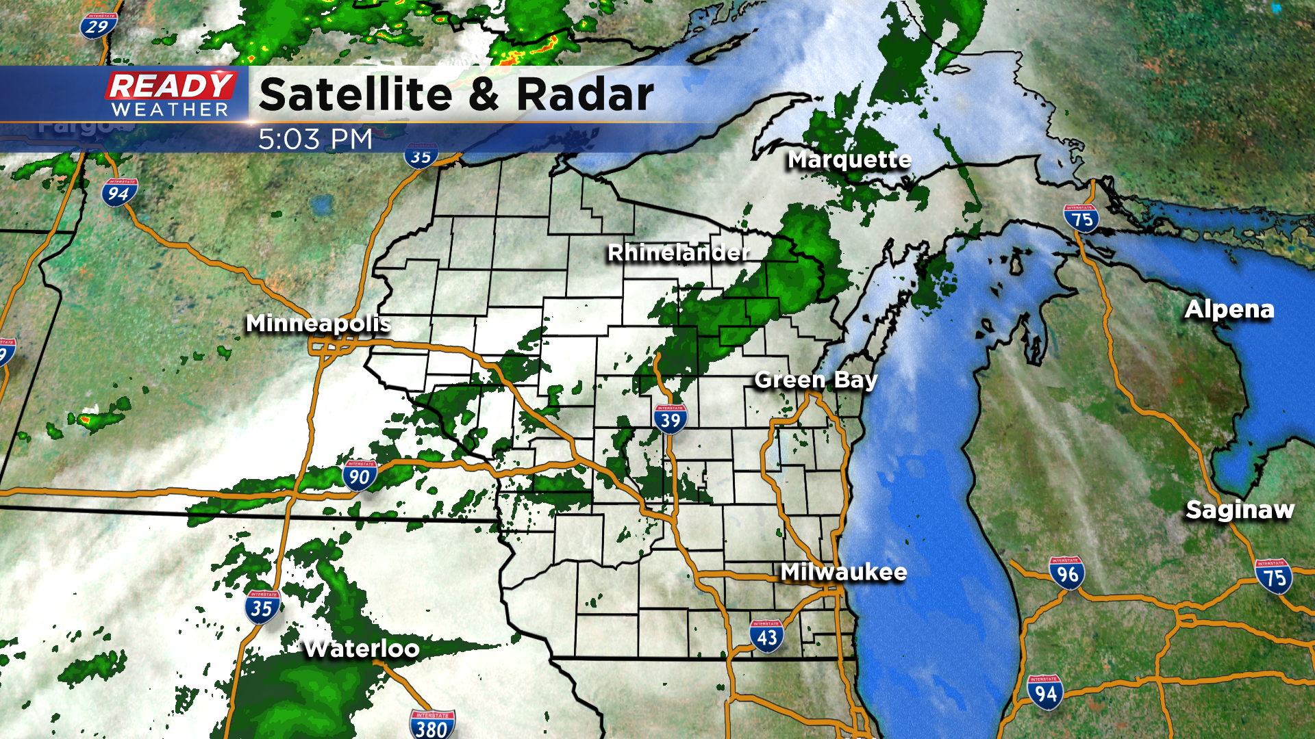
This has been bringing a few showers into the northern half of the state, but the showers are falling apart as they move east due to the very dry air in place over southeast Wisconsin.
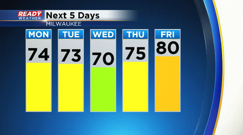
These showers will continue to fall apart this evening, but clouds look to hang around overnight and into the start of Memorial Day. After some morning clouds, skies will turn partly cloudy for the afternoon with southwest winds helping temps rise into the mid 70s.

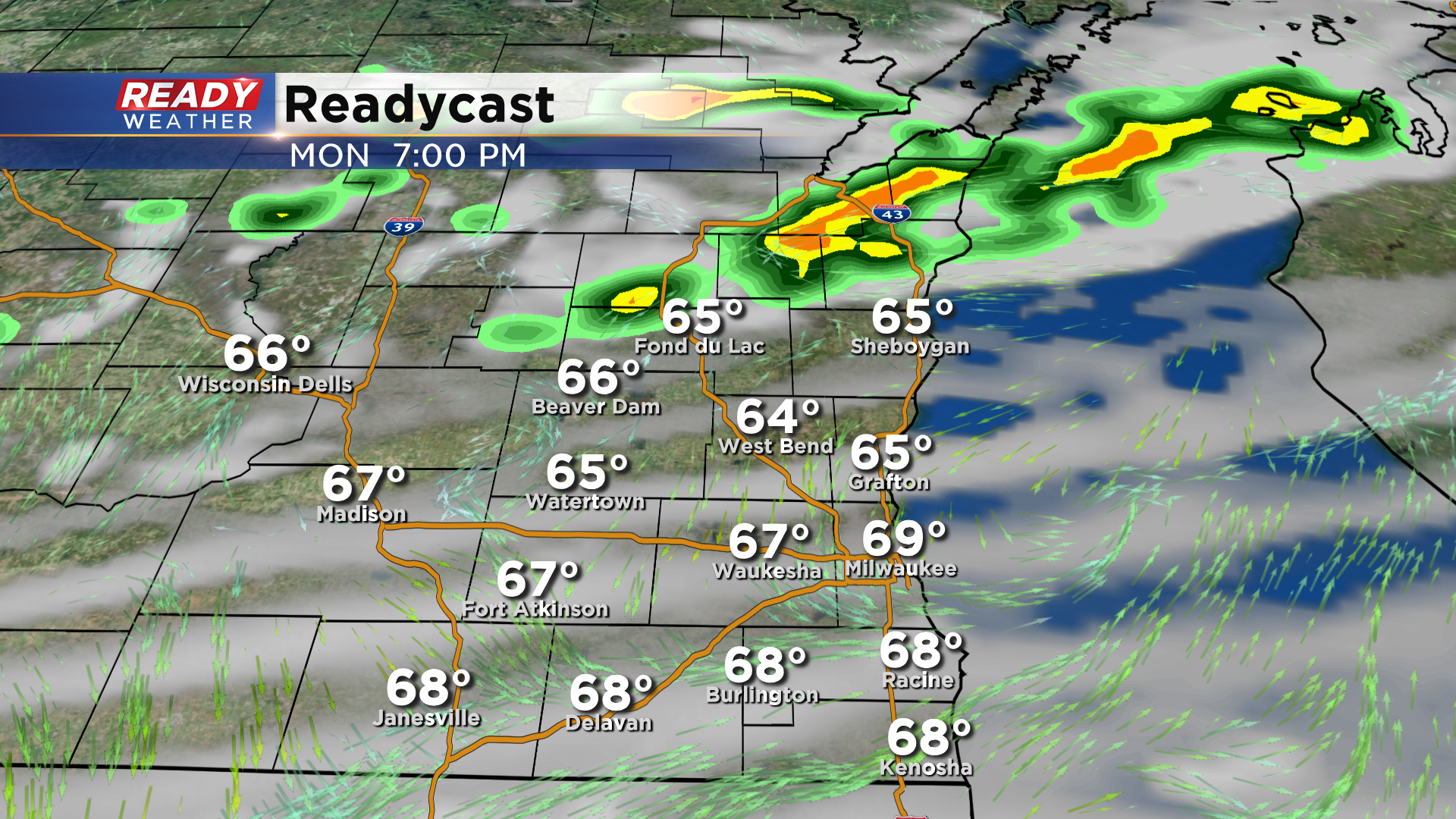
While we're dry during the afternoon in SE WI, scattered showers and storms will be developing in northern and central Wisconsin.
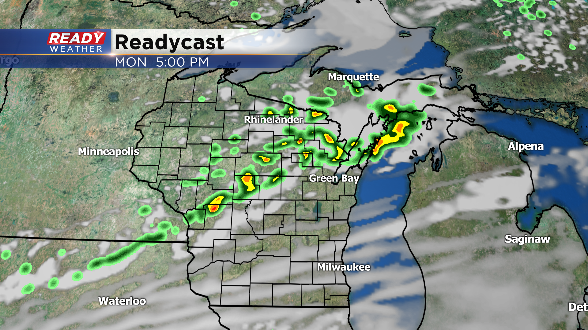
This area of showers and storms will attempt to track into Fond du Lac and Sheboygan counties around 5-8pm, but they'll likely be weakening as they push into the area. Folks south of a line from West Bend to Port Washington will likely stay dry throughout Memorial Day.
Dry weather returns on Tuesday with a lake breeze developing around midday. Spotty showers and isolated storms are possible Wednesday and Thursday before the heat builds back in by the end of the week.
Download the CBS 58 Ready Weather App to see how hot temps may be next weekend.