


It's now been 13 days since we last had measurable precipitation across southeast Wisconsin, and our dry stretch of weather will continue for another few days. Sunday won't be as sunny as Saturday as a weak disturbance will bring a few clouds through the area in the afternoon. Winds will be from the southeast with highs topping out in the low to mid 40s.
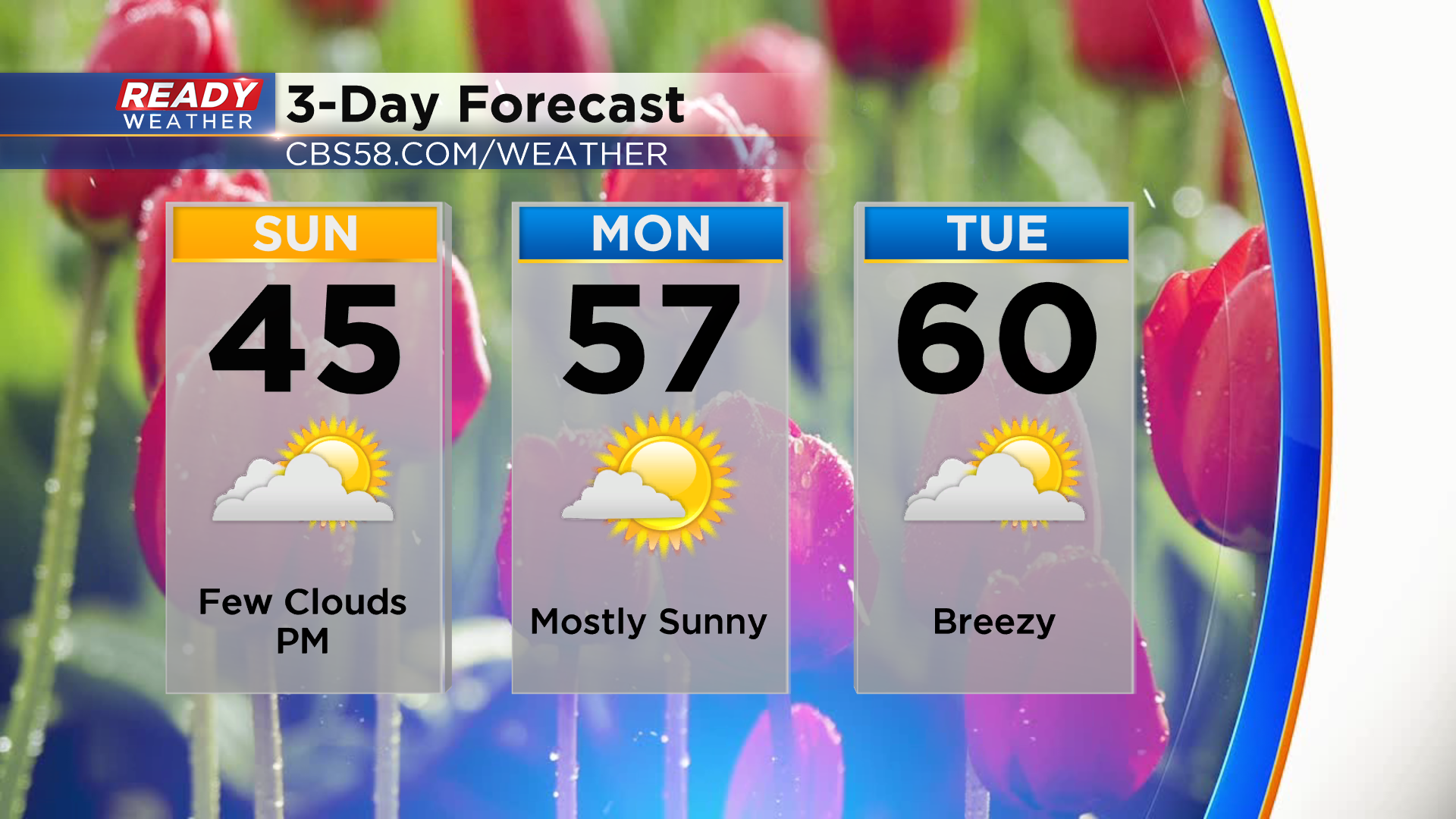
Winds will turn to the west and southwest Monday and Tuesday, boosting temperatures into the upper 50s to low 60s. There's a chance a lake breeze develops on Monday afternoon, so the best chance for 60 on Monday will be inland, but southerly winds will be breezy on Tuesday which will prevent a lake breeze. If Milwaukee hits 60° on Tuesday it would be right on schedule. March 9th is the date of Milwaukee's average first 60.
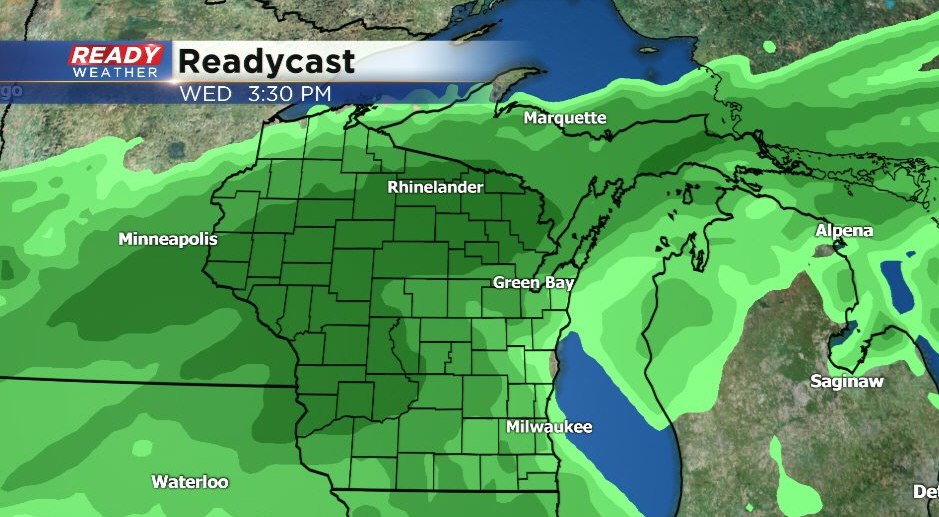
Our dry stretch of weather will likely come to an end on Wednesday as scattered rain showers look likely. A few rumbles of thunder will be possible in the evening when the cold front moves through.
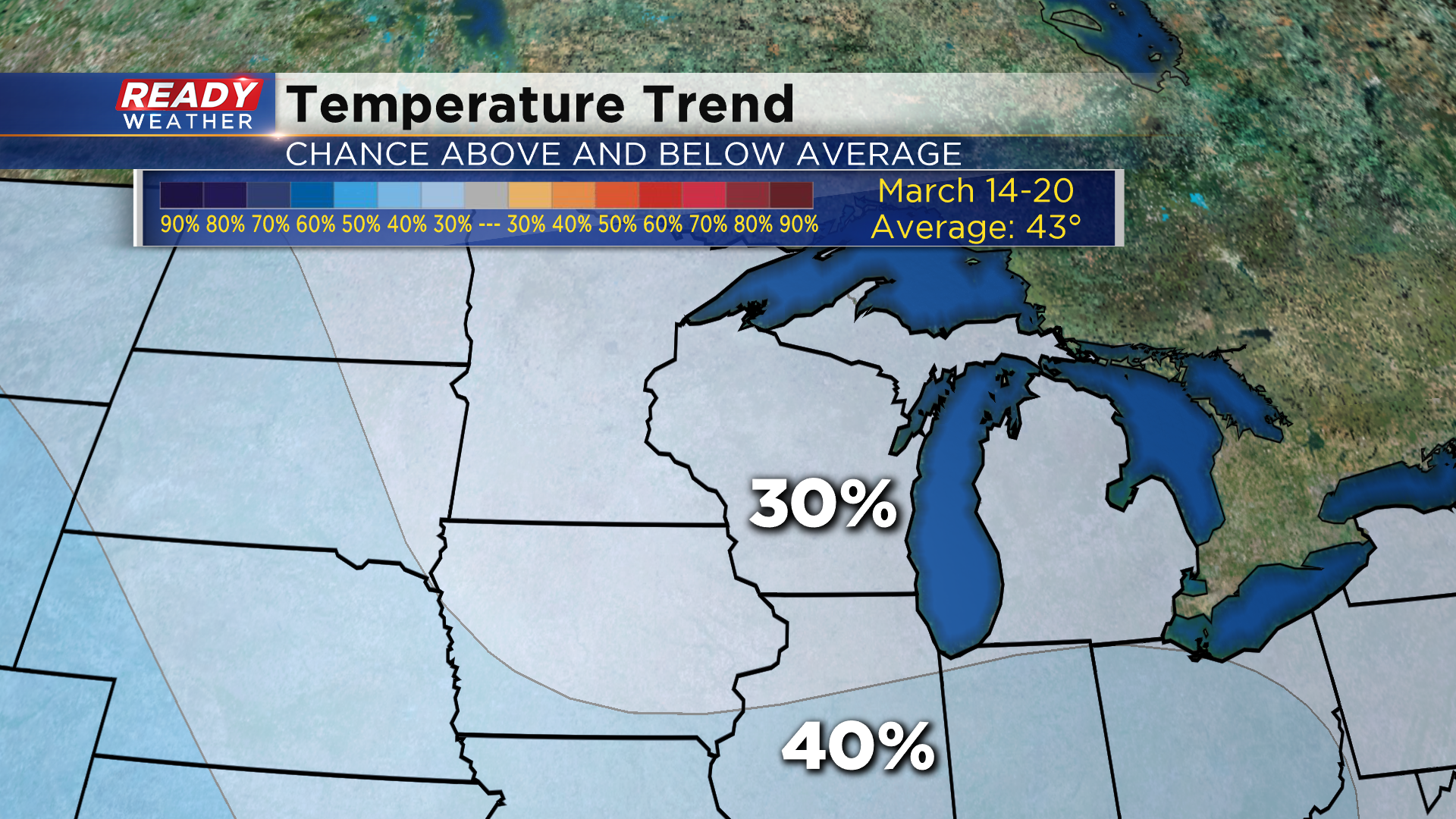
We all know this warm weather isn't here to stay quite yet. Cooler temperatures will move in behind the cold front for the second half of the week, and below normal temperatures are slightly favored for the third week of March. Normal highs are in the low 40s by then.
Download the CBS 58 Ready Weather App to see the full 7 day forecast.