


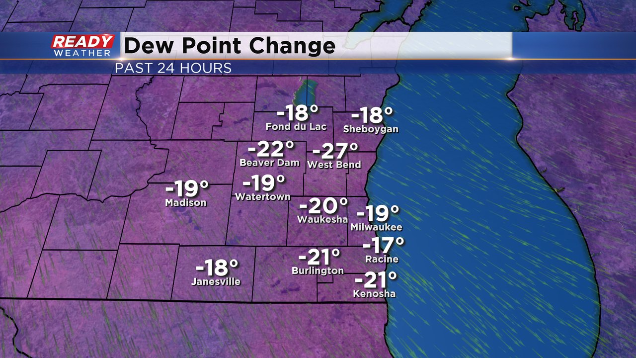
After a long week of heat and humidity, we more than deserved today's perfect weather. Dew points have dropped around 20 degrees compared to yesterday, and temps topped out in the mid to upper 70s.
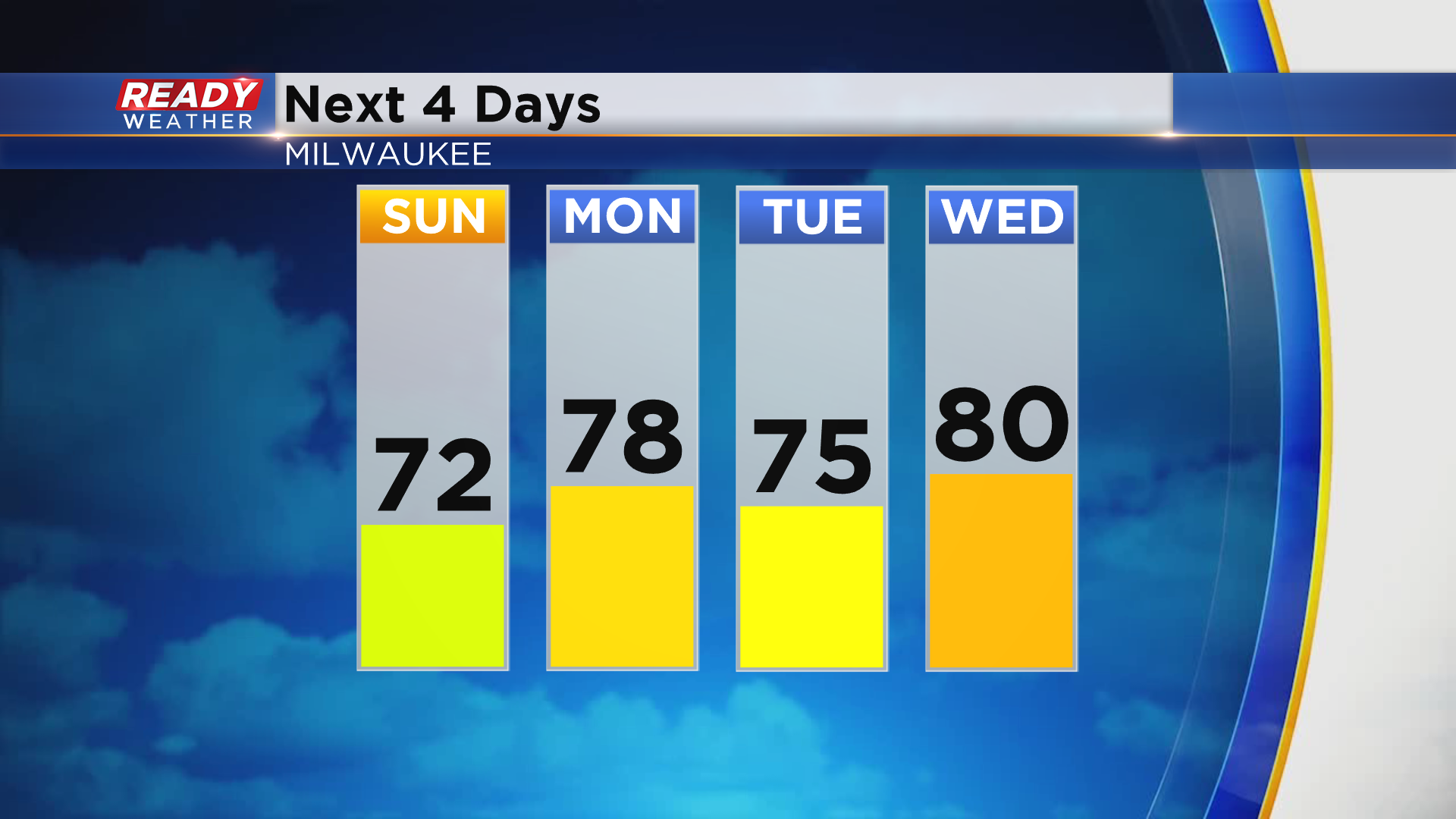
Temps will be a few degrees cooler tomorrow, but abundant sunshine is expected and it won't be as windy. Temperatures will be fairly seasonal throughout the week between 75-80° with comfortable levels of humidity.
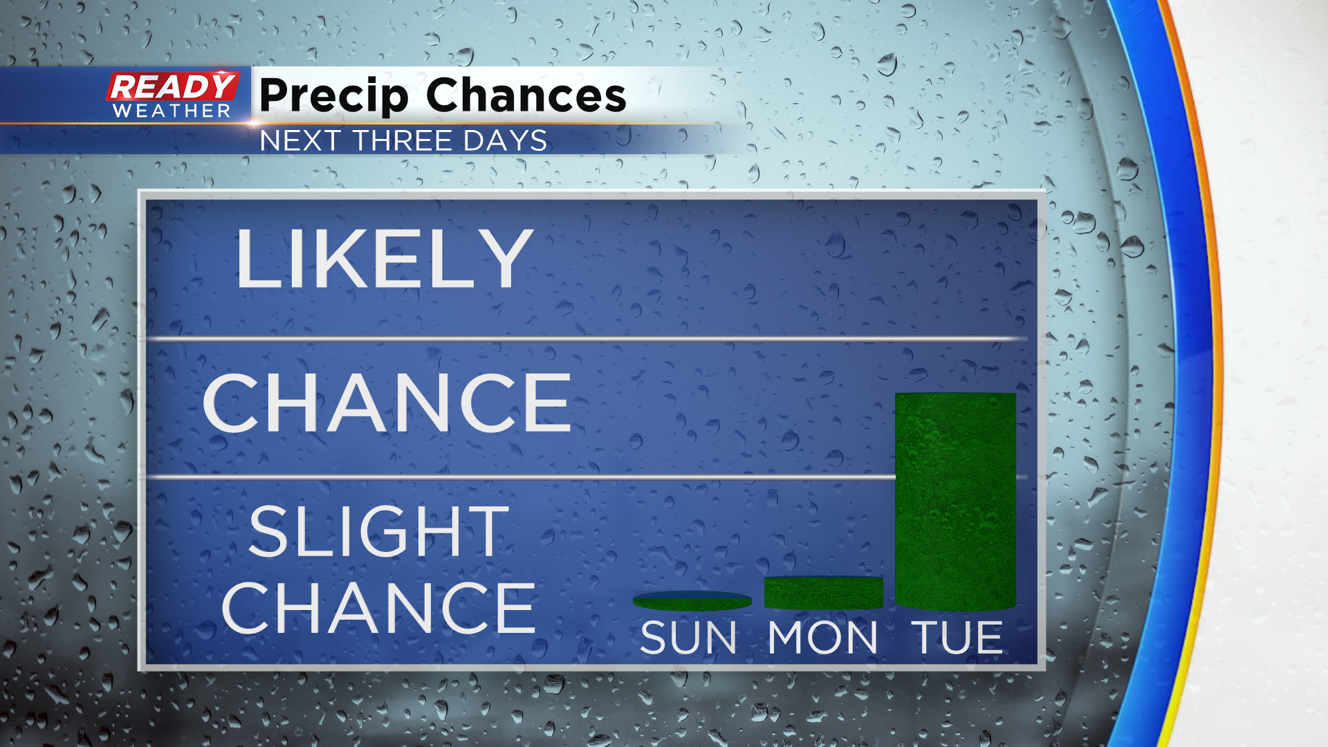
Dry weather will continue to end the weekend and most of us will be dry on Monday. However, we can't rule out a stray sprinkle as a front slowly moves towards the area. That front will stall around SE Wisconsin on Tuesday and provide a better chance for scattered showers and storms.
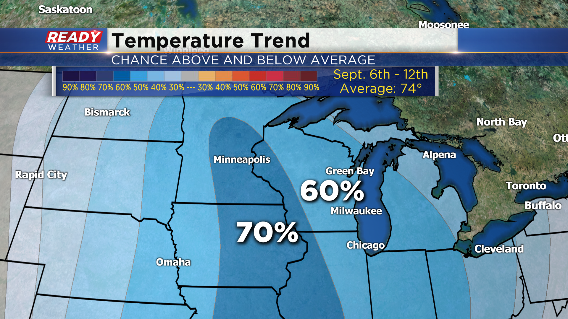
Dry weather will return for the second half of the week into the start of next weekend, but a stronger cold front at the end of next weekend could bring us our first shot of cooler fall air around Labor Day. The 8 to 14 temperature outlook favors cooler than normal temps September 6-12, and by then our normal highs are around 74 degrees.
Enjoy the break from the heat and humidity!