


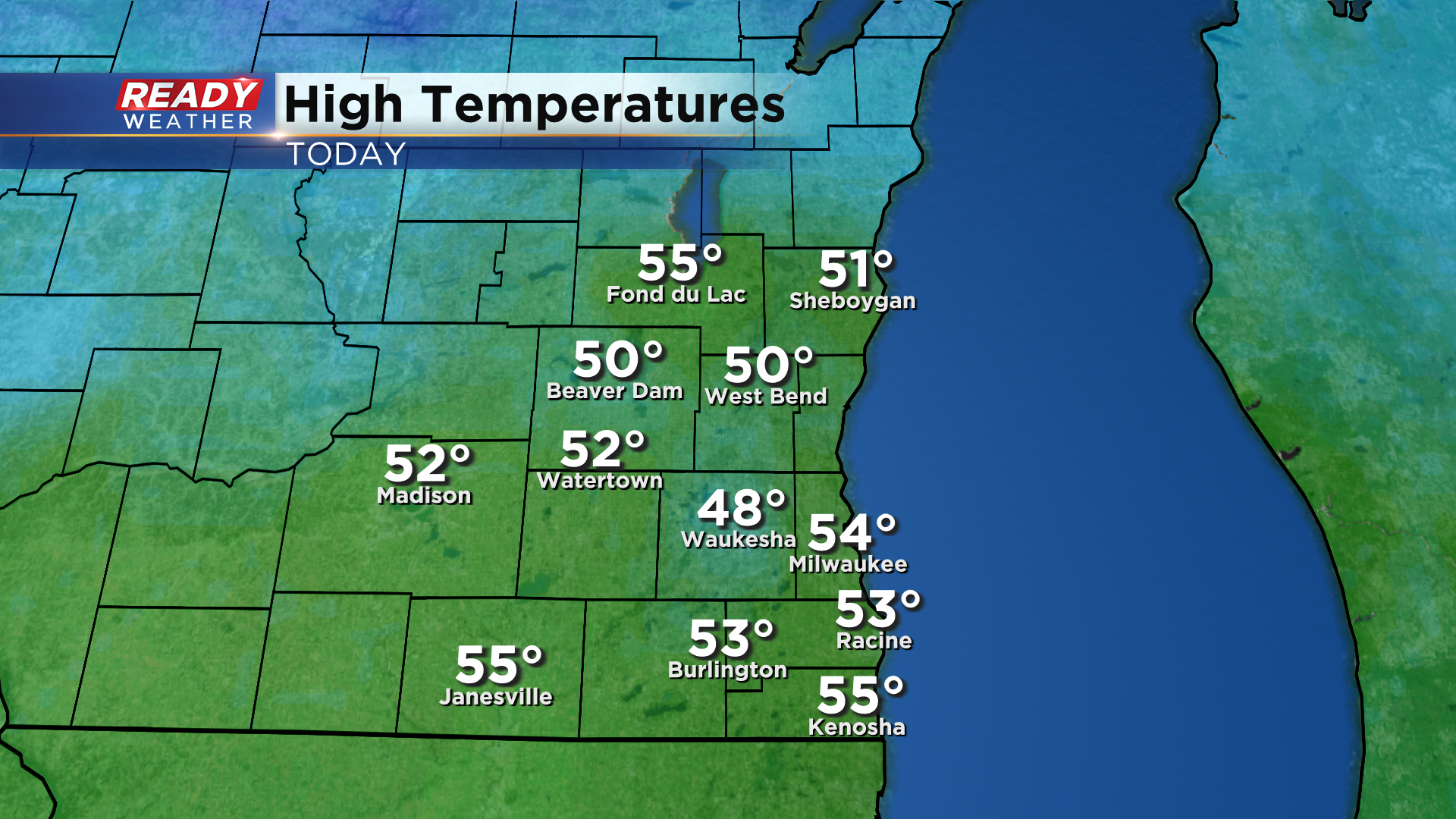
It was another mild day across southeast Wisconsin with highs topping out in the low to mid 50s for most before the cold front moved through.
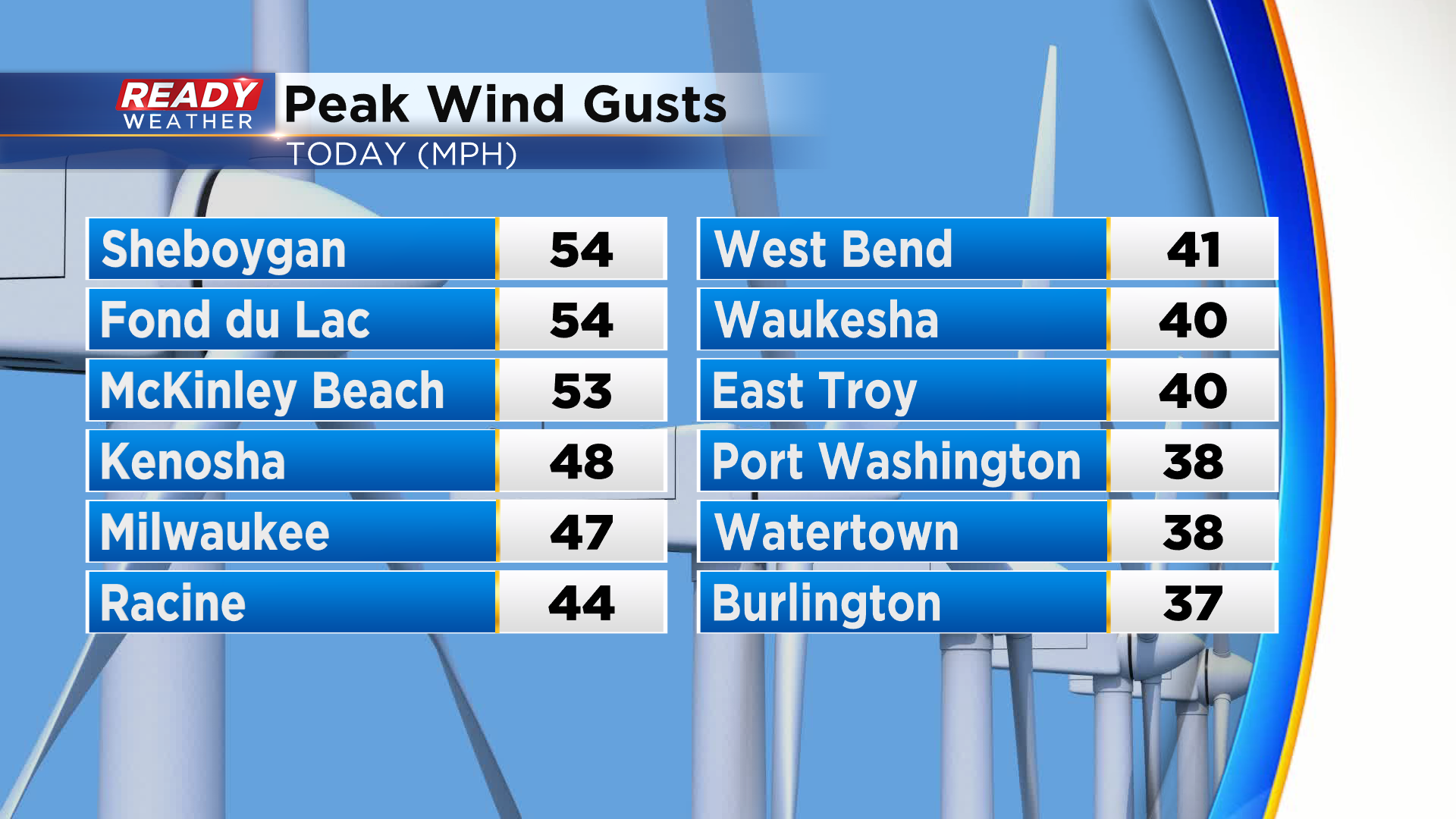
The front didn't bring much precipitation besides a couple rain/snow showers in Fond du Lac and Sheboygan counties, but those showers produced wind gusts of nearly 55 mph! Many spots experienced 35-45 mph wind gusts with the passage of the front.
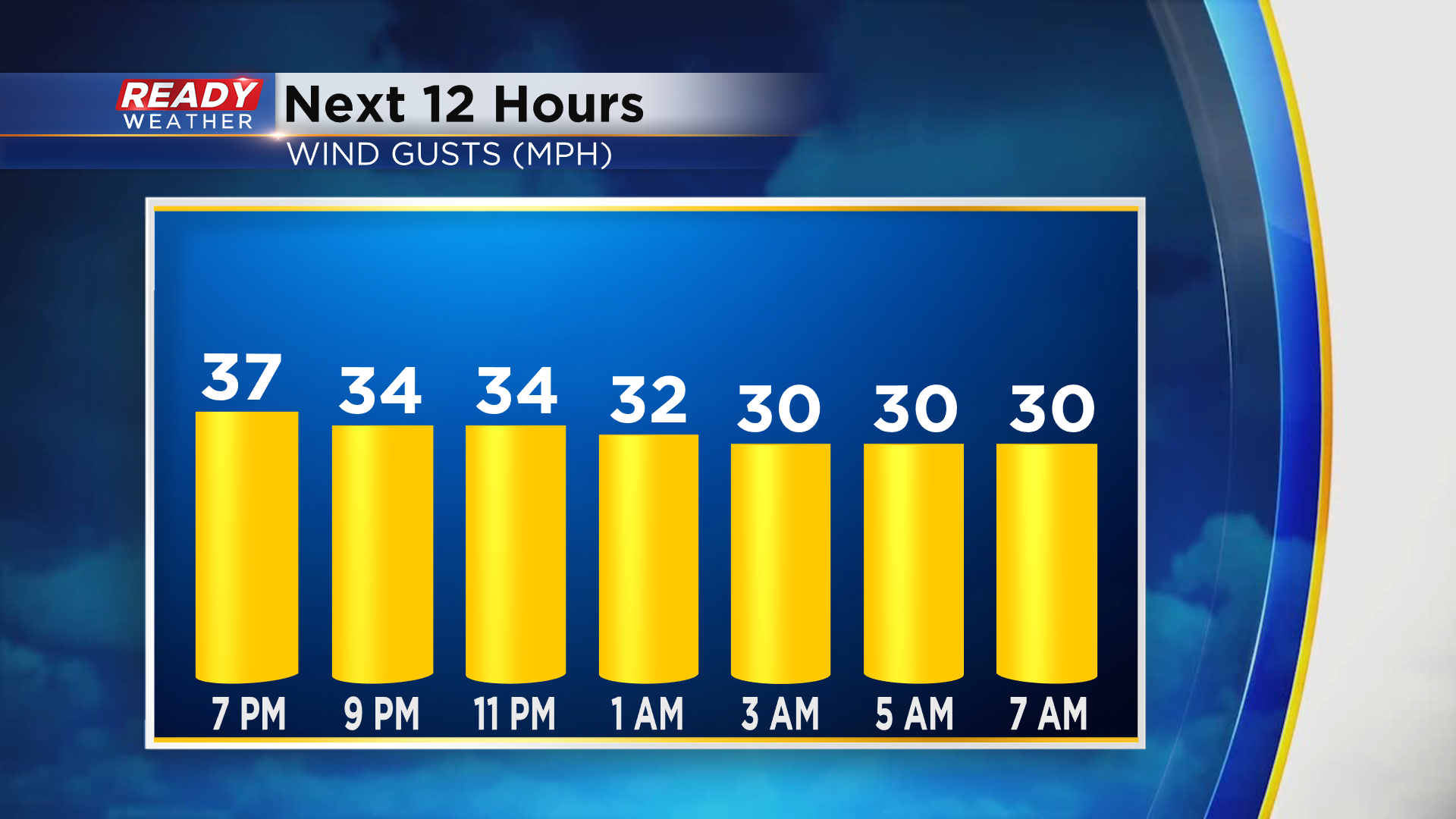
The 40 mph wind gusts will taper off before midnight, but gusts of 20-30 mph will continue overnight tonight into Monday morning.
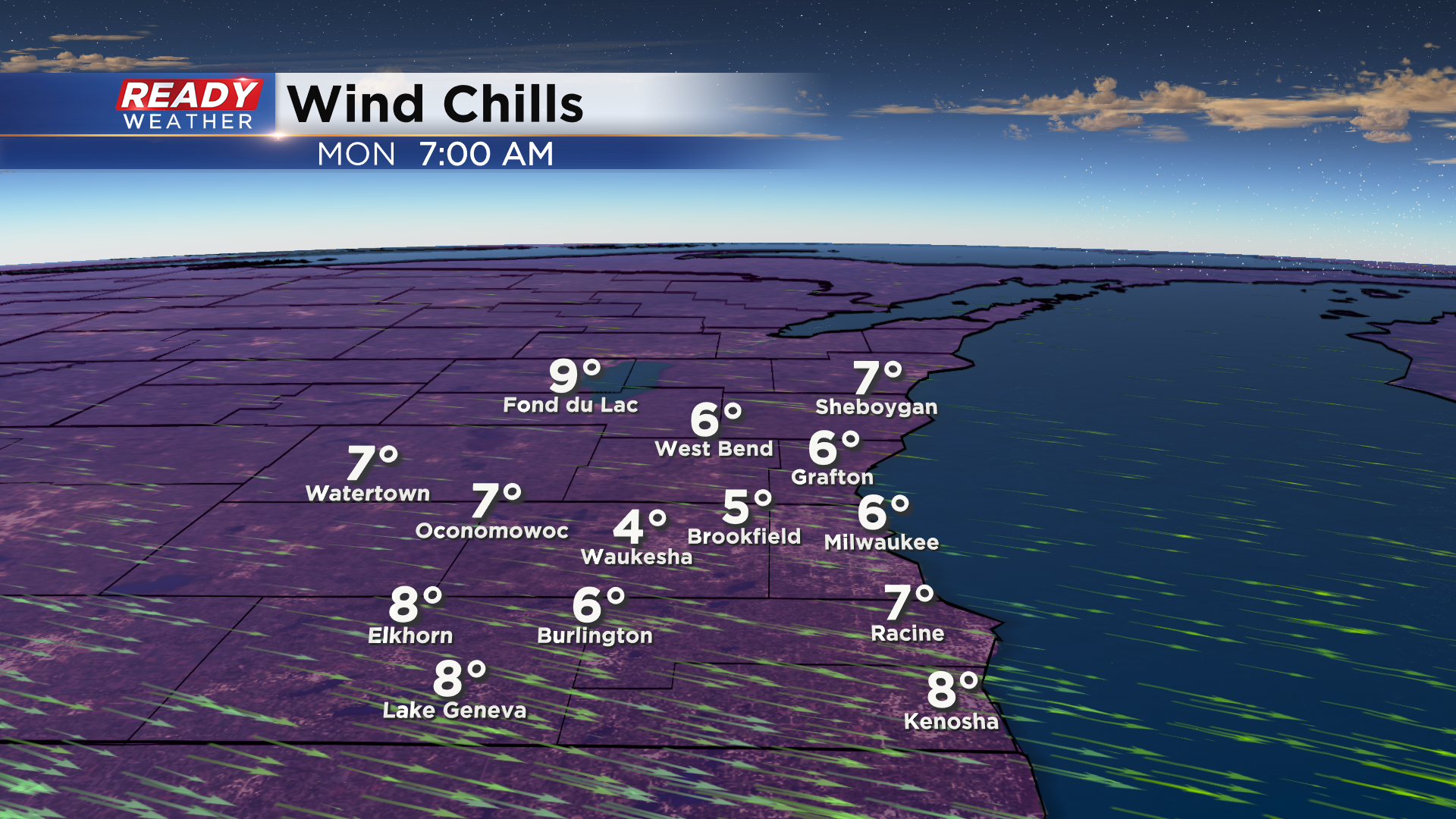
These strong NW winds and clear skies will help drop temps into the teens to around 20 degrees by sunrise Monday morning, but once you factor in the wind it'll feel like the single digits area-wide.
Temps won't warm too much on Monday with highs topping out in the low to mid 30s, feeling like the teens to low 20s all day. However, southerly wind returns Tuesday and Wednesday, warming temps back into the low 50s ahead of a cold front.
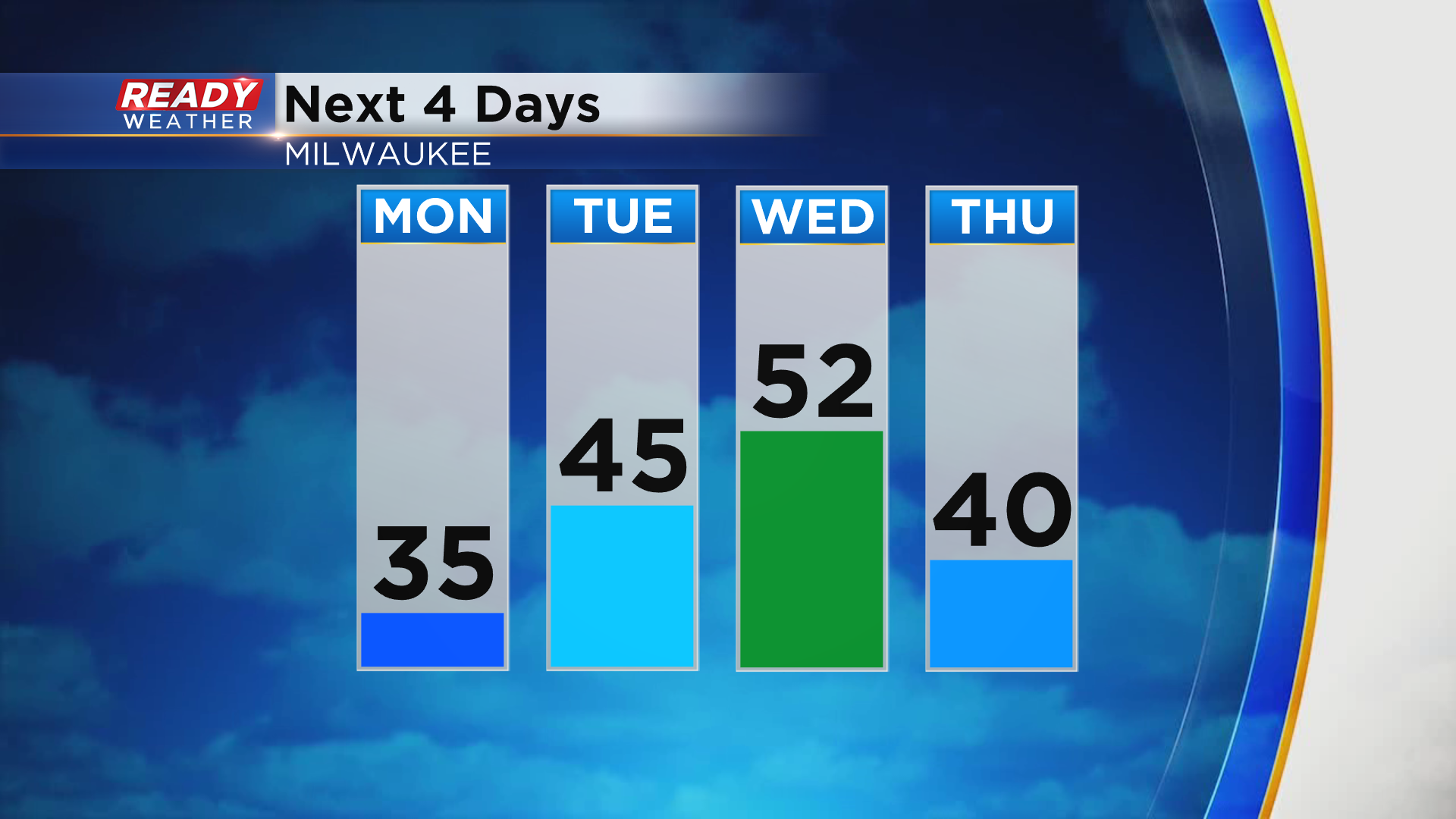
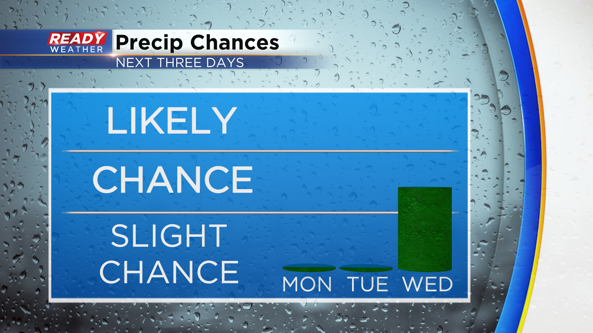
That cold front will bring a chance of showers into the area late Wednesday into Wednesday night. Right now the showers look light and isolated. This will be our best chance of precipitation through the Thanksgiving holiday.
Download the CBS 58 Ready Weather App to track the forecast heading into Thanksgiving.