Few light snow chances the rest of the week as a snowy start to the season continues


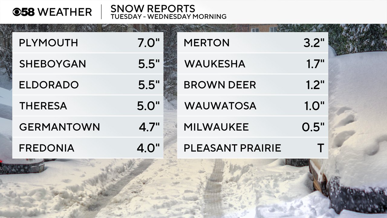
The latest round of snow ended during the late morning hours of Wednesday. Northern counties saw the most snow with 3-7" reported there where the I-94 corridor and Milwaukee metro area got closer to an inch and our southern counties like Walworth, Racine, Kenosha saw mostly rain and mix with no measurable snow.
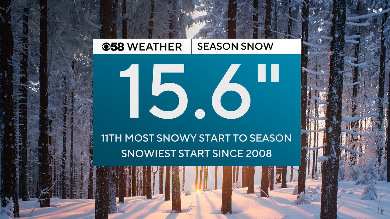
The snowfall in Milwaukee pushed our season snowfall total over 15". The 15.6" we've picked up so far is nearly three times the average and is the 11th most snowy start to the season on record and the snowiest start since 2008. So, if you feel like it's been awhile since it's been this snowy this early in the season you are exactly right!
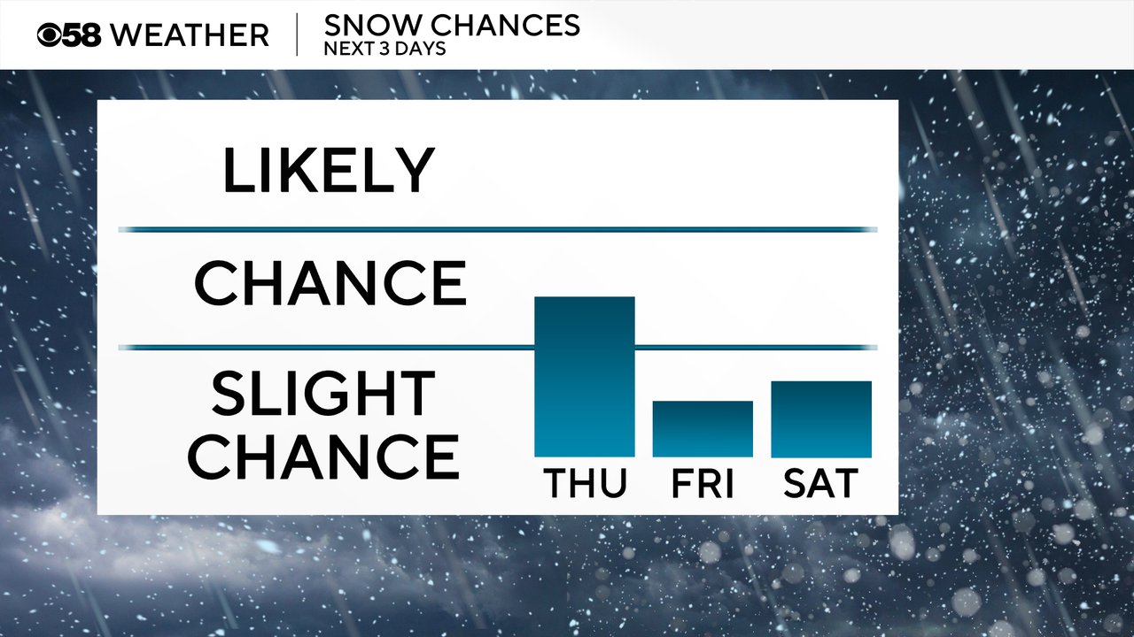
The next chance for snow has a HIGH level of uncertainty. It started showing up in the weather models Tuesday afternoon with a clipper bringing in a quick round of snow Thursday evening into early Friday morning. That chance for snow stayed in the weather models for about 24 hours but over the last 12 hours has shifted farther west and almost entirely out of our local area. However, IF we see some snow it will mainly happen after 7 PM and only in our south and southwest counties like Jefferson, Walworth, Racine and Kenosha.
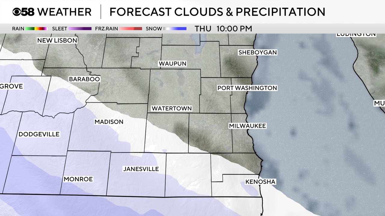
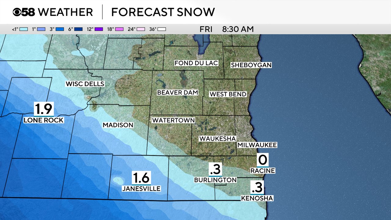
IF those south and southwest areas manage to get snow it looks very likely with under a half inch possible. West of Madison has the better chance to see an inch or more of snow with best chances in SW Wisconsin.
After the uncertain chance for snow Thursday evening a few snow flurries could fly on Friday. A dusting is possible Friday but shouldn't be very impactful. Saturday could also see a slight chance for snow. Another clipper rolls in from the west and right now looks to stay mainly west and south but some snow could impact the IL border.
Download the CBS 58 Weather app to track the snow chances in real time with the interactive radar.