Forecast turns unsettled for midweek but a nice stretch for the start of State Fair

-
3:01

Natalie’s Everyday Heroes: JCC disability inclusion programs...
-
2:05

Milwaukee Lyft driver held at gunpoint, carjacked by passengers
-
2:20

Milwaukee mayor criticizes Trump administration, pushes for housing...
-
0:20

Woman wanted in connection to Waukesha stabbing investigation...
-
2:41

14 arrested at Bayshore Mall on charges of disorderly conduct,...
-
0:50

Friendship Circle of Wisconsin president presented with FBI director’s...
-
2:12

Tosa residents say postal workers won’t deliver mail on their...
-
2:28

Dogs attack grandmother on Milwaukee’s east side, neighborhood’s...
-
1:40

Domestic violence suspect shoots police drone during standoff...
-
0:52

All 13 Milwaukee County golf courses now open for 2026 season
-
2:03

Trial begins with new felony charge added for Tremaine Jones...
-
1:53

Step into a virtual reality at new Port Washington arcade

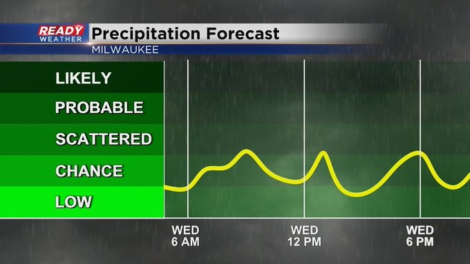
MILWAUKEE (CBS 58)--All in all, the timing isn't so bad with this forecast. I think we're able to shake the showers from the forecast once we start State Fair. First off, Tuesday looks like another nice day with an onshore flow. So expect a bit cooler temps by the lakeshore, mainly around 80. As a cold front closes in from the west into Wednesday evening, the chance for showers and thunder will increase. It looks scattered. Keep in mind any storm we get could be on the stronger side.
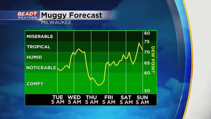
Once the front clears the building, it'll get a whole lot better for Thursday and Friday. Then we'll see another increase in heat and humidity for the upcoming weekend. Highs will be 85-90 with a better chance for showers and storms into Saturday evening and throughout Sunday too.