Heat and humidity return Monday along with a chance of storms
MILWAUKEE (CBS 58) -- It's been a beautiful Sunday across southeast Wisconsin with plenty of sunshine and temps in the upper 70s to low 80s. We're keeping an eye on an area of showers and thunderstorms in the northern portion of the state. These storms are moving into some pretty dry air in southeast Wisconsin, so they should weaken as they push into southeast WI, but we can't rule out a few showers closer to the Fox Valley.
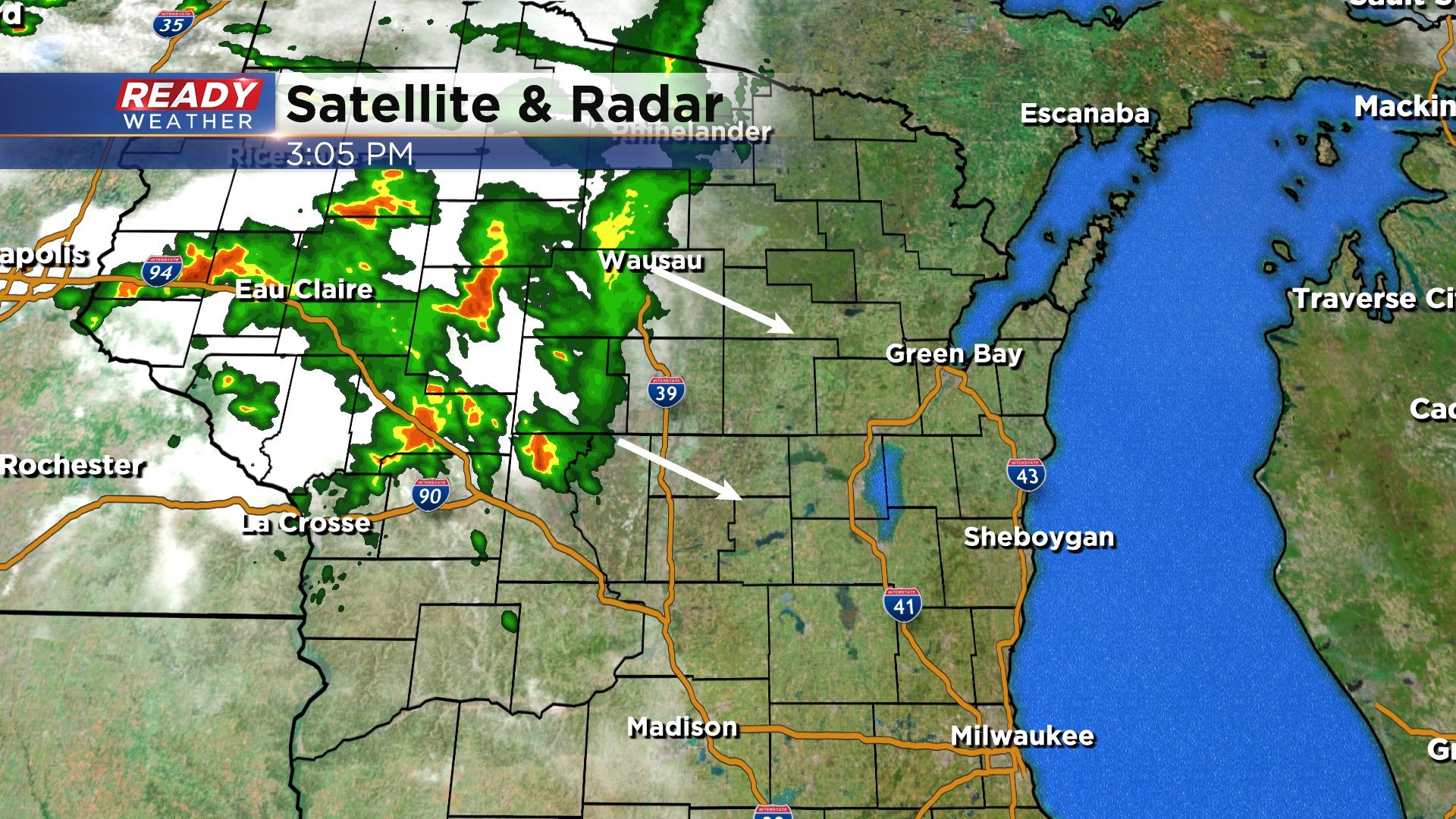
A few additional isolated showers or storms will be possible overnight as a warm front lifts through the region.
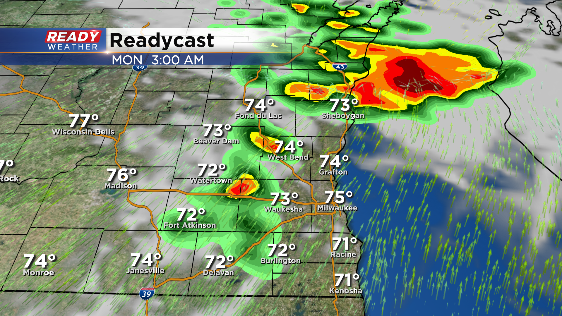
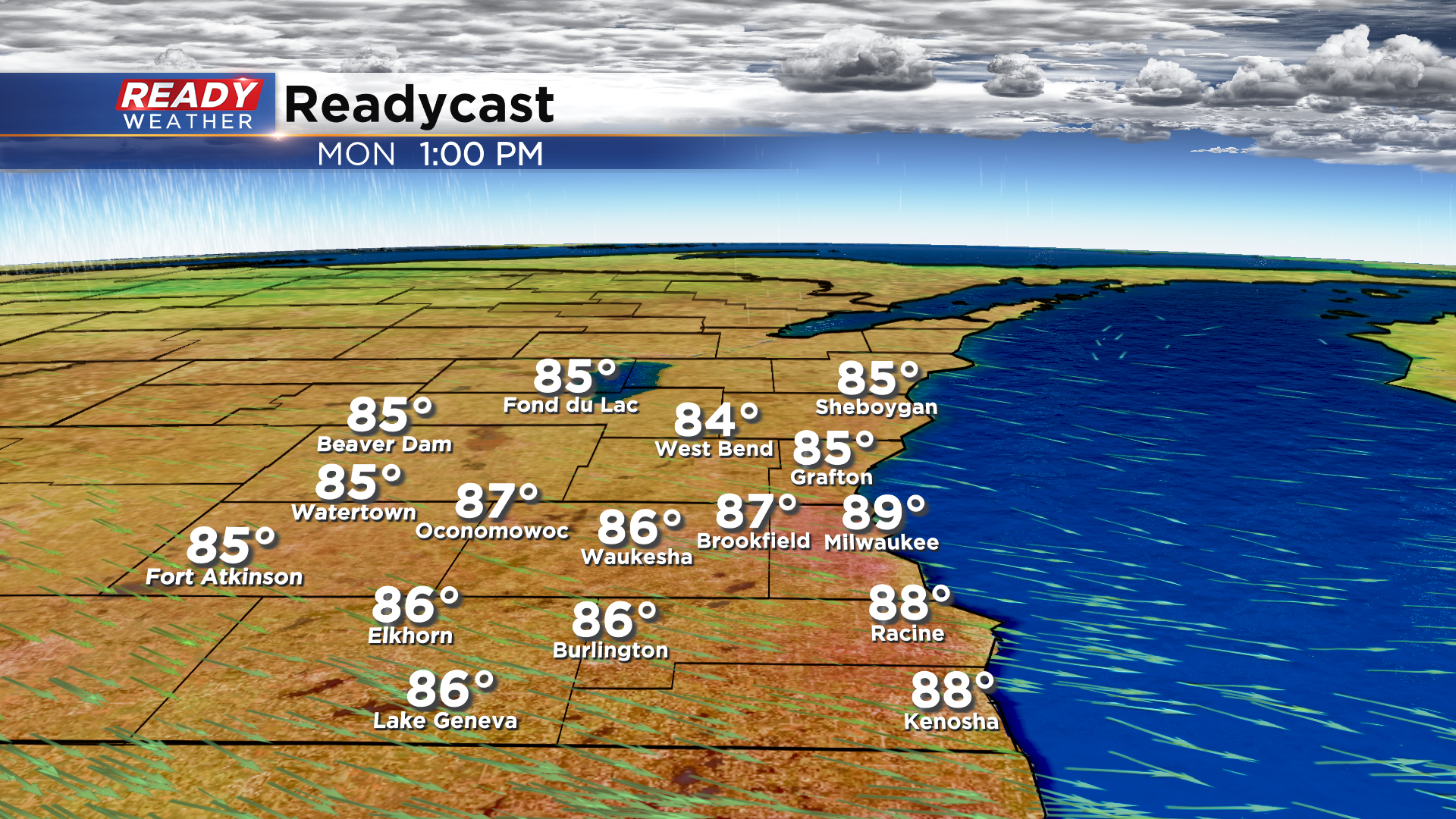
This will bring hot and humid air back to southeast Wisconsin on Monday with highs topping out in the upper 80s to around 90 degrees and dew points near 70 degrees.
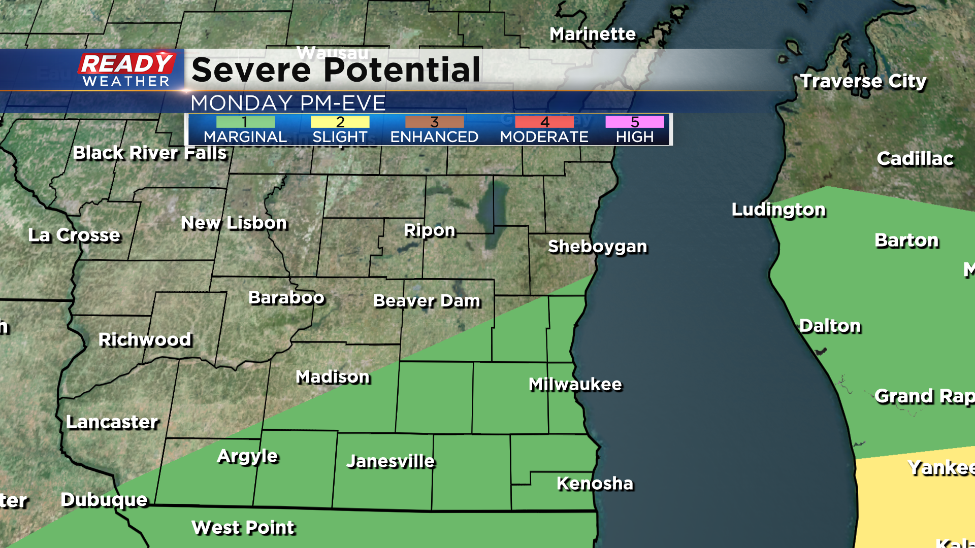
This heat and humidity may fuel another round of scattered storms Monday afternoon and evening as a cold front moves through the area.
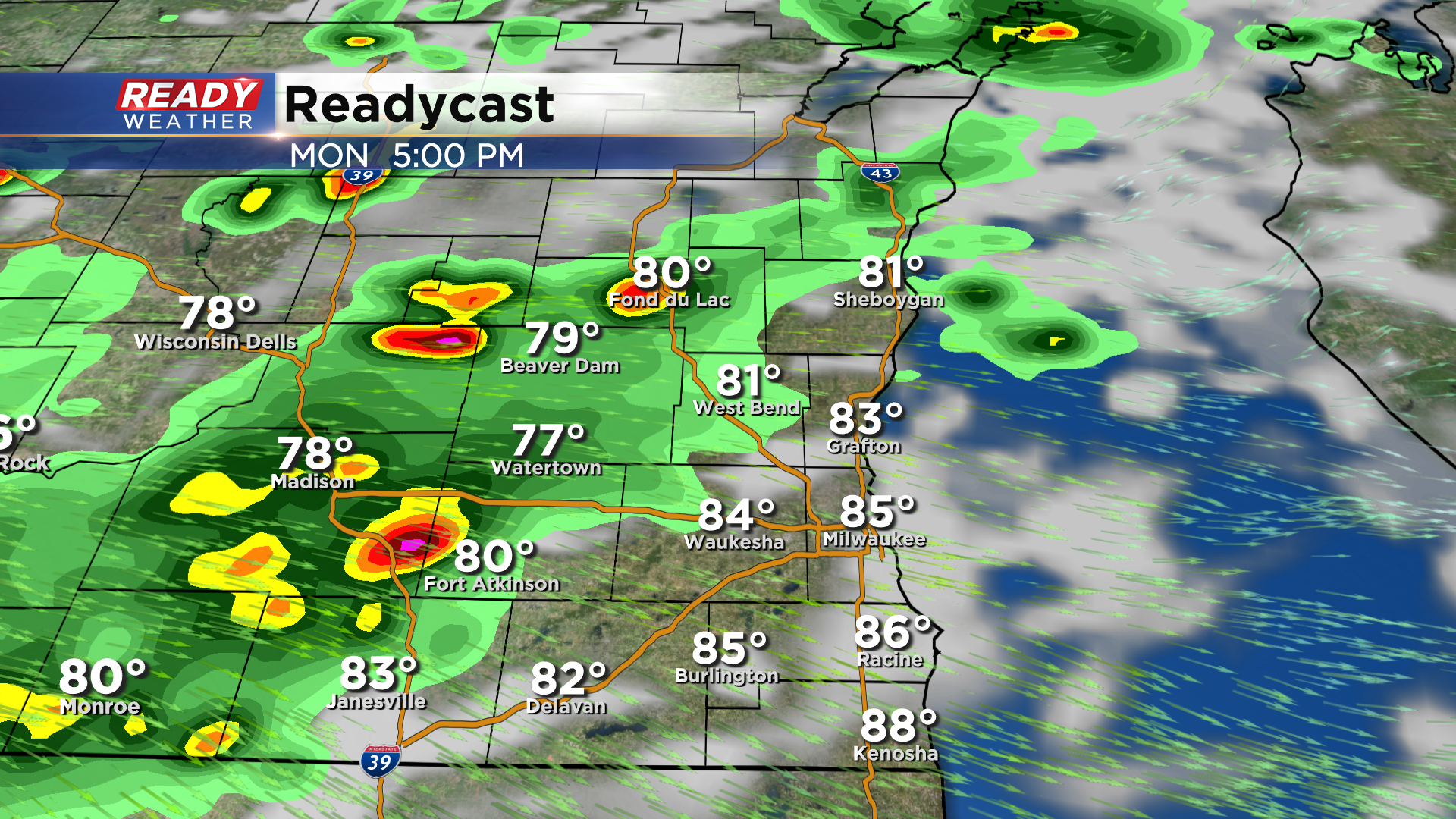
A few of these storms could be on the stronger side with hail and gusty winds. Due to this risk, there is a level 1 of 5, Marginal Risk, in place for a good portion of southeast Wisconsin on Monday.
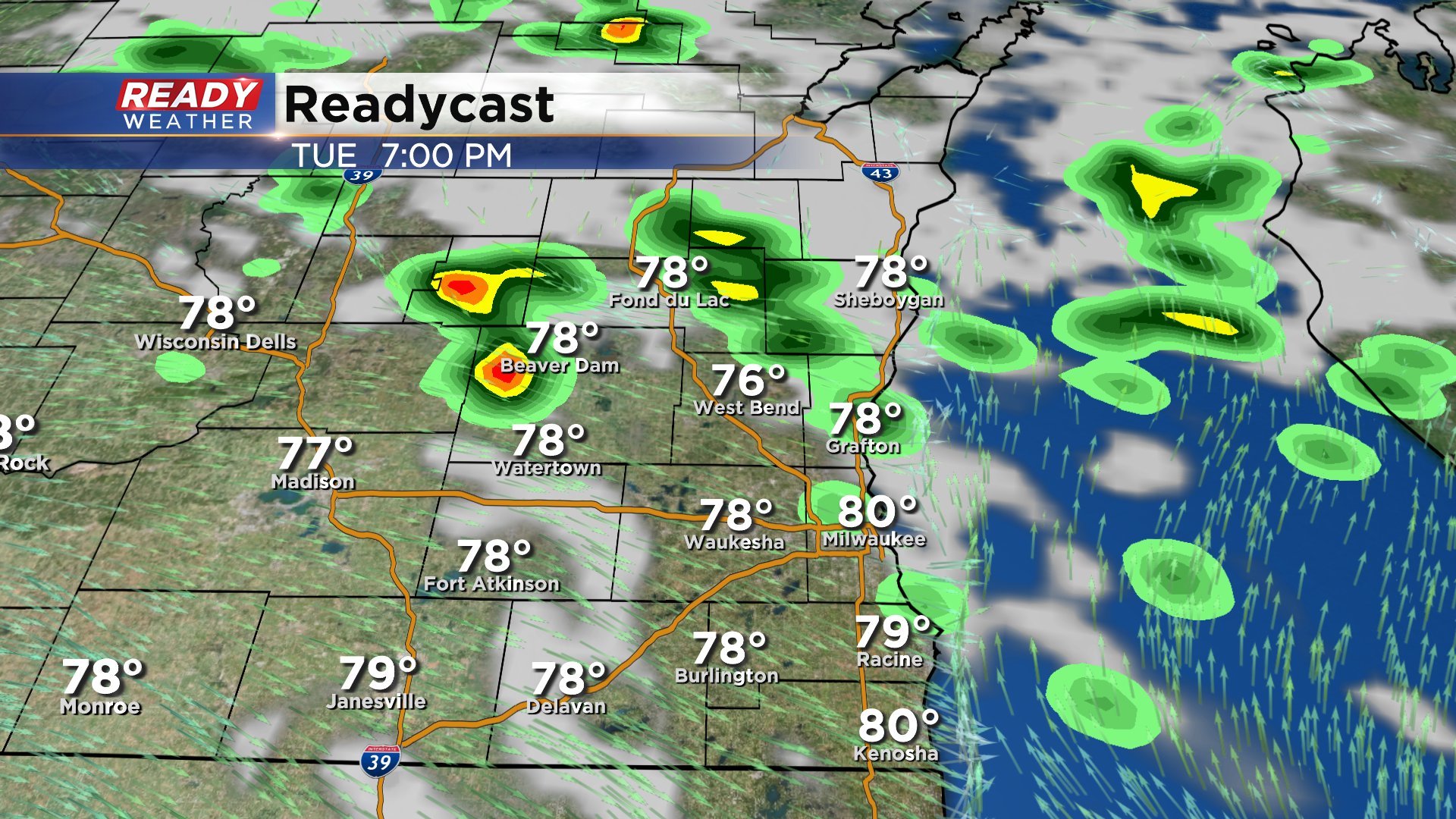
We'll dry out Monday night through early afternoon Tuesday before a few more spotty showers and storms pop up late afternoon, dissipating by mid evening as the sun sets.
Much cooler and drier air settles in for the middle of the week with highs dropping back into the 70s Wednesday and Thursday. Download the CBS 58 Ready Weather App to see the full 7 day forecast.
