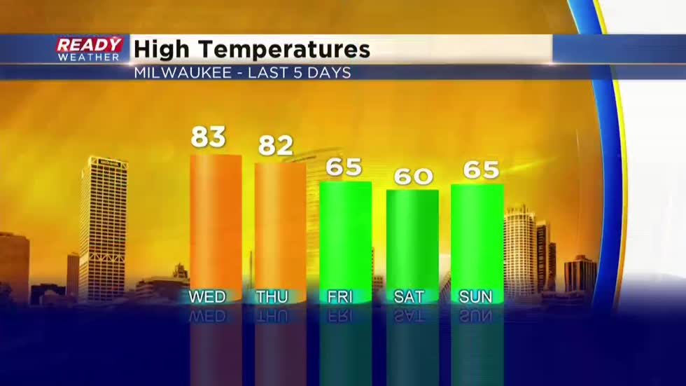
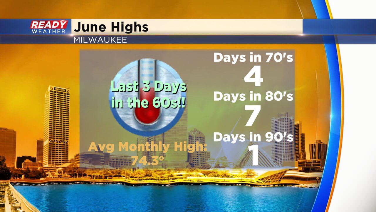
We just got through our coldest three days of the month so far with highs getting held up in the 60s, in Milwaukee.
Continuing the trend of up and down temps this month we're once again eyeing a warm up in the coming days. And as mentioned, we've already had our fair share of June heat.
Yesterday Sam Kuffel discussed the blocking pattern keeping us quiet and under a sunny sky. This pattern could very well last all week, before storms roll in Friday night and at times through the weekend.
During this period we will have a persistent southerly flow. At times it will still flow southeast, but overall should tick more south by midweek to really allow heat to settle into the area, including lakeshore spots.
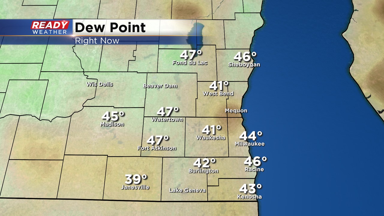
For now, although the sun is hot, the dew points are rather low. This airmass lends itself to a refreshing day and cool, but calm night ahead. Tonight we'll drop back to the 40s and low 50s but tomorrow should fare slightly warmer than the 70 degree day we had in the city as most spots approach the upper 70s for Tuesday afternoon. Beyond that highs move to the 80s right through the first day of summer, which occurs this Saturday. Despite the warm up, dew point levels will stay in check.
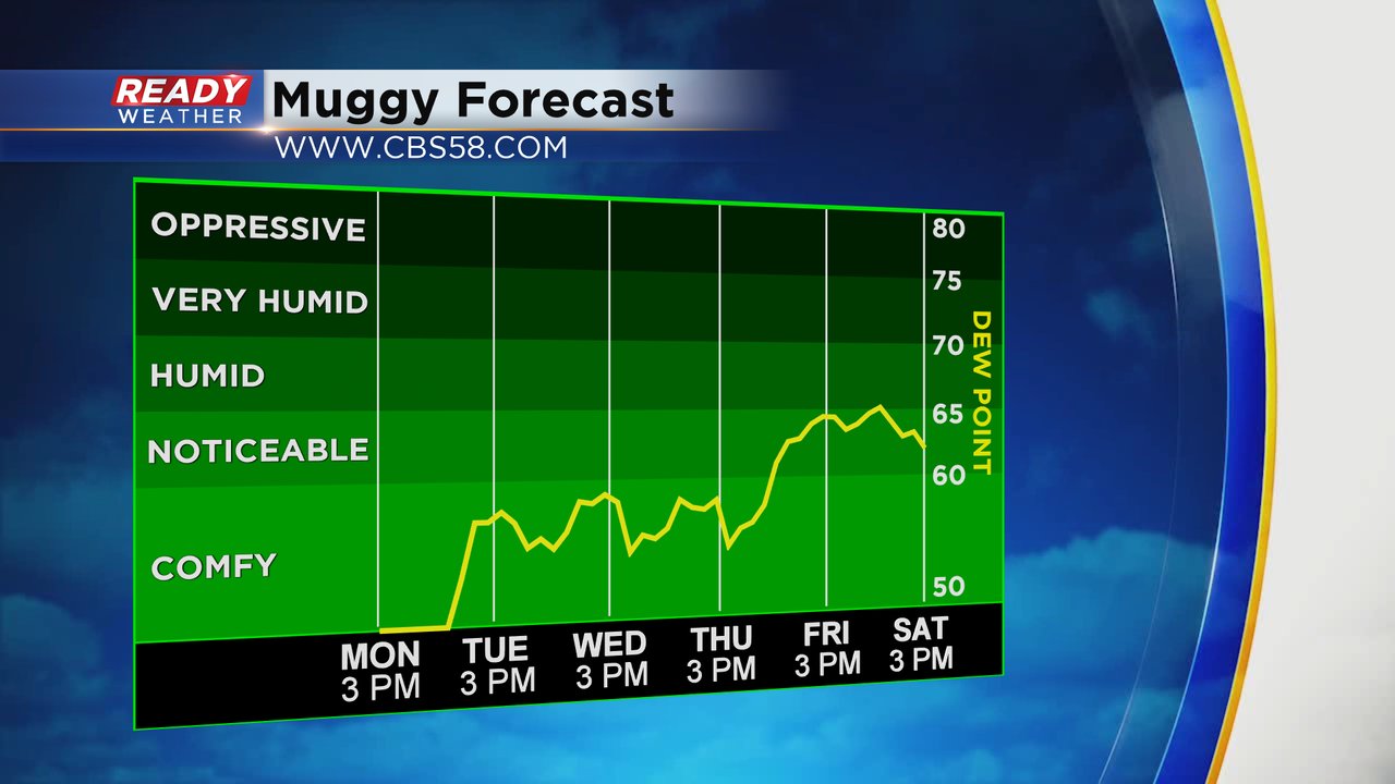
Notice as dew points finally get back to the summery feel in the 60s, that's about the time we'll be on storm watch. As of now, best chance for storms in the area would be Friday evening-night and on and off Saturday. Father's Day on Sunday could also feature some wet weather, but most holds off until the night. Overall typical weather is expected for the first weekend of summer.
I'm meteorologist Rebecca Schuld