
-
2:30

Family of victim in east side hit-and-run speak; alleged suspect...
-
2:11

Racine County first responders honored with life-saving awards...
-
3:53

Salvation Army’s Angel Tree program brings holiday cheer to...
-
0:56

Wisconsin Humane Society food pantry struggling with empty shelves
-
1:56

Teen accused of double murder, $25,000 reward offered for his...
-
1:11

Fort Atkinson officers won’t face charges in deadly police...
-
0:44

Wellpoint Care Network celebrates 175 years and hosts 3rd annual...
-
1:18

Glendale man sentenced to 17 years in prison for May 18 homicide
-
2:25

Cold weather advisory issued for Saturday and Sunday as the coldest...
-
2:00

Meet CBS 58’s Pet of the Week: Eddie
-
3:28

Amilinda to serve Hanukkah dinner inspired by chef’s heritage
-
3:11

’It’s really devastating’: Fire destroys well-known Muskego...

A powerful storm system will arrive from the southwest on Wednesday increasing the winds and rain all across southeastern Wisconsin.
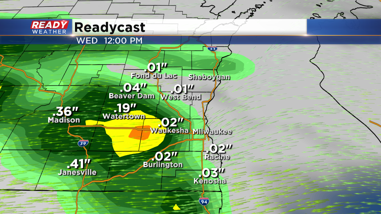
Rain moves in from 6 am through the early afternoon. There could be a break early in the afternoon with more rain and some chances for storms by the evening.
The heaviest rain will arrive for Wednesday night. Embedded storms will be possible as wind gusts approach 40 mph. An isolated strong to severe storm will be possible late Wednesday night.
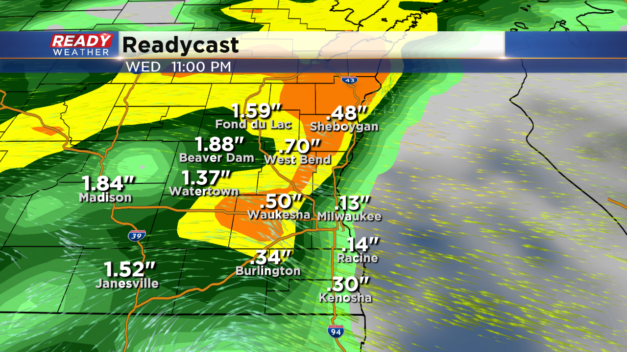
The winds shift south on Thursday as temperatures spike into the 60s. There's another chance for storms on Thursday before the system clears. Rainfall between 1.00" to 2.00" possible! River levels could rise; however, widespread flood watches are not expected.
Sign up for the CBS 58 Newsletter