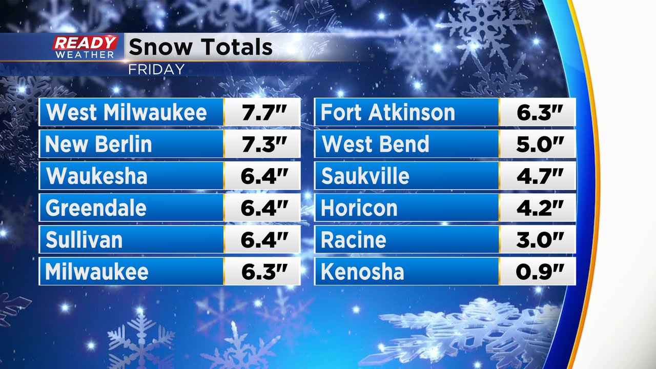
Snowfall has ended across the area! Looking back on some very high totals.
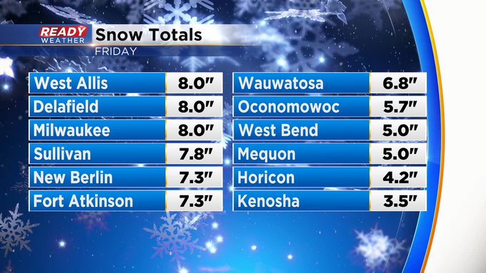
The snow has ended across southeastern Wisconsin. Other than some flurries tonight, we don't expect any more accumulation. Milwaukee picked up 8" of snow!
Look at how crazy this winter has been! Milwaukee tallied 3.9" from the middle of January to almost the end of March. Today changed all of that.
Temperatures are expected to fall into the 20s, so a refreeze is likely. Use caution on driveways and secondary roads.
Another system will approach the area on Sunday; however, other than a mix, the majority of the snow should stay across the western part of the state.
______________________________________________________________________________________________________________
Updated: 1 p.m. March 22, 2024
Snow is still coming down heavily for some southern spots. Meanwhile, others are starting to dry out.
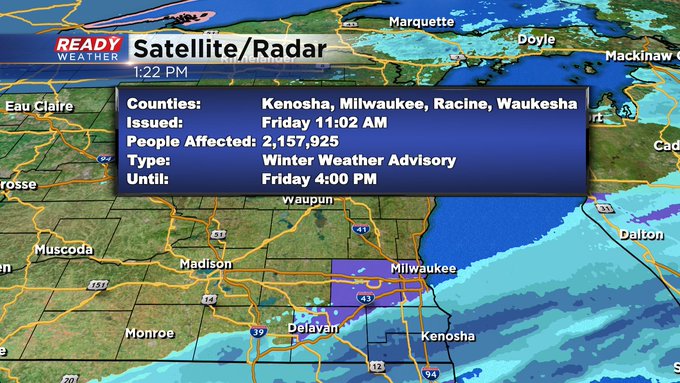
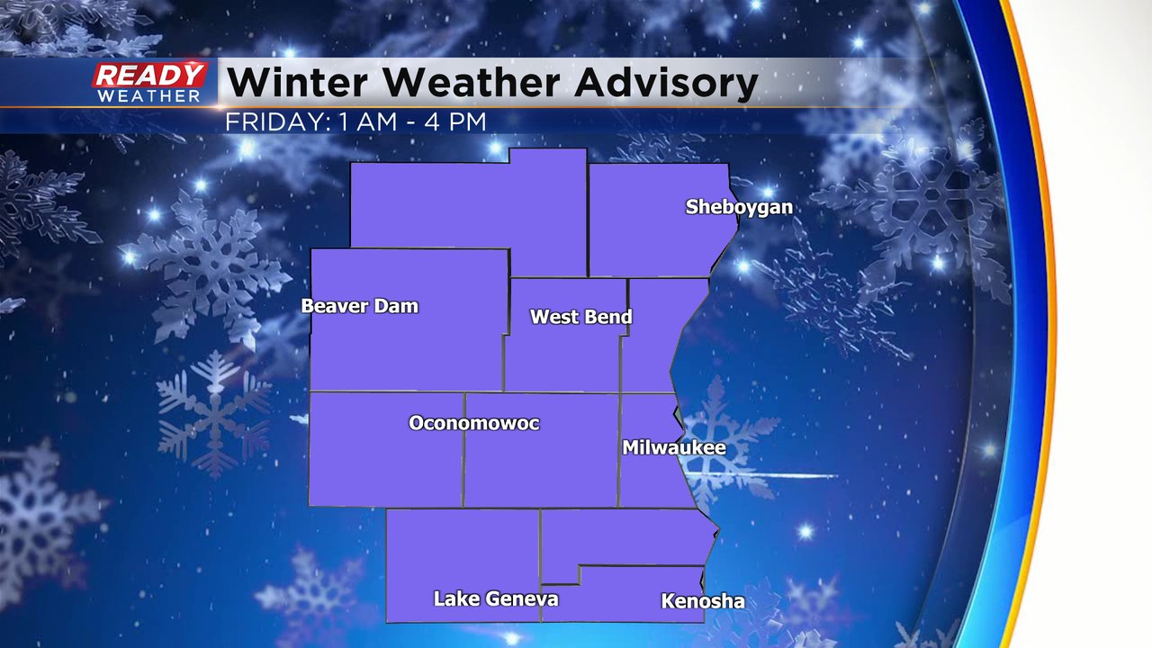
Milwaukee took a direct hit from this system with a snow total of 8" as of 1pm. This is more than double the snow we've had since mid January and about a third as much as we've had all season long! That said, as snow ends for some the National Weather Service has canceled the Advisory for a handful of counties. Check it out: Even as the edge of the snow lines pulls away from Milwaukee, I'm still seeing light snow falling downtown. The counties in the Advisory can still expect snow over the next couple hours, but it should become lighter and more scattered in nature.Snow continues for many, but wrapping up to the north.
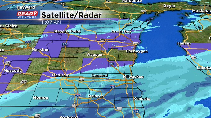
Along and south of 43 cutting back through our southwest locations snow is still coming down at a good clip. Expect snow showers to continue for Walworth, Milwaukee, Racine and Konosha counties through mid afternoon before becoming light and winding down for the evening commute.The steady, heavy snow has wrapped up for a majority of southeast Wisconsin. We still have a few hometowns dealing with snow in two distinct areas. The first is light along and north of I-94. The second is heavier near the IL border and impacting southern Walworth and Kenosha Counties.
Check out a current radar image that will update with time below:
Additional snowfall the rest of the day looks fairly light with 1-3" south of I-94 depending on if some heavier snow bands in northern Illinois drift north. North of I-94 probably sees less than an inch the rest of the day with scattered snow showers.
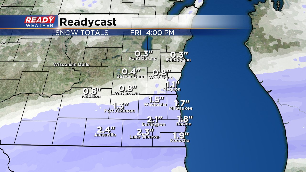
Snow totals have been rolling in Friday morning. Highest totals have been in the I-94 corridor of Milwaukee, Waukesha and Jefferson Counties where 4-8" of snow has been reported. Areas south and north of there have seen less.
Download the CBS 58 Ready Weather app to track when snow comes to an end where you live.
------
Posted: 4:46 a.m. Mar. 22, 2024
If you were waiting to believe it until you saw it, then you better believe it now! Steady snow is currently falling across all of southeast Wisconsin Friday morning. Most locations have already picked up an inch or two of snowfall. The heaviest snow is just starting to get organized.
There is no change to the winter weather advisory that was issued Thursday. That advisory is still in effect until Friday afternoon for the likelihood of over 3" of snow for all of southeast Wisconsin.
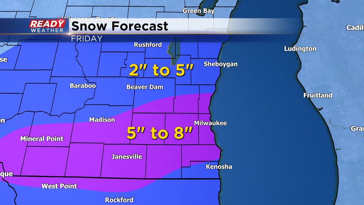
The high end of snow totals has come down a bit from Thursday and the axis of heavy snow has shifted farther south. It still looks likely that parts of southeast Wisconsin will see over 5" of snowfall with this system and the best chance for that is from West Bend and Port Washington to Lake Geneva and Racine. Northern counties likely end up with a little less with 2-5" in those areas.
Even though a few inches of snow is likely for all of southeast Wisconsin, that snow will be a little slower to accumulate on the roads. Most of the main roads are pretty slushy right now. Even so, drive times are already very slow for the early morning commute and some of the DOT cameras are showing snow covered roads.
You can see winter road conditions update with time here:
Make sure to download the CBS 58 Ready Weather app to track the snowfall all day.


