Thursday Afternoon Update: Wind Advisory through 5 pm as gusty winds continue


Updated: 1:20 pm December 16, 2021:
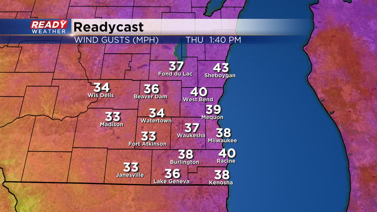
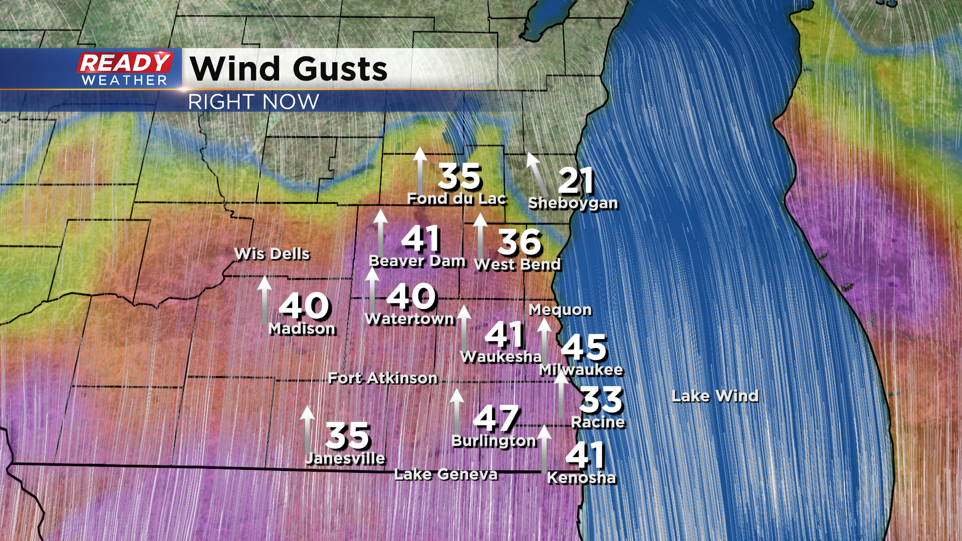
A Wind Advisory has replaced the High Wind Warning across all of southeast Wisconsin through 5 pm. Winds continue to gust between 35-45 mph early this afternoon, still bringing down branches in spots.
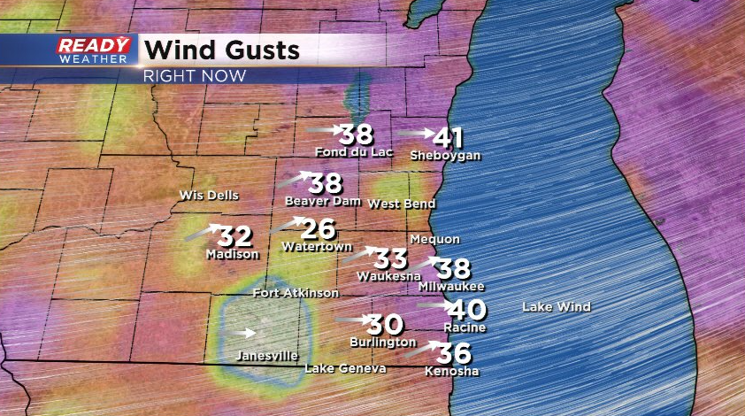
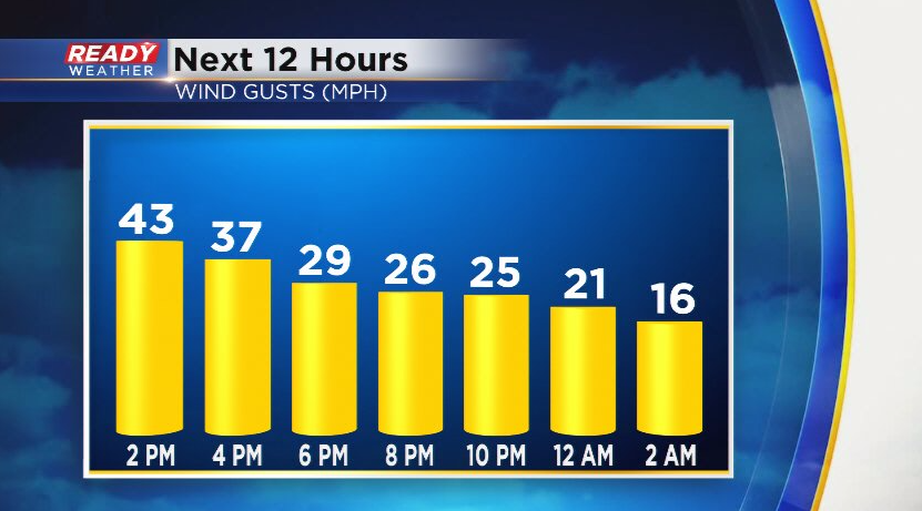
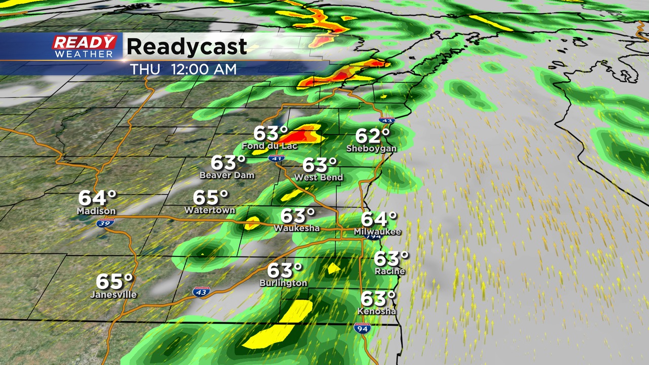
Wind gusts will only gradually taper off today, down to 20-30 mph through the evening then calming down overnight.
---------------------------------------------
Updated: 5:06 a.m. Dec. 16, 2021
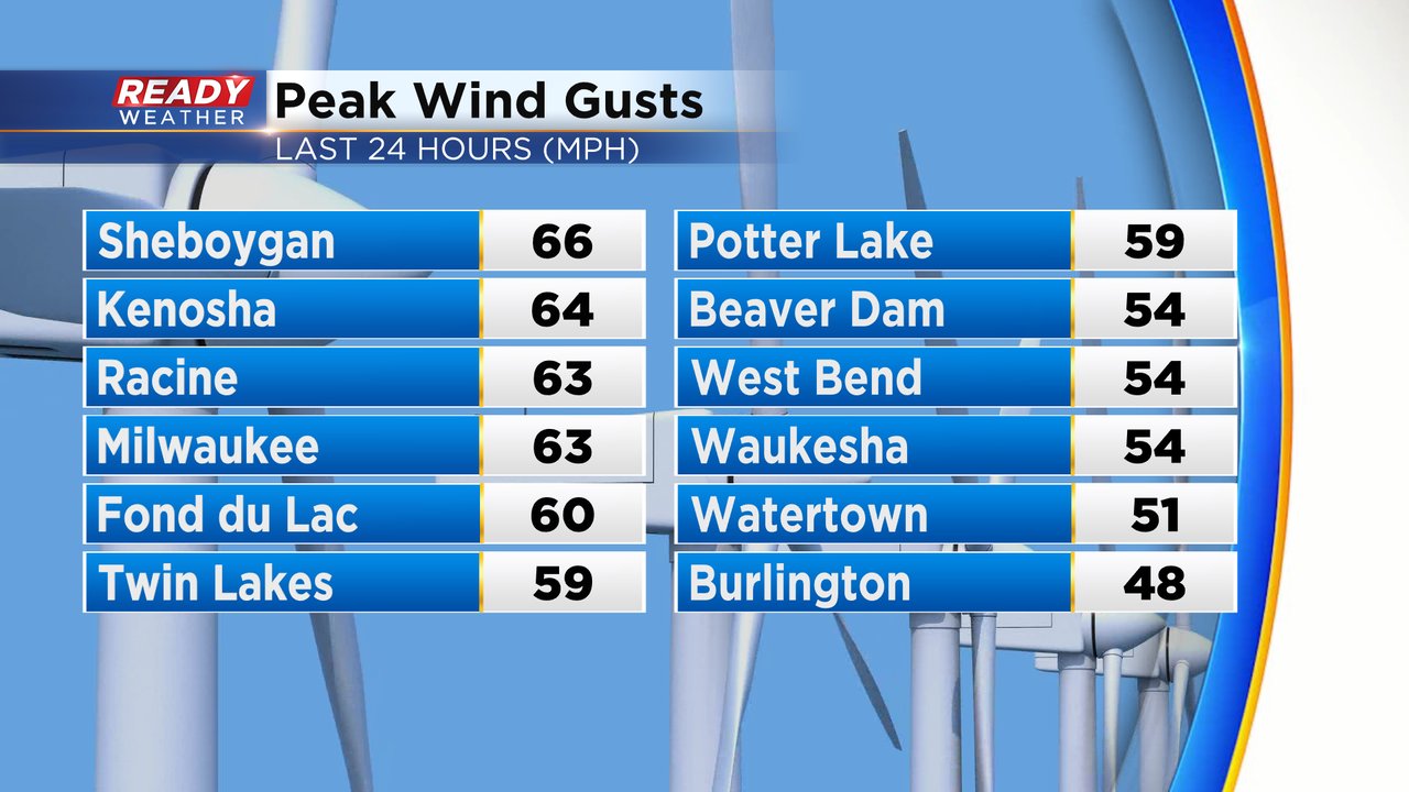
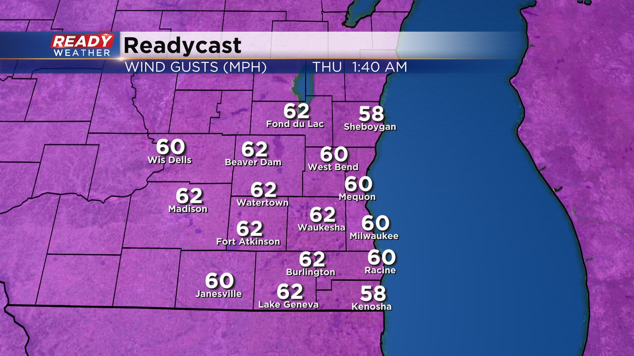
The High Wind Warning is still in full effect across southeast Wisconsin until 9 AM. Peak wind gusts have surpassed 60 mph in many communities.
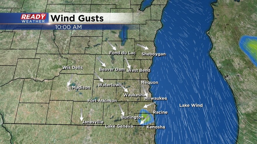
The wind gusts are finally starting to come down a bit but still elevated in the 35-55 mph range. This wind gust map will update with time:
Even after the warning expires the wind gusts will stay high with gusts to 30-40 mph throughout much of Thursday. By late Thursday night and Friday more of a calm wind arrives.
------
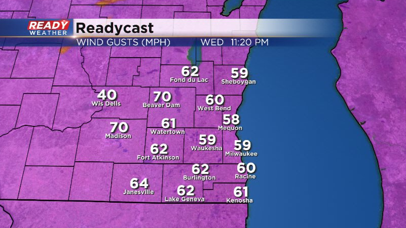
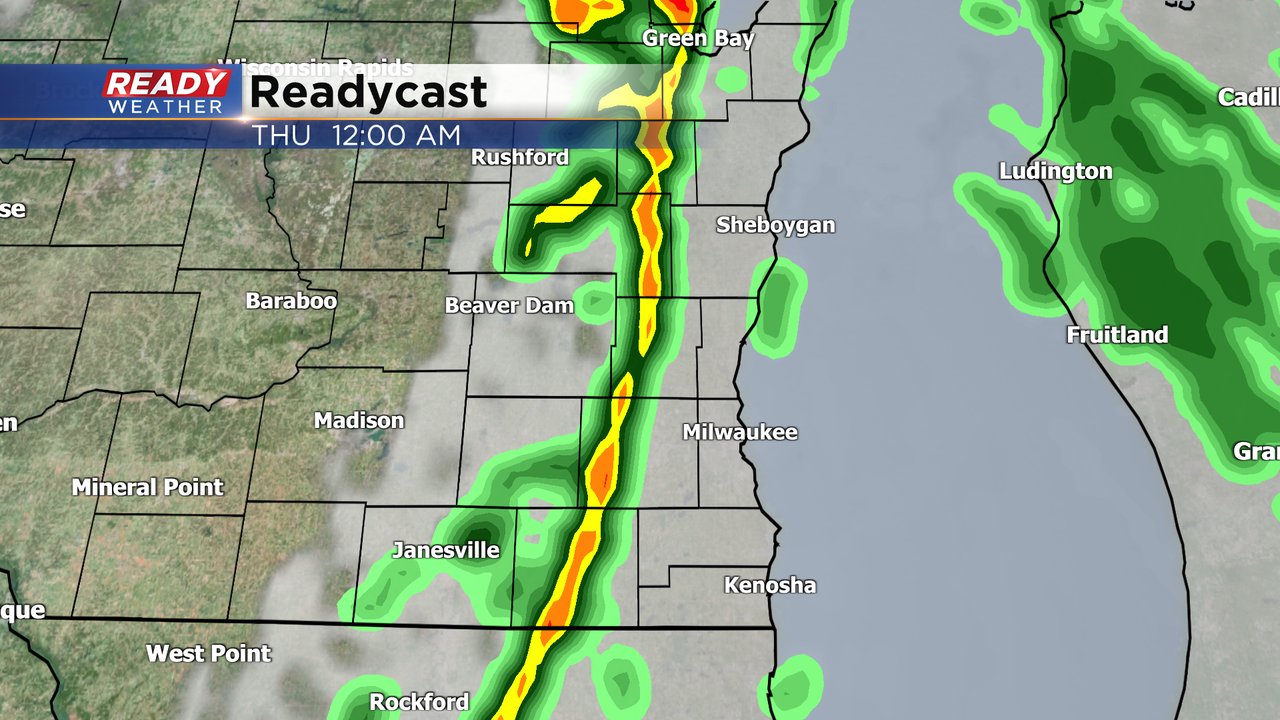
Updated: 12:00 am December 16, 2021
The NWS has canceled
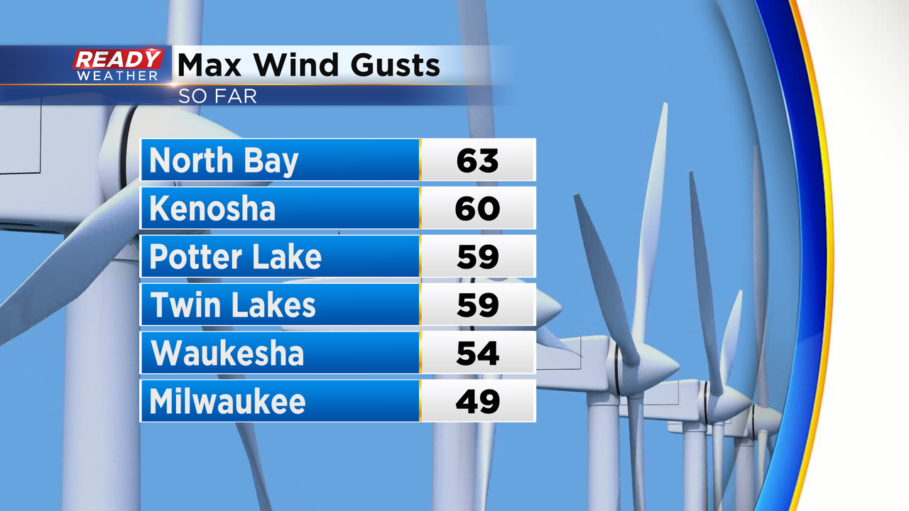
As showers continue to move through, winds are starting to gust over 60 mph. Here are some of the strongest gusts so far.
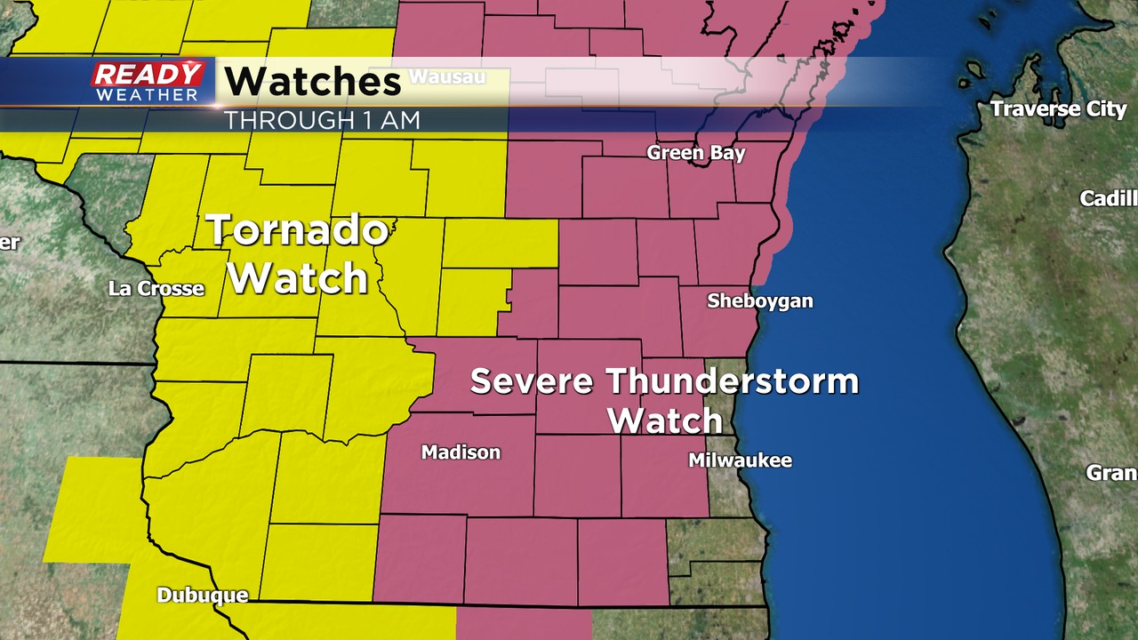
A severe thunderstorm watch remains in effect; however, warnings aren't anticipated with the high wind warning already in place. Isolated gusts over 60 mph remain possible.
We Energies is reporting close to 25,000 people without power across our area.
______________________________________________________________________________________________________________
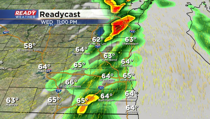
Updated: 9:55 pm December 15, 2021:
A Severe Thunderstorm Watch has been issued for Fond du lac, Dodge, Sheboygan, Washington, Jefferson, Waukesha, and Walworth counties until 1am.
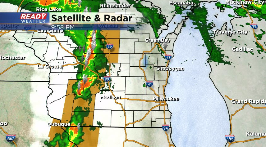
Severe line of storms continues to produce damaging straight-line winds of 65-70 mph. While this line continues to weaken, these gusts will be possible in storms and showers than hold together into SE WI.
Download the CBS 58 Ready Weather App to get warnings sent to your phone.
Updated: 8:00 pm December 15, 2021
Winds are starting to gust well over 40 mph. Over the next several hours wind gusts will exceed 50 mph.
No real changes to our ongoing forecast! The strongest wind gust across the central plains was in Lincoln, Nebraska today at 93 mph.
Our winds will start to increase between 9 pm and 3 am. The high wind warning begins at 9 pm. Isolated wind gusts could approach 70 mph as a line of showers comes through. Many wind gusts will range from 55 to 65 mph.
Power outages are possible, so please have your phones charged.
Thursday will also be windy with winds gusting near 40 mph throughout the day.
______________________________________________________________________________________________________________
Updated: 1:45 pm December 15, 2021:
A Tornado Watch has been issued to our west where the bullseye for severe weather will be through this afternoon and evening. A few tornado warnings are already in progress in Nebraska.
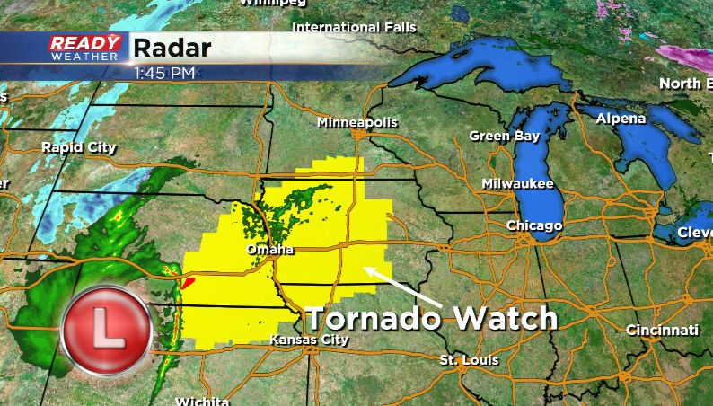
This low pressure system will track into Iowa and Minnesota this evening and overnight, putting the highest chance at fast moving tornadoes and extremely damaging straight-line winds to our west and north.
While this line may no longer be producing lightning or thunder as it reaches SE WI between 10pm-1am, it will still have the potential to bring down wind gusts of 65-70 mph+, so don't be surprised if there are a few Severe Thunderstorm Warnings late in the evening.
-------------------------------------------------
Updated: 9:33 a.m. Dec. 15, 2021
The 9 a.m. temperature in Milwaukee reached 56* officially breaking the 130-year-old record of 55* set back in 1891. We will continue to warm with afternoon highs reaching the record shattering 60s.
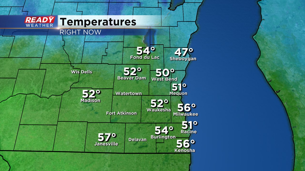
Wind gusts are still fairly tame between 15-25 mph as of 9 AM but will continue to increase during the day. Damaging 60 mph wind gusts are still likely tonight.
------
Posted: 6:01 a.m. Dec. 15, 2021
A high wind warning has been issued for all of southeast Wisconsin. The warning starts at 9 PM Wednesday and lasts until 9 AM Thursday. Most of the Plains and Upper Midwest is under a high wind warning. In southeast Wisconsin this is our first High Wind Warning since February, 2019 over 1,000 days ago!

The wind will be strong enough to cause damage. Don't blow up your inflatables and make sure any holiday decorations are tied down. Travel along east/west roads like I-94 from Milwaukee to Madison will be difficult with the SW wind. Trees could fall and some power outages are possible. Wind gusts will ramp up throughout the day on Wednesday and by the evening frequent gusts above 40 mph are possible. Gusts will hit their peak in the late evening and early morning with gusts to 60 mph. The gusts will stay strong for all of Thursday to 40 mph.
Fog, drizzle and light showers will be possible on and off throughout Wednesday. Most of the rain totals will remain light with less than a tenth of an inch but it could by gloomy and a little soggy all day. The best chance for some thunderstorms will be along the cold front that arrives late tonight into tomorrow morning.
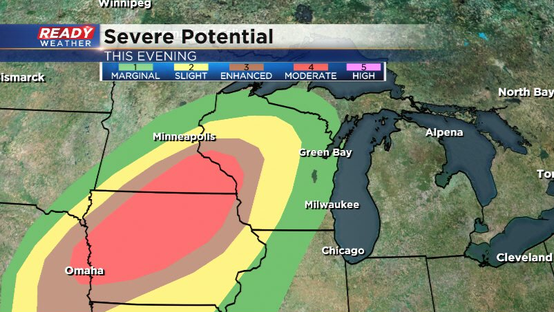
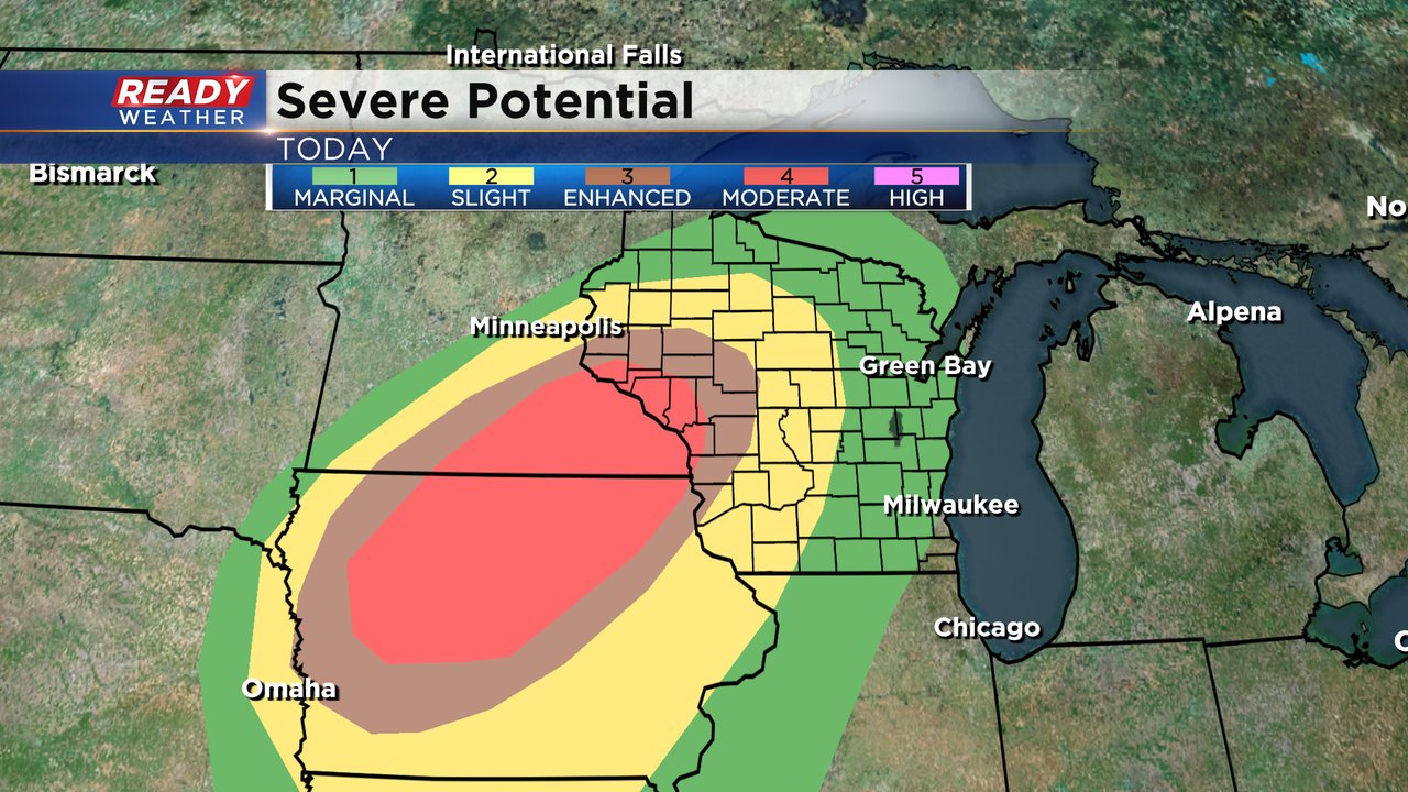
With wind gusts already extremely strong any thunderstorms that tap into those winds could easily be strong to severe with wind gusts to 80 mph. Most of southeast Wisconsin has been placed in a marginal (level 1 of 5) for severe weather for the chance for strong wind gusts in thunderstorms. The severe risk is worse in SE Minnesota and Iowa where a very rare December moderate (level 4 of 5) risk of severe weather exists. Wind gusts in thunderstorms there will be extremely strong and a few tornadoes are possible along the line of thunderstorms with the cold front.
Record breaking temps are still expected. We are already waking up very mild Wednesday morning around 50*. We slowly and consistently warm the rest of the day and by midday we already see some record breaking 60s arrive. All of southeast Wisconsin should reach the low to middle 60s for highs during the afternoon and stay in that range through just after midnight.
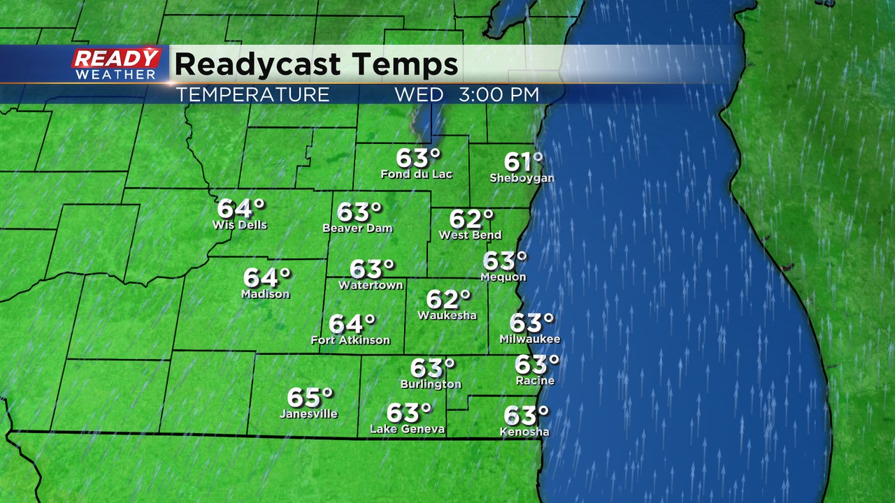
So far Wednesday the temperature has only dropped into the upper 40s far away from the previous record warmest low of 41*. We can't officially say we broke that record until midnight but it looks very likely. No change in forecasted highs today in the middle 60s shattering the 130-year-old record. We likely are still in the low 60s just after midnight before the cold front moves in meaning we will also shatter the record high for Thursday.
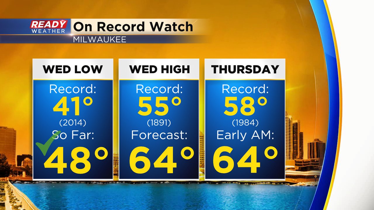
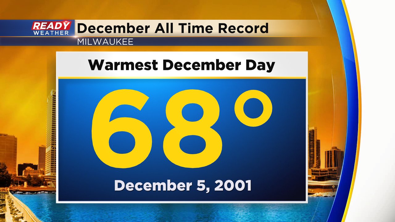
If temps can overachieve a little Wednesday evening or early Thursday we could still make a run at the all time December warmest record of 68*.
Temperatures will drop fast after the cold front rolls through Thursday morning dropping into the low 40s and upper 30s by the time many of us are getting out of the door. We may warm a few degrees to around 40* for Thursday afternoon highs. Download the CBS 58 Ready Weather app to track the dangerous wind, thunderstorm chance and record temps.