Isolated afternoon/evening storms could be strong to severe


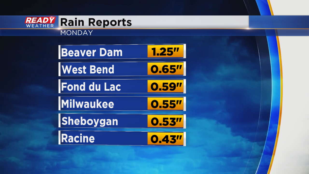
A couple rounds of strong thunderstorms rolled through southeast Wisconsin on Monday. No severe thunderstorm warnings were issued, but there were a couple reports of hail including a quarter sized hail report in Racine just before 6 p.m.
Most of southeast Wisconsin picked up around a half inch of rain, including Milwaukee. Beaver Dam saw the most with over 1" there.
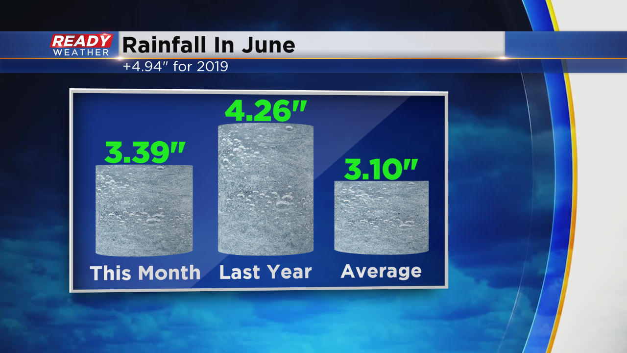
With the added rainfall, Milwaukee is now back above-average for rain in June by about a quarter inch. This June is still below last year's very wet June. Milwaukee is still in a rain surplus of almost 5" since January 1.
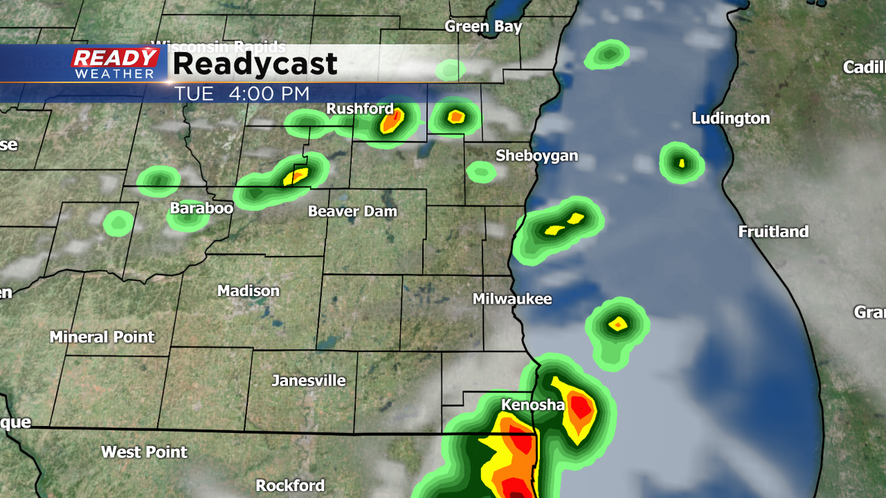
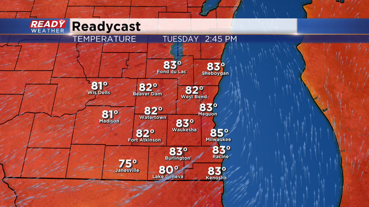
The bulk of Tuesday will be sunny and warm, but a few isolated storms are possible Tuesday afternoon and evening. Not everyone will see the storms but the best chance will be from 2 p.m. to 8 p.m.
If storms do pop, there is a good chance they could be strong to severe. Damaging wind and large hail will once again be the main threats. Almost all of southeast Wisconsin is in the slight risk for severe weather.
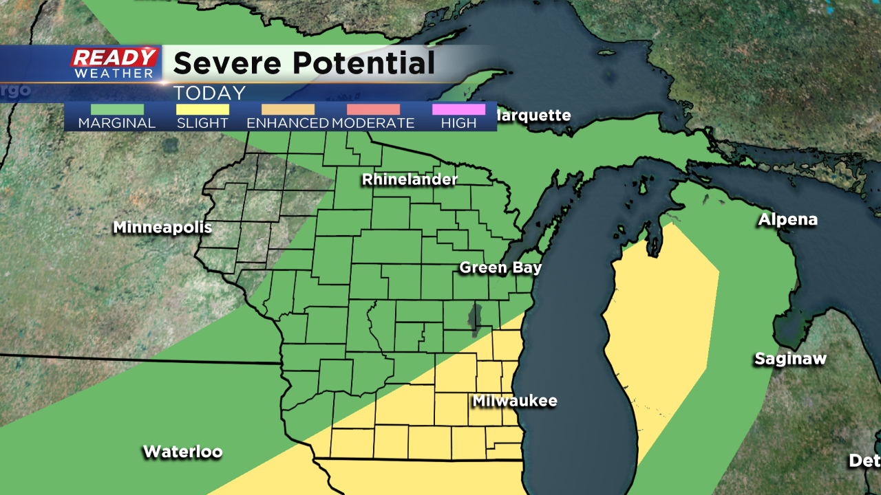
Although the humidity Tuesday is less than Monday, some nice warmth is expected. Highs will reach the middle 80s which could tie or surpass the warmest day of the year.
Download the CBS 58 Ready Weather app to track any storms that do pop up. If warnings are issued, the app will alert you.