Isolated PM storms becoming more numerous into Thursday


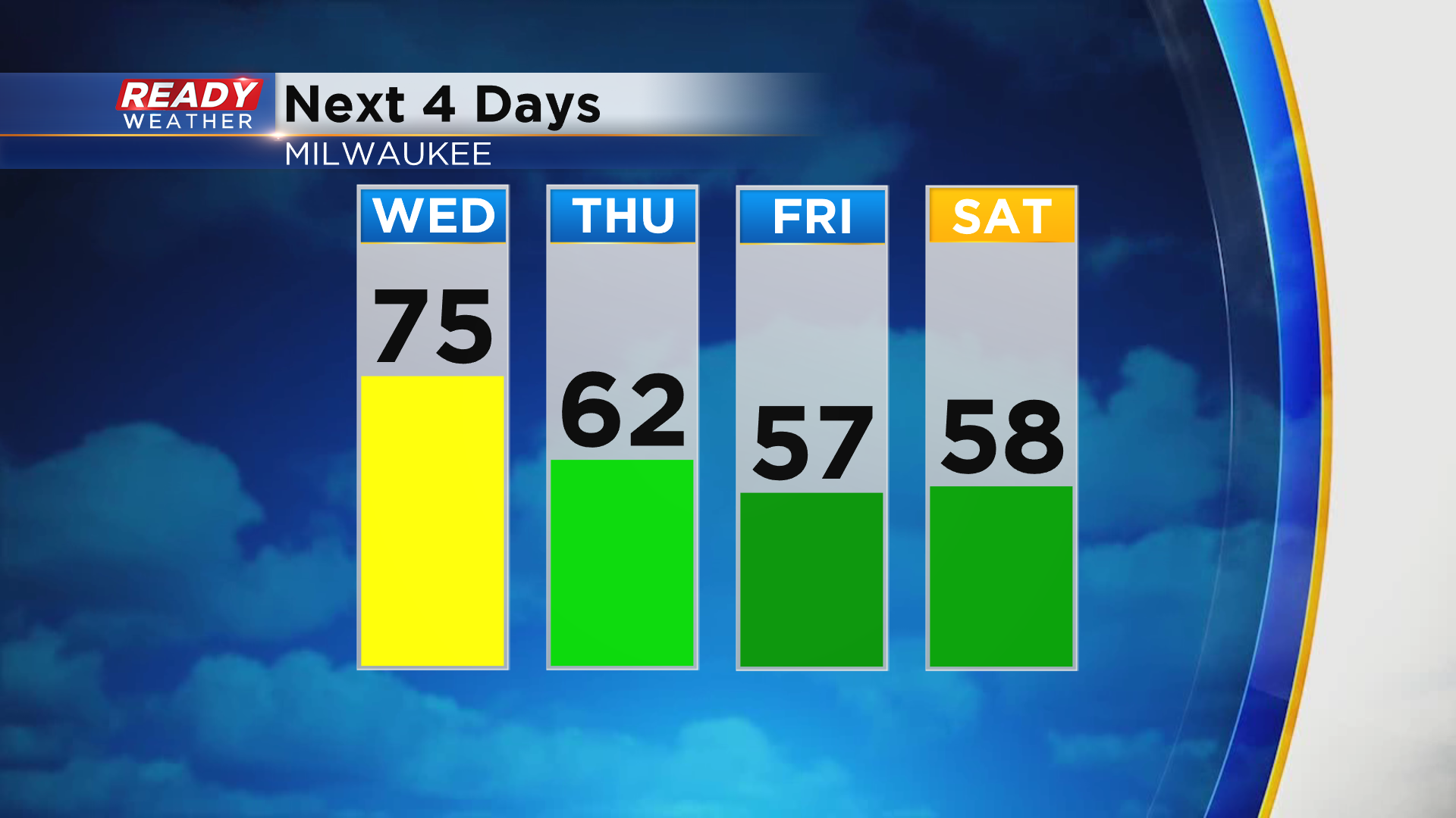
This week has felt more like summer than early spring across southeast Wisconsin with temperatures in the 70s and isolated storms. A similar day is expected today with highs climbing into the mid to upper 70s away from the lake, closer to 70 lakeside
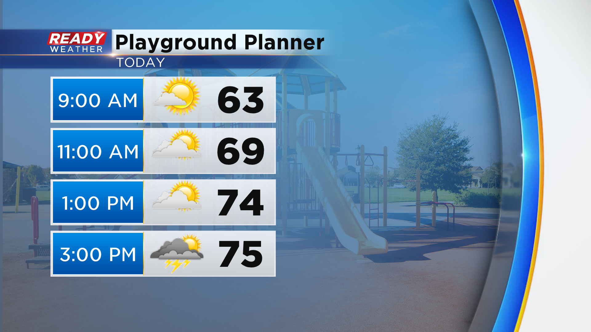
Dry and sunny to partly cloudy skies are expected this morning, but more clouds will mix with the sun this afternoon with isolated storms possible after 3pm.
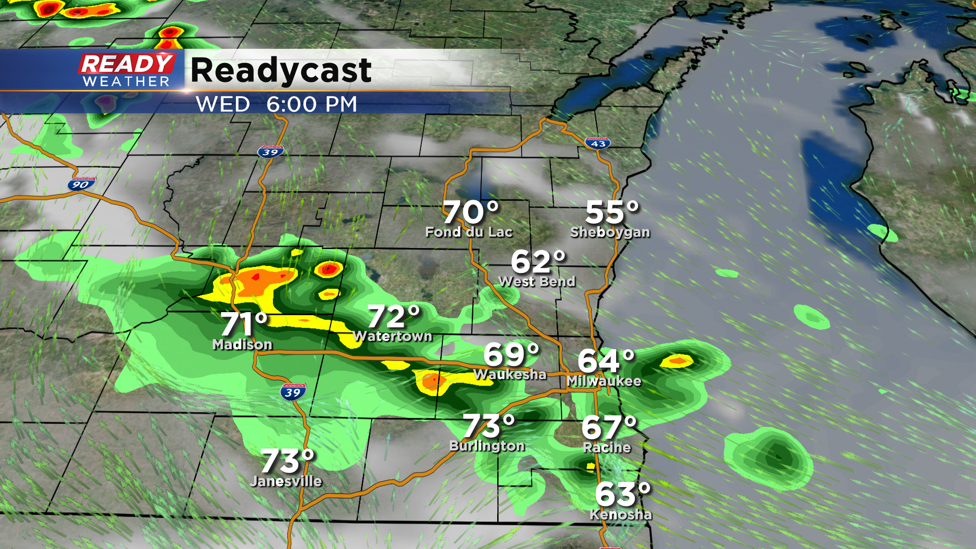
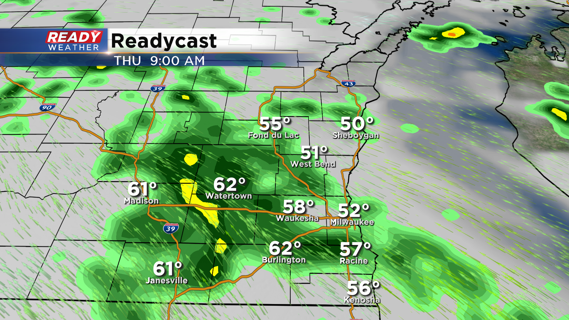
Isolated showers and storms will be possible overnight but will be more concentrated in south central Wisconsin. Showers will become more numerous Thursday morning and will continue off and on throughout the day.
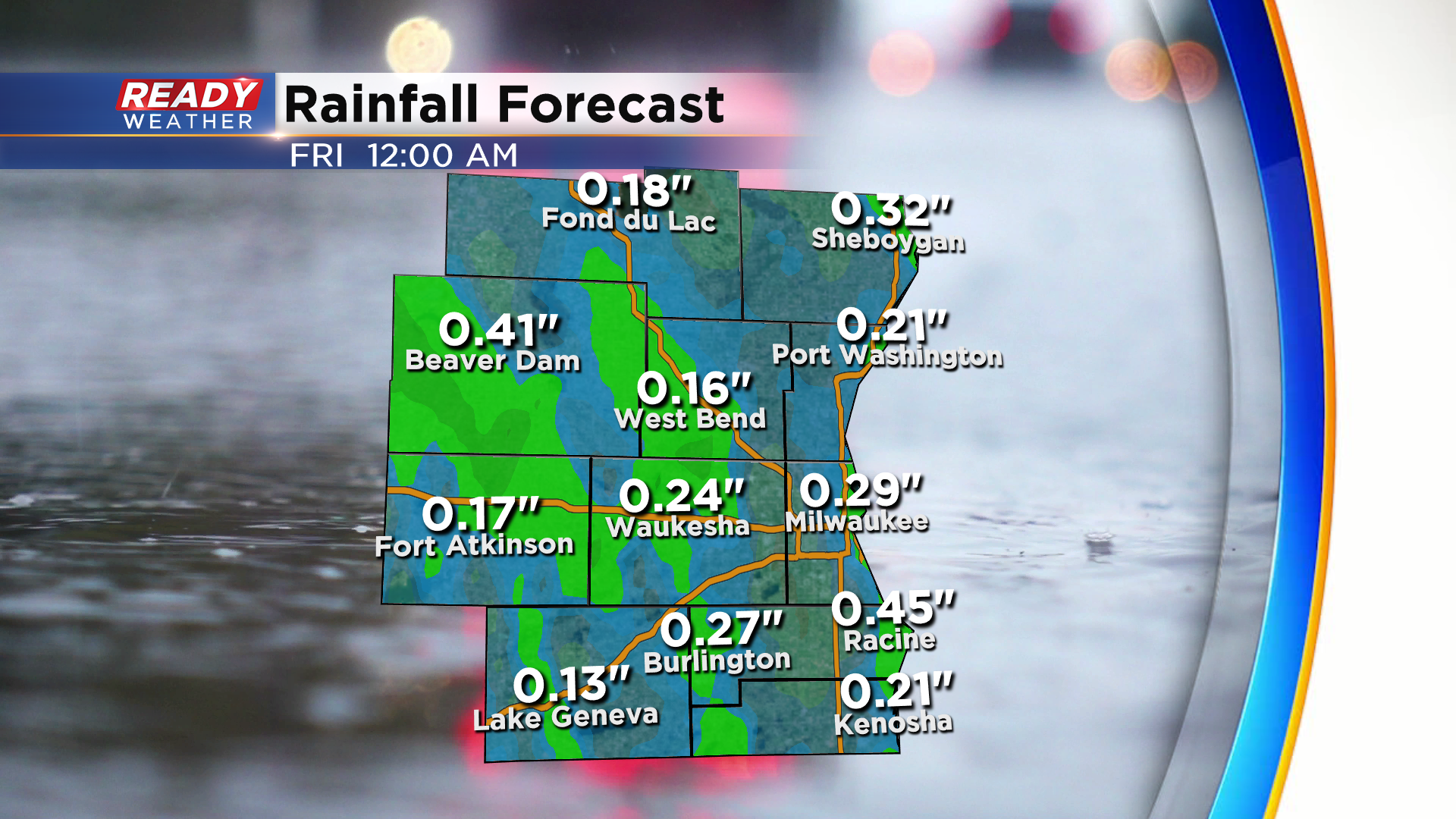
This slow moving low pressure system will sit and spin over the state into Friday, keeping spotty showers around for most of the day. However, they won't be a numerous as Thursday. Rain won't be too heavy, with most of the area picking up around .25", but isolated higher totals will be possible in spots that see storms.
Another low pressure system will rush in for the weekend, bringing another round of rain into the area Saturday afternoon into Sunday. With showers and more clouds around, temperatures will drop back into the 50s for highs to end the week.
Download th CBS 58 Ready Weather App to track the scattered showers and storms.