Winter weather advisory has been issued. Two rounds of snow are coming!


____________________________________________________________________________________________________________

A very active pattern this week will lead to several chances for snow! The first round is coming tonight between 10 pm and 3 am. This a fast-moving system with most areas picking up 1" of snow. There could be some locally higher totals north.
Untreated roads and side streets will be impacted the most. Use caution overnight; however, we are not expecting snow for the Tuesday morning commute.

The next system is coming Tuesday into Wednesday, and this will be more impactful for the entire area. Our northern counties have been added to the advisory that starts Tuesday evening and lasts until Wednesday morning.
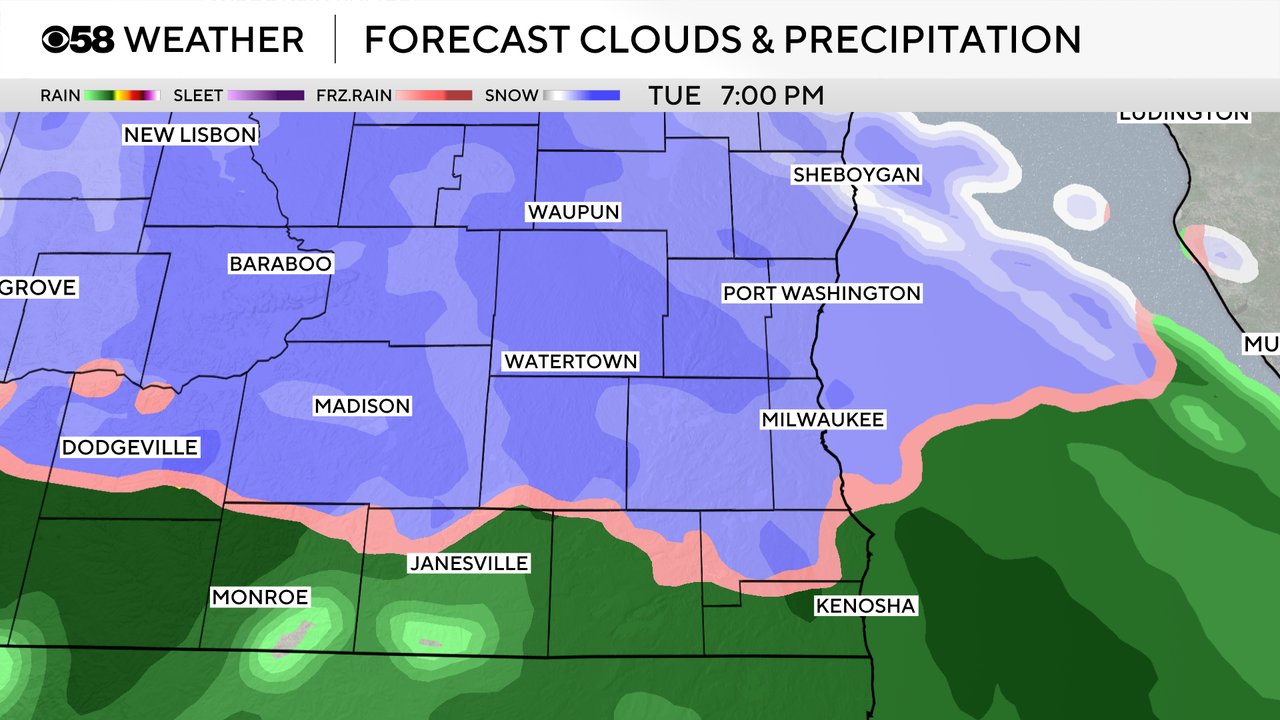
Plan on a band of snow to move through Tuesday evening, causing problems on the roads. That band will likely keep producing snow for the advisory, while a mix of snow and rain develops south.
There is a lot of uncertainty for our southern counties. The track of the system puts the greatest snow potential within the advisory. Those areas will have a decent chance for 3" to maybe 5" of snow. Mixing will likely chew into totals across the southern part of the viewing area, where 1" to 2" is possible.
Check back because this forecast will change!
______________________________________________________________________________________________________________
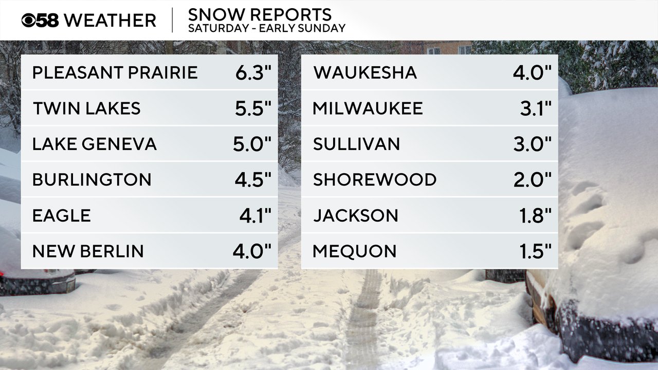
Winter continues to stay active across southeast Wisconsin. We had a winter weather advisory issued this past weekend and we satisfied that with 3-6" of snow in our southern half of counties then northern areas got closer to 0-2". Milwaukee added another 3" to an already impressive start to the snowy season.
Some lake effect snow flurries are possible most of the day on Monday with a dusting not out of the question here and there from Sheboygan all the way south to Kenosha. There's a better chance for light snow showers Monday night into Tuesday morning. Best timing looks like midnight to 7 AM.
Snow doesn't last very long, but just enough to allow some accumulation and cause some roads to be slippery for the Tuesday morning commute. Around an inch of fluffy snow is possible in our northern counties with less the farther south you go and only a dusting near the IL border.
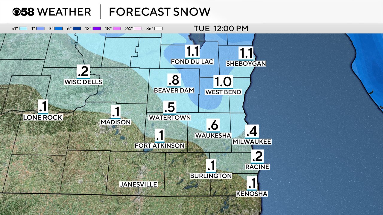
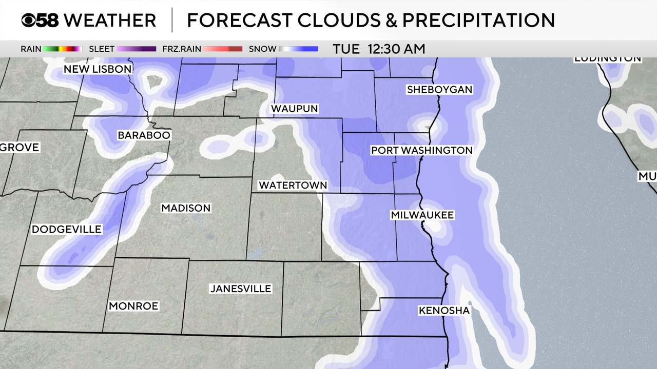
The snow should wrap up during or even before the morning commute Tuesday. The rest of Tuesday morning through the early afternoon looks dry but then the weather turns messy with snow, sleet, freezing rain and rain all possible for Tuesday evening through Wednesday morning. There is still uncertainty as to where the rain/snow line sets up and how much wintry mix we get. The Tuesday evening and Wednesday morning commutes could be icy and tricky. Some accumulating snow and sleet is likely in our northern counties with over 1" likely but exact numbers are uncertain with all the mix.
Download the CBS 58 Weather app to track the light snow Monday night and the wintry mix Tuesday into Wednesday morning.