Light snow showers Friday and Saturday increase White Christmas chances


The massive winter storm that's been moving across the country this week and impacting Wisconsin since Tuesday evening is still with us. As the center of the low pressure slowly slides to the east we have light snow showers through Friday and at least some flurries on Saturday.

A few bursts of snow and wind gusts to 30 mph on Friday could reduce visibility at times. The breeze will remain for the weekend but weaken a little with gusts to 20 mph Saturday and Sunday.

Snow totals from Thursday night through Friday and into Saturday will range from a dusting to a few tenths in lakeside areas and 1-2" for inland hometowns.

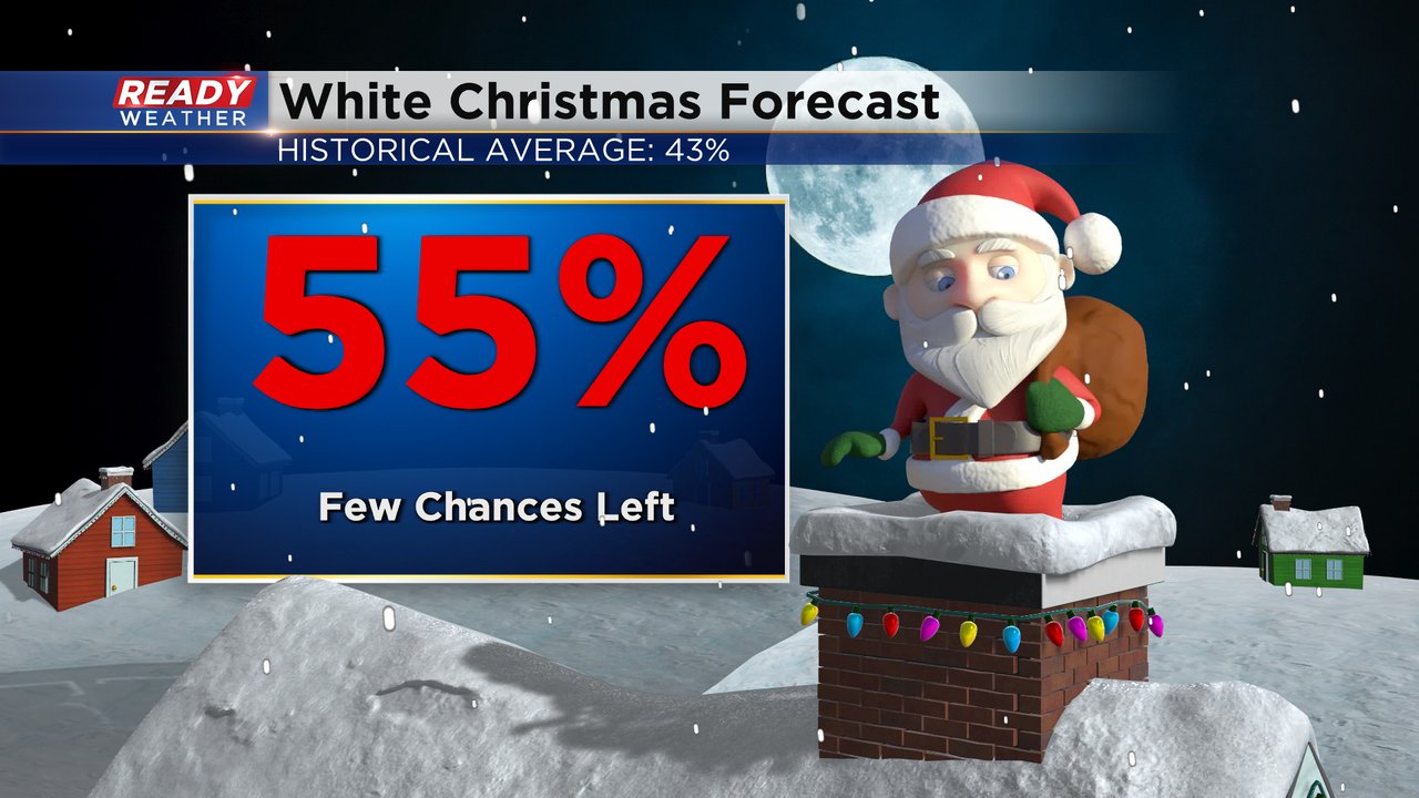
With cold temperatures on the way for most of next week through Christmas Day any of the snow that does fall should stay on the ground. The snow chance Friday and Saturday is not our only one before Christmas. We have another chance for some light snow Monday evening and a third one next Thursday. Our chance at a White Christmas is increasing! With a few more chances for snow on the way before Christmas that White Christmas chance sits at 55%.
Download the CBS 58 Ready Weather app to track any snow before Christmas.