


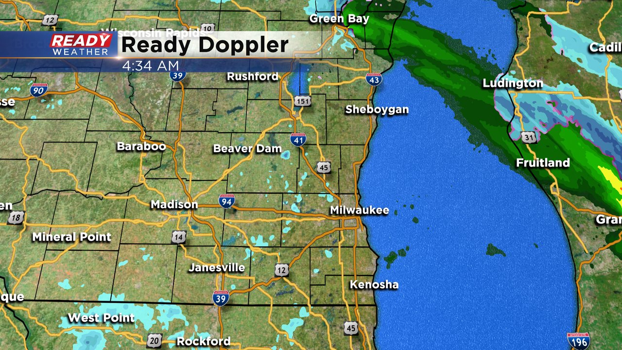
Updated: 4:42 a.m. January 15, 2021
The main area of rain and snow from Thursday night has left the area. Now we just have some flurries and drizzle out there. Some of the drizzle could freeze so a winter weather advisory remains in effect for some of our northern counties. Light snow showers or flurries not really accumulating will be possible off and on through Friday. A better chance for some accumulating snow will happen Friday night into Saturday with up to 2" of new snow possible. A few flurries will linger through the rest of Saturday and Sunday. Sunday could see another dusting of snow.
------
Updated: 5:30 PM January 14, 2021
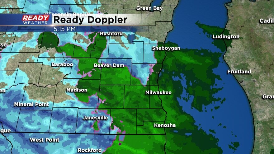
The snow will continue into 6 am and then taper to flurries. Light snow showers are possible for Friday with another band of snow late Friday night into Saturday morning.
We are still expecting 1" to 4" of snow areawide.
------
Updated: 3:30 p.m. January 14, 2021
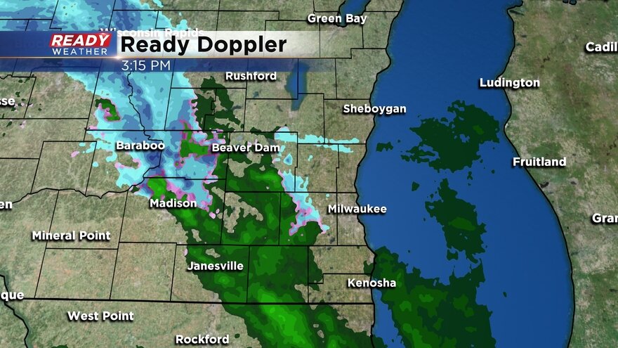
Scattered rain showers are developing across the area. Snow will start mixing across our western areas over the next several hours. Lakeside areas will remain more of rain and a mix.
Best chance for snow will be across our western counties. 1" to 2" is possible this evening and overnight, especially within the winter weather advisories.
------
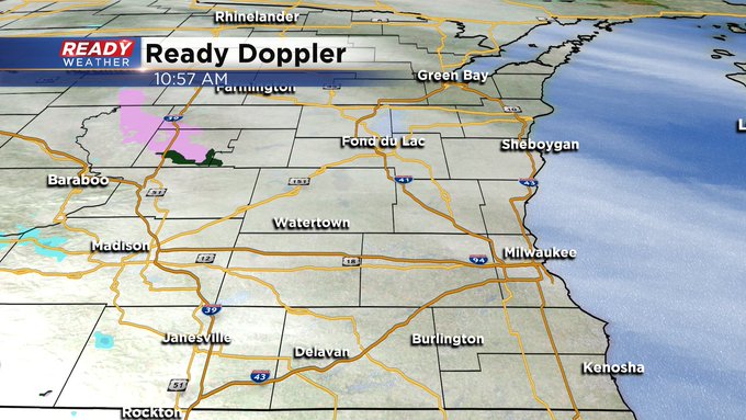
Updated: 10:59 a.m. January 14, 2021
------
Updated: 8:54 a.m. January 14, 2021
Our storm system is still on track to arrive during the afternoon and evening Thursday between 3-6 p.m. for most areas. The bulk of the accumulating snow falls Thursday evening into early Friday morning with wet roads expected for the Thursday evening commute and slushy roads for Friday morning. Lingering light snow showers through Friday and flurries Saturday morning could add up to another inch.
We are missing out on the most impactful part of this storm with high wind warnings in the Plains and Dakotas and Blizzard Warnings in Minnesota and Iowa. The wind here won't be much of an issue at all staying in the 5-15 mph range.

------
Posted: 5:51 a.m. January 14, 2021
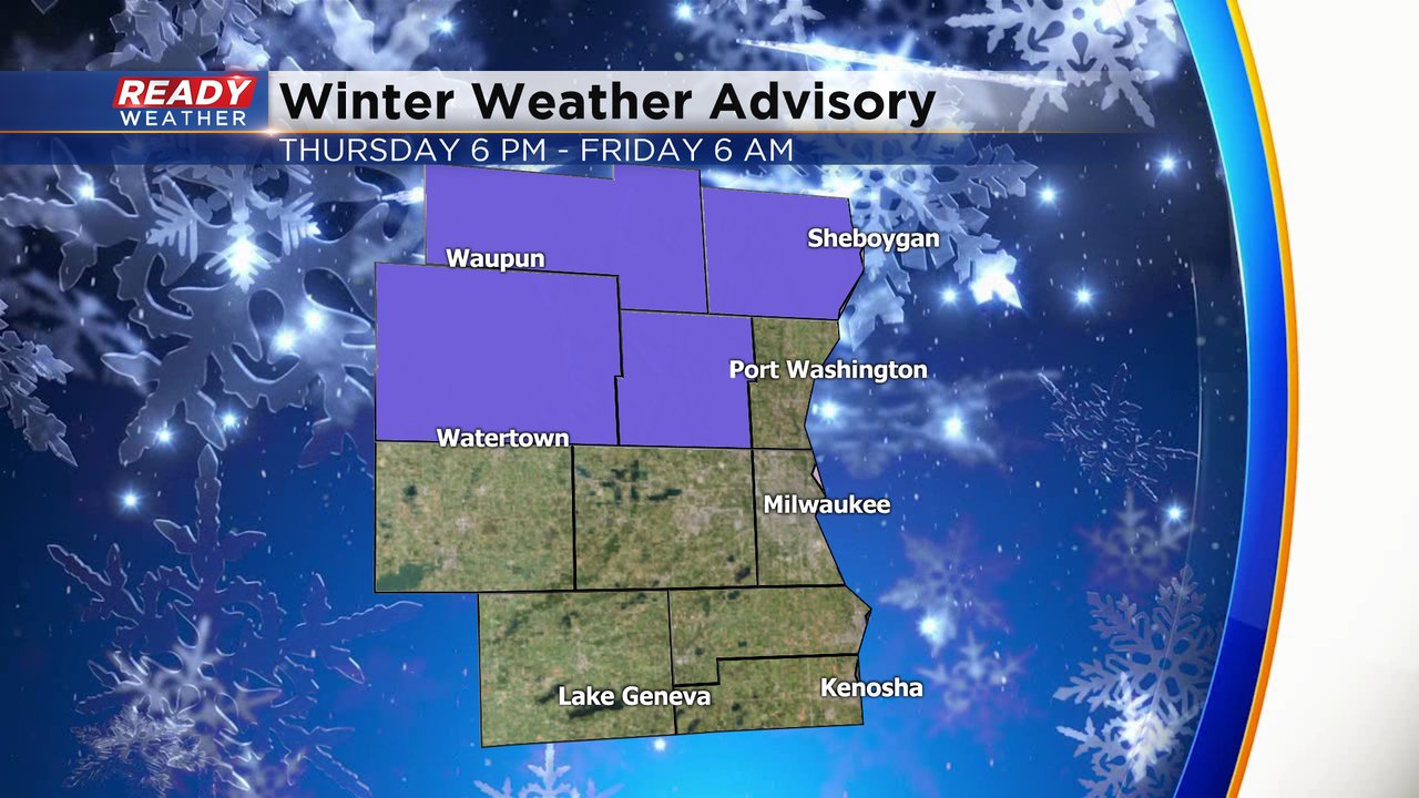
Our day of chaning weather is here. We start out dry Thursday morning with rain or a rain/snow mix arriving during the afternoon that switches to all snow by late evening. A winter weather advisory has been issued for a few of our northern counties highlighted in purple from 6 p.m. Thursday to 6 a.m. Friday. These are the areas that have the best chance to see over 3" of snow.
A few minor changes to the snow forecast from yesterday. 1. The start of the snow looks a little later with most staying dry around midday and seeing the snow move in from 3 p.m. to 6 p.m. 2. The period of rain or rain/snow mix could linger a little longer, especially for eastern counties, with some not switching over to all snow until midnight.

The lingering rain and rain/snow mix combined with a later arrival time means that the evening commute won't be super difficult but some wet roads are expected in the Milwaukee metro area and some western counties could see some slushy snow already on the roads. Travel will become more difficult Thursday night into early Friday morning but by the heart of the Friday morning commute the accumulating snow will be done. None of the threats with this storm look extreme but roads, visibility and snow will be the biggest impacts.

This will be a slow moving storm but there's not a ton of moisture to go with it. Because of that overall snow accumulations will stay light but you may have to shovel multiple times. An couple inches of snow will be possible from Thursday afternoon through Friday morning then another half to full inch of snow with light showers during the day Friday and a dusting is possible Saturday morning with some lingering flurries. When the storm is finally finished most are looking at 1-3" of snow with lower totals near the lake and south and higher totals to the west and north.

Download the CBS 58 Ready Weather app to track the storm with the interactive radar.