More showers to start the new work week then our first widespread frost


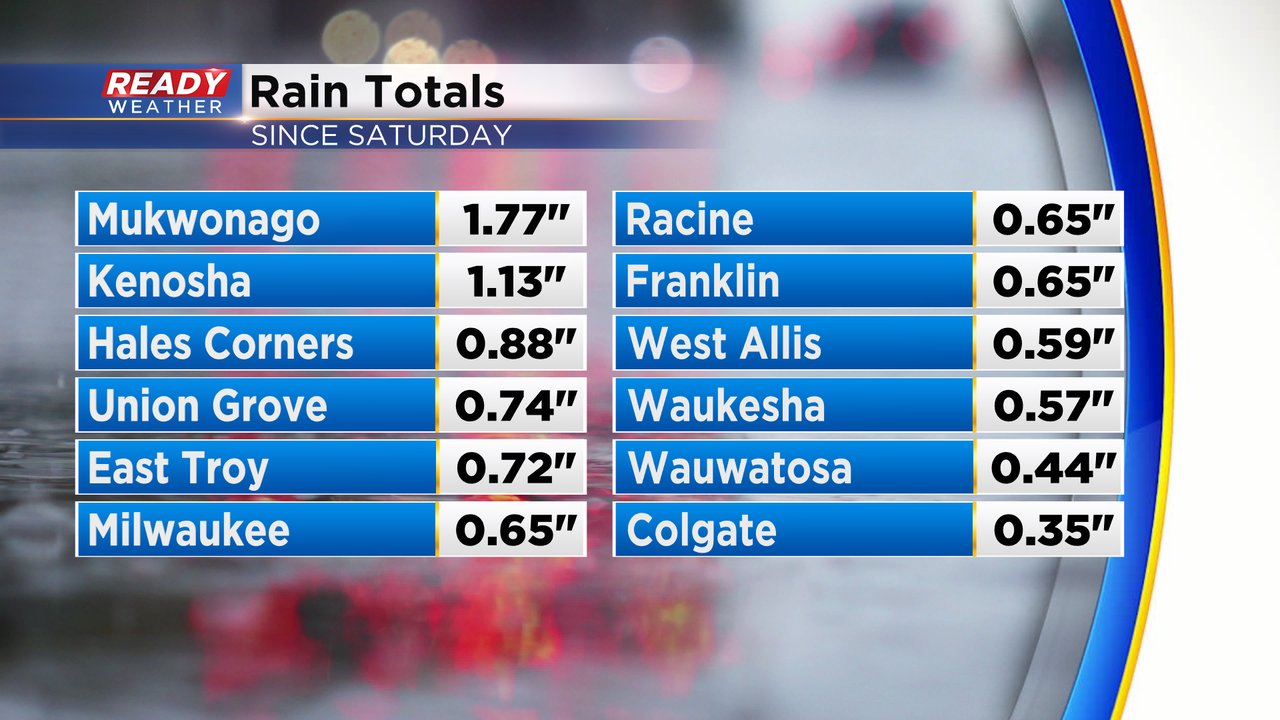
We finally had some rain over the weekend with showers and storms on Saturday then more showers and even a few waterspouts over Lake Michigan Sunday. Rain totals were highest in areas that saw thunderstorms with a few locations getting over an inch. Most of southeast Wisconsin got at least a quarter inch Saturday and Sunday.
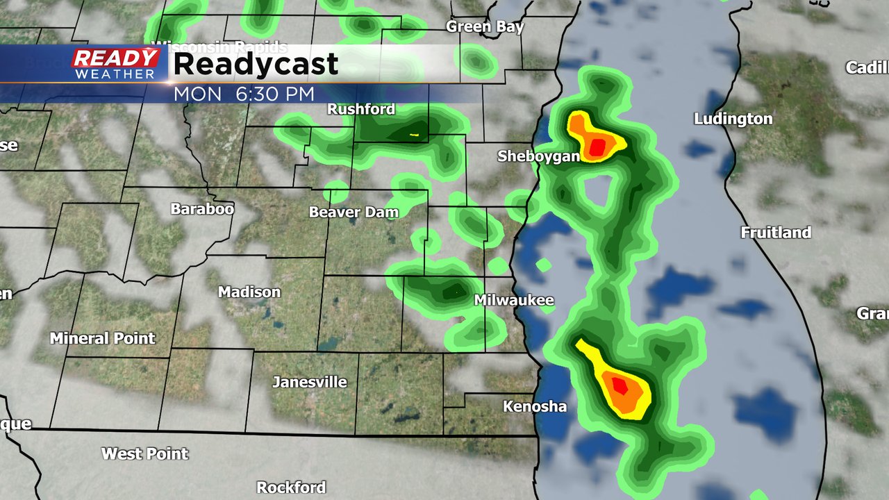
After drying out most of Monday morning, the chance for more showers returns Monday afternoon and evening through Tuesday morning. An isolated storm or downpour are possible near the lakefront with another chance to see waterspouts.
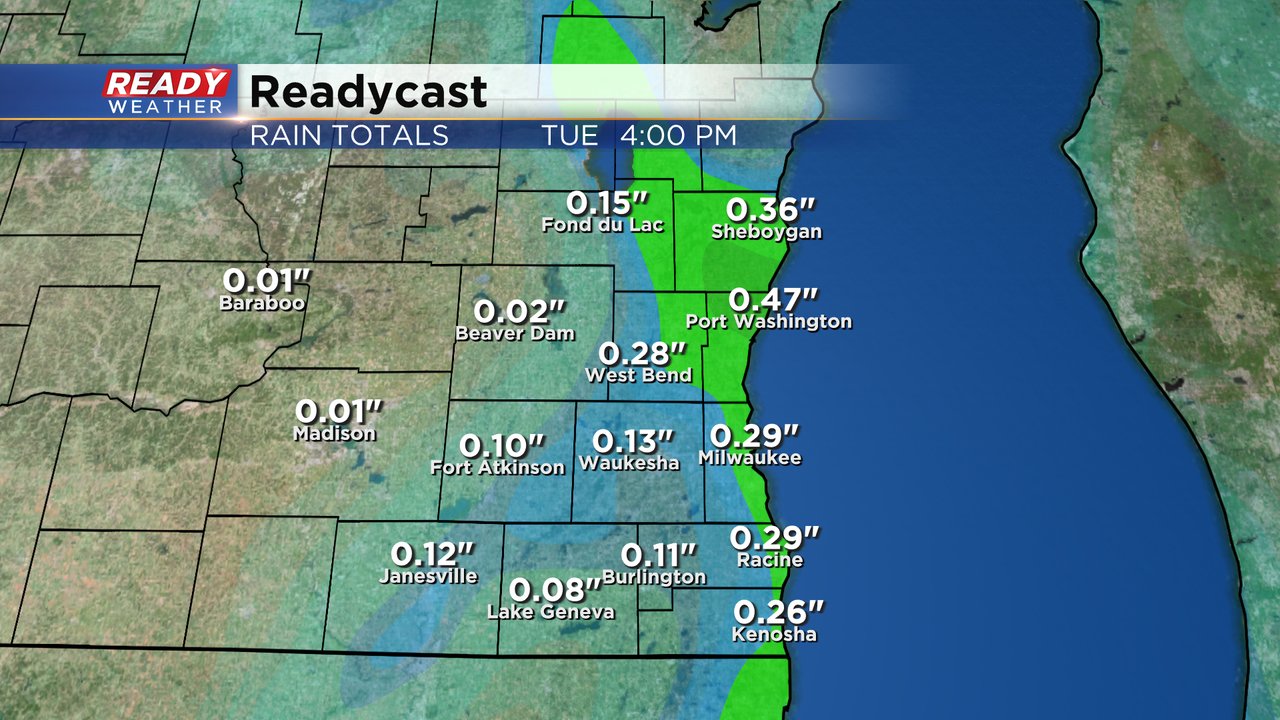
Rain totals from Monday morning through Tuesday lunch time will range from 0.10-0.25" for most of southeast Wisconsin with some higher totals around a half inch.
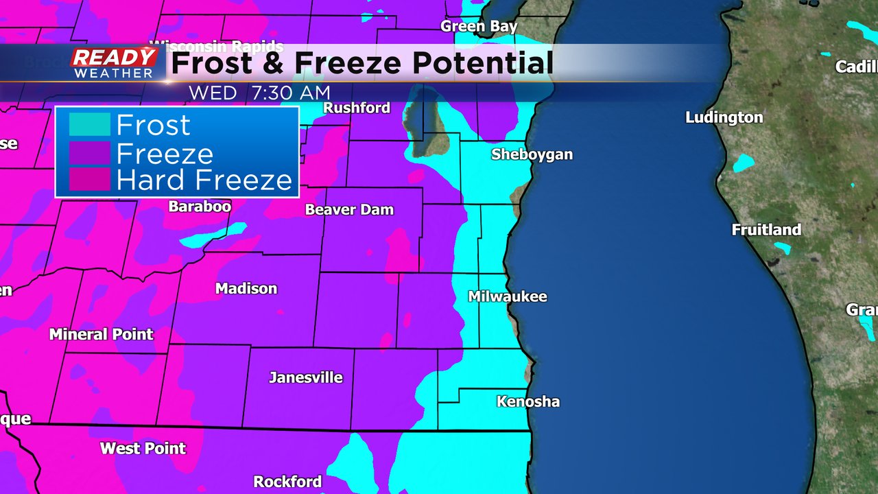
The rest of the week is back to dry conditions with lots of sunshine through the upcoming weekend. Temperatures will stay chilly through Wednesday with highs in the mid 50s. Morning lows could drop into the low to middle 30s in most areas giving us our first widespread chance at frost and even the possibility of a freeze away from the lakefront Wednesday and Thursday mornings.
Download the CBS 58 Ready Weather to track the rain showers then the cold air.