


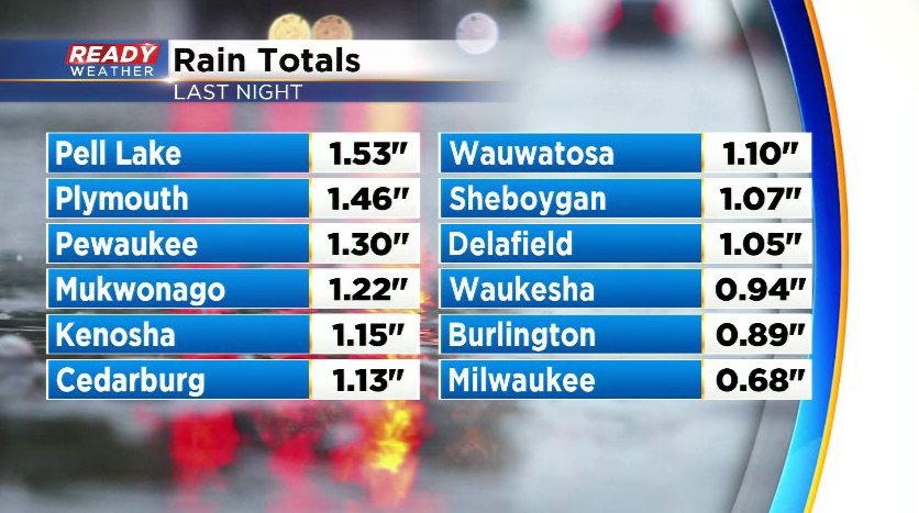
Southeast Wisconsin FINALLY picked up a decent rainfall overnight with most of the area receiving .50-1", but a few spots saw around 1.50"!
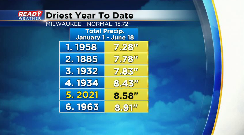
While some rain is better than none, we still need a LOT more rain to get rid of the ongoing drought. Even including the .68" of rain that fell at the airport this morning, this is still Milwaukee's 5th driest year to date.
We'll have a couple of chances for showers and storms through Father's Day weekend, but there will be a solid dry window from Saturday afternoon into Sunday morning for any outdoor activities. We'll be dry for the rest of today, but a few isolated showers and storms will be possible after midnight as a stronger cold front tracks into the area.
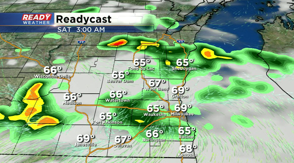
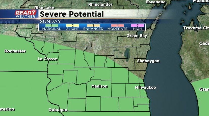
Any showers or storms should end by late morning Saturday with more sun developing for the afternoon. A much better chance for rain and storms arrives Sunday afternoon and evening with a stronger low pressure system. By then, some humidity will be creeping back into the area, which could fuel some stronger storms. A level 1, Marginal Risk, for severe storms is in place for most of southern Wisconsin on Father's Day.
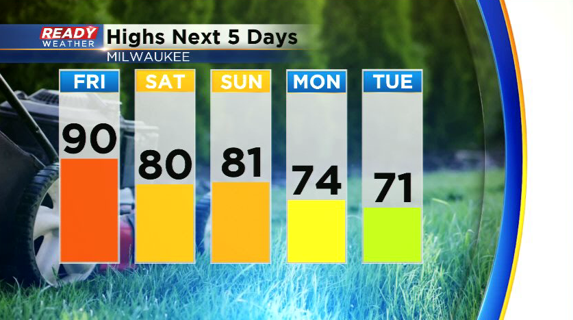
After making a run at 90° this afternoon, most of the weekend will be in the upper 70s to low 80s with a lake breeze knocking down temps lakeside. Temps will cool even more behind Sunday night's cold front with temps struggling to reach the low 70s on Tuesday.
Download the CBS 58 Ready Weather App to track the weekend storms.