Midday Update: Storm threat is over with falling temps this afternoon behind a cold front


Updated: Wednesday, April 5th 1:00pm:
After warming into the upper 60s to low 70s this morning, the cold front is currently pushing across southeast Wisconsin.
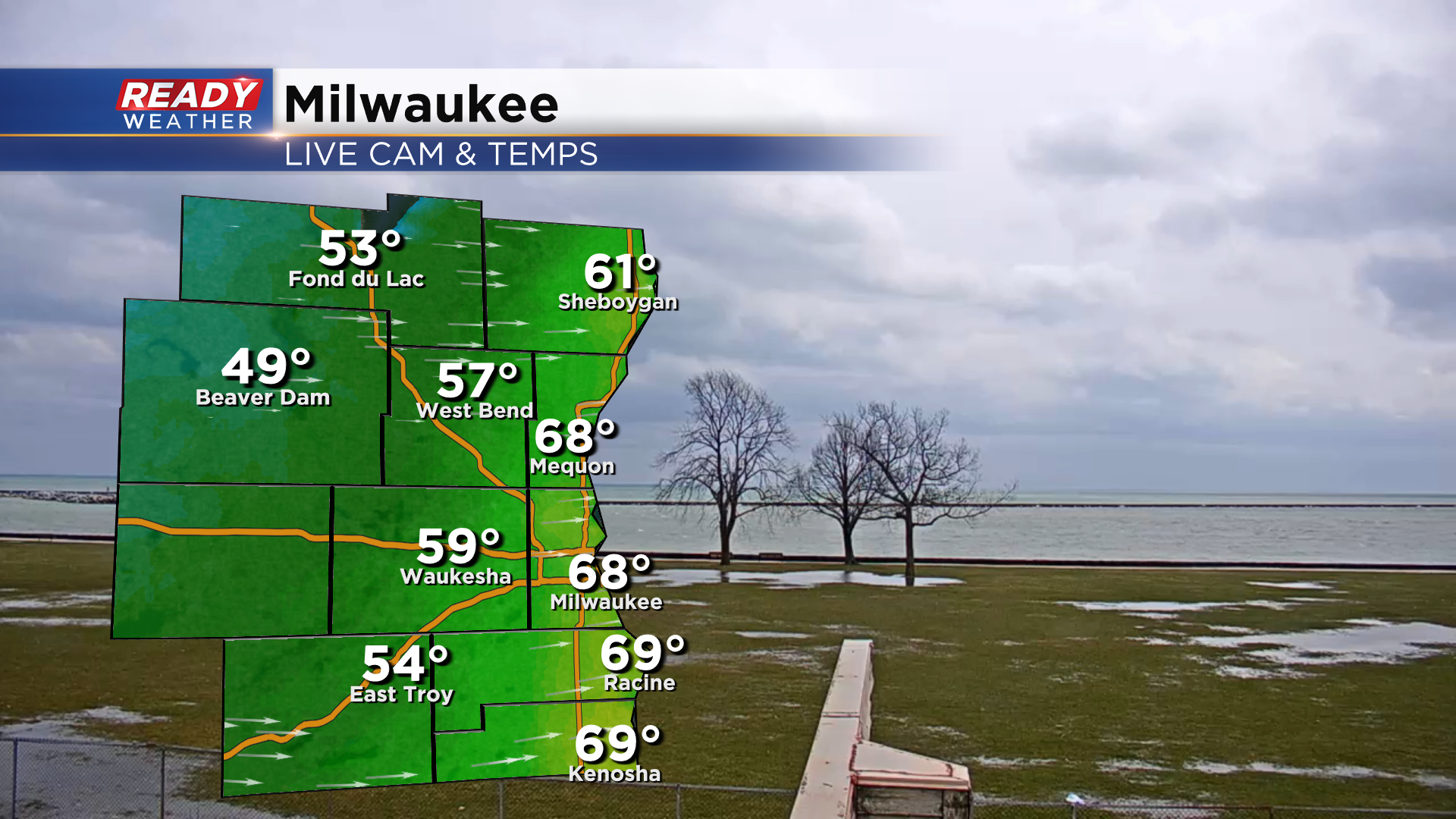
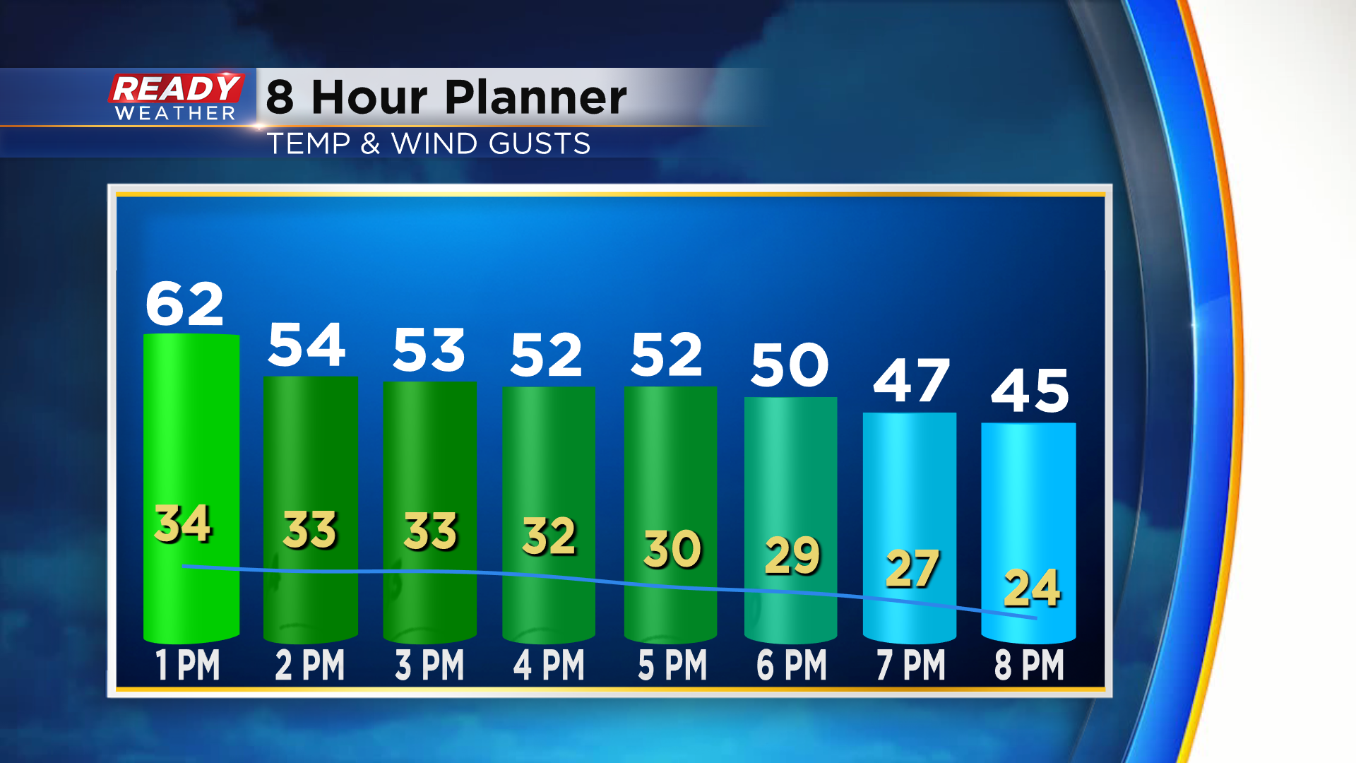
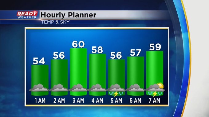
Temps will drop back into the low to mid 50s this afternoon as gusty WSW winds usher in colder air. Most gusts this afternoon will be between 30-40 mph.
-------------------------------------------------------------
Updated: 8:37 a.m.
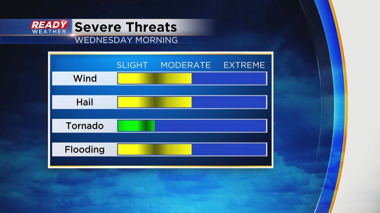
The severe weather threat for Wednesday is almost over. A line of strong to severe storms rolled through the southern part of Wisconsin from 4-7:30 AM with strong wind, small hail, heavy rain and lots of lightning. A very isolated strong to severe storm is still a possibility until the cold front passes through southeast Wisconsin late Wednesday morning through the early afternoon.
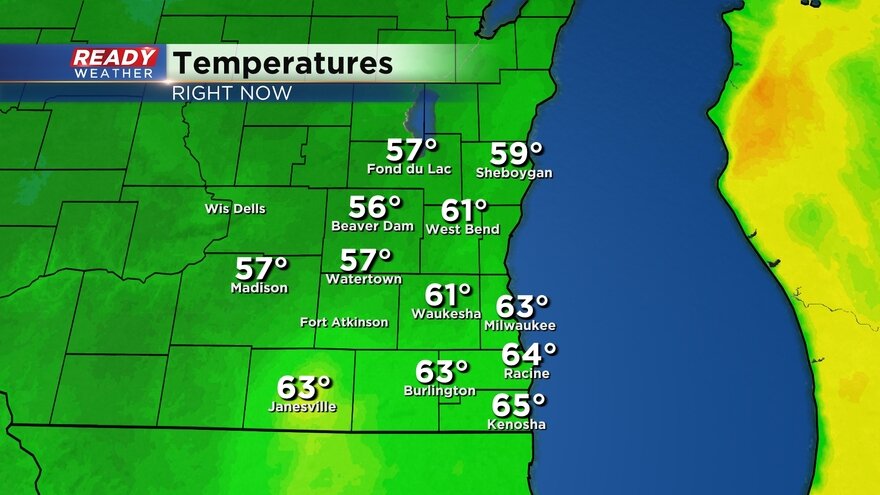
Tuesday night a warm front that had lifted north of Milwaukee started drifting south with Kenosha dropping 19* at one point when the warm front moved south of them, but now that warm front is lifting back north. While 70s aren't looking as likely, many southern counties could get into the 60s today with 50s to the north. The cold front around midday will drop those temps into the 50s this afternoon and 40s this evening.
Here's a look at temps that will update with time:
------
Updated: 6:35 a.m. Apr. 2023
A new severe thunderstorm warning has just been issued for Walworth, Racine and Kenosha Counties until 7:30 AM. This severe thunderstorm warning is mostly for the potential for strong wind gusts to 60 mph and small hail. There is a small tornado threat with this storm but at this point no tornado warning has been issued.

This storm is currently located over Lake Geneva and moving east. It is expected to reach Burlington around 6:45 AM then Kenosha and Racine around 7:15 AM before moving over Lake Michigan.
------
Updated: 6:02 a.m. Apr. 5, 2023
As of 6 a.m. Wednesday morning all severe thunderstorm warnings have either expired or been canceled. These storms are still strong with wind gusts over 50 mph and some small hail. There is currently no tornado threat. The latest track on the storms brings them into central Dodge and Jefferson Counties around 6:15 a.m. then Waukesha just after 6:30 a.m. and Milwaukee County around 6:45 a.m.

Even if these storms are not severe make sure you are staying safe from the frequent lightning.
------
Updated: 5:34 a.m. Apr. 5, 2023
Storms are starting to perk up just ahead of a cold front. So far these storms mainly pose a hail risk with wind gusts expected to say under 50 mph and no tornado threat. A severe thunderstorm warning has been issued for western parts of Dodge and Jefferson Counties until 6:15 a.m.
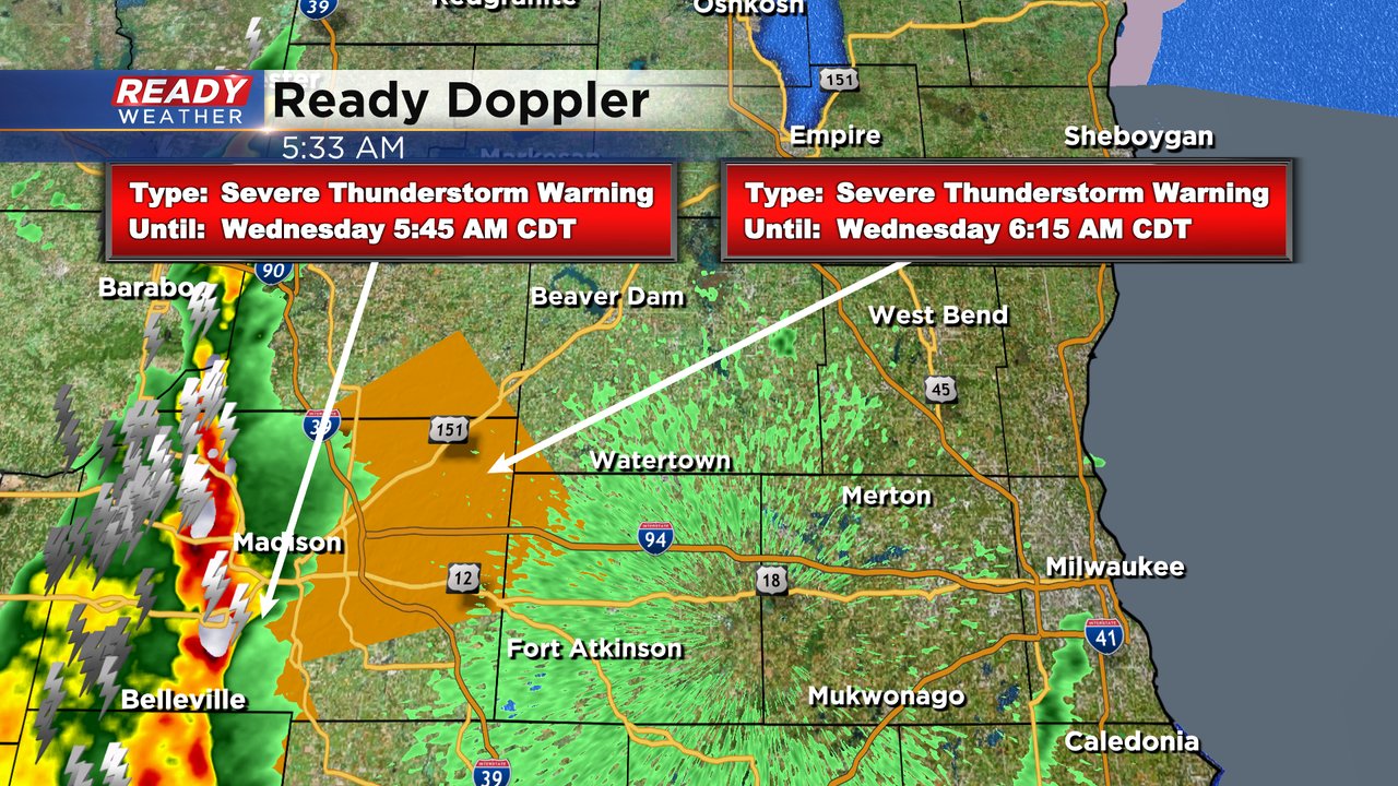
As these storms roll across southeast Wisconsin the severe thunderstorm warnings will likely continue. As soon as this cold front passes our local counties our severe threat will go away.
------
Updated: 3:55 a.m. Apr. 5, 2023
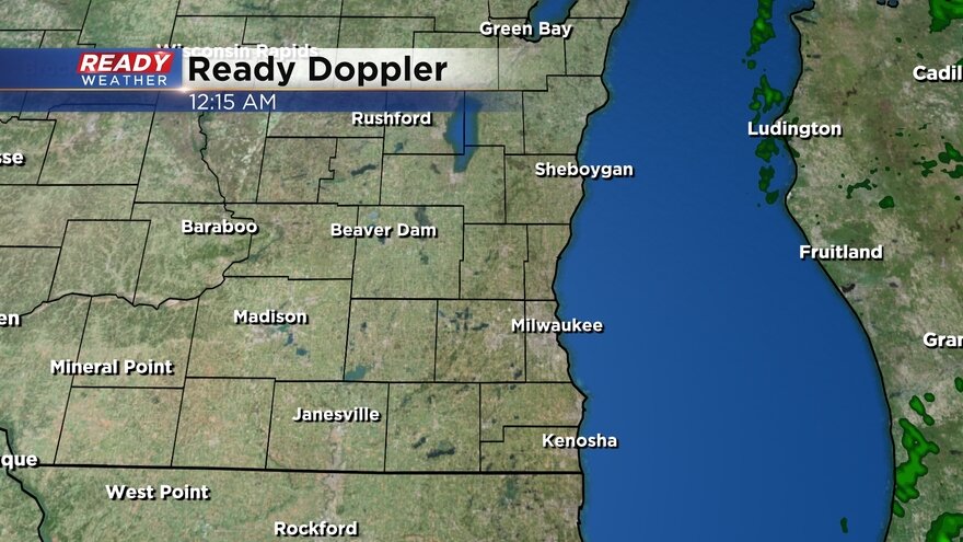
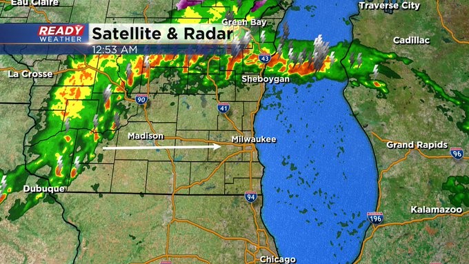
A few lingering showers and storms are currently located over southeast Wisconsin. No storms have been strong since about 2:30 a.m. Wednesday morning. Until a cold front rolls through in the late morning hours we do still have the potential for severe weather.
Here's a radar image that will update with time:
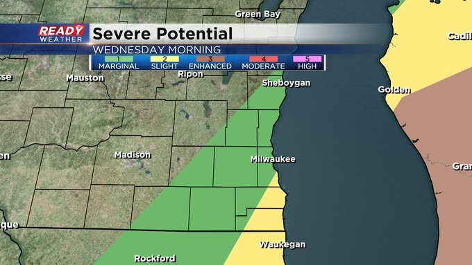
The severe threat overall for Wednesday morning has decreased. Only a sliver of southern Milwaukee and eastern Racine and Kenosha Counties remain in a Level 2 Slight Risk with a Level 1 Marginal Risk in play from Sheboygan to Janesville and east.
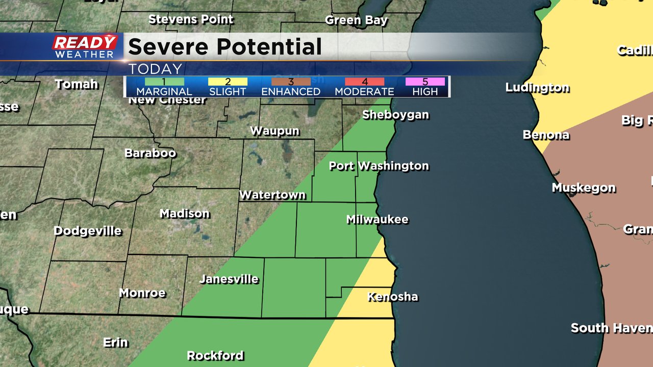
The tornado threat has decreased with any severe storms Wednesday morning. Some strong wind and hail remain the big threat and after some good heavy rain on Tuesday the flood threat has increased a bit but is not overly concerning.
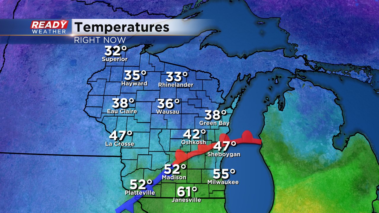
Besides the chance for strong to severe storms Wednesday morning, the other big story is the surge of warmth. A warm front is currently moving north across southeast Wisconsin pushing temps close to 70* in southern counties. Everyone has a chance at some 60s to around 70 for late morning highs. The temperatures will drop this afternoon into the 50s.
Here's a current map of temperatures that will update with time:
Download the CBS 58 Ready Weather app to track the cold front and any stronger storms.
------
Posted: 12:44 a.m. Apr. 5, 2023
The storm threat remains through much of Wednesday morning. Still waiting on a strong cold front to move through the area.
Some of the storm activity could be on the strong side with damaging wind, heavy rain, frequent lightning, and hail.
Behind the front, look for rather breezy conditions along with falling temperatures through the 50s and eventually the 40s this evening.
The rest of the week looks fairly quiet, including the start of Passover Wednesday evening and Good Friday as well. Actually, the Easter holiday weekend looks okay. Expect a milder trend too. Highs into the weekend will be in the 50s and 60s.